Our 20 Favorite Hikes in Washington State
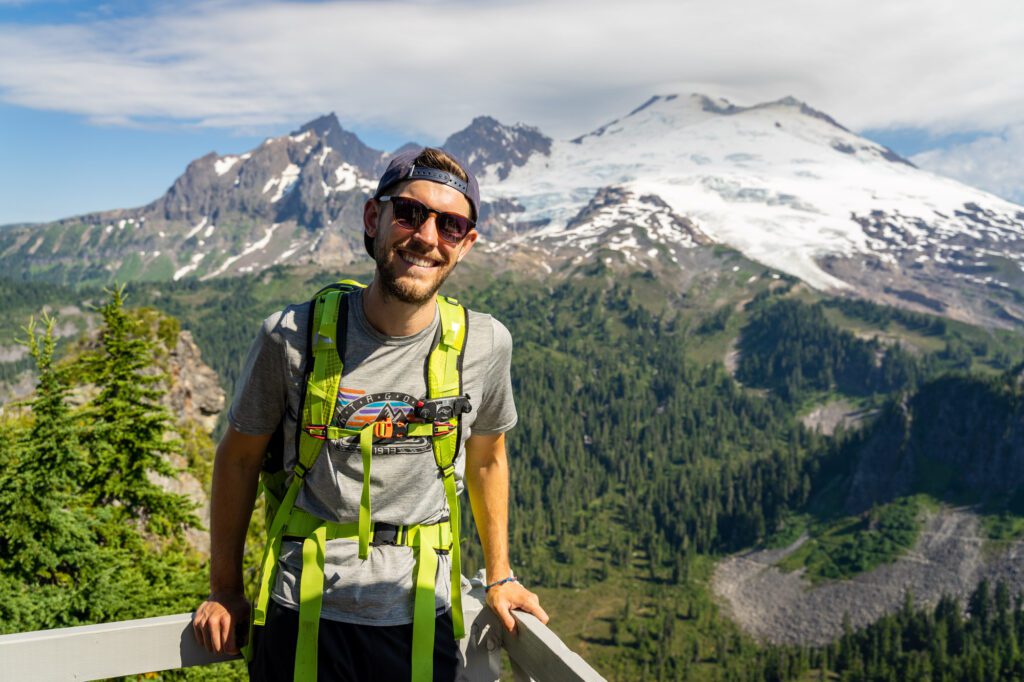
Despite growing up in the Seattle area, I (Matt here!) had never really explored the hiking trails in the state I grew up in until relatively recently.
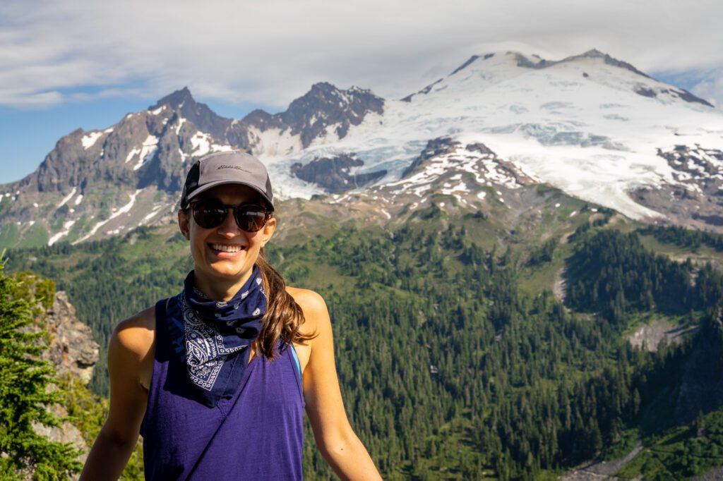
By the time I was into hiking, which is all thanks to Alysha who was essentially born with a backpack on, I had moved down to California with an eye on making a triumphant return to the Pacific Northwest at some point.
Which finally happened recently when we settled down in Portland, Oregon, which has surprisingly good access to many of our favorite hikes in the state, like the ones around Mount Rainier and in the Columbia River Gorge.
There are options for everyone in Washington – from grizzled trail veterans looking for a rugged climb, to families who want to take in some amazing views with minimal effort – and we’ve done our best to cover them all (both in terms of hiking them, and also writing about them).
In this guide, we’ll take you through our favorite hikes in the great state of Washington.
Here’s what we’ll cover:
- Our picks for the top 10 Washington hikes, ranked (we each ranked them independently, and then found a middle ground).
- Honorable mentions that cover 10 hikes that didn’t quite make the cut, but we think deserve your attention.
- A handy interactive map of all the trailheads mentioned in this guide.
- A few things to know before you hit the trail, which will be particularly useful if you’re not used to exploring Washington State.
Here’s what we think is the best part – we’ve done every single one of the hikes on this list. Which we think counts for something.
Over time, we’ll be adding to this as we’re able to tackle more of them (every summer we seem to discover one or two more trails to add to the list!).
Sound good to you? Let’s get into it!
Disclaimer: Some of the links below are affiliate links, which means that if you click on one and purchase something, I make a small portion of the sale at no additional cost to you. It goes without saying that I would never recommend something I wouldn’t use or do myself.
The Best Hikes in the State (According to Us)
Now, onwards (and probably upwards) to the reason you’ve read this far – the list of our favorite hikes in the state.
We’re going to organize this list by our personal preference, which is extremely subjective, and give them to you in reverse order of our preference (from #10 to #1).
Yes, that means we’ve done every. Single. One of these hikes. And this guide is based on our own experiences on the trail up and down Washington State.
It’s worth noting that this is by no means a guide to every single one of the amazing hikes in this beautiful state.
It would take a lifetime to explore all of the hiking trails in Washington – which we fully intend to do – and as we make it to more of them, we will update this list with our finds.
It’s also worth noting that this guide doesn’t include some of the more tame (but still spectacular) hikes in the state, like the Hall of Mosses in the Hoh Rainforest, or Tipsoo Lake near Mount Rainier.
We love hikes that combine a great workout with an incredible reward – we like to work for the views.
The hikes in this guide are thigh-burners (to various degrees) with a payoff that will make it all worth it in the end.
It will also become apparent fairly quickly that we’re mountain people (versus beach people), and this list very much reflects that. Lucky for us mountain people, there are plenty of gorgeous mountain landscapes to explore in Washington.
There are also hikes that should be on this list – like the Cascade Pass / Sahale Arm (one of the best hikes in the North Cascades) and the Skyline Divide near Mount Baker – but aren’t because we didn’t have the type of car required to navigate the long and bumpy forest road that takes you to the trailhead.
Who knew a Honda Odyssey isn’t made for off-roading?
For that reason, we do have a section below the main list, which is a list of honorable mentions (the hikes that were just below the cutoff line).
If you have any hikes that you love that you think we should add to our agenda, please please please contact us and let us know, or leave a comment below!
Think of this as a guide from two hiking enthusiasts who love the Pacific Northwest.
We hope you discover AT LEAST one amazing hike that you didn’t know about before (hopefully more than one).
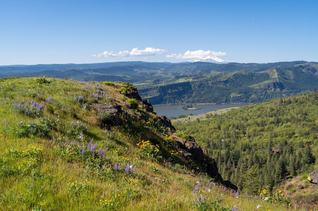
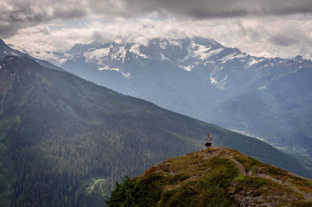
#10: The Coyote Wall Trail (Columbia River Gorge)
- Length: 6.8 miles
- Elevation Gain: 1,600 feet
- Trail Type: Loop
- Difficulty: Moderate
- Dog Friendly? Yes, on a leash
- Pass Required: None
- Trailhead Location: Coyote Wall Trail
We now live in Portland, Oregon, which means we have great access to hikes in southern Washington (like Mount St. Helens and Mount Adams, for example).
It also means that the hikes in the Columbia River Gorge, which marks the border between Oregon and Washington State, is basically our backyard.
We hike in the Gorge all the time, and we tackled the Coyote Wall trail one spring morning in May.
Coyote Wall is a massive basalt rock formation that we have seen from across the Gorge, but had never ventured far enough east to see up close and personal until that recent trip.
We were the first ones in the parking lot – which is on the Washington side of the Gorge a few miles past the town of White Salmon and the Hood River Bridge – and were greeted by a spectacular display of wildflowers once we made the ascent up to the ridge, about two miles into the hike.
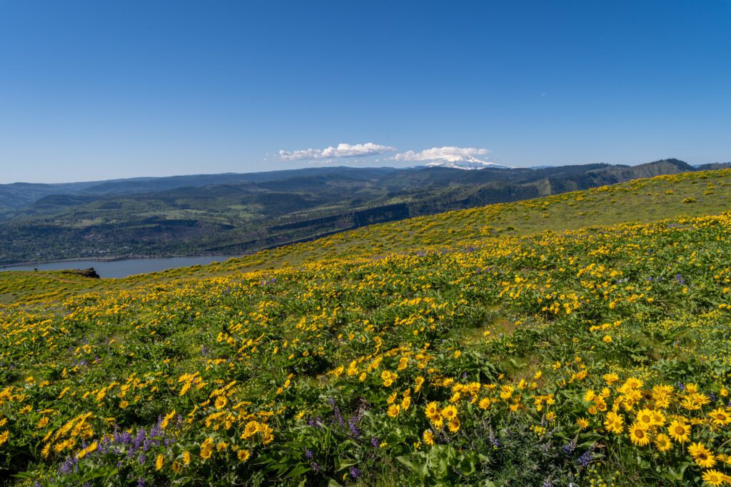
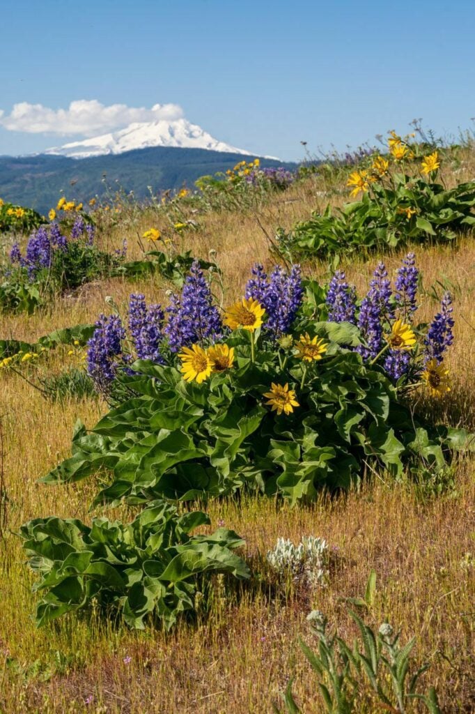
It was early spring, and the trail was COVERED in balsamroot and lupine as far as the eye could see, with Mount Hood’s snowy peak in the distance. Magical.
There are two routes here – the Little Maui trail, which is longer and more gradual, and the Little Moab trail, which is rockier, steeper, and more exposed.
You can do a nice little reverse lollipop, going up Little Moab and coming down Little Maui before following the Coyote Wall trail along the ridgeline.
Watch out for ticks and rattlesnakes on this one, especially in the summer.
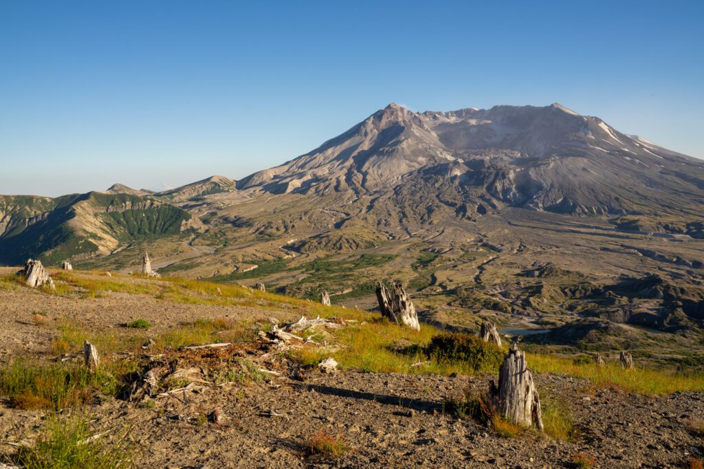
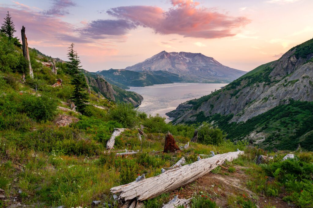
#9: Harry’s Ridge (Mount St. Helens)
- Length: 8.2 miles
- Elevation Gain: 1,000 feet
- Trail Type: Out and Back
- Difficulty: Easy / Moderate
- Pass Required? America the Beautiful Pass
- Dog-Friendly? No
- Trailhead Location: Johnston Ridge Observatory
The best part about this hike is the continuous views of Mount St. Helens’ north face throughout the entire hike.
It’s a pretty easy hike that climbs over rolling hills that are dotted with wildflowers in the summer (June is the best time here).
The only thing that puts it in the moderate category is the distance at a hair over 8 miles. Bring plenty of water and snacks.
The hike starts from the Johnston Ridge Observatory, which is worth a stop to learn all about the active volcano and the eruption that covered the entire Pacific Northwest in ash just a few decades back.
From there, you’ll traverse the surprisingly barren terrain east with minimal elevation gain and loss.
You’ll reach a couple of forks along the way – stay left at the first two to continue northeast, then take the marked turnoff to Harry’s Ridge to start the short and sweet climb to the top of the ridge that overlooks Spirit Lake to the left, and Mount. St. Helens to the right.
From here, you can see the thousands and thousands of logs that are in Spirit Lake to this day from the eruption 40 years ago. The devastation is mind boggling.
Enjoy a snack, taking in the views, and return the way you came.
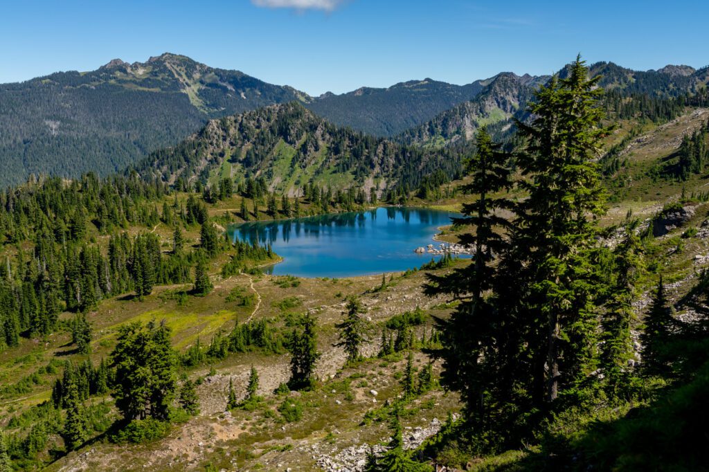
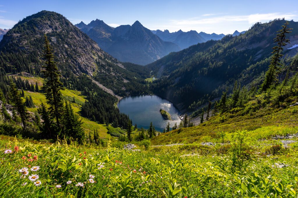
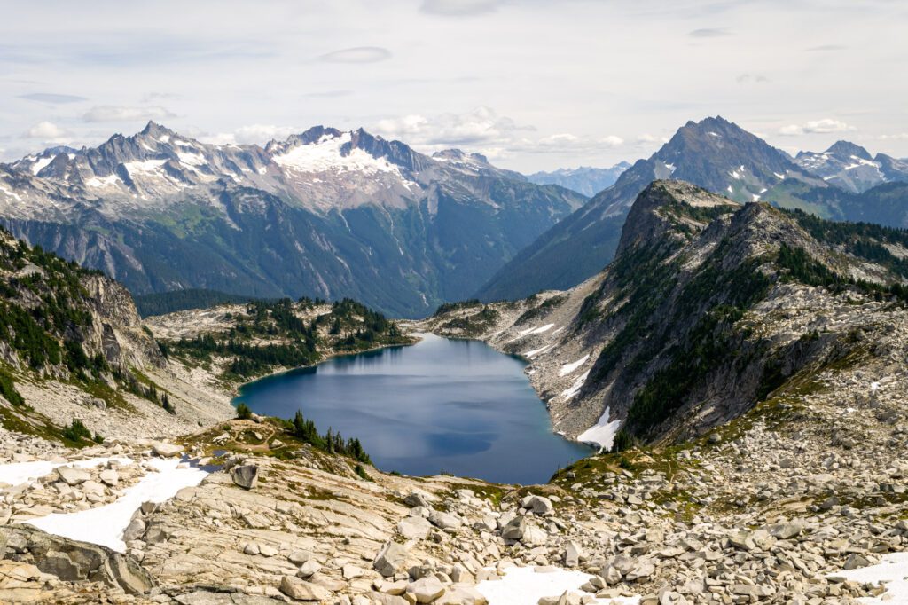
#8: The High Divide / Seven Lakes Basin (Olympic National Park)
- Length: 19 miles
- Elevation Gain: 5,000 – 6,000 feet
- Trail Type: Loop
- Difficulty: Hard
- Pass Required? America the Beautiful Pass
- Dog-Friendly? No
- Trailhead Location: Sol Duc Trailhead
The same summer we got permits to backpack the Enchantments, we also were lucky enough to get permits to do a second of Washington’s best backpacking trips – the High Divide Trail through the Seven Lakes Basin in Olympic National Park.
It’s a loop that takes you through the dense forest up to a ridge where on one side you have a string of seven gorgeous alpine lakes, and on the other you have the Hoh River Valley and Mount Olympus.
It’s quite an effort to get there, but standing atop that ridgeline makes all the sweat worth it.
It’s best done with at least two nights (which is what we did). You need to reserve campsites in advance, and that’s going to be your limiting factor here.
If you can snag a night or two at Lunch Lake, which is up on the Divide in the heart of the best alpine lakes, do it! If not, we’d stay at Heart Lake and Deer Lake on either side of the Divide.
Read More: Hiking the High Divide Trail Through the Seven Lakes Basin in Olympic National Park
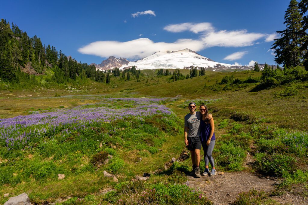
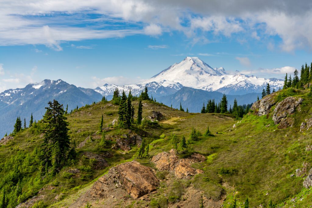
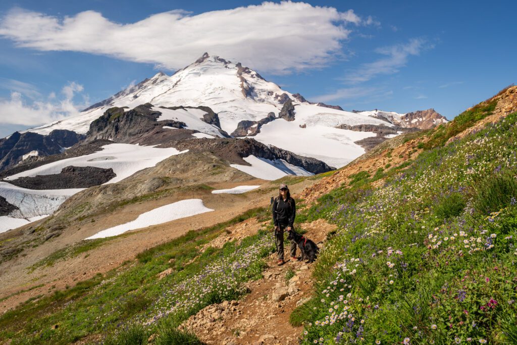
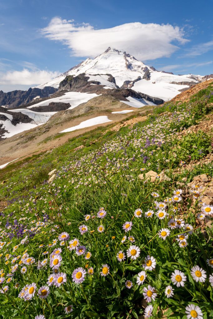
#7: Park Butte (Mount Baker)
- Length: 7.5 miles
- Elevation Gain: 2,200 feet
- Trail Type: Out and Back
- Difficulty: Moderate
- Pass Required? Northwest Forest Pass
- Dog-Friendly? Yes, on a leash
- Trailhead Location: Park Butte Lookout Trailhead
Another hike to another one of Washington’s Insta-famous fire lookouts? BORING.
Just kidding. We loved this hike, and think you will too.
This hike was one of our favorites near Mount Baker, though it’s on the south side of the mountain along Highway 20, which is the gateway to the North Cascades, rather than along Highway 542 (the Mount Baker Highway).
The trailhead is along the western edge of Baker Lake, about eight miles up a treacherous forest road that we barely squeaked through with white knuckles and Alysha at the wheel (she doesn’t like me driving the bumpy roads very much).
Take it slow. But if you happen to have a high-clearance vehicle, definitely drive that.
This hike starts with roughly a mile of meandering through meadows before crossing a bridge over rip-roaring creek (at least when we were there) and you start the climb in earnest.
You’ll climb a series of switchbacks before emerging into some of the most spectacular meadows you’ll encounter anywhere north of Rainier (which has the best meadows in the world, we think).
One after another, you’ll stroll through meadows exploding with wildflowers and amazing views of snow capped Mount Baker before, once again, starting to climb.
This is the final ascent up to the fire lookout, which has jaw dropping views of the surrounding area and Mount Baker.
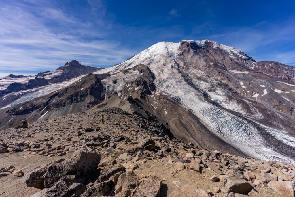
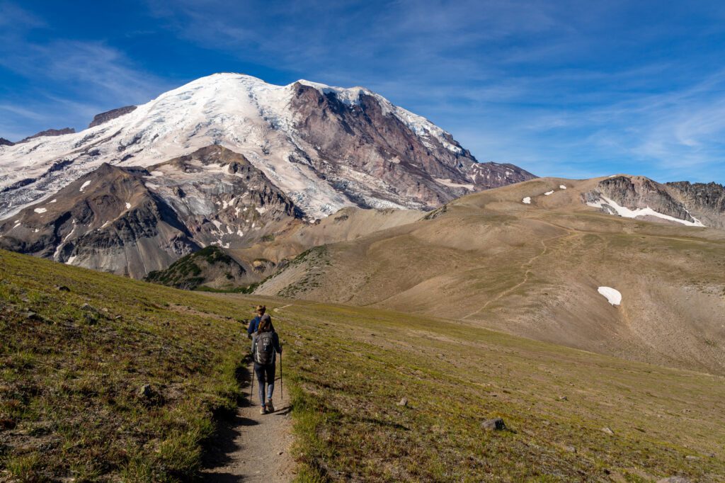
#6: Burroughs Mountain (Mount Rainier National Park)
- Length: 9.5 miles
- Elevation Gain: 2,700 feet
- Trail Type: Lollipop
- Difficulty: Moderate
- Pass Required? America the Beautiful Pass
- Dog-Friendly? No
- Trailhead Location: Sunrise Visitor Center
First of all, if you’ve got gas in the tank, definitely make it all the way to the third borough. It’s worth it.
We were a bit confused by the information in the national park brochure, which seemed to show the trail ending at the second borough.
It doesn’t. Go to the third one, you won’t regret it.
The hike up Burroughs Mountain is the best of the many hikes on the Sunrise side of Mount Rainier, which is less visited but is the highest point you can drive to in the park.
Not that the elevation of the parking lot really matters that much, since you’ll be climbing several thousand feet above it on this hike. Go counter-clockwise.
That will have you climbing Sourdough Ridge, doing the out and back to the three burroughs, and returning via the sunrise trail, which is a nice stroll through the woods.
You’ll start the climb up to Sourdough Ridge from the parking lot, and follow that until you reach a three-way junction in the trail at Frozen Lake.
To the right is the trail up the ridge to Mount Fremont, which is also among the best day hikes at Mount Rainier.
Straight ahead is Berkeley Park, which is wildflower central during the peak summer months.
And to the left is what you came for – the climb up to the three burroughs.
As you ascend to the three vistas, you’ll probably encounter marmots and mountain goats, and maybe even a black bear if you’re lucky (though that would probably be in the meadows on the way down).
Read More: Hiking the Amazing Burroughs Mountain Trail in Mount Rainier National Park
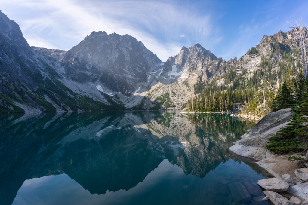
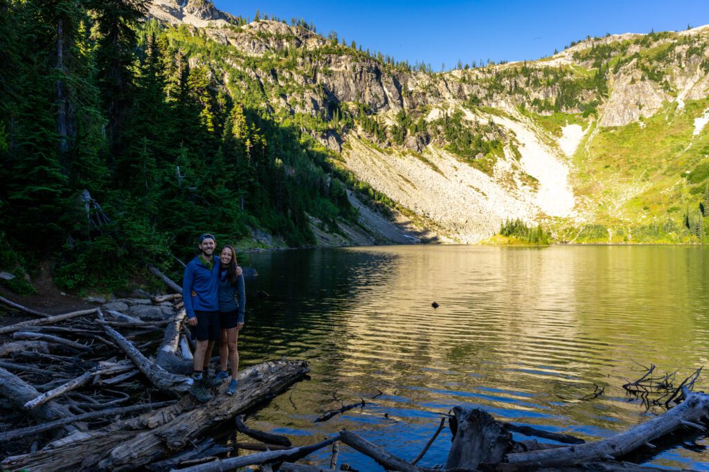
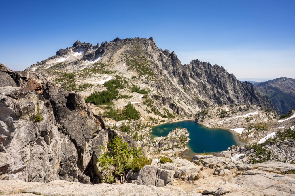
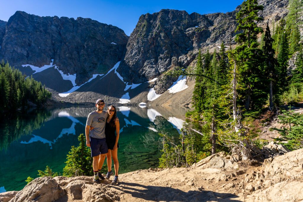
#5: Colchuck Lake (Alpine Lakes Wilderness)
- Length: 8 miles
- Elevation Gain: 2,300 feet
- Trail Type: Out and Back
- Difficulty: Moderate
- Pass Required? Northwest Forest Pass
- Dog-Friendly? No
- Trailhead Location: Stuart Lake Trailhead
Colchuck is probably the most accessible of the lakes in the Alpine Lakes Wilderness, but that certainly doesn’t mean it’s not incredibly beautiful.
Before the sun rises above the nearby peaks, the water is still, with perfect reflections. When the sun is at its highest point, the water turns an unbelievable shade of blue-green.
The hike itself isn’t too bad – at 8 miles and 2,300 feet of elevation gain.
It’s a fairly gradual climb through the forest, but as you approach the lake it definitely gets a little bit rockier and steeper, making it harder as you go.
The views from where you emerge onto the lake are great, but you should definitely explore along the shoreline to the left and right.
The left, in particular, has great views of Dragontail Peak and Aasgard Pass across the lake.
The trailhead gets super crowded, especially in the summer and fall, so we’d recommend getting there before 6:30am, which is when we got there and snagged one of the last parking spots.
The road up to the trailhead is a bit bumpy, but if Homer (that was our Honda Odyssey, RIP) can make it, so can you! Take it slow and you’ll be fine.
You might be wondering why we have this hike in our list but not the full Enchantments route, which we got to do a few years ago as an overnight trip. It’s mostly because it’s not really accessible from a logistical standpoint.
The backpacking permit situation for the Enchantments is wild, and it’s incredibly difficult to get an overnight permit.
And, to be honest, we’re not really interested in a ~20 mile thru-hike because you don’t really get to enjoy the scenery if you’re focused on making it to the trailhead before it gets dark.
Read More: How to Hike the Stunning Colchuck Lake Trail
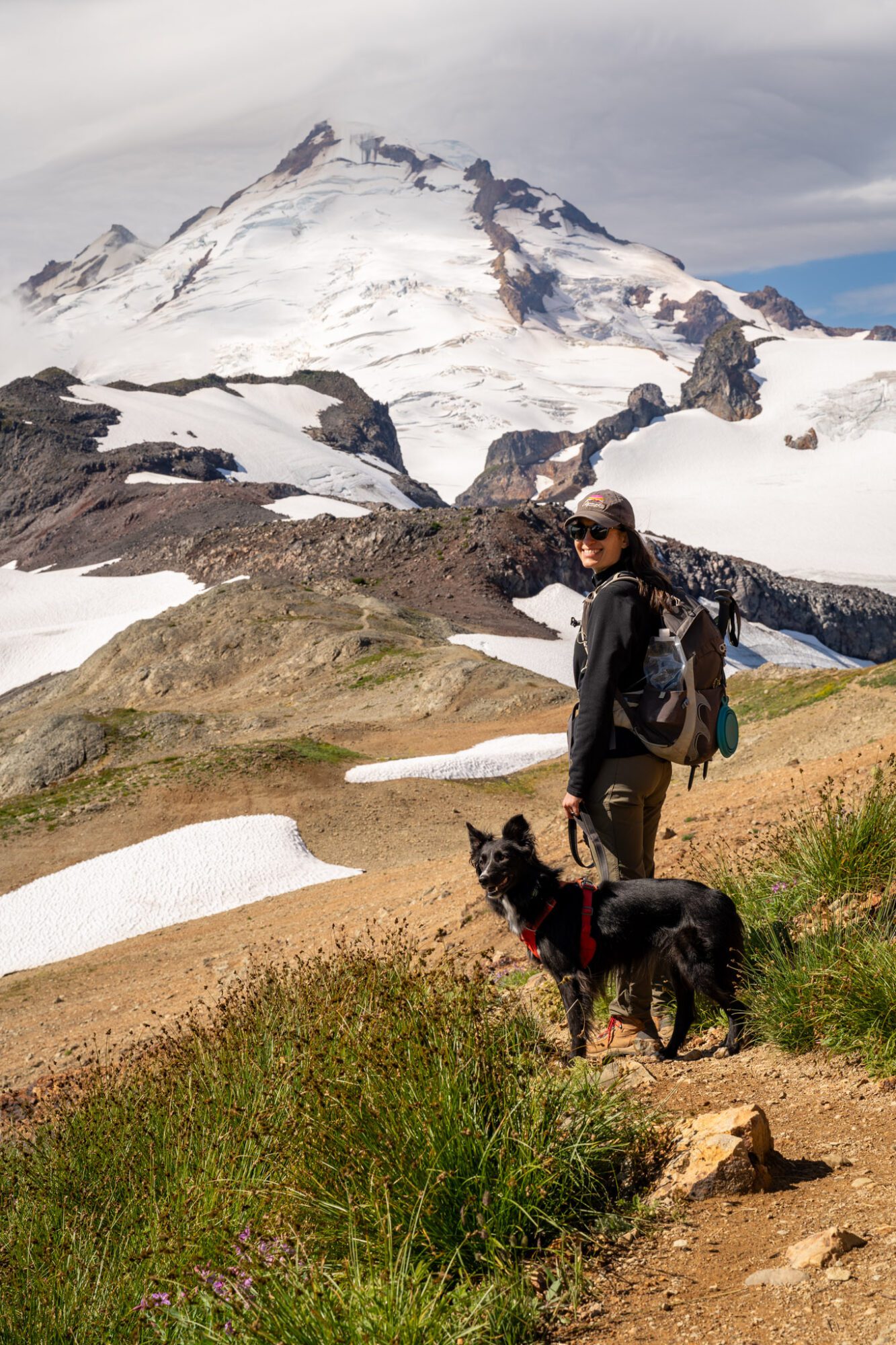
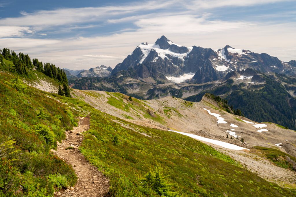
#4: Yellow Aster Butte (Mount Baker Wilderness)
- Length: 8.2 miles
- Elevation Gain: 2,600 feet
- Trail Type: Out and Back
- Difficulty: Moderate / Hard
- Pass Required? Northwest Forest Pass
- Dog-Friendly? Yes, on a leash
- Trailhead Location: Tomyhoi/Yellow Aster Butte Trailhead
The Yellow Aster Butte Trail is our pick for the best hike near Mount Baker. It has literally everything you could possibly want in a hike in the Pacific Northwest, with the exception of a pristine alpine lake with picture-perfect reflections, I suppose.
Wildflowers. Panoramic views. Plenty of climbing to have you waddling around in pain for a few days afterward.
This hike is equally good in the summer and fall.
In the summer, which really starts in August for the whole area around Mount Baker, you’ll get wildflowers lining the trail for miles.
In the fall, the landscape lights up with brilliant reds, oranges, and yellows.
The main downside of this trail, along with the other hiking trails around Mount Baker, is that it’s only reliably accessible two months out of the year – August and September, with October being a little bit sketchy due to snow.
The snow lingers on the trail through July, and then returns quickly in October most years.
This is another hike that requires some tricky driving, at least if you have a low-clearance car, to access.
The trailhead is up a narrow forest road with questionable maintenance.
But once you get there and park, the stress changes to an “oh man, this hike is going to be tough” kind of stress instead of an “is my car going to survive this?” kind of stress.
The climb begins with switchbacks right off the bat before turning into a gradual climb through dense forest.
Eventually, you’ll get your first glimpse of Baker as you emerge into a wildflower meadow and curve around to the left, following the valley.
You’ll emerge onto a ridge, with Mount Baker views galore, before starting the final ascent up to the butte, which is a steep one.
From the top, you can continue on to another summit, which requires climbing along a narrow ridge with steep drop offs on either side.
We decided to skip it, mostly because I’m not a huge fan of heights, but saw two hikers do it while we were at the summit.
Read More: Hiking the Jaw-Dropping Yellow Aster Butte Trail near Mount Baker
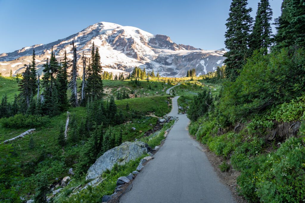
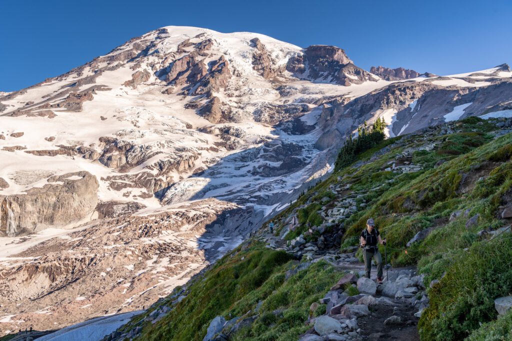
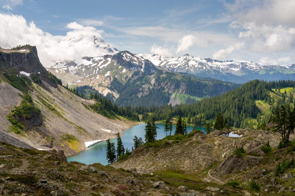
#3: The Skyline Trail (Mount Rainier National Park)
- Length: 5.5 miles
- Elevation Gain: 1,700 feet
- Trail Type: Loop
- Difficulty: Moderate
- Pass Required? America the Beautiful Pass
- Dog-Friendly? No
- Trailhead Location: Henry M. Jackson Memorial Visitor Center
The epic Skyline Trail is at the top of our list of the best hikes at Mount Rainier, and also the best hikes near Seattle, which means it HAS to be on this list.
The hike leaves from the Henry Jackson Visitors Center on the Paradise side of the mountain, which is the most popular area for visitors.
That means that the trail will be packed, but the up-close-and-personal views of the mountain are well worth braving the crowds for.
We’ve now done this hike in both directions, and the decision on which one we’d opt for is complicated (you can read more about it in the trail guide we’ve linked below).
Basically, if it’s early (like, 7am ish), go clockwise, where you’ll have the best meadow and mountain views in front of you on the way up.
If it’s later and already crowded, go the opposite direction (counterclockwise) for the solitude on the eastern half of the loop.
The ascent up the eastern half of the trail is much more gradual, which makes it a bit more pleasant.
We strolled along the path (which was eventually covered in snow… in late July), passing babbling brooks and fuzzy marmots on our way to Panorama Point.
If you do hike counterclockwise you’re going against the flow of traffic, which given the crowds means you might be waiting for people going the other way to pass a lot.
But, on the other hand, you might just be waiting behind them to pass them if you were going the other way, so it’s probably a wash.
The views from Panorama Point are incredible – you can see the face of Mount Rainier so close it seems like you can basically reach out and touch it, and to the other direction you’ve got panoramic views of the Tatoosh Range, Mount Adams, and Mount St. Helens.
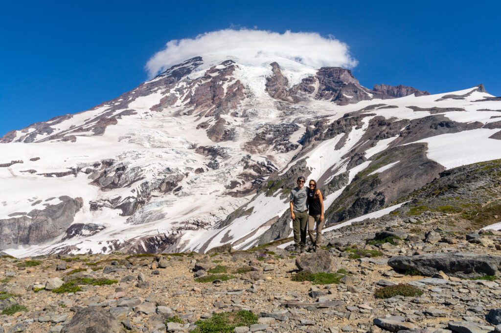
It’s truly spectacular, and we think it’s one of the best views in all of Washington.
Read More: Hiking the Skyline Trail at Mount Rainier – A Complete Trail Guide
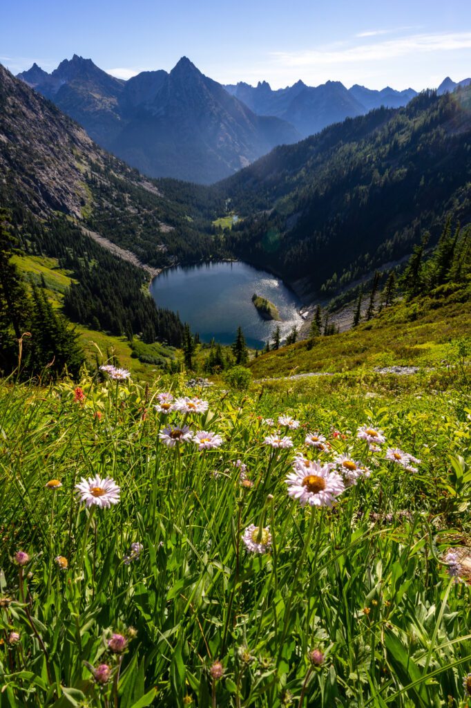
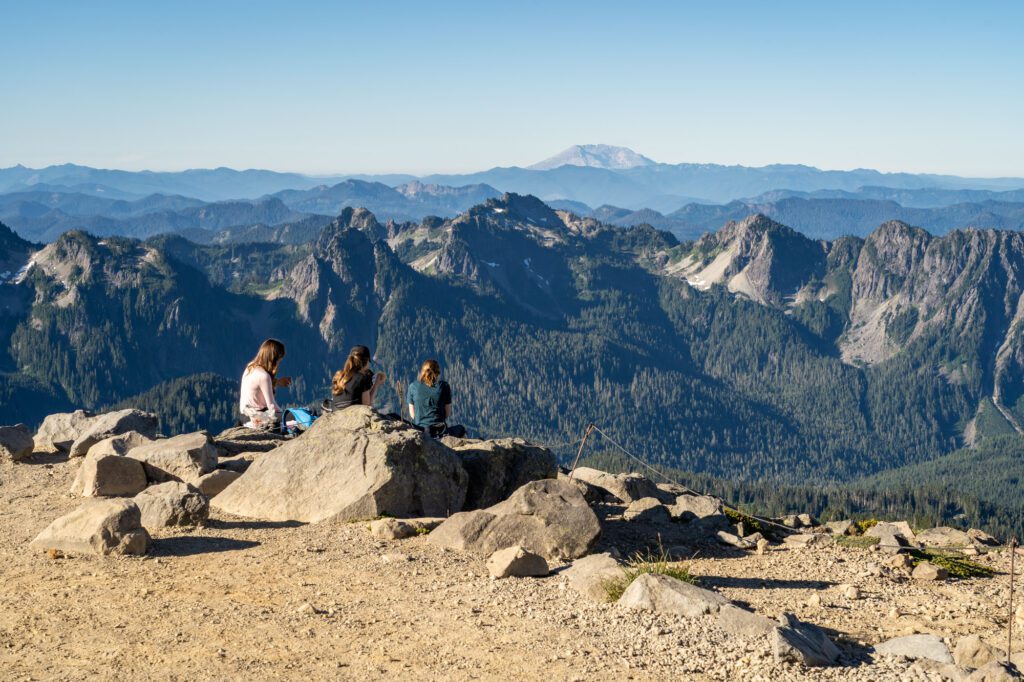
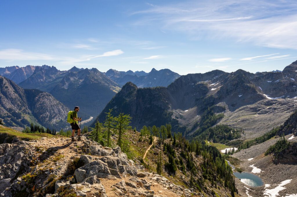
#2: The Heather Maple Pass Loop (North Cascades National Park)
- Length: 7.6 miles
- Elevation Gain: 2,100 feet
- Trail Type: Loop
- Difficulty: Moderate
- Pass Required? Northwest Forest Pass
- Dog-Friendly? Yes, on a leash
- Trailhead Location: Maple Pass Trailhead
We think this is the best hike in the state in terms of bang for your buck. We’ve done it twice, and would do it again in a heartbeat.
You’ll get the picturesque rocky peaks that are quintessential North Cascades, a gorgeous lake framed by said rocky peaks, and panoramic views of the surrounding area from the top of the pass. Plus, marmots.
We recommend tackling this hike counter-clockwise for a couple of reasons.
First, if you choose to do it counter-clockwise, the views will be in front of you as you descend from the high point in the hike.
Second, the trail is more gradual along the north side of the lake, which means you’ll have a more gentle climb and a steeper descent.
If you have knee problems, you might want to go the other direction to save your knees.
If you choose to go the same direction we did, you’ll start with a series of switchbacks, climbing away from the parking lot.
It’s a gradual climb to the top of the pass, and you’ll gain about 2,000 feet of elevation in 3.5 miles – just over 500 feet per mile.
Not too hard, but plenty of climbing to get a good workout in.
About a mile and a half in, take the fork in the trail to the left to make a quick detour to Lake Ann.
It adds a mile to your trip, but is worth seeing the lake from the shoreline before you climb the pass and see it from above.
At the top of the pass, you’ll have panoramic views over Lake Ann and the surrounding peaks.
The views to the east are particularly impressive from the summit, with the trail winding its way through the landscape, with the Cascade Range in the distance.
This trail is amazing in the summer and fall. In the summer, which is mid-July for the North Cascades due to late snowmelt, wildflowers are everywhere.
In the fall, the larches turn gold, and fall color illuminates the landscape with beautiful hues of red, orange, and yellow.
Remember that the scenic North Cascades Highway is closed seasonally, often between November and May.
But you’ll still find tons of snow on the trails through mid-July, which is the earliest you should consider visiting if you plan on doing some hiking.
Read More: A Complete Guide to Hiking the Heather-Maple Pass Loop in the North Cascades
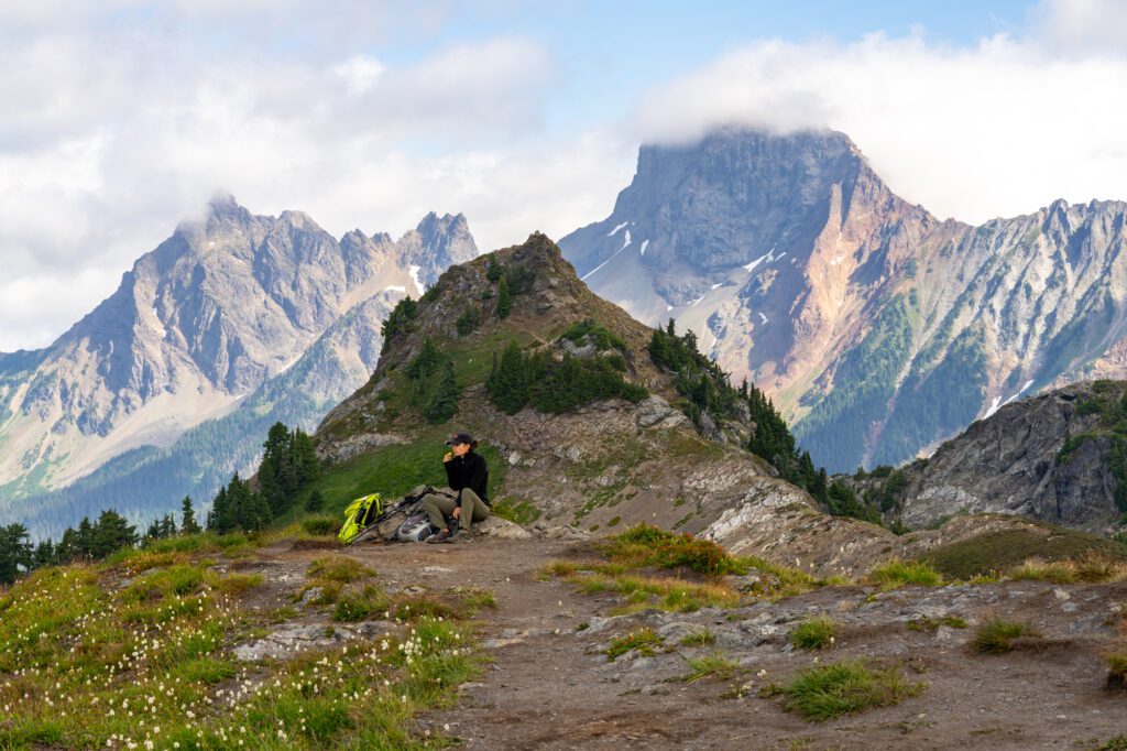
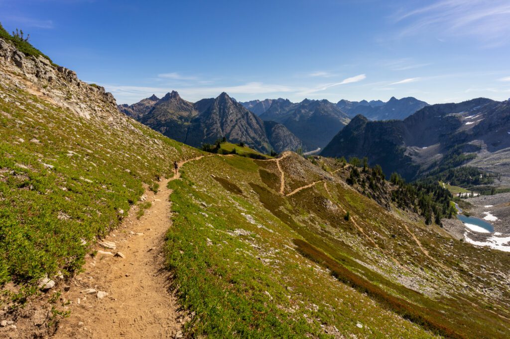
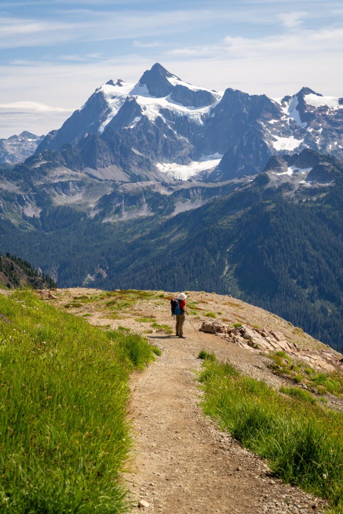
#1: The Ptarmigan Ridge Trail (Mount Baker Wilderness)
- Length: 10.5 miles (11.5 miles to the Portals)
- Elevation Gain: 1,800 feet (~2,200 feet to the Portals)
- Trail Type: Out and Back
- Difficulty: Hard
- Pass Required? NW Forest Pass (or America the Beautiful Pass)
- Dog-Friendly? Yes (on a leash)
- Trailhead Location: Artist Point
This is the most recent addition to our list, and while it may be a bit of recency bias that is affecting our ranking, this hike is truly spectacular and, we think, deserves to be in the same conversation as some of the most iconic hikes in the state (Maple Pass and Skyline, for example).
However, we think the reason it’s not usually in that conversation probably has to do with the location.
It’s up at Mount Baker at the end of Highway 542, tucked away near the northern border of the state. Which means it’s really, really far from any of Washington’s main cities, and a full 90 minutes from Bellingham, the nearest city.
Location aside, this hike is full of nonstop views because you are hiking towards one of the northwest’s most iconic peaks… in either direction.
On the way out, you’re hiking directly toward the hulking figure of Mount Baker, which looms in the distance at the beginning of the hike and is towering over you when you end the hike right at the base of Baker.
On the way back, Baker is behind you, but you’re hiking directly towards Mount Shuksan, the other notable peak in this area.
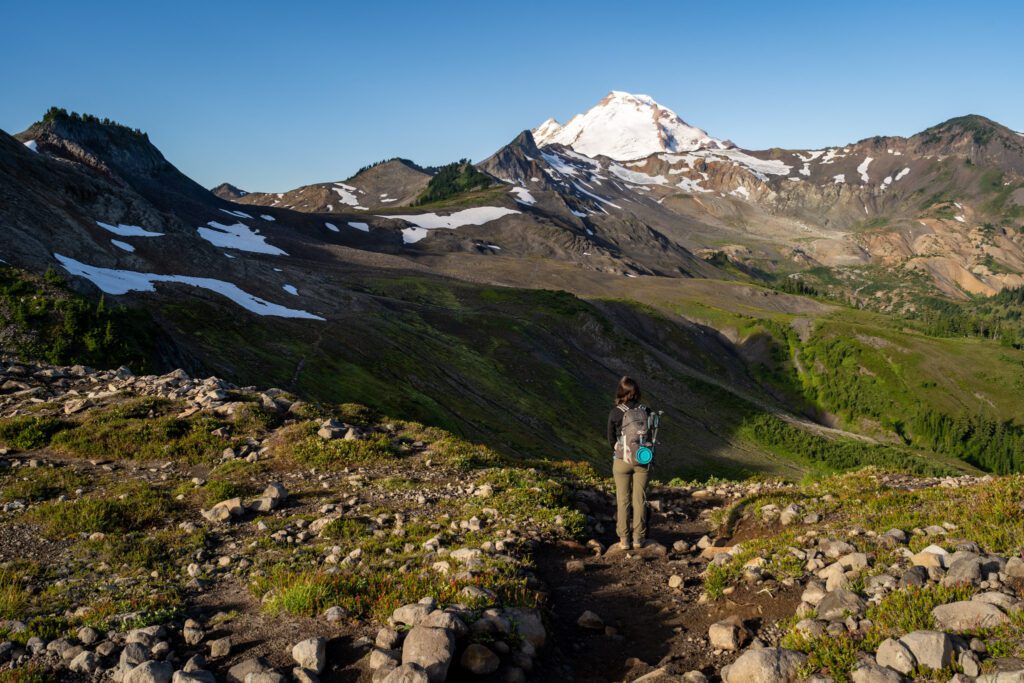
It’s magic for mountain lovers, and while the hike is long and exposed (there is basically no shade the entire way because you’re above the treeline), it’s not terribly difficult in terms of climbing.
A Note on the Route: The statistics above represent the hike to Camp Kiser, which more or less represents the end of the maintained trail.
Going another half mile (ish) involves some route-finding and scrambling along a rocky route with steep drop offs that takes you even further, ending at the Portals East (you can’t go any further).
We cut our hike off at the end of the maintained trail given the fact that we had the dog with us and didn’t feel comfortable going further with her.
Read More: Hiking the Ptarmigan Trail at Mount Baker – A Complete Trail Guide
Honorable Mentions: Even More Spectacular Hikes
If you know me (Matt), then you know brevity isn’t exactly my strong suit.
Since we cut the main list of our favorite trails down to just 10 hikes, we’re going to put our honorable mentions in this section.
Again, these are all hikes that we’ve done ourselves and really enjoyed, but for the sake of brevity, were relegated to this section.
Like we’ve said throughout, there are SO MANY great hikes in this state, and the fact that this section is so long is a testament to that fact.
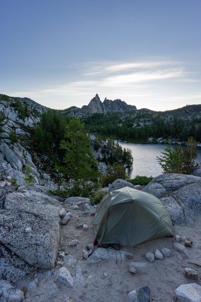
The Enchantments (Alpine Lakes Wilderness): While we included a shorter, more accessible version of this hike in the main list (Colchuck Lake), it is certainly worth mentioning the full Enchantments route somewhere in this guide because it is magnificent.
Once you ascend past Colchuck, climbing treacherous Aasgard Pass, you find yourself immersed in high alpine paradise.
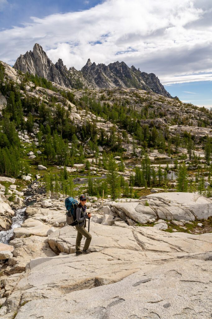
It’s a long route at 19 miles and 4,500 feet of elevation gain, and we don’t really have much interest in doing it as a day hike, but backpacking trips require an elusive permit that you have almost zero chance of actually getting.
Great hike, but the hoops you have to jump through are what make this an honorable mention.
We have an entire separate guide to hiking the Enchantments, which you should read for more information on permits, routes, etc etc.
Hidden Lake Lookout (North Cascades National Park): One of the first hikes we ever did in any of the national parks in the Pacific Northwest, and what a note to start on!
This is a tough hike that relentlessly climbs up to a saddle, and from that saddle you have jaw-dropping views out over the basin where Hidden Lake is tucked away, backed by the rocky peaks of the North Cascades.
The road to the trailhead is fairly rough (we had my mom’s big SUV), and you should check trip reports for current road and trail conditions.
The Naches Peak Loop (Mount Rainier): If you’re looking for a nice, easy hike away from the most chaotic parts of Mount Rainier National Park, this is a great option on the eastern edge of the park (part of the trail is inside the park, part of it is outside).
The views of the wildflower-laden meadows and snowcapped peak of Rainier are unbeatable, especially when you consider that it’s just a three mile loop with 600 feet of elevation gain.
Here’s our guide to hiking the Naches Peak Loop with all the details you need to plan your trip.
Lake Ann & Chain Lakes Loop (Mount Baker): To be clear, these are two separate hikes up near Mount Baker that leave from trailheads that are basically across the road from each other.
We love hiking around Mount Baker (two of our top 10 are up there), and these two hikes are the third and fourth hikes we’d prioritize up there.
Chain Lakes is a nice loop that takes you down into a basin with a smattering of alpine lakes, while Lake Ann is an out-and-back to an alpine lake at the base of Mount Shuksan. Magical, both of them.
Bench & Snow Lakes Trail (Mount Rainier): This hike is an excellent option in the Paradise area at Rainier, and the fact that it’s down on Stevens Canyon Road – away from the main parking lot – means that it’s also a bit less crowded. It’s a relatively easy climb to two beautiful lakes.
Norway Pass (Mount St. Helens): A little harder to access than Harry’s Ridge because of its location on the back side of Mount St. Helens, the views of St. Helens are no less spectacular (it’s one of the hero images on our home page).
While it’s far from Seattle or Portland, it’s actually a pretty accessible hike from an elevation profile perspective, and the payoff at the end is incredible.
Blue Lake (North Cascades National Park): This hike, along with Naches Peak above, are perhaps the two best bang-for-your-buck hikes in the state.
It’s a relatively easy climb up to a beautiful alpine lake that is emblematic of the raw beauty of the North Cascades.
The Enchanted Valley (Olympic National Park): Another great backpacking trip in Olympic National Park, this hike follows a babbling creek through a lush, fern-y rainforest before emerging into an open valley surrounded by rocky peaks.
It’s a long-ish hike into the valley (~13 miles), but it’s relatively flat and is not particularly difficult. It’s a busy trail, and you need a permit in advance.
More information on permits and trail details in our guide to hiking the Enchanted Valley Trail.
Wallace Falls (Highway 2 / Gold Bar): Is Wallace Falls the best waterfall hike in Washington State?
If we’re talking about waterfalls that ACTUALLY involve hiking to reach (so Palouse and Snoqualmie are out), we’d say it’s right up there with Comet Falls near the top of our list.
It’s at the western end of Highway 2 near Monroe, which makes it an easy day trip from Seattle, at about an hour and a half away from downtown (without traffic).
This is a fairly moderate hike that follows the Wallace River for most of the way, with three main attractions along the way.
First is the view of the Lower Falls, which is cool, but isn’t the best view you’ll have.
A bit of climbing later brings you to the highlight, the Middle Falls, which is the best view of the entire hike.
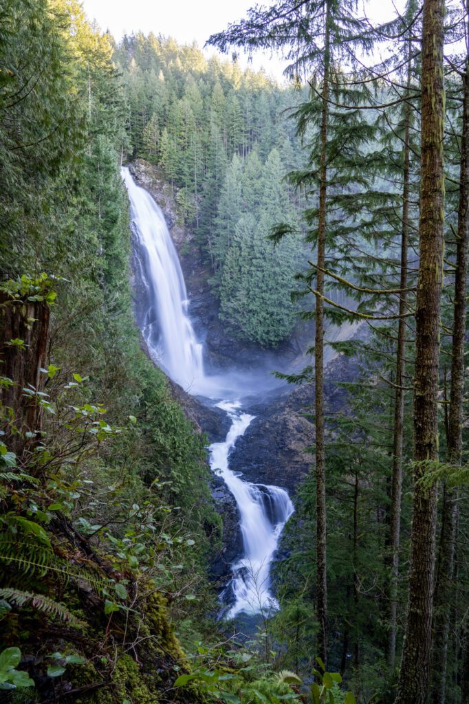
From there, a set of switchbacks separates you from a commanding view out over the valley all the way to the Olympics (and the upper falls, which is barely even worth mentioning).
More information on permits and trail details in our guide to hiking the Wallace Falls Trail.
In addition to these hikes, we have a few trails that are high on our bucket list that, for one reason or another, we just haven’t gotten to yet.
Namely Cascade Pass / the Sahale Arm in the North Cascades and Lake Ingalls in the Alpine Lakes Wilderness.
The Best Hikes in Washington State, Mapped
So you can visualize where these hikes are, here’s a map of the hikes in this guide (really, the trailheads for the hikes).
Pro-tip: To view a full size version of the map, click on the “expand” icon in the top right.
Things to Know Before You Hit the Trails in Washington
Before we get into the hikes themselves, here are a few things we think you should know before you hit the trail.
In the list above, you’ll find hikes in state parks, national parks, and on national forest land. The parking pass situation can be confusing!
Which is why for each hike, we’ve included a bullet for which parking pass you’ll need to display at the trailhead.
Here’s a high-level summary of the passes you might need.
A Northwest Forest Pass covers all of the trailheads on national forest land in both Oregon and Washington State, and is essentially a must-have for hikers in either state because the vast majority of hikes are on federal land.
However, the America the Beautiful Pass (colloquially, the “national parks pass”) covers all federal land in the country, including national forests.
Basically, if you’re planning to visit more than two national parks in the next 12 months, buy an America the Beautiful Pass.
If not, just get a Northwest Forest Pass (also available at REI).
There are sometimes day pass envelopes at trailheads, but you should know that the infrastructure on national forest lands is much less reliable (and you’ll need $5 cash in most cases).
There are also a couple of hikes on this list that are on land that is operated by Washington State Parks.
There is an annual Discover Pass that is a great deal for Washington residents, otherwise you can pay the entrance fee when you enter the park. More information here.
Summer in the mountains in Washington State starts in mid-to-late July.
For the most part, trails at higher elevations – this includes Mount Rainier, the North Cascades, Snoqualmie, and Mount Baker – are covered in snow from November to June, sometimes later.
July and August is the ideal time to visit Washington State for the most consistently nice hiking weather, but it is also peak tourist season – expect accommodations and flights to be the most expensive if you’re coming from out of town.
If you want to avoid premium prices and crowds, September and October are generally fairly nice, but there will definitely be a higher chance of gray and drizzly days.
Plus, the larches in the Cascades light up the hills with their brilliant golden shine during the middle of October, which is quite a sight.
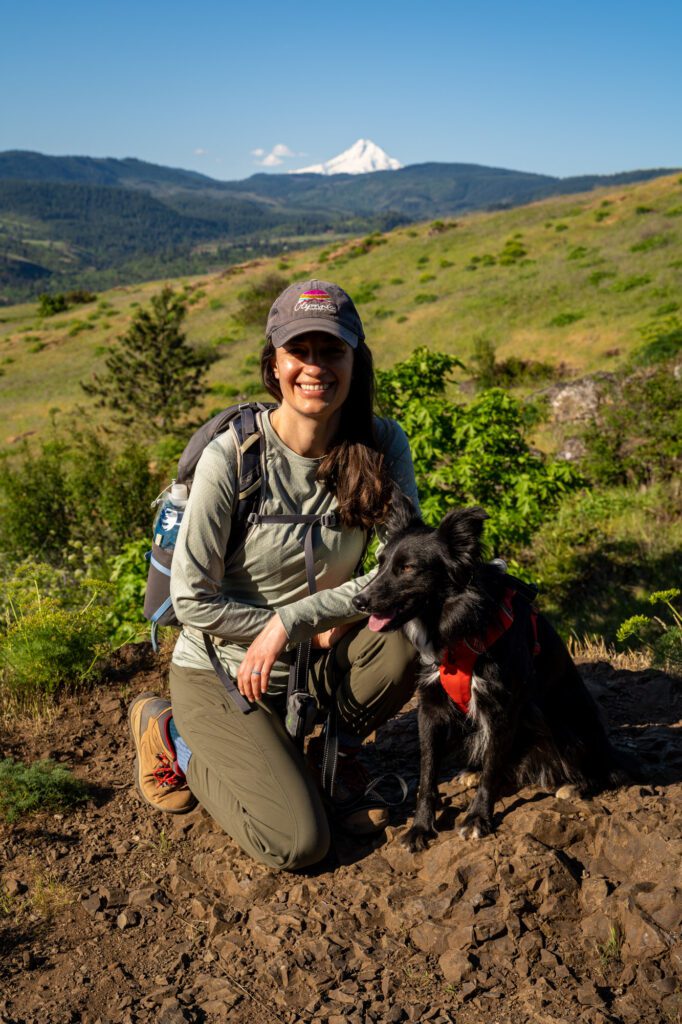
Dogs are generally allowed on trails, EXCEPT in national parks. You should really keep your dogs on a leash (even if they’re friendly – which Lupine is – you don’t know if other dogs are friendly, if people are scared of dogs, or what wildlife you’re going to encounter!).
And pick up your dog poop bags (or better yet, have the dog wear a harness with pockets and make them carry it!).
Washingtonians LOVE hiking, so expect things to be busy. Particularly on the top 10 hikes we have below, which include some of the most popular in the state.
Plan on being at the trailhead early to beat crowds and get a parking spot (or, alternatively, visit in the late afternoon/evening, when it’s generally a little calmer).
There are some gnarly forest roads in Washington. I would say a solid 70% of the great hikes in the state are on National Forest Land, which means you’re dealing with forest roads that may or may not have been maintained in the past decade or so.
There are many hikes that we haven’t done yet because we’re anxious about driving 20+ miles on a bumpy gravel forest road.
If you have a vehicle that is AWD and high clearance, you’re probably good.
If you have a low clearance vehicle, we’d recommend reading trail reviews on either Alltrails or the Washington Trails Association to get an idea of what you’re getting into ahead of time (if the road is bad, people will mention it).
More to Explore in Washington State
Heading to the great state of Washington? Here are some other posts you might like.
- The Best Things to Do in Seattle: A Complete Guide for First Timers
- Where to Stay in Seattle: 5 Amazing Areas to Stay
- How to Plan an Amazing Weekend in Seattle (3 Day Itinerary)
- Two Days in Seattle: The Best of Seattle in 48 Hours
- One Day in Seattle: How to See The Best of Seattle in a Day
- The 8 Best Day Trips from Seattle: A Complete Guide
- 10 Amazing Weekend Getaways from Seattle: A Complete Planning Guide
- Where to Find the Best Coffee in Seattle: 15+ Amazing Seattle Coffee Shops
- Gluten Free Seattle: A Complete Travel Guide for Celiacs
- How to Plan an Amazing Washington State Road Trip
- The 19 Best Airbnbs in Washington State
- 33 Incredible Cabins in Washington State
- 12 Amazing Easy Hikes in Washington State for Beginners
- How to Plan an Amazing Olympic National Park Itinerary
- What to Do in Leavenworth, Washington: A Complete Guide
- What to Do on San Juan Island: A Complete Visitors Guide
- The Best Things to Do on Orcas Island: Complete Planning Guide
- The Best Things to Do on Vashon Island: A Complete Day Trip Guide
Hello from Saskatchewan…
We are planning a Washington trip next fall.
When you rate the trails as a no for dog friendly…does that mean dogs are not allowed or just the difficulty of the trail?
Hey Treena! Obviously, it depends on your dog and what they’re able to do, but we’re generally referring to whether or not they’re even allowed on the trail. Usually both though – there are only a couple of trails I can think of that would be one but not the other, and they’re both in Oregon. Washington is great for dog hiking buddies, and the only thing you need to keep in mind is that national parks don’t allow dogs (which is different from yours in Canada – we spent two weeks in the Canadian Rockies last summer with our pup hiking our hearts out). Does that make sense?