
How to Plan an Incredible Utah National Parks Road Trip
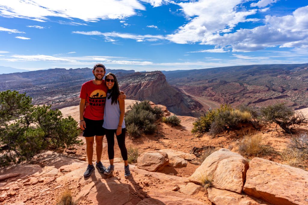
Over the last few years, we’ve been to 18 national parks as we spent a few years living in a Honda Odyssey on a never ending road trip (before settling down here in Portland, Oregon).
As you might imagine, one of the questions we get asked most often – both online and in person – is what our favorites are.
Well, multiple national parks in Utah make it into our top five list of America’s national parks (though we haven’t visited them all…yet).
We’ve now been twice in the past few years – fall and spring – and have updated the guide below with some of our latest discoveries.
We absolutely love Utah, and think you will too. I, Matt, have been to Utah four or five times at this point, including two trips in the past few years. The diversity of landscapes in southern Utah – which is home to the “Mighty Five” national parks – is pretty mind boggling.
You’ll find natural arches in, well, Arches National Park. Unique rock formations called hoodoos in Bryce Canyon. The vast and surprisingly lush canyon in Zion National Park. And there’s so much more – it would take a lifetime of exploring to see everything that Utah has to offer.
If those incredible landscapes sound like something you want to experience, you’re in the right place.
In this Utah national parks road trip itinerary, we’re going to cover – in almost excruciating detail – how to plan an amazing road trip through Utah.
We’ll begin with some important logistics, like where to start and end your trip and how many days to spend in Utah, and then get into the best stops, things to do and see, sunrise and sunset spots, hikes, places to stay, and more.
Sound good to you? Let’s get into it. We love Utah, and think you will too.
Disclaimer: Some of the links in this post, like hotel links, are affiliate links, meaning at no additional cost to you, we make a little bit of money if you click through and book. That being said, we would never recommend something to you that we don’t stand behind 100%.
How Many Days Do You Need in Utah?
We think that you need a full 10 days to do the complete Mighty Five circuit.
Less time means a lot of driving and not a lot of time dedicated to each park.
With 7 days, you’d essentially only have one day for each. Which we don’t think is enough time.
Some parks have more to see than others and are worth spending two to three days in to have the best experience.
We’ve written this guide for someone with 10 days, which I think is the perfect amount of time to see all five national parks in Utah, and have an extra day to spend on the other things that make Utah special.
What if You Only Have 5-7 Days?
If you have a week or less in Utah, we’d strongly urge you to focus on EITHER Zion National Park and Bryce Canyon, OR Arches, Canyonlands, and Capitol Reef.
When you include driving time, which totals around 10 hours or so over the course of the itinerary, 5-7 days BARELY gives you a day in each park if you were to do all five.
Focusing your time on only a few of them will give you a little more time in each park, rather than spending less than one day in each.
The key benefit of this approach is that you’ll be able to spend more time in the early morning and late afternoon, which is when the crowds are thinnest at these parks.
Where to Start and End Your Road Trip
There are two options for getting to Utah – driving in from nearby, or flying in, renting a car, and driving.
The two best starting points for this road trip are Las Vegas and Salt Lake City. Denver is a distant third. It’s still doable, but involves more driving.
If you don’t live nearby, like in Salt Lake City or Denver, you’ll need to fly to one of the gateways to Utah, rent a car, and drive to your first destination.
The two easiest airports to fly into would be Salt Lake City and Las Vegas.
From Salt Lake City, it’s going to take around four hours to drive to the start and end points on this road trip itinerary (Zion and Moab).
From Las Vegas, it’s going to be just two and a half hours to Zion, but six and a half hours to Moab.
The best way to do this road trip if you want to avoid long days of driving is to fly into Salt Lake City and out of Las Vegas, which is how we’ve organized the itinerary below.
You could absolutely do it the other way around, but doing it this direction front loads the longer drive from Salt Lake City to Moab, versus having to do that drive at the end of your trip when your enthusiasm is waning and you only have your return flight to look forward to.
You can also fly in and out of the same airport, it’ll just involve a few hours of extra driving on one end of the trip.
You could fly into Denver and out of Vegas if you wanted to add on a few days exploring Colorado.
It’s going to be five and a half hours of driving between Denver and Moab, but there’s plenty of things to do and see along the way.
Important Note: You need to check with the rental car company to make sure that it’s okay to pick up in one spot and drop off in another.
You might have to pay a one way fee, but we think it’s worth it to avoid wasting a day of your vacation driving.
The Perfect 10 Day Utah National Parks Road Trip Itinerary
Now, on to the itinerary itself!
Below, you’ll find a detailed day-by-day itinerary for a 10 day road trip based on our personal experience over the course of multiple trips.
We’ll give you our favorite stops, the best hikes, places to stay, and more.
Grab a cup of coffee and strap in – this is a long one, but it has literally everything we could think of to help you plan an amazing adventure.
Here’s an overview of that road trip, plus a map to help you visualize the route.
Here is the 10 day itinerary that you’ll find – in detail – below:
- Day 1: Arrive in Salt Lake City, Drive to Moab
- Day 2: Arches National Park
- Day 3: Canyonlands National Park (Island in the Sky)
- Day 4: Around Moab + Drive to Capitol Reef
- Day 5: Capitol Reef National Park + Drive to Bryce
- Day 6: Bryce Canyon National Park
- Day 7: Bryce Canyon National Park + Drive to Zion National Park
- Day 8: Zion National Park
- Day 9: Zion National Park
- Day 10: Zion National Park + Fly Home from Vegas
If you have a full two weeks in Utah, you’ll be able to get a little bit off the beaten path, exploring places like Kolob Canyons in Zion National Park and the Needles District in Canyonlands National Park that most visitors never even realize exist.
Below the full itinerary, you’ll find our suggestions for extending the 10 day trip.
With 7 days, rather than trying to fit in the entire Mighty Five Circuit, we’d opt for spending 7 days exploring EITHER Zion, Bryce, and Capitol Reef OR Arches, Canyonlands, and Capitol Reef.
Days 1 & 2: Arches National Park
On your first day, you’ll spend most of the day in transit between Salt Lake City and Moab, which is the jumping off point for this itinerary.
We spent five full days in Moab, and loved just about every minute of it – minus the hour-long wait to get into Arches National Park to check into our campsite.
A good reminder to make sure to enter the parks early (before 9:00 am at the latest!) to avoid long lines and crowds.
We didn’t realize it before arriving, but there are an astounding number of things to do in Moab.
Between exploring the two national parks that are a stone’s throw away – Arches and Canyonlands – to hikes outside the parks, and more adventurous activities like whitewater rafting and 4WD-ing, there’s plenty to keep you busy even if you had a full week JUST in Moab.
Pssst! Make sure to read our guide to the best places to stay in Moab to find the perfect home base for exploring this incredible area.
What to Do in Arches National Park
Here are our favorite things to do in Arches National Park.
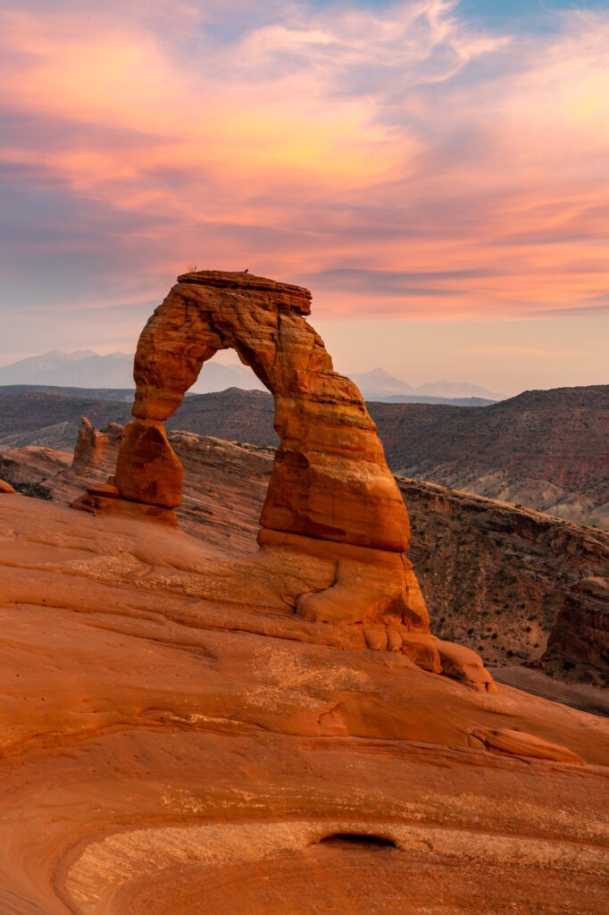
Sunset at Delicate Arch
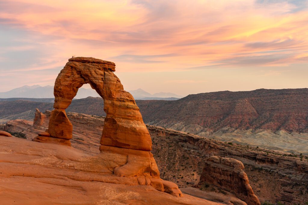
On your first day, you’ll be driving from the airport and you’re probably going to be arriving mid-afternoon depending on what time your flight was (try and get the earliest flight possible!).
Check into your accommodations for the next few days and head up to Arches National Park for that sweet, sweet golden hour light and sunset at Delicate Arch.
It’s a 3 mile hike (round trip) that was a little harder than we thought it would be, but that didn’t stop literally a hundred people – ages 5 to 65 – from doing it.
It will probably be crowded if you’re there anytime between April and the end of October, but it’s worth it.
You’ll climb up a section of rock, so you’ll want to wear your hiking shoes with plenty of grip.
There’s one short section of the trail right before you get to the arch that’s narrow with a steep drop off, so keep an eye on your kids.
If you do that hike at sunset, make sure to bring a headlamp for the way down.
It gets dark FAST, and the last thing you want is to be hiking down the slab of rock in the dark.
The Windows and Double Arch
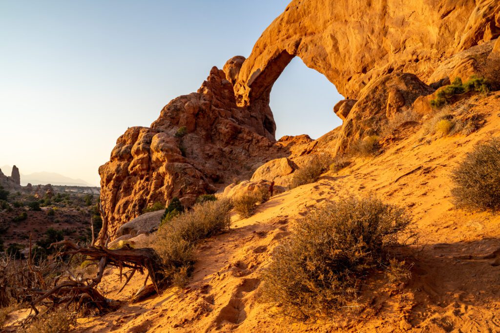
Start your day off your second day with an early morning at the Windows and Double Arch, which are quite possibly our favorite set of arches in the park.
And they’re so close together that you can easily see all of them (there’s four arches here in total) in about an hour or so.
The Windows are two huge rock formations that are on the southeast side of the parking lot.
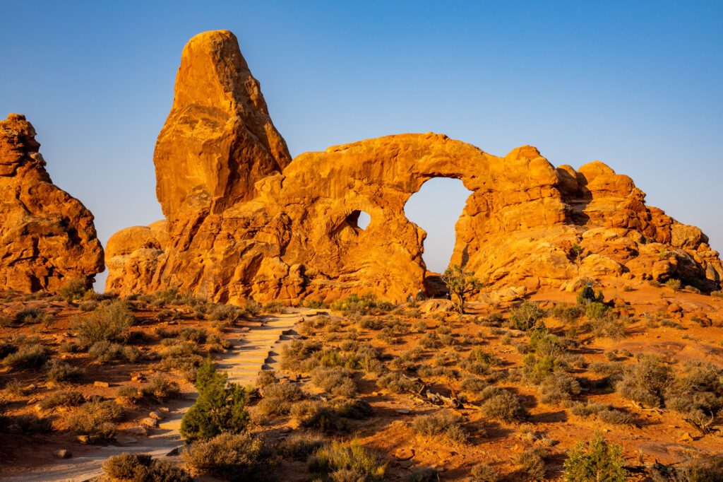
There’s a nice trail that connects the North and South windows, along with nearby Turret Arch.
Make sure to walk through the North Arch and look back through the window to get a nicely framed picture of Turret Arch.
Double Arch is on the opposite side of the parking lot, and it’s the tallest arch in the park. There are two separate (huge) arches that you’ll be looking up at.
You can climb around inside the arch and marvel at the two arches sharing the same base structure. It’s about a quarter of a mile from the parking lot on a flat, sandy trail.
Hike the Devils Garden Trail
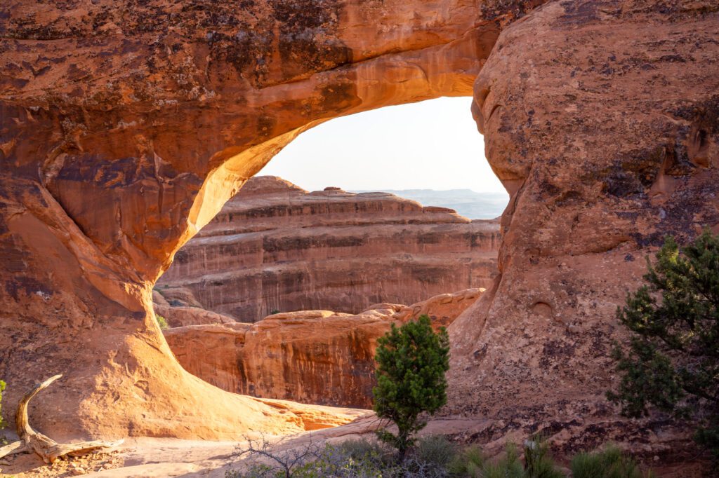
The Devils Garden Trail is a must-do hike in Arches National Park.
The best part about this hike? You can customize it based on your experience and fitness level.
If you do the entire loop, including the fun primitive trail on the way back, it’s going to be just under seven miles, with 1,000 feet of elevation gain.
Along the way, you’ll see seven different arches, and you’ll do some light scrambling and trail finding on the primitive trail, which we thought was a lot of fun.
You’ll want solid hiking shoes or hiking boots (Alysha loves her Columbia Newton Ridge boots, an excellent first hiking boot) with good traction for the scrambling sections, which have you making some steep climbs on rock that necessitate good footing.
It’s nothing too crazy though if you’re an experienced hiker.
If you’re not up for 7 miles in the desert, do the 2 mile hike to Landscape Arch or the 4 mile (ish) hike to Landscape, Navajo, and Partition Arches, which takes you a bit further than most of the hikers go.
Whatever you choose, it’s going to be hot. Drink plenty of water, eat plenty of snacks, and wear sun protection. Sun exposure is no joke, particularly in the summer.
Broken Arch and Skyline Arch
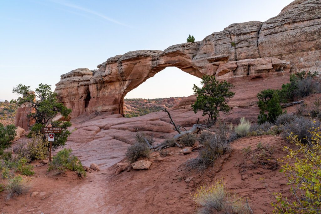
Stop for a quick picnic lunch near the Devils Garden trail (there’s a picnic area just south of the campground and trailhead), then do the short hikes out to Broken Arch and Skyline Arch.
You can park in Devils Garden Campground (here) to start the hike out to Broken Arch.
It’s a cool hike, which is why it’s on this list duh, and you’ll pass through a couple of cool canyons on the way back from Broken Arch. It’s about 1.8 miles round trip, and is basically flat.
This is a good sunset hike too if you’re staying at Devils Garden Campground since you can leave from camp without driving anywhere.
Skyline Arch is also worth seeing. You get there via a pull off just south of the campground, and it’s a short, easy hike out there.
Day 3: Canyonlands National Park
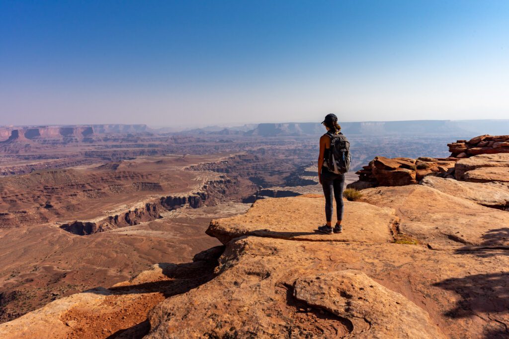
On your third day in Moab, head out to Canyonlands National Park, which is a very different experience than Arches.
While Arches is about feeling small standing under the towering rock formations littered around the park, Canyonlands is about feeling miniscule while looking out over the deep fissures in the earth created over thousands (millions?) of years of tectonic plate action.
There are three sections of Canyonlands: Island in the Sky (closest to Moab, most accessible), the Needles District, and the Maze (technically I think there’s a fourth called the Rivers, but I’m not quite sure about that one).
With just one day, you should focus on Island in the Sky, which is the most accessible part of the park coming from Moab.
However, if you have more time, a trip down to the Needles District is worth your time.
What Not to Miss in Canyonlands National Park
Here are some that we enjoyed in the Island in the Sky part of Canyonlands National Park.
Early Morning at Mesa Arch
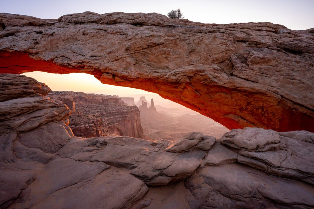
Start your morning at Mesa Arch just after sunrise. It’s a really short hike out to a low arch, through which you get a nice glimpse of the vastness of Canyonlands.
Why just after sunrise, you ask?
Because at sunrise, there will be hundreds – yes, hundreds – of photographers vying for the best position to take that picture-perfect shot of the natural bridge with the sunstar on the bottom.
I bet you’ve seen it before – it looks like the picture above.
I took that around sunrise at Mesa Arch, where we’d arrived an hour before sunrise and still didn’t get a spot.
Instead of jostling for position, we took a seat on a rock overlooking the arch and watched the sun rise, then I ventured down when the crowds started to thin.
Here’s the behind the scenes view of the sea of photographers that you don’t see in the pictures on Instagram.
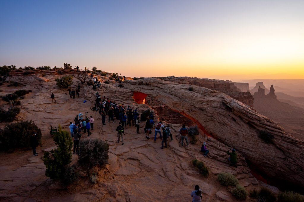
The point is that going after sunrise is a much more pleasant experience.
Hiking in Canyonlands
After experiencing Mesa Arch, head out on a hike in Canyonlands’ Island in the Sky District.
Here are three options for various levels of hiking experience and fitness.
If you’re up for it, you could totally do a couple of the shorter ones together as part of a little circuit along Canyonlands’ main thoroughfare.
Aztec Butte (1.7 miles / 250 ft. elevation gain): This is a cool hike that has two distinct parts that form a “Y” shape. First, take the right fork to climb to a nice viewpoint over Canyonlands.
Then on the way back, take the left fork and check out the ancestral Puebloan structures, which are pretty cool. DON’T TOUCH THE STRUCTURES – leave them be.
White Rim Overlook (2 miles / 200 ft. elevation gain): A short and sweet hike to an incredible overlook that really illustrates the scale of Canyonlands.
It’s a short, well-marked hike out to a little “peninsula” (for lack of a better word – there’s no water, but it’s a peninsula shaped part of the canyon rim). Follow the rock piles, known as cairns.
The Gooseberry Trail (5 miles / 1,500 ft. elevation gain): This hike is no joke. You basically climb straight down the wall of the canyon to get to the lower plateau, which takes you to a nice overlook of the canyon forged by the mighty Colorado River.
Just remember, the first part of the hike is a descent…which means what goes down must come back up. Try to get an early start so that you’re not out there in the heat of the day.
Grand View Point Overlook
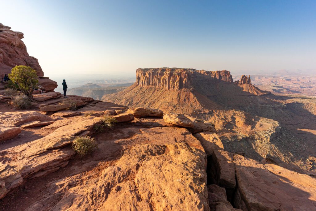
Next, head out to Grand View Point, which is another short stroll along the rim of the canyon that we DEFINITELY think you should do, no matter what.
It’s mostly flat, with a little bit of up and down, but the end viewpoint is going to be well worth the small effort to get there.
The Scenic Drive
Grand View Point is at the end of the road, which means you can make the drive back towards the visitor center a scenic drive by stopping at all the viewpoints along the way.
The first stop, if you didn’t already tackle it, is the White Rim Overlook. We loved this short hike, and it’s worth mentioning again.
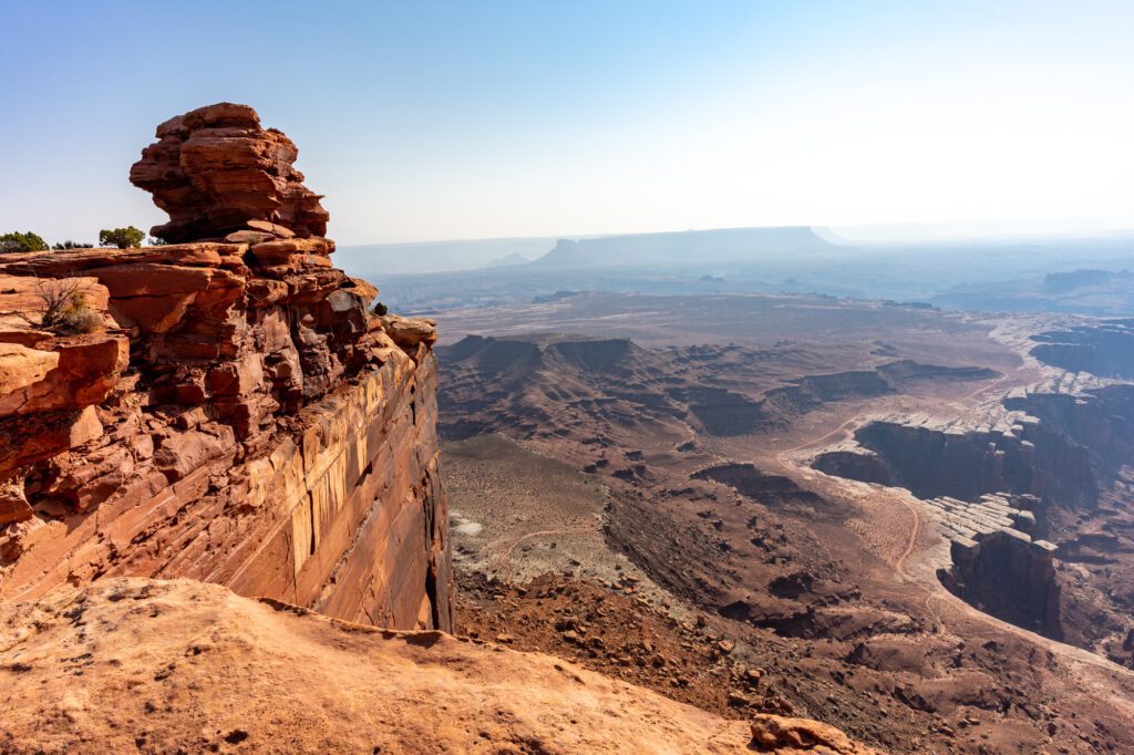
Make sure to also stop at the Buck Canyon Overlook and, our favorite viewpoint on the drive, the Shafer Canyon Overlook, which has amazing views of the canyon, and of the steep switchbacks of Shafer Canyon Road, which descend from the rim down to the plateau via tight switchbacks that I would be too terrified to drive myself.
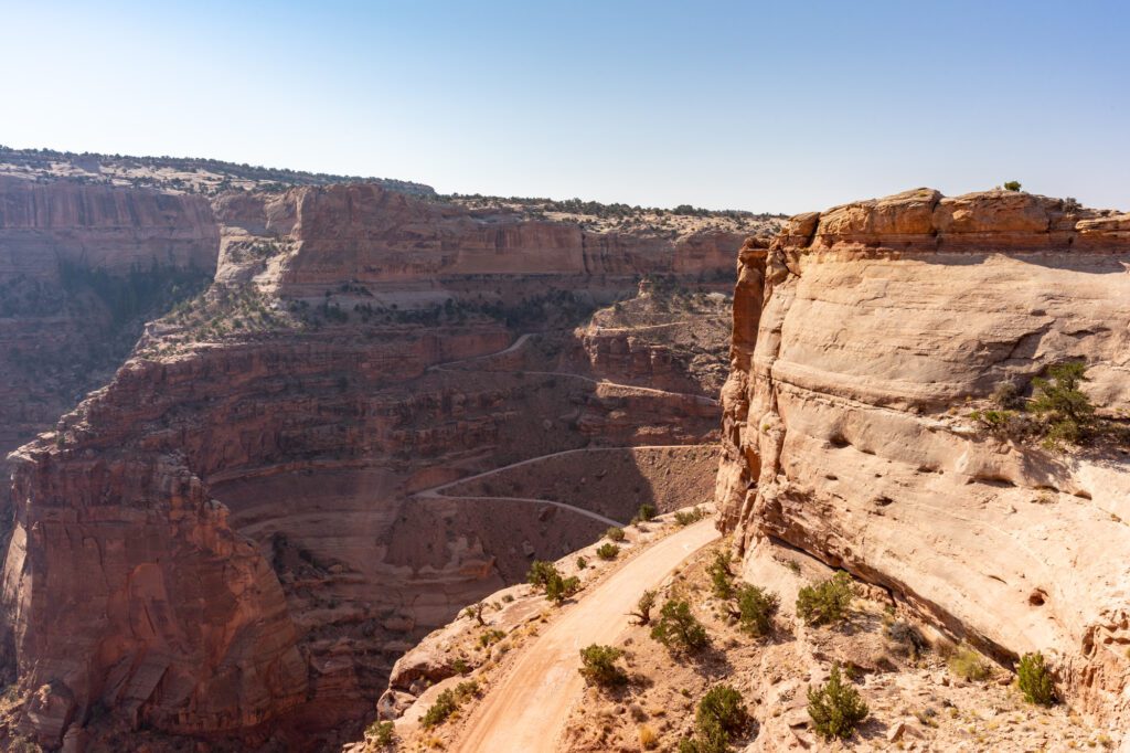
It’s also worth venturing out on the road that leads to Upheaval Dome, aptly named Upheaval Dome Road.
The turnoff is a little ways south of Shafer Canyon Overlook.
Willow Flat Campground, the main campground in this part of Canyonlands, is out there, but stay on Upheaval Dome Road to get to Upheaval Dome, Whale Rock, and Aztec Butte – three great short hikes just off the road.
Day 4: Exploring Around Moab
Spend the morning and afternoon around Moab, exploring what we think are two of the best hikes in the area – neither of which are inside a national park – and then make your way over to Capitol Reef National Park.
Things Not to Miss Around Moab
Here are some things we really enjoyed near Moab (that aren’t within national park boundaries).
Corona Arch
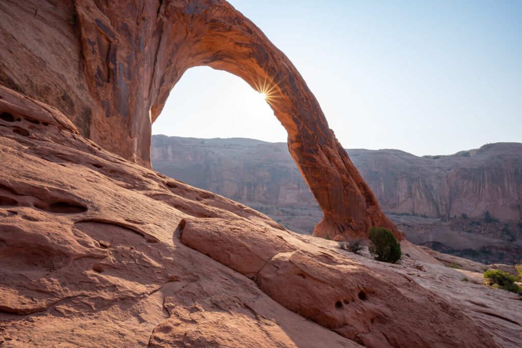
We did the hike out to Corona Arch at sunrise, and sat on a rock watching the light creep down, illuminating the arch about an hour after sunrise.
Because of the rock walls here, we actually think the best time to be here is just after sunrise.
It’s only 2.5 miles long (round trip), but there are some sections of scrambling along slickrock, and a ladder that you have to climb.
As long as you’re prepared with sturdy footwear, you should be fine, but you should know what you’re getting into before you leave the parking lot.
The arch itself is enormous, and is one of the more impressive arches we saw in Moab, including the ones in Arches (Delicate Arch and Double Arch might be the only two ahead of it).
The trailhead is along highway 279, just a twenty minute drive northwest of Moab.
Jeep Arch
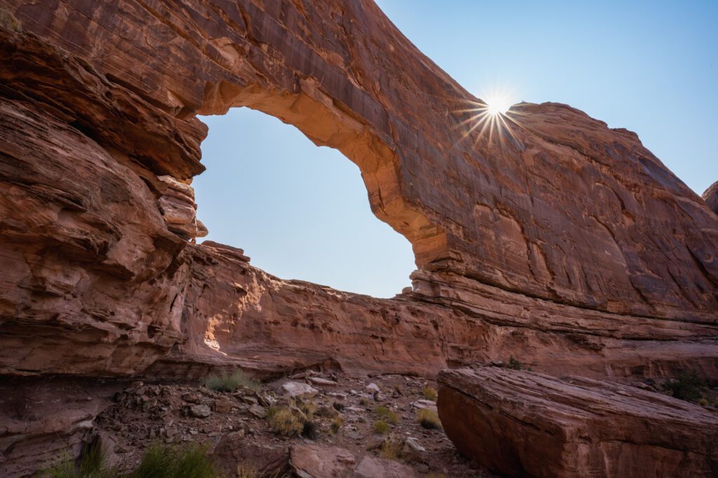
Just down the road from Corona Arch is another amazing hike that most people probably skip since it’s not inside one of the nearby national parks – and that’s Jeep Arch.
You’ll park in the small dirt parking lot along the road.
We were there mid-morning after our hike to Corona Arch, and we were only the second car in the parking area.
This hike is a bit longer at 3.6 miles (1,000 ft. of elevation gain), and it is COMPLETELY exposed. No shade to speak of, except right at the base of the arch.
You’ll start by hiking up through the water pipe, which we didn’t realize on our way out and ended up hiking up to the railroad tracks, crossing the tracks, and then scrambling down the other side.
Only to look through the other end of the pipe and say “ah, that’s the way you’re supposed to go.”
From there, you’ll follow a trail that is somewhat well marked by cairns across the rocky landscape, surrounded by the towering red rock walls of the canyon.
It’s a loop, and after doing it both directions, we really don’t think it makes a huge difference which direction you go.
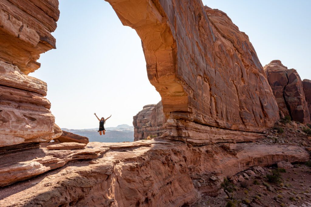
We will say that the arch will sneak up on you. We were very worried that we were going the wrong way because the map showed the arch just ahead of us, and we couldn’t quite see it yet.
It’s carved into the towering canyon wall, and if you squint, it looks a little bit like a jeep, hence the name (Matt’s not convinced).
Sunset at Dead Horse Point State Park
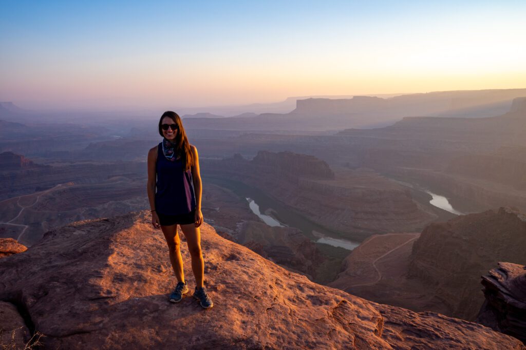
After a day of exploring Moab, head out to nearby Dead Horse Point State Park for sunset.
Dead Horse Point is on the way back to Moab, which makes it a perfect last stop of the day before retiring to your hotel or campground for the night.
You’ll need to pay the entrance fee, since it is a Utah State Park and is not covered by your America the Beautiful Pass. It’s $20 a vehicle at the time of writing – double check the up-to-date fees here.
If you’re up for it and have some extra time before sunset, it’s worth doing one of the short hikes along the west rim.
Our pick would be to park at the main parking lot and hike out to the Rim Overlook, and back along the rim to the parking lot, with a short detour to the Shafer Canyon and Meander overlooks along the way.
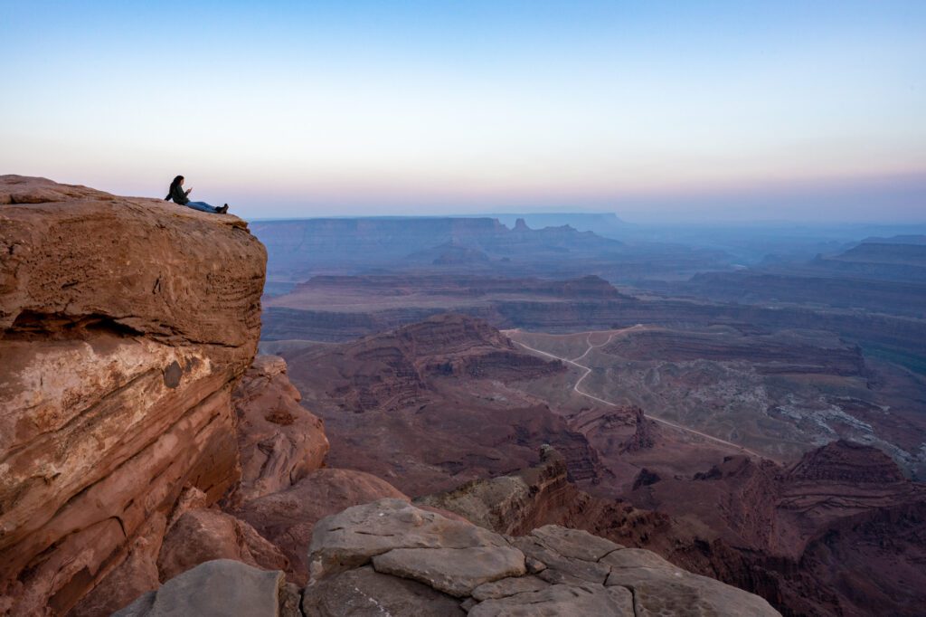
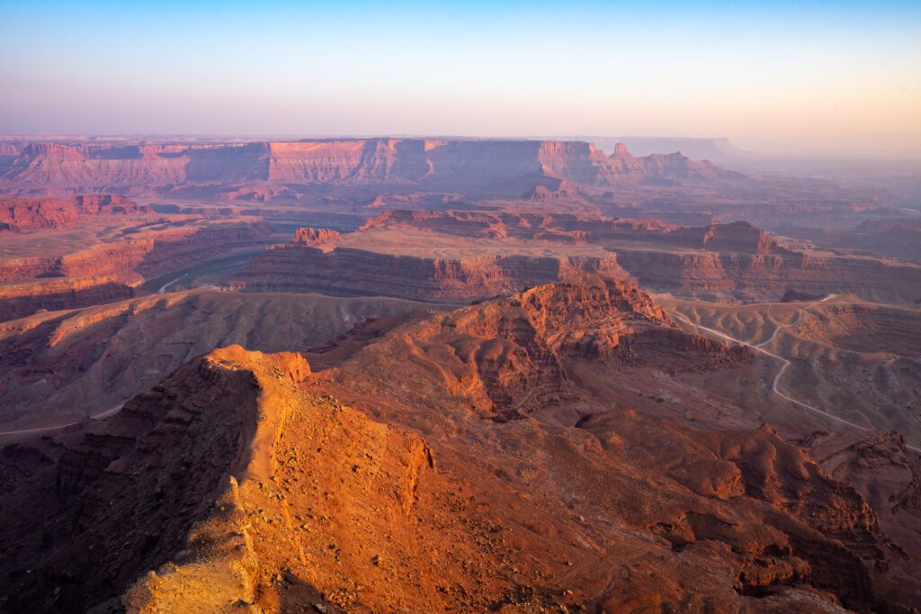
It’s about 2.5 miles there and back, and it’s flat.
After that, pick your spot, plop down, and watch the sunset over the canyon.
Day 5: Capitol Reef National Park
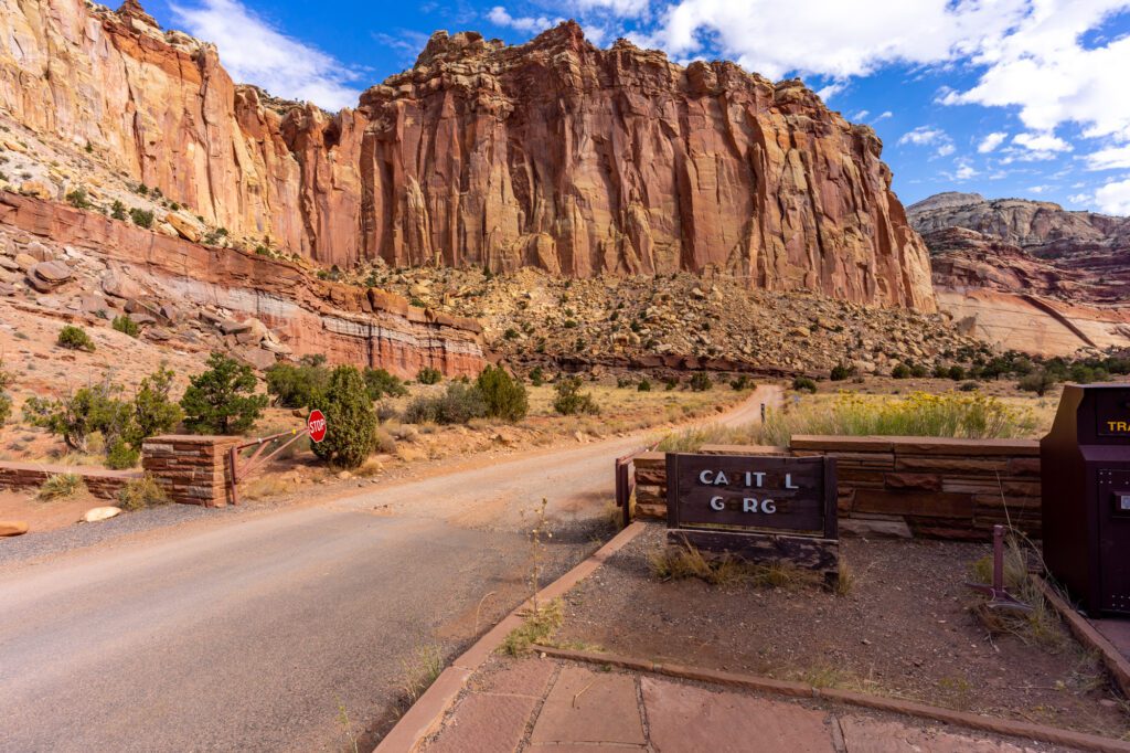
Be honest – before you started researching for this trip, had you ever heard of Capitol Reef National Park?
We hadn’t either.
But I understand why.
Sandwiched between Arches and Canyonlands to the east, and Bryce and Zion to the west, it is the runt of the litter.
Not that it isn’t a great stop and well worth your time, it’s just that the rest of the national parks in Utah are spectacular.
The most unique part of Capitol Reef in my book is the amount of green you’ll see.
Coming from Moab, it’s pretty surprising to drive around a corner with red rocks towering above you and see… an orchard? Several orchards, actually.
And you can freely walk through them and eat the fruit in the late summer too! You have to pay if you want to take it to eat later though.
What Not to Miss in Capitol Reef National Park
Here are some things not to miss in Capitol Reef National Park.
Capitol Reef Scenic Drive
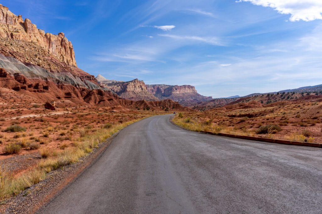
Stop at the visitor center to grab a map and a hiking guide, then it’s time to tackle the 10 mile scenic drive out to Capitol Gorge.
Take your time on the drive – it’s a gorgeous road through the red rock formations that are Capitol Reef’s specialty.
Eventually, you’ll arrive at the end of the paved road, where there’s a small parking lot and picnic area.
If you continue on the dirt road, you’ll end up at the trailhead for Capitol Gorge, which is the beginning of a short one mile stroll through the towering canyon along the original path into the Fruita Valley.
Be careful with weather in the summer – afternoon thunderstorms and rain showers can cause flash floods, and you definitely don’t want to be stuck in the gorge during a flash flood.
Head back the way you came, making a right onto the dirt road that will take you to the Grand Wash Trailhead.
Cassidy Arch
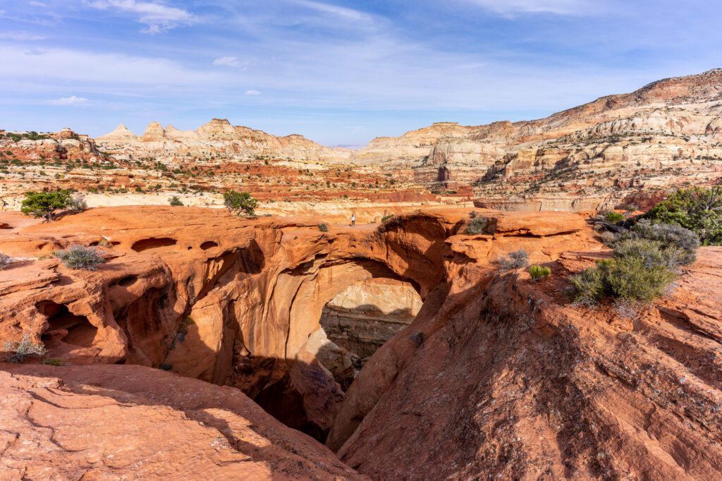
Head to the Grand Wash trailhead, which includes a short drive on a well-maintained dirt road, to hike to Cassidy Arch.
In high season, you might have to wait a few minutes to get a parking space, since the lot is small and the dirt road makes it hard if not impossible to park on the side of the road.
The wait will be worth it – you’ll climb the wall of the valley to an arch that you can actually walk on!
It’s a steep climb up some stairs for the first bit of the trail, but it mellows out as you wind between the cairns (those are the little rock piles that mark a lot of the trails) up to the arch.
It’s a pretty stunning hike, as you’ll get views of the surrounding valley and beyond as you make the ascent. All in all, it’s a three mile hike with 660 feet of elevation gain.
You should know that it will be hot in the afternoon, so bring tons of water, snacks, sunscreen, and a hat for sun protection.
Hike Hickman Bridge + Rim Overlook Trail
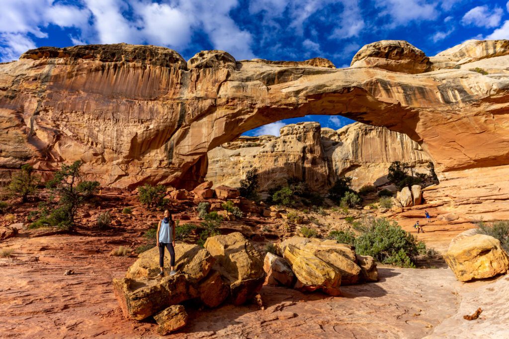
We really enjoyed the hike to Hickman Bridge, which is another natural bridge (which is similar to an arch, but slightly different).
It’s a short one mile hike up, and it’s another spot where the trail actually takes you up and through the arch, which is pretty cool.
From the Hickman Bridge, it’s another 2 miles to the Rim Overlook, which is an incredible hike that takes you to a high point on the canyon walls and looks over the entire valley.
It was one of our favorite spots not only in Capitol Reef, but on our entire time in Utah. Well worth the effort.
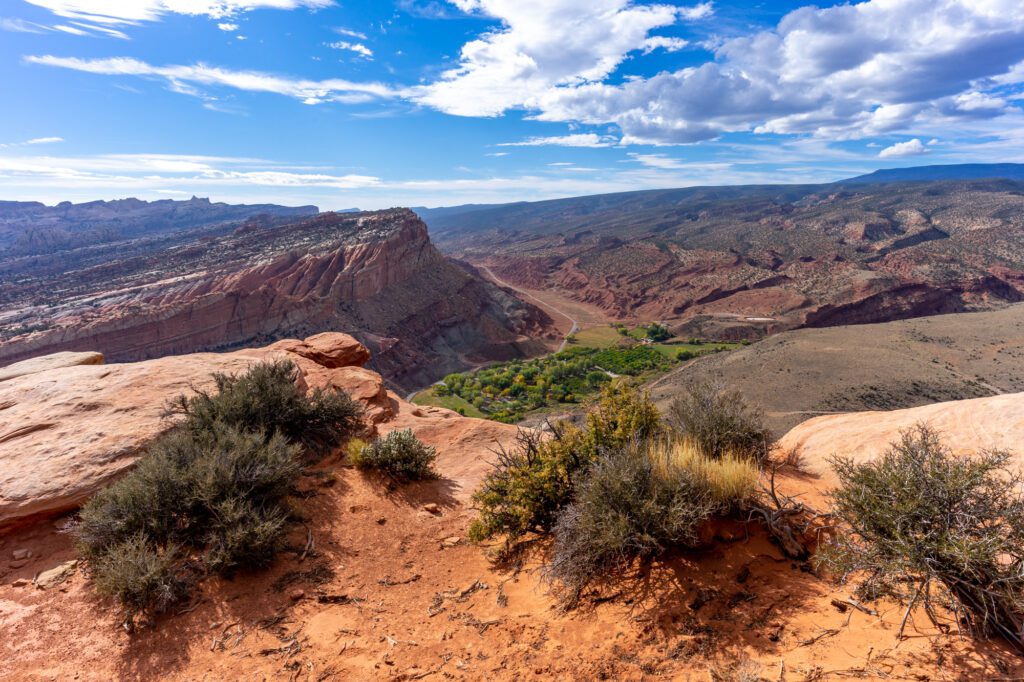
All-in, if you go all the way up to the Rim Overlook, it’s going to be between 5 and 6 miles, with a moderate elevation gain of about 1,000 feet.
Fruita and the Barn
Post-hike, head to Fruita and hit the Gifford House for a fresh baked fruit pie as a reward for finishing the morning hike.
They don’t have gluten free options, so we ended up skipping the actual pies, but the historic Gifford House is worth a stop regardless.
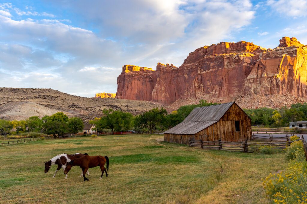
It’s a good representation of the original Mormon Settlement in Fruita Valley, though it has definitely been updated and renovated since it was built in 1908.
Grab a mini pie and take it out to the picnic area outside.
Don’t miss walking up the road towards the campsite to get a picture of the Fruita Barn with the red rocks in the background – I love the contrast between the dry red rock canyon, and the lush field (with horses, if you’re lucky) where the barn stands. Super unique.
Sunset Point for… Sunset
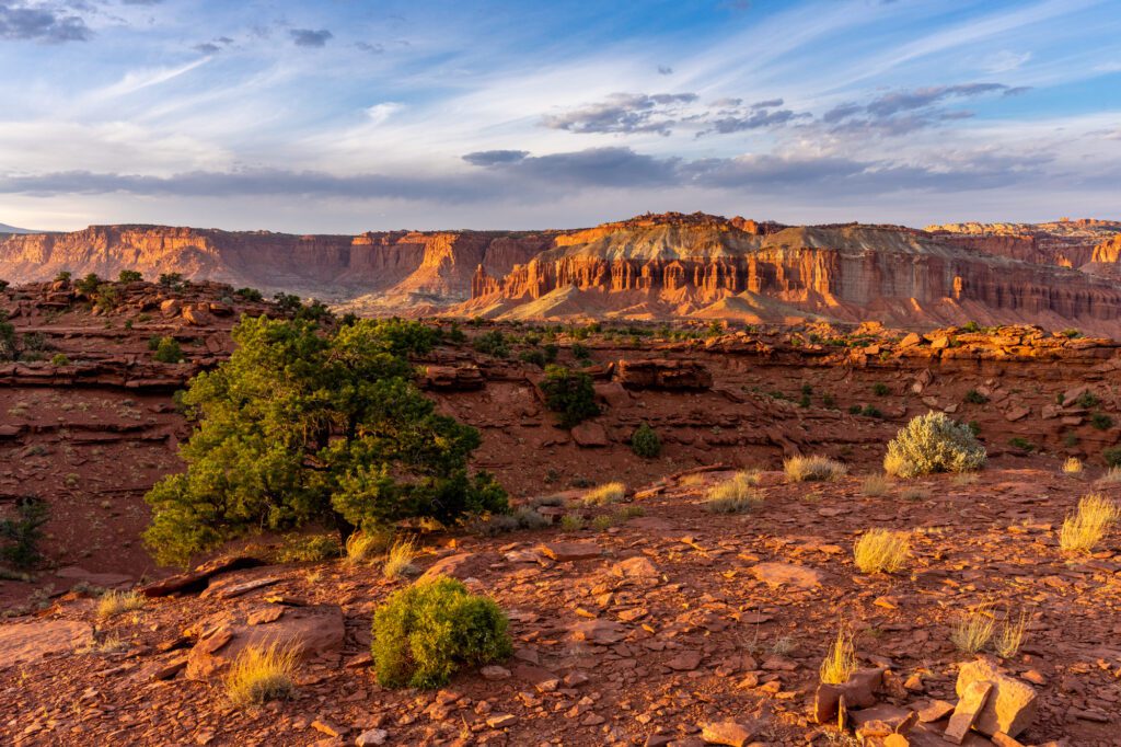
A little over an hour before sunset, head out to Sunset Point / the Goosenecks for the second most breathtaking panorama in the park (don’t worry, you’ll tackle the best viewpoint tomorrow morning).
The Goosenecks are an okay view of the river winding through the valley below, and they’re basically at the parking lot.
But the star of the show is Sunset Point, which has a view across the Fruita Valley with all sorts of interesting terrain as far as the eye can see.
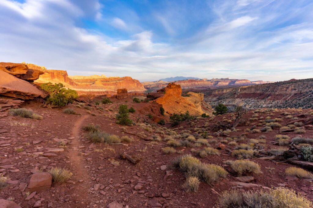
It’s spectacular about a half hour before sunset, when the golden light brings out all the different colors in the surrounding landscape, particularly the red in the canyon walls.
Days 6 & 7: Bryce Canyon National Park
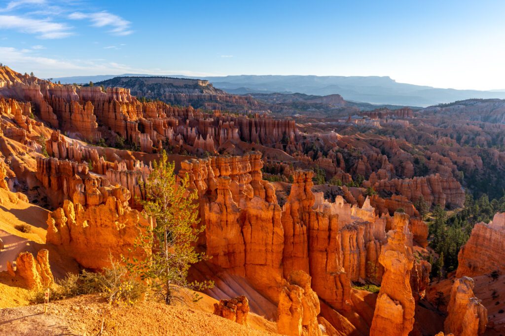
We spent two and a half days in Bryce Canyon, and I didn’t quite realize just how compact this national park is.
Unlike places like Yellowstone and Yosemite, where you can literally drive for hours and still not leave the park, there’s essentially one 19 mile road that makes up the entirety of Bryce Canyon National Park.
Bryce Canyon really isn’t that big, so we think that a day and a half is enough to see the highlights.
For that reason, if you’re time constrained and only have ten days, I’d only spend one day in Bryce Canyon National Park, plus a portion of the next morning before driving to Zion.
If you’ve got more than 10 days, this is the first place I’d add time (an extra day would be perfect).
One thing you should know for Bryce that I didn’t know before my trip: the best light for photos is in the morning.
In the afternoon, the sun is on the opposite side of the canyon from most of the interesting stuff, which leads to long shadows that really mess with your pictures because of the extremes of light and dark in the photo.
In the morning, the sun lights up the hoodoos and other formations, making them that much more spectacular.
The Best Things to Do in Bryce Canyon National Park
Here are five things not to miss in Bryce Canyon National Park.
Sunrise at … Sunrise Point
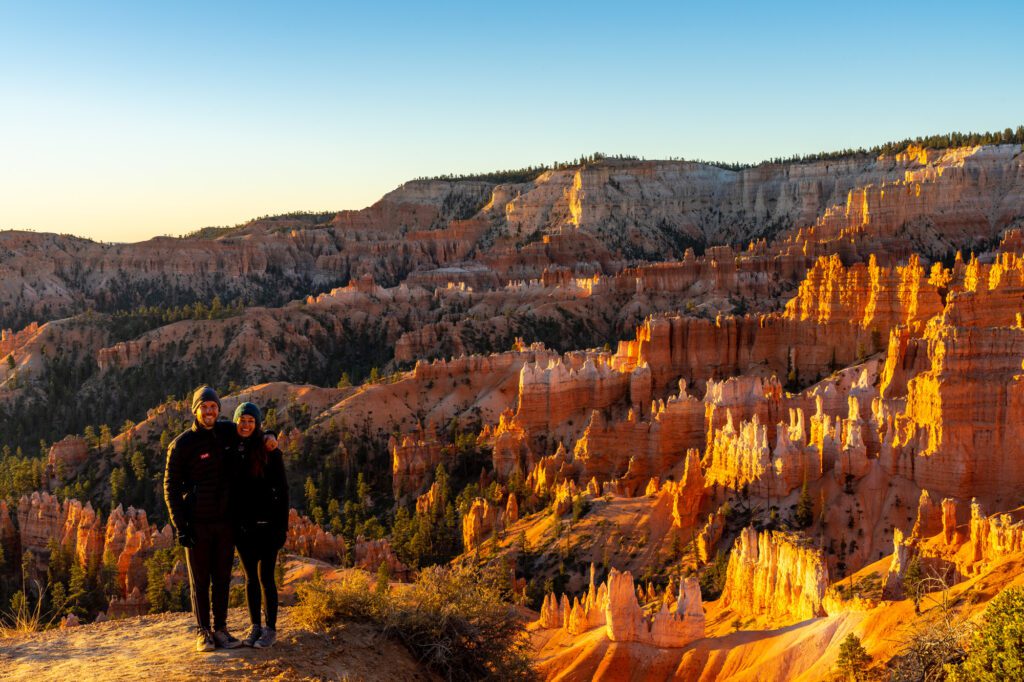
Start your time in Bryce Canyon with sunrise at Sunrise Point. This is a popular spot, so get there early.
You’ll have views of the hoodoos to your right, which is the direction you want to be facing, and the horizon on the left, which is where the sun will come up.
Again, it bears repeating, make sure to watch the rising sun light up the hoodoos – most people will be looking at the horizon to watch the sunrise, which would be a mistake!
As the sun comes up, it brings out all the different hues of the hoodoos, making for some spectacular photos.
Sunset Point and Thor’s Hammer
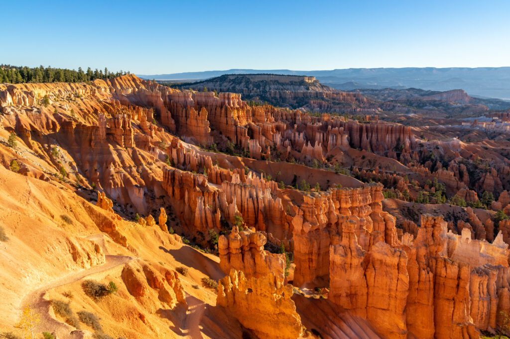
Next, walk along the rim to Sunset Point, which is another good viewpoint to see the hoodoos from a slightly different angle.
Hike down a little ways to get a good view of Thor’s Hammer, a unique rock formation that looks like the Marvel hero’s signature hammer.
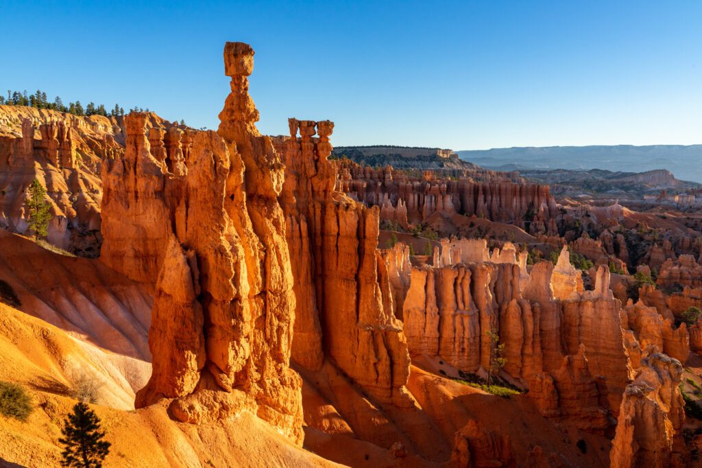
Hike the “Figure 8” Loop
After you’ve taken ALL the photos, you should embark on our favorite hike in Bryce Canyon – the Queen’s Garden / Navajo / Peek-a-boo Loop, which we’ll call the “Figure 8” loop because it sounds cooler and is less of a mouthful.
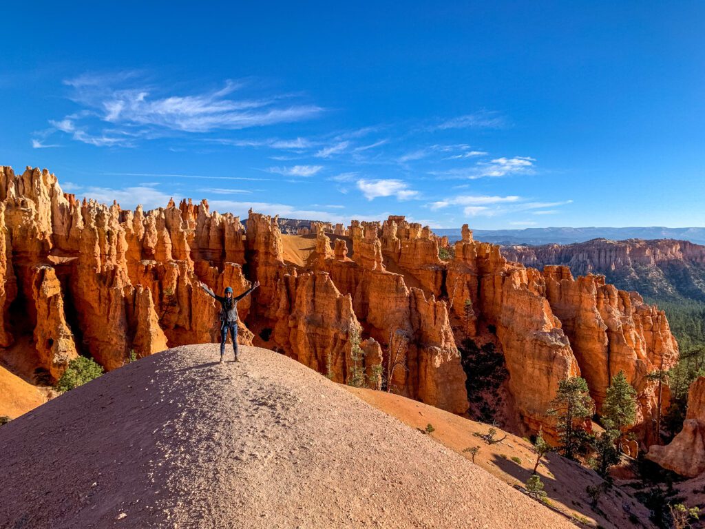
It’s a six mile hike with 1,500 feet of elevation gain. You’ll start at Sunset Point and end along the rim near Sunrise Point.
Make sure you’re fueled up with coffee and breakfast before heading out. To really take in the beauty and scale of Bryce Canyon, you HAVE to get below the rim.
This hike takes you through canyons, between hoodoos, and to viewpoints with sweeping views of the magnificence of this park.
You’ll start by descending Wall Street – a set of (very photogenic) steep switchbacks that take you down, down, down into the canyon. Try to get started early, because this spot gets very, very congested.
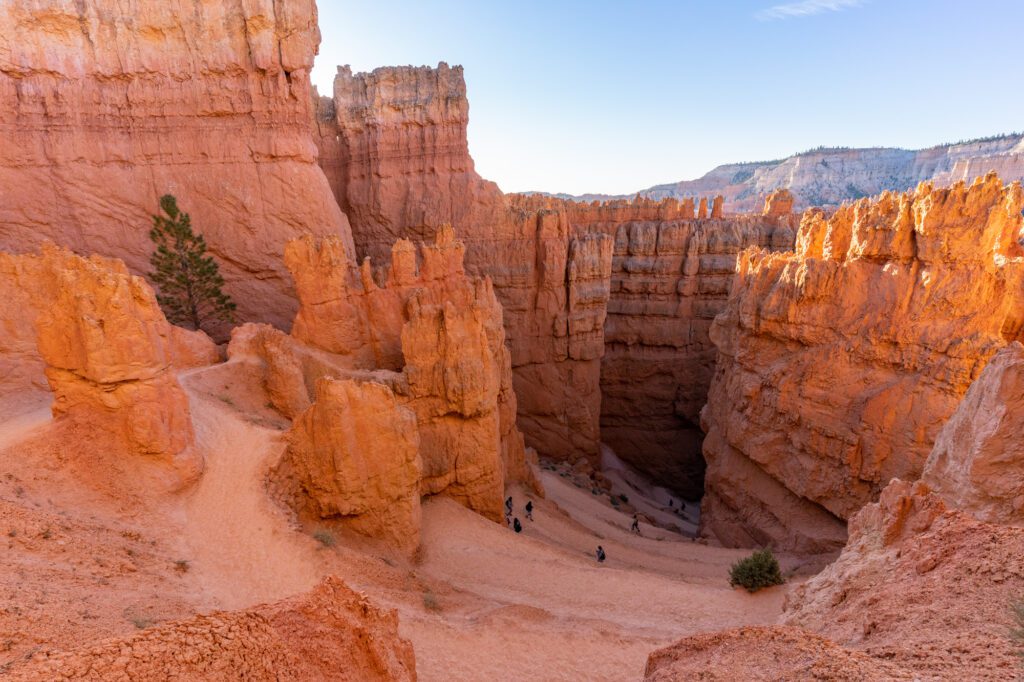
You’ll wander through the canyon for a bit before you reach a junction – veer right to tackle the peek-a-boo loop, ending back at the exact point you veered right.
From there, you’ll climb back up to the rim of the canyon via the Queens Garden trail, which is not an easy hike, especially if it’s hot, but it’s totally doable for most people.
After the hike, take a break from being in the sun and eat some lunch to refuel, either a picnic lunch, or at the Bryce Canyon Lodge are your best options.
The Bryce Canyon Scenic Drive
One thing you definitely shouldn’t miss in Bryce Canyon is the scenic drive along the 19-mile road that runs from one end of the park to the other.
It’s a good afternoon activity, and it will only take you about an hour or so.
Make sure to check out Natural Bridge and Bryce Point, our two favorite stops, and stop at any viewpoints along the way that catch your eye.
You’ll want to start this drive at least two hours before sunset, before the sun drops behind the canyon wall and takes all the color out of the hoodoos for the night.
Days 8 – 10: Zion National Park
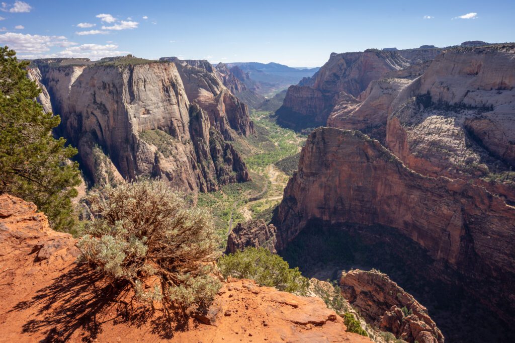
Zion is the park I’ve spent the most time in on road trips growing up, and finally we made it back in the spring to marvel at both the canyon itself, and the ingenuity that went into constructing the Mt. Carmel – Zion tunnel, and the trail up to Angels Landing.
Both were built during the Great Depression by the Civilian Conservation Corps, and are amazing feats of engineering, especially when you consider they were made almost a century ago.
Zion is one of the best national parks in the country, let alone Utah, so you’re ending your trip on a high note.
There’s tons to do and see, and two days in Zion is not nearly enough time to see all there is to see, but you can get a great taste of the park that will leave you hungry to return and spend more time exploring the canyons, rivers, and hanging gardens that make Zion a special place.
The best thing to do in Zion National Park, by far, is hiking. And there are two iconic hikes in the park that you should tackle – one on each day.
They are the Narrows and Angels Landing – you’ll do Angels Landing on Day 1, then the equally-iconic Narrows of the Virgin River on Day 2. In between, there are some great shorter hikes to tackle.
A note here for RVs and trailers: if your vehicle is higher than 11’ 4” or wider than 7’ 10”, you’ll have to pay a $15 “escort fee” to pass through the Zion-Mt Carmel tunnel, which you’ll have to do to get into the park from the east.
It basically means that a ranger will stop traffic in the tunnel and make it one-way so that you can pass through to avoid accidents.
More information can be found here.
The Best Things to Do in Zion National Park
Here are some of our favorite things to do in Zion National Park.
Hike Angels Landing
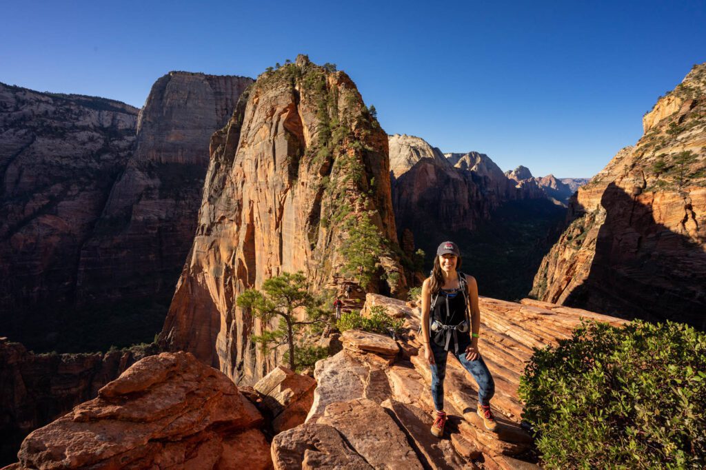
Get an early start on your first day in Zion to make your way out to Angels Landing (shuttle stop is the Grotto).
It is, along with the Narrows, one of the best and most unique hikes in Utah if not the entire western United States.
It’s only 5.4 miles long, but it’s a steady climb of over 1,500 feet, which is going to feel like A LOT at this elevation and temperature.
Seriously, the trail starts flat for about a quarter of a mile, but then it starts climbing steadily for the rest of the hike up to Angels Landing.
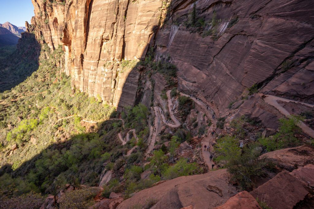
You need to pack plenty of water (more than two liters per person), sunscreen, and a hat. If you’re afraid of heights, the tail end of this hike is going to test your willpower.
You’ll need to do some scrambling and climbing with the help of chains, but the sweeping views at the top will make it all worth it.
However, you should know that we stopped before the serious part of the chains started.
There are essentially two sections of chains – one that traverses the side of a ridge, and another that makes the ascent to the summit. We did the first section, and turned around before the second section.
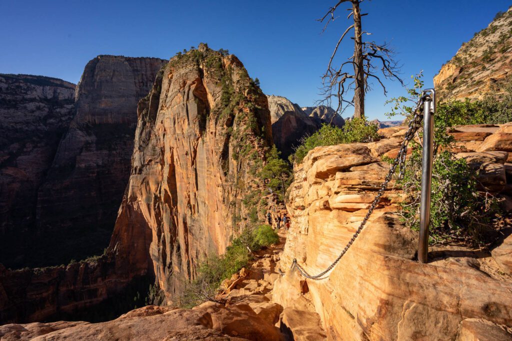
It had rained the day before, which created a fine sand that coated every rock surface on the hike.
We weren’t super comfortable with our footing as we were traversing the first set of chains, and the unbearable crowds didn’t help with the anxiety.
Know that it is perfectly okay to stop and turn around if you’re not feeling comfortable. We did, and we regret absolutely nothing.
I mean it when I say to start early. It gets hot in Zion, and the last thing you want is to be stuck at one of the sections with chains waiting for a slow group to go up or down while you, quite literally, roast in the desert sun.
It’s going to take you most of the morning and part of the afternoon to do this hike.
Afterwards, head to the Zion Lodge to eat lunch – either a pre-packed picnic, or a meal at the lodge’s cafe – and relax before tackling some other short hikes in the afternoon.
Note: In 2026, you need an advance reservation to hike to Angels Landing. It’s meant to control crowds, which we experienced and literally said to each other on the way down “they should really permit this hike.”
Sunset at the Watchman
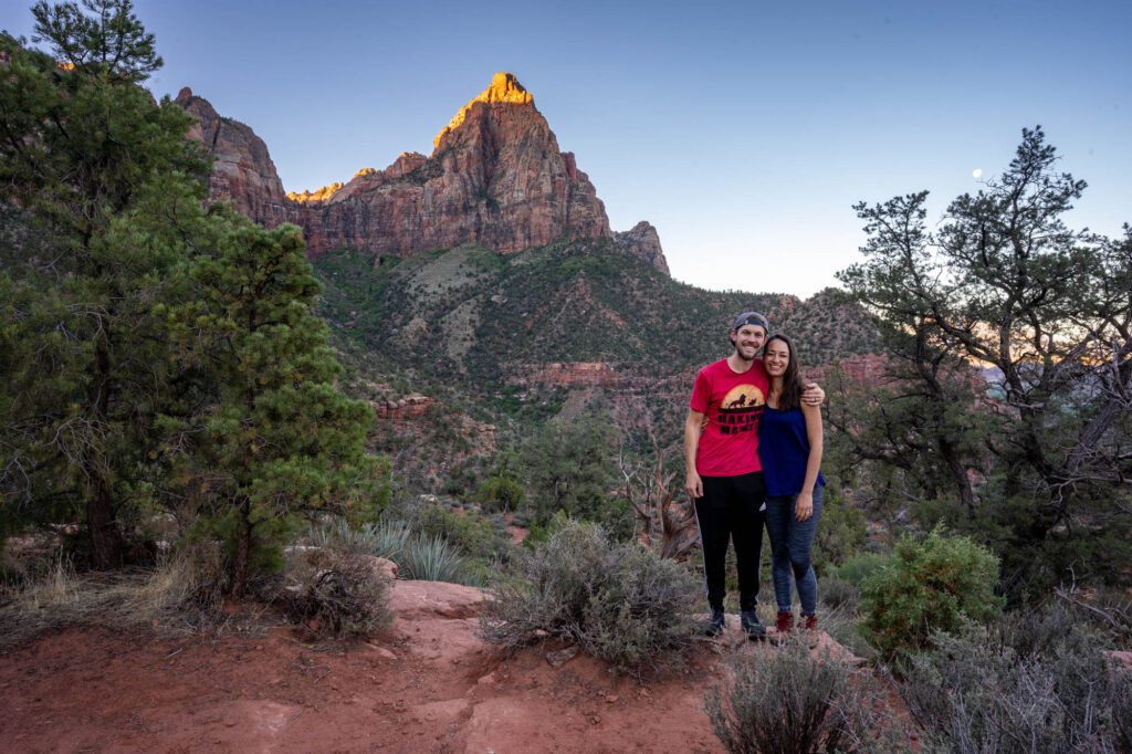
This was one of our favorite hikes in Zion, though we did it at sunrise, when the light wasn’t at its best thanks to the towering rock wall behind you that blocks the sun from lighting up the Watchman.
That’s why we have it here, at sunset instead.
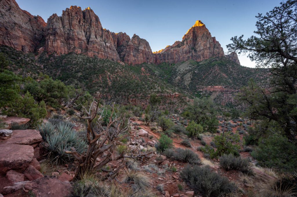
It leaves from the visitor center, and climbs pretty gently to a mesa that is directly across the valley from the Watchman, one of the most famous rock formations in the park.
It’s a good spot to pack a picnic and a couple of beers after a long day of exploring.
Hike The Narrows
Hop on the shuttle early and head up the canyon to the Temple of Sinawava stop to do the ten mile hike (roundtrip) to the Narrows.
This hike is through a canyon and river, which means it is CRUCIAL that you check with the rangers about conditions and flash flood warnings before you start the hike.
In the spring, heavy water flow from snow runoff might mean that this trail is closed.
Seriously, flash floods in canyons are no joke. Stop by the visitors center to make sure you’re good to go.
Don’t let that scare you – the hike through the Narrows is the #1 Zion experience that I think you should have on your trip.
The hike follows the Riverside Walk for the first bit, then continues on when that trail ends.
You’ll pass through narrow canyons, deal with knee-high water, and do some bouldering en route to Big Springs, where the hike ends and you’ll turn around to head back the way you came.
It’s going to take you five to six hours, maybe more. To make it as smooth as possible, bring plenty of water, tons of snacks, proper footwear (not flip flops – either hiking sandals like Chacos, or real hiking shoes), a dry bag, and a pair of trekking poles for stability.
After that, recharge for a second and catch your breath. Maybe take a nap. It has been a whirlwind of a couple of days!
The East Zion Scenic Drive
The eastern side of Zion National Park is one of the more unique landscapes in the country.
Checkerboard Mesa, in particular, is pretty impressive. It’s a huge, textured cone-like formation that has checkerboard textures all over its surface.
The drive through the eastern side of the park, from the East Entrance to the tunnel, is spectacular.
You should do it in the late afternoon if you can, so that you’re well-positioned to do the Canyon Overlook Trail at sunset.
The Canyon Overlook Trail
Parking for the Canyon Overlook Trail is a bit of a pain due to all the people vying for a very limited number of spots. You’ll need to park along the road and walk to the trailhead.
The hike itself is short, but a little steep, and takes you up to a spectacular view out over the canyon.
Below, you’ll see the road switchbacking its way up to the tunnel, and the iconic, impressive rock formations of Zion Canyon across the valley below.
Last light on the canyon from the setting sun is amazing, and it’s worth hanging out up here for a bit until after sunset.
Psst! We have a whole guide dedicated to helping you find the perfect place to stay at Zion National Park, whether you’re camping inside the park or looking for a nice hotel outside the park entrance.
What to Do with More Time in Utah
Here are three things to add to your Utah itinerary if you are lucky enough to have some extra time.
Grand Staircase Escalante National Monument
Time required: 1 full day
Before heading to Bryce, it’s well worth a stop in Grand Staircase Escalante National Monument, home of some of the best slot canyons in Utah that don’t require a permit lottery to access.
The best way to do it is to tackle one or two of the hikes (if you’re ambitious) on the way to Bryce Canyon, staying overnight either in nearby Boulder, Utah, or completing the hikes and heading into Bryce at the end of the day.
There are at least three hikes that are worth your time in this area, and which ones you choose basically depends on your ability to navigate a long dirt road with some questionable spots for passenger vehicles and your willingness to navigate tight spots in slot canyons.
The road to get to the trailhead for Peek-a-Boo and Spooky Canyons is a 26-mile long dirt road called “Hole-in-the-Rock Road”.
It’s passable in a passenger vehicle, but you’ll need to take it slow and it’s going to take you about an hour.
I’d recommend a 4WD, high clearance vehicle to get to the second two hikes on the list.
We skipped them all because Homer, our Honda Odyssey, was sick of unpaved roads after some misadventures in the Pacific Northwest.
Here are those three hikes, with a short description of each.
Lower Calf Creek Falls (6 miles roundtrip): This is right along Scenic Byway 12, which means you don’t have to survive a dirt road to get to the trailhead.
It’s a lovely hike through a surprisingly green canyon to a 126 foot waterfall, Lower Calf Creek Falls, which is in a grotto-like setting. Bring a swimsuit on a warm summer day to take a dip in the pool underneath the falls.
Zebra Slot Canyon:This trail is not always accessible, since the entry point fills with water after storms. But if it hasn’t rained in a while, it’s a worthy five mile trip.
I haven’t personally done it, but I’ve seen plenty of pictures on Instagram of the wave-like textures in the Zebra slot.
Peek-a-Boo and Spooky Slot Canyons:This hike includes a 15 foot climb on rock walls, and a 20 foot descent with assistance from a rope, along with some very tight spots (12-18 inches wide) through a slot canyon.
We didn’t make it here because the 26 mile long dirt road scared us and our minivan off, but I’ve heard from family members and friends who have done it that it’s amazing.
The reward is two of the best slot canyons in Utah, which means it’s a busy trail.
Be careful in slot canyons if there’s an incoming rainstorm – flash flooding is no joke.
If you’re looking for an awesome overnight backpacking trip, look no further than the 11.5 mile journey to Coyote Gulch.
It has quite a bit of elevation gain, which makes it a little much for a day hike. But the destination is pretty epic. Permit information here.
If you’re not up for the 26 mile drive on a dirt road, do the hike to Lower Calf Creek Falls on the drive from Capitol Reef, then head to Bryce Canyon National Park that night.
Add a Detour into Arizona
Time required: 3-4 days
If you’ve got two weeks and you’re looking for a great addition to your Utah adventure, a mini Arizona road trip would be a great option.
Zion is just two hours away from Page, Arizona, which is home to two amazing natural wonders – Horseshoe Bend (you’ve probably seen it on Instagram) and Antelope Canyon.
Horseshoe Bend is a giant picture-perfect bend in the Colorado River that makes for an amazing sunset location, while Antelope Canyon is one of the most picturesque slot canyons in the Southwest, but is only accessible by guided tour (check out this company, which is Navajo-owned).
On the way to Page, make a stop at Paria Canyon to hike to Buckskin Gulch.
The Wave is also here, in Vermillion Cliffs National Monument, but you’ll need to apply in advance to get a permit to hike it. More information here.
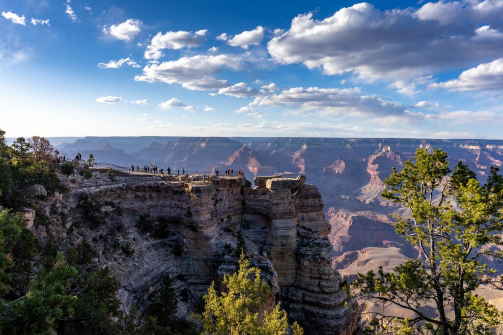
After Page, continue on to the South Rim of the Grand Canyon, and spend two days at the Grand Canyon in constant awe over the natural beauty and scale on display.
Make sure to drive Desert View Road at sunset, hike the South Kaibab Trail, and catch sunset at Hopi Point along Hermit Road while you’re there.
From the Grand Canyon, it’s a four hour drive west to Las Vegas. You’ll pass by Hoover Dam along the way, which is worth a stop for the sheer scale of the dam.
Cedar Breaks National Monument
Time required: 1 full day
Sitting just north of Zion (an hour and a half drive) is Cedar Breaks National Monument.
It’s even higher than Bryce Canyon at 10,000 feet above sea level, which means the ecosystem is very different from most of the places you’ve seen so far in Utah.
It’s most similar to Bryce Canyon, with its orange-tinted rocks and ponderosa pine forests.
It’s also shaped kind of like Bryce, forming an amphitheater, but unlike Bryce you can’t hike below the rim because it’s steep and dangerous.
As a result, there aren’t a whole lot of long hikes here, so a half day is probably enough time.
Similar to Bryce, morning is the best time to be here for the light since the sun sets behind the canyon and mid-afternoon it’s shrouded in darkness.
While you’re there, make sure to hike both the South Rim Trail and the Alpine Pond Trail. Both are short and relatively easy.
How to Plan a Shorter Itinerary
If you have less time in Utah, like we mentioned above, rather than trying to fit in the entire Mighty Five Circuit, we’d opt for spending 7 days exploring EITHER Zion and Bryce OR Arches, Canyonlands, and Capitol Reef.
The first itinerary might look something like this (you’ll want to fly in and out of Las Vegas for this one).
- Day 1: Arrive in Las Vegas, drive to Zion
- Day 2: Zion National Park
- Day 3: Zion National Park
- Day 4: Bryce Canyon National Park
- Day 5: Bryce Canyon National Park
- Day 6: Day trip to Grand Staircase-Escalante (Calf Creek Falls)
- Day 7: Drive Back to Las Vegas
If you’re more interested in spending your time in and around Moab (which is where you’ll find Arches and Canyonlands), here’s what it might look like.
- Day 1: Arrive in Salt Lake City / Moab
- Day 2: Arches National Park
- Day 3: Arches National Park
- Day 4: Canyonlands National Park
- Day 5: Around Moab
- Day 6: Capitol Reef National Park
- Day 7: Drive Back to Salt Lake City / Moab

This has been by far the most imformative review I have ever had the pleasure of reading on any vacation. Awesome, Thank you so much for the detailed description and personal tips. This is helping us plan for our trip next summer, I’m taking some of your advice and hope for a great trip with out teenage boys. Thanks again
Hey Paul, thanks for the kind words! Glad you found it helpful – we plan (and pay for) all of our own trips, so we do our best to include all of those important tidbits that come from personal experience on a route. You’re going to have an amazing trip next summer. Cheers!
Hello Matt and Alysha – this site is amazing and full of info. My hubby and I and another couple are thinking of visiting Utah from Wisconsin. Our plan is to drive from home so no flying. We are all retired. If we visit in April are hotel/motel reservations still necessary? My thoughts are traveling ‘on the fly’ so to speak and when we are tired we stop and get a hotel room. Possible? Thanks.
Hey Pam! April is actually high season for the Utah parks, so yes you will probably want to reserve in advance. With the huge rise in number of visitors at national parks over the past couple of years, it’s really tough to do it “on the fly” these days between hotel reservations and park entrance permits (those haven’t quite hit the Utah parks yet, but I imagine they’re coming at some point!). Enjoy!