The 12 Best Things to Do in Moab, Utah: A Complete Guide
When we drove from Denver to Moab on our big four month United States road trip, we had spent three months exploring Washington State, Oregon, and Colorado (among others). Towering mountains, lush greenery, and bright blue alpine lakes was our steady summer diet.
When we rolled into Moab to start our Utah National Parks road trip, it was what I imagine landing on Mars would feel like. Incredible red rock formations, towering arches, and sagebrush as far as the eye can see. We even drove by multiple tumbleweeds! Needless to say, Utah is a different world from every other place we explored that summer. And we kind of loved it.
We spent five days in Moab, which we thought was going to be too much, but as we were leaving, we decided that there are so many different and exciting things to do in Moab that we’ll have to make our way back someday.
In the guide below, you’ll find our take on what to do in Moab. We did most of the things on the list ourselves, but there are a few things that are on our list for a return trip in the future.
Don’t miss our guide to spending 4 days in Moab, which includes exploring both Arches National Park and Canyonlands National Park, along with some other gems near Moab that are outside the boundaries of the parks.
If you’re into hiking, check out our guide to hiking in Arches National Park, with our six favorite hikes in the park and everything you need to know to tackle the trails.

Disclaimer: Some of the links in this post are affiliate links, meaning at no additional cost to you, I make a little bit of money if you click through and book. That being said, I would never recommend something to you that I don’t stand behind 100%.
What to Do in Moab: A Complete Guide to Arches, Canyonlands, and More
Moab is central to both Arches and Canyonlands National Parks, but there is so much to do and see outside the national park boundaries.
Whether you’re looking for a breathtaking sunrise hike, an exhilarating whitewater rafting or 4×4 trip, or a relaxed drive through a red rock canyon, you’ll find it below.
Planning a trip to Moab? Don’t miss my complete guide to where to stay in Moab, Utah. In it, you’ll find the everything you need to know about camping, the best hotels and Airbnb options, and even a unique desert glamping experience.
Explore Arches National Park
On the long drive home, Alysha and I were talking about our favorites out of the “Mighty Five” Utah National Parks (Arches, Canyonlands, Capitol Reef, Bryce, and Zion). For me, it was a tie between Arches National Park and Bryce Canyon.
Arches is a pretty compact area, which means it can feel PACKED. The National Park Service actually closed the entrance for a few hours on the day we were checking into our campsite at Devils Garden Campground (which is one of the best places to stay in Moab). You’ll want to enter the park early. Both to beat the crowds, but also to beat the heat. It is scorching in the summer, with temperatures reaching over 100 degrees fahrenheit on a pretty regular basis.
Here are some of our favorite things to do in Arches National Park.
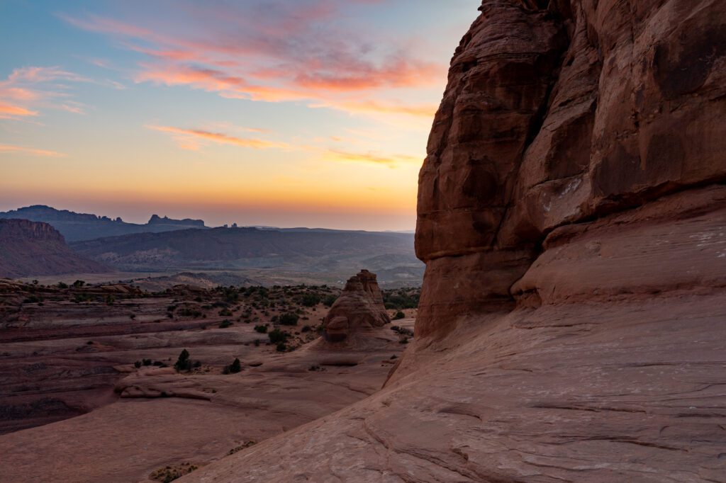
Hike to Delicate Arch at Sunset (or Sunrise)
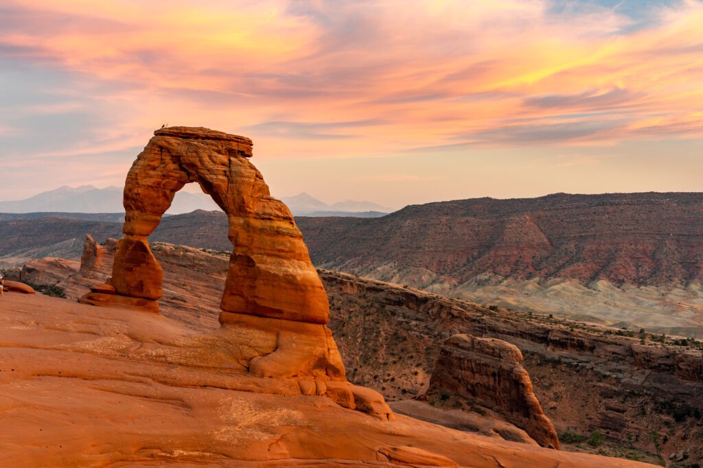
Sunset at Delicate Arch is high on every list of the best hikes in Arches National Park, and for good reason. The setting sun makes the arch glow a burning red as the clouds over the mountains in the background turn a faint pink color. It was spectacular.
But what you don’t see in those guides is an acknowledgment that, during peak season from about June through October, it is a madhouse. There were hundreds of people at the top when we showed up to watch a beautiful sunset, and that’s not an exaggeration.
We talked to a woman the next morning on a hike who said she had been there at sunrise the same day, and was one of about ten people there.
If you want the best light, sunset is the time to be there. If you want solitude, go at sunrise. Mid-morning through the afternoon, the arch is backlit, which means your pictures might not be great.
To get to Delicate Arch, you’ll hike a mile and a half uphill, winding through the relatively level desert before starting the ascent up a steep rock slab (make sure you have hiking shoes with solid grip!). Eventually, you’ll reach a narrow part of the trail that snakes around the side of the mountain, which might be a little scary for those of us afraid of heights (me) or with small kids. Hug the right side of the trail (close to the mountain) if that sounds like you, and you’ll be fine.
You can’t actually see the arch until you’re basically on top of it. You’ll emerge onto a little bowl, with the arch on the far side. The two best spots for photos are just to the left of the arch, and from the little rocky outcropping on the far side of the bowl (up and to your right from where the trail ends) where you’ll be able to get the mountains, clouds, and arch all in one shot.
Make sure to bring a headlamp if you’re hiking at sunrise or sunset. It gets dark quick once the sun sets, and we found ourselves needing our headlamps when we started descending the rocky slab.
If that hike sounds like too much for you, there are some viewpoints along the road that you came in on. Be warned – the views are pretty far away. If you can swing it, I’d definitely recommend doing the short hike up.
The Best Hike in Arches: Devils Garden
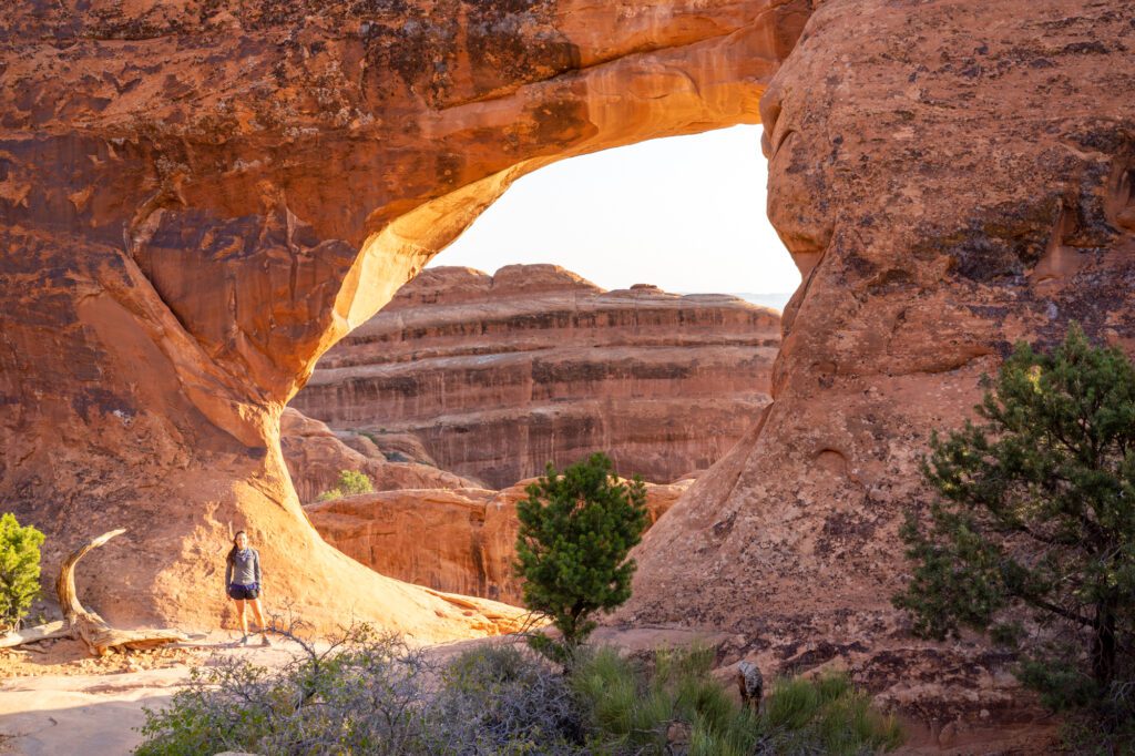
This was our favorite hike in the park, and it kind of allows you to choose your own adventure and go at your own pace. The trailhead is at the far end of the scenic drive in Moab, and it’s walkable from the Devils Garden Campground if you managed to snag a spot. It has restrooms and water fill stations, so bring your reusable water bottle to fill up – always hike with plenty of water in the desert, especially on a longer hike like this one.
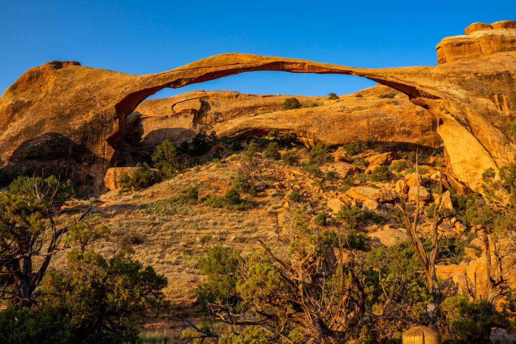
If you choose to do the full eight mile loop, you’ll see eight arches in total (skip the side trail to Dark Angel – it was a letdown for us). We loved hiking the primitive trail on the way back, which involves a little bit of scrambling and route finding – follow the cairns (the little stacks of rocks)! Follow the trail up past Landscape Arch, do the offshoot to Navajo and Partition Arches, and then continue out to Double O Arch before making the return journey along the primitive trail. The primitive trail isn’t marked well, and you’ll end up doing some scrambling across rock slabs, but it winds its way through some of the most spectacular scenery in the park.
All in all, it’s a great hike, but it’s very exposed. Bring plenty of water, snacks, sunscreen, and a hat.
If that sounds a little ambitious for your tastes, don’t worry. You can cut the hike short in a couple of different ways to see a few of the arches, and avoid the long route back.
The first option would be to hike out and back to Landscape Arch, a towering arch that stretches across a valley that you’ll view from the base. On the way back, hit Pine Tree and Tunnel Arch, which are a short way away from the trailhead. If you do it this way, it ends up being a relatively flat two miles round trip.
If you’re craving more than two miles, but less than eight, continue on past Landscape Arch to the offshoots to Navajo and Partition Arches, which are well worth the trip. Then retrace your steps and do Pine Tree and Tunnel Arches on the way back to your car. This clocks in at just under three miles round trip.
The third option is to avoid the primitive trail, which isn’t marked well and has some spots of scrambling / easy rock climbing. Follow the full eight mile hike out to Double O Arch, then just turn around and go back the way you came rather than following the winding primitive trail. This puts you at between four and five miles round trip if you don’t go all the way out to Dark Angel.
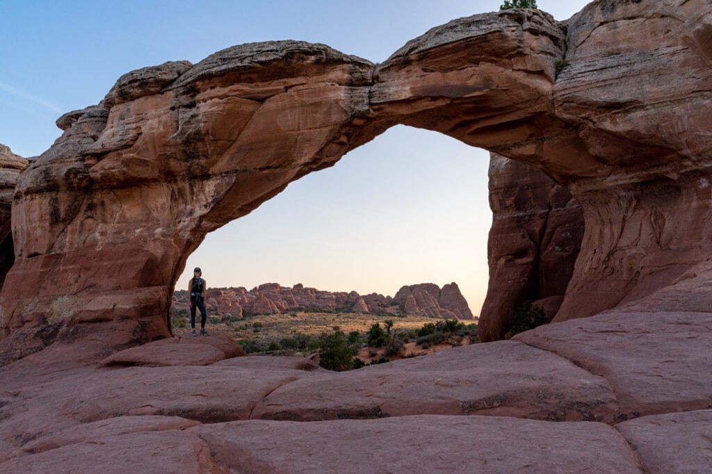
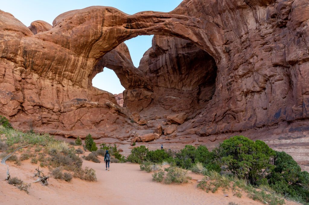
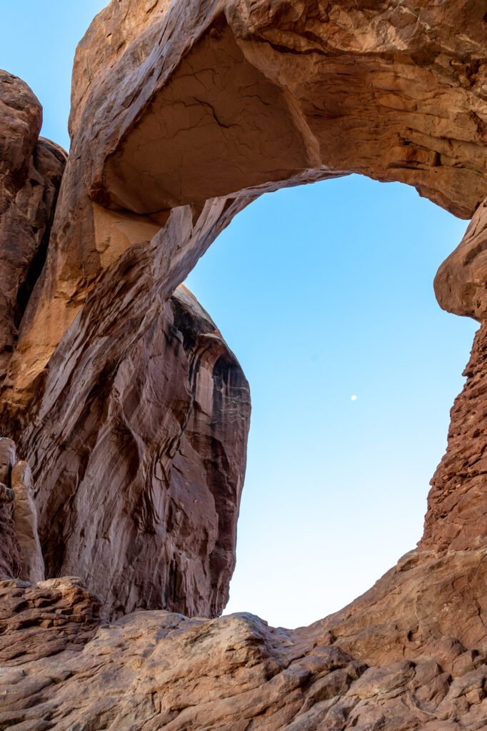
Sunrise at the Windows
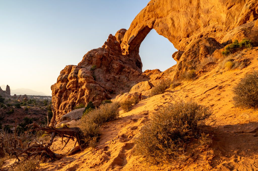
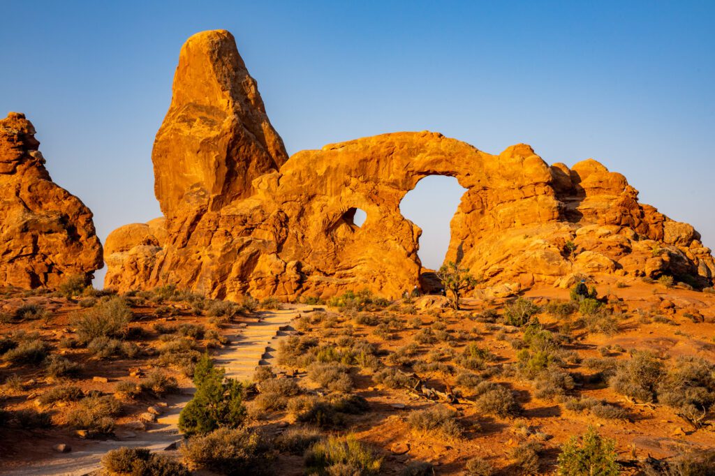
On our last day in Arches, we got up at the crack of dawn to head out to the Windows area, which turned out to be one of our favorite spots in the park. There are four arches here – the North Window, the South Window, Double Arch (which I’m counting as one), and Turret Arch.The two windows and Turret Arch are connected by the Windows Loop Trail, which is a very short and easy walk through the desert.
The sun rises to the east, which means you should head to the Windows first, which face out towards the rising sun. If you go through the north window and hike down the little trail, you’ll be able to get a good view of the arches as the light from the sun turns them a brilliant bright red color.
Continue on the loop trail to Turret Arch, which looks like a castle with its rising spire.
Across the parking lot is Double Arch, which was in our top three favorite arches. It’s a quarter mile from the parking lot, and you can climb up and into the arch where you’ll have a view to the south over the rest of the park. Fun fact: Double Arch is the tallest arch opening in the park.
On the drive out, stop by Balanced Rock and do the short walk out to it. It’s exactly what it sounds like, a balanced rock.
4×4 Tour of Arches National Park
There was only one thing we didn’t get to do in Arches National Park, and that was getting off the beaten path and exploring around the west side of the park, which is accessible only by high clearance, 4WD vehicles. Our Honda Odyssey just wasn’t going to cut it.
Lucky for you, you can do a guided 4×4 tour of Arches National Park that will get you off the beaten path to see the ONLY arch in the park that we missed (that’s probably not quite true, but of the ones on the map) Tower Arch.
It’s a guided tour, so not only will you get to see things that most people who visit Arches don’t get to see, but you’ll also get an expert guide who will weave a narrative about the park and its history and guide you through rough patches in the road.
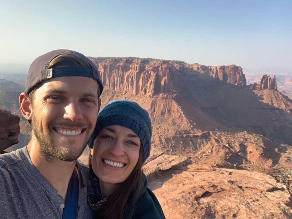
Explore Canyonlands National Park
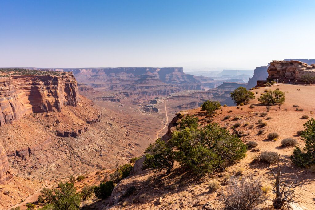
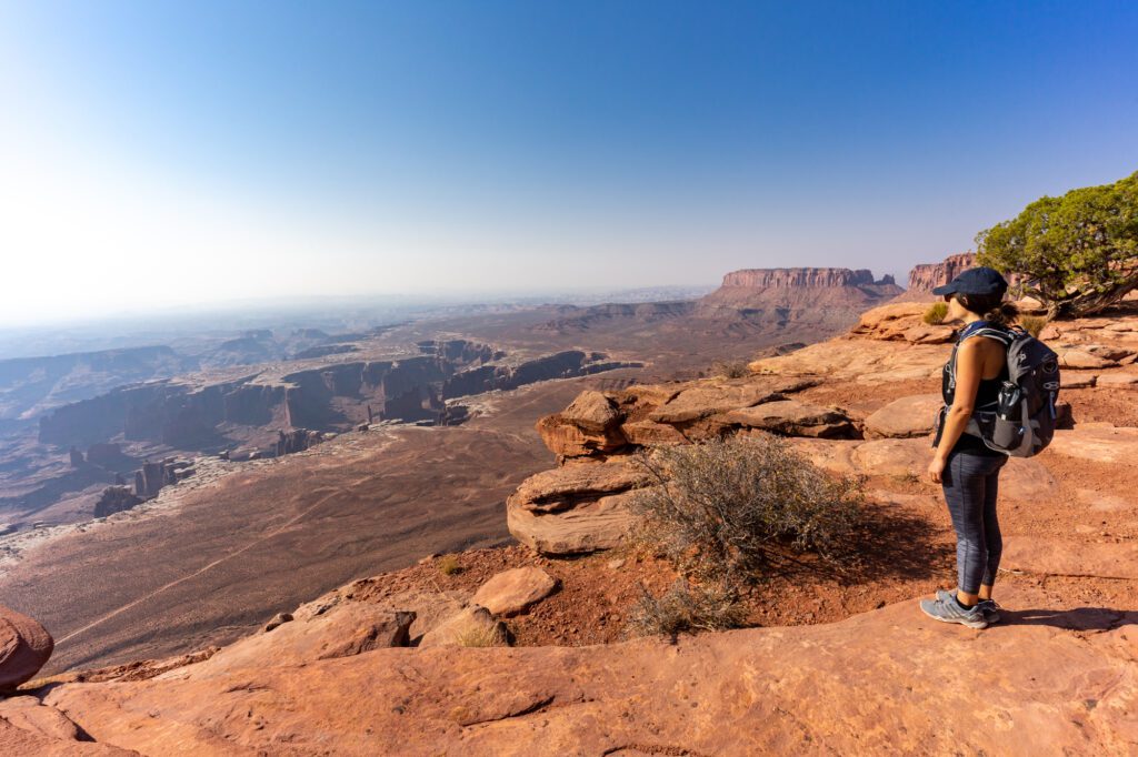
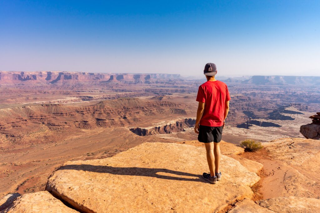
Unlike Arches, where the highlights are towering rock formations that you’re looking up at and marveling over, Canyonlands National Park is quite different. Instead of looking up, you’re looking down, and often you’re not looking at a specific rock formation (except for Mesa Arch), you’re looking at the vast network of interwoven canyons and crevices carved into the landscape over millennia.
Canyonlands is huge, and it’s made up of three areas.
First is Island in the Sky, which is the one we spent time in and is the most accessible from Moab. Here, you’ll find the famous Mesa Arch, as well as the White Rim Road (4WD ONLY). It’s the one that the majority of visitors to Canyonlands visit, but it’s not the only one.
The Needles, which is about an hour and a half south of Moab, is the southeast corner of Canyonlands and is probably the best part of the park for hiking. But it’s FAR from Moab, and I’d recommend finding somewhere to stay closer to that area if you want to spend time there.
The Maze is pretty inaccessible if you only have a short amount of time. It’s remote and rugged, and you need a high clearance, 4WD vehicle to even think about getting there. It’s going to take you a few days to get there and back, so if you have one or two days to devote to exploring Canyonlands, focus on the other two parts of the park.
Mesa Arch at Sunrise
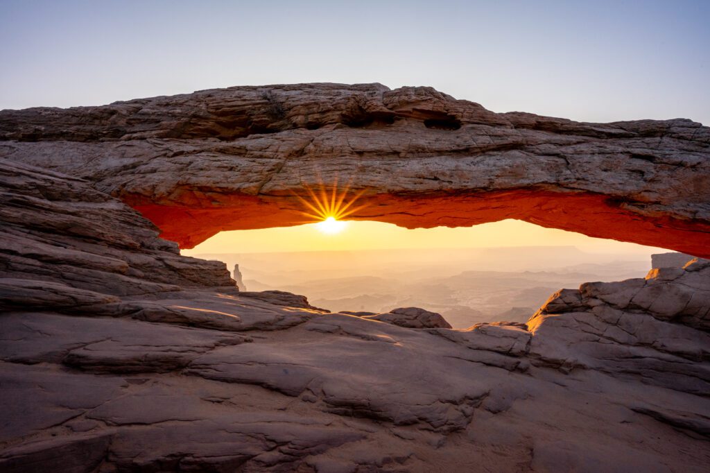
Mesa Arch is gorgeous, but don’t expect solitude if you’re there at sunrise. The sun comes up over the landscape as you’re looking through the arch, which is spectacular. As a result, about a hundred photographers were there with their tripods an hour before sunrise on the day we visited.
That being said, I snuck in and got some pretty incredible pictures.

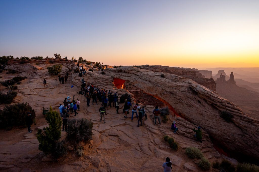
If you want more solitude, plan on coming midday or at sunset, when less people are jostling to get the perfect shot.
It’s a short hike from the parking lot, and should be your first stop on a day in Canyonlands.
Hike to Grand View Point
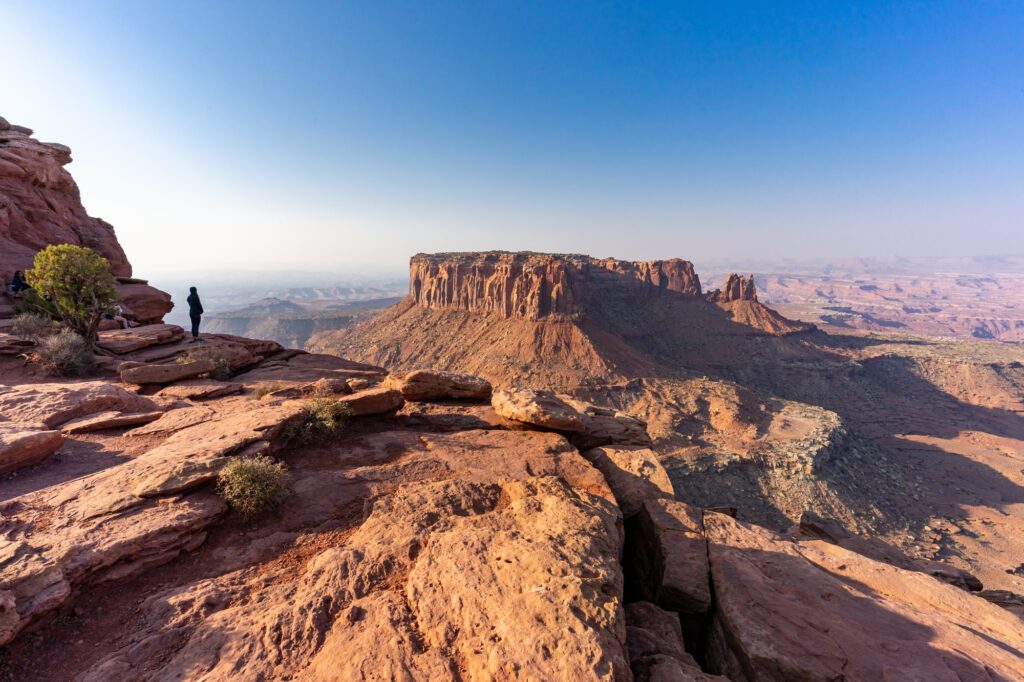
You’ll find Grand View Point at the southern tip of the scenic drive through Canyonlands National Park. It’s a short and sweet two mile walk out to the edge of the mesa with incredible panoramic vistas the entire way. At the mesa’s edge, you’ll have sweeping views to the southwest, including White Rim Road and the Green River.
It’s roughly an hour away from Moab, and a perfect day in Canyonlands takes you to Mesa Arch at sunrise, then straight out to Grand View Point before returning and stopping at the White Rim Overlook, Aztec Butte, and Shafer Canyon Overlook along the way back to the Visitors Center.
A side trip to Upheaval Dome, a huge crater, is worth a detour if you’ve got extra time.
If you’re looking for a longer hike that takes you down to the canyon rim, look at the Gooseberry Trail, which is the steepest trail in the Island in the Sky and takes you all the way down to the White Rim.
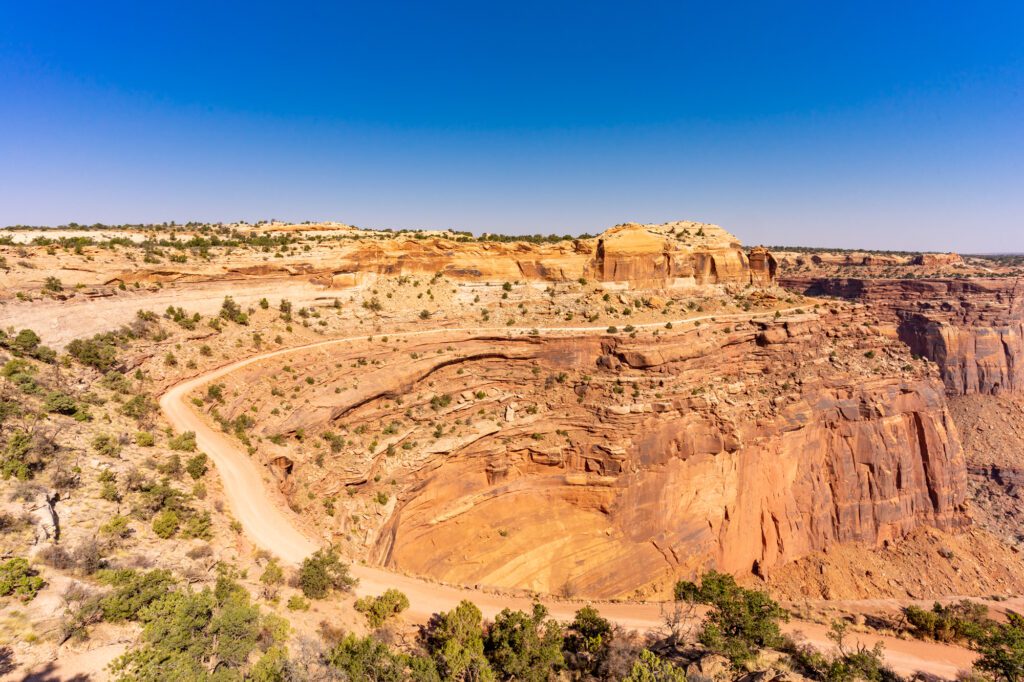
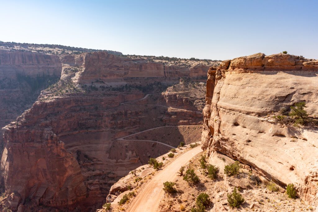
Drive the White Rim Road
This is another one that, unfortunately, we had to skip because our Honda Odyssey doesn’t exactly count as a “4WD, high clearance” vehicle. Especially when it’s loaded down with all the things we need to live in it.
But just because we didn’t get to do it doesn’t mean you shouldn’t consider it. It’s the best way to get off the normal tourist track and get a sense for the vast rugged terrain that makes Canyonlands the most unexplored National Park in Utah.
The White Rim Road is 100 miles long, and is made up of sections of dirt, gravel, and rock road that wind along the rim of the canyon past countless incredible viewpoints that only a small percentage of visitors to Canyonlands ever get to see. You can either drive the road, or rent a mountain bike and do it on two wheels. NO ATV’s THOUGH.
I loved this guide to driving the White Rim Road, which has basically all the information you’ll need to plan the perfect trip from someone who actually did it.
Make sure you have the relevant permit if you’re planning on tackling the White Rim Road – day permits here, overnight backcountry permits here. Make reservations well in advance during the high season since, like most popular backcountry destinations these days, they often have more people who want a permit than permits available.
Don’t feel comfortable driving this road yourself, but still want to experience it in all its glory? No worries – do a guided 4×4 tour where an expert guide will navigate the road for you and take you to all sorts of incredible spots along the way that you never even knew existed.
Explore the Needles District
Like I mentioned before, the Needles District in Canyonlands is further from Moab itself, but it’s worth spending a day there, particularly if you’re looking for the best hiking in the park.
The Needles, named for the colorful sandstone spires, is about an hour and a half (75 miles) south of Moab, so you’re going to want to plan on spending the full day there. Think of it more as a day trip from Moab.
The first thing to do would be the 6.5 mile scenic drive, which culminates in Big Spring Canyon Overlook. You’ll find the best view of the Needles themselves off of Elephant Hill Road (about a mile in on the dirt road – 2WD vehicles are fine until the Elephant Hill Trailhead – past the viewpoint – then you need 4WD).
The second thing to do is to hike one of the countless trails in this part of the park.
Here are some easy hikes that are little more than a stroll from the parking lot.
- Cave Spring (0.6 miles RT) – short loop where you’ll find the remnants of an old campsite that cowboys used to use, along with some prehistoric rock paintings.
- Pothole Point (0.6 miles RT) – I know, this doesn’t sound like a trail you want to drive to. But it’s right off the main road. It’s a short loop that takes you through a unique desert landscape featuring potholes that trap rainwater on the rare occasion that it rains in the desert. Signs along the way help you learn all about the ecology and ecosystem that has found a way to thrive here
If you’re looking for a longer hike, I’d choose either Chesler Park Viewpoint (6 miles RT) or Druid Arch (11 miles RT).
4×4 Tour of Canyonlands
Like Arches, the best way to get off the beaten path and see the parts of the park that most people don’t ever make it to is to do a guided 4×4 tour.
Next time we’re in Moab, we definitely will be finding a way to explore White Rim Road, which probably means renting our own Jeep and driving it ourselves. But if you don’t feel comfortable navigating the steep switchbacks that you’ll need to tackle to get to White Rim Road, hop on a 4×4 tour to have an expert guide do the driving.
This half day backcountry 4×4 tour takes you deep into the Island in the Sky District, where you’ll navigate the switchbacks of the Shafer Trail to get down to White Rim Road, and see a different side of the park than most people ever get to experience.
This full day 4×4 tour of the Needles District takes you past Elephant Hill Trailhead on one of the most challenging 4×4 trails in Utah with a knowledgeable guide. Then you’ll enjoy a buffet-style lunch at a lovely viewpoint, tackle a three mile hike in the afternoon, and return back to Moab.
Other Fun Things to Do in Moab
There are plenty of things to do outside of the two national parks near Moab. In fact, I would say that while the parks are spectacular, some of our favorite things to do in Moab are actually found outside of the National Park boundaries, where the crowds will be thinner and you’ll have more space and time to yourself.
Whitewater Rafting Near Moab
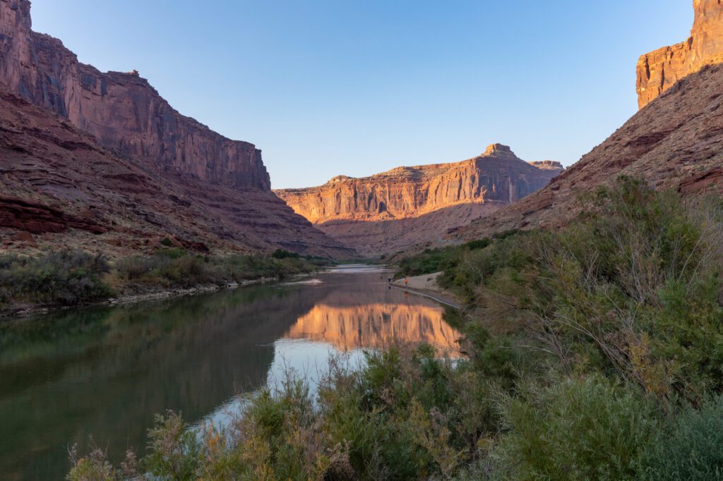
Does floating a picturesque river through incredible red rock canyons that tower thousands of feet above you sound like your idea of fun? We love whitewater rafting, and Moab is a great place to do it with options for all levels of experience and comfort.
Between us, we have been whitewater rafting in California, Oregon, and Washington, and I’ve actually rafted the Colorado River closer to the Grand Canyon. Unfortunately, we skipped this in the Moab area – it was one of the things that we wished we had more time for – but I did the research to figure out what we could do if we had more time.
There are essentially four whitewater rafting trips near Moab that are worth considering.
I used to work for a whitewater rafting company in Washington State, and you should know that your experience on the river can vary wildly based on water levels. That means that in a light rain/snow year and later in the summer, the water levels are going to be lower and the rapids are going to be smaller. Not necessarily a bad thing, but something to be aware of going in to set expectations.
(Easiest) First is a half day trip on the Colorado River from Fisher Towers to Rocky Rapids (about 7 miles). This route features some Class II rapids, which are relatively tame, and long stretches where you can hop out of the boat and float in the river. You can also tackle this one in an inflatable kayak if you’d prefer – you’ll get instructions from your experienced guide to help you navigate the river before you get going. This is a pretty tame stretch of river with smaller rapids, so it’s probably best for people not comfortable in the water, and families with smaller children. Click here to check prices, reviews, and availability for this trip.
(Easy, Longer Trip) Next would be doing a full day trip on the Colorado River through the Castle Valley, which is about 14 miles and covers the same stretch of river in the half day tour, plus the stretch of river below Rocky Rapids. It’s still a very mild trip, with plenty of time to splash around in the water. If you’re looking for an exhilarating trip that will get your heart racing and make you question “WHY DID I DECIDE TO DO THIS??”, this probably isn’t it. Click here to check prices, reviews, and availability for this trip.
(Medium – this is my sweet spot) Consistently rated among the best short whitewater trips in the USA, a full day trip to Westwater Canyon is at the top of my list of things to do when we make it back to Moab. On this 8-10 hour trip, you’ll paddle through 12 different class III / IV rapids, which means there will certainly be points where you ask yourself how you got to this point in your life. Don’t worry, your guide will help you navigate them. It’s worth noting that water levels dictate the experience you’ll have – lower water levels later in the summer means smaller rapids, which you should know and ask about going in. Minimum age on this trip is 12 years old. Click here to check prices, reviews, and availability for this trip.
(Multi-day Trips) If you want to spend a few days on the river, look at a two or four day trip to Cataract Canyon, which will take you along 100 miles of river and 30+ Class III to V rapids.
Hiking to Jeep Arch and Corona Arch
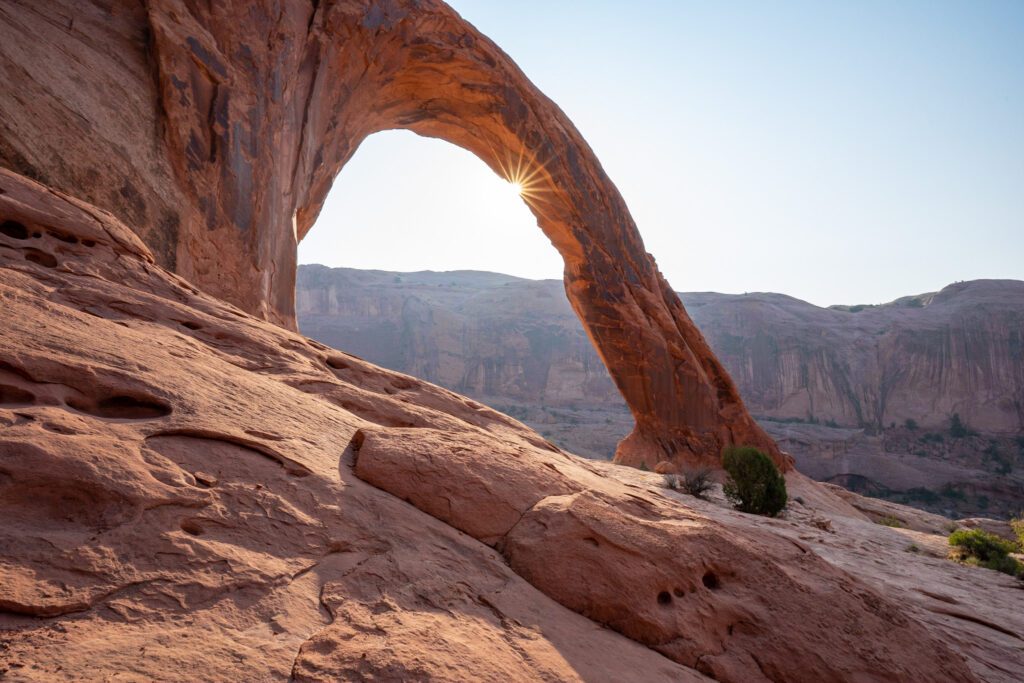
Two arches outside of Arches National Park? Sign me up! These two arches are along Highway 279, which runs northwest of Moab along the Colorado River. The two trailheads are about a quarter mile apart, so you can totally park at one and tackle both without having to worry about parking.
These two short hikes are a must-do in Moab.
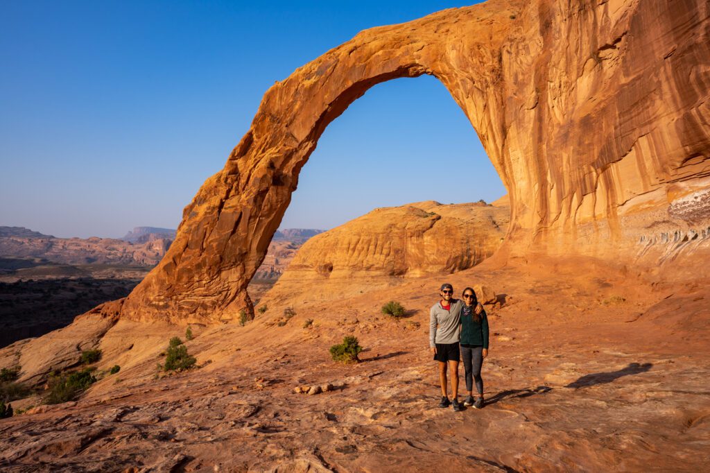
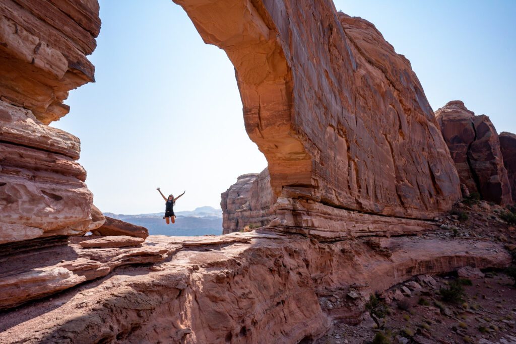
First, tackle Corona Arch, which is the shorter journey and also the more popular of the two. We came for sunrise, which probably isn’t the best time to be there since the sun takes a long time to rise over the canyon behind the arch. Still, it’s spectacular. The hike itself is just over two miles (round trip), and there’s a bit of elevation gain that is totally manageable for most people. There are two tricky parts – an ascent up a slick rock face aided by cables, and a ladder that you have to climb – but we had absolutely no trouble making it up to the arch. Don’t miss Bowtie Arch, which you’ll come across before Corona, and the face in the rock on the far side of Corona Arch!
Next, head to Jeep Arch. On this hike, which is super exposed and doesn’t offer a whole lot of shade, we saw a total of four people midday on a Thursday. Not a whole lot of people make it to this one, but they probably should. This one is a 3.6 mile loop that takes you through a spectacular valley, up and through the arch, and then back down the other side. It’s not particularly hard, but it’s a lot of time in the blistering sun, so bring plenty of water, sunscreen, and sun protection like a hat. The arch itself is basically a hole in the towering rock wall. Alysha thinks it looks like a Jeep, but I’m not convinced. I’ll let you decide for yourself.
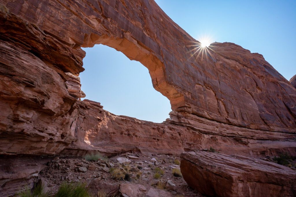
One note: we didn’t realize that you can walk through the large drain pipe at the trailhead that takes you under the mountain, so we climbed up to the railroad tracks and then back down to the other side. Don’t do that! Just walk through the pipe (as long as conditions are dry).
Sunset at Dead Horse State Park
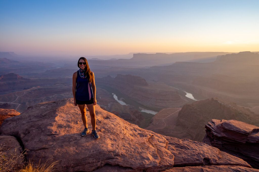
We capped off our time in Moab, Utah, with a sunset at Dead Horse Point State Park.
It’s in the direction of Canyonlands along the road that takes you into the Island in the Sky section of the park, so it’s worth adding on to your foray into that section if you have time.
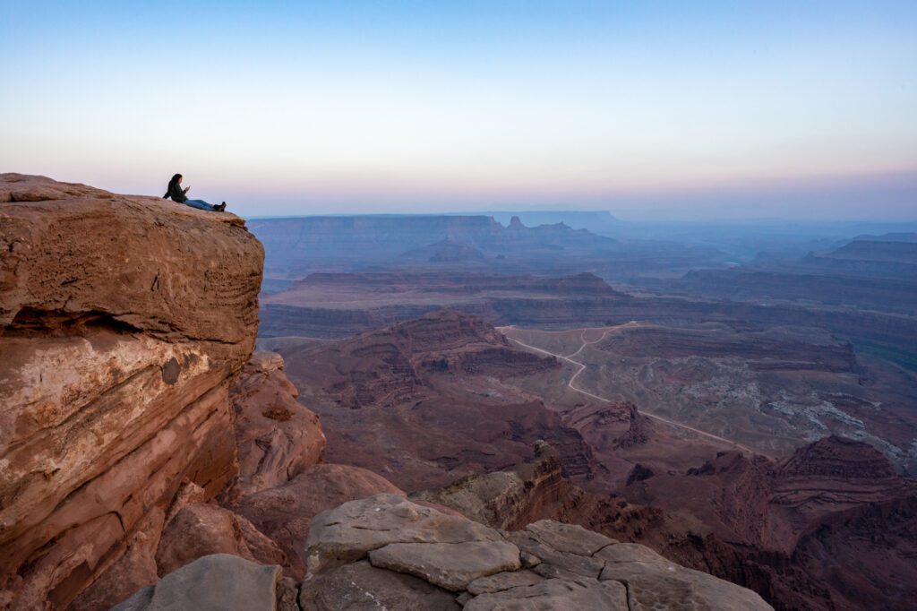
The draw here is the sweeping views over the landscape that includes a picturesque bend in the Colorado River. For the best views, I’d park at the end of the road, walk out to Dead Horse Point for some great views, and then walk back north along the western side of the road until you find a spot that looks good to you. That’s exactly what we did, and we ended up taking a seat about a quarter mile north of Dead Horse Point and watching the sunset over the Colorado. Not a bad way to end our time in Moab.
We loved Moab, and it’s no wonder that it has a stellar reputation as a major adventure town. Whether you’re into hiking, cycling, climbing, rafting, or basically any other outdoor activity, you’ll find it in Moab. I can almost guarantee you’ll leave your time in Moab wishing you had more of it. I know I did.
Like this post? Here are some other posts you might like.
More on Utah’s National Parks
- How to Plan an Incredible Utah National Parks Road Trip
- 4 Days in Moab: A Complete Moab Itinerary
- 12 Awesome Things to Do in Moab, Utah
- The Best Places to Stay in Moab, Utah
- How to Spend One Day in Arches National Park
- A Complete Guide to Hiking in Arches National Park (6 Hikes)
- How to Spend One Day in Bryce Canyon National Park
- 6 Amazing Hikes in Bryce Canyon National Park