A Complete Guide To Hiking The Yellow Aster Butte Trail
Looking for a hike up in Northern Washington with amazing views of Mount Baker and the other peaks of the North Cascades and impressive displays of wildflowers or fall color (depending on the season)?
Let us introduce you to Yellow Aster Butte, one of our favorite hikes near Mount Baker (and in the entire state!).
We first tackled this hike on our two year road trip that took us on a big loop of the western United States.
We spent nearly three months – the majority of two summer/fall seasons – in Washington, and fell in love with the area on the north side of Mount Baker, which is paradise for mountain lovers.
In this guide, we’re going to cover everything you need to know to get out and hike the Yellow Aster Butte Trail yourself.
We’ll start with the logistics – where to park, and other things you need to know for a smooth trip – and then go into a trail report based on our own experiences hiking the trail.
Our intention is to set you up for hiking success by the end of the guide so you can get out on the trail safely and confidently, prepared for the trail and knowing what to expect.
Sound good to you? Let’s get into it.
Disclaimer: Some of the links in this post, like hotel links, are affiliate links, meaning at no additional cost to you, we make a little bit of money if you click through and book. That being said, we would never recommend something to you that we don’t stand behind 100%.
Yellow Aster Butte: Trail Details
- Length: 8.2 miles
- Elevation Gain: 2,600 feet
- Season: Late July – October
- Trail Type: Out and Back
- Difficulty: Difficult
- Pass Required? Northwest Forest Pass OR America the Beautiful Pass
- Dog-Friendly? Yes, on a leash
- Trailhead Location: Tomyhoi/Yellow Aster Butte Trailhead
How Difficult is the Hike to the Yellow Aster Butte?
We would put this hike firmly in the difficult category, partially because of the elevation gain (2,600 feet is a lot, especially over a hike less than 10 miles) and partially because of the distance and terrain you’re covering.
There are a few steep, rocky stretches of trail – particularly on the final push to the false summit – but nothing sustained. It’s also not particularly long.
For the most part, it’s a gradual climb on a well-maintained trail with great views of Mount Baker and the surrounding landscape.
The Route for Yellow Aster Butte
This hike is fairly straightforward, though there are some things to know about the false summit versus true summit at the end.
You’ll start out on the Tomyhoi Lake Trail, which is a steady forested climb featuring some wide, sweeping switchbacks, following it to the trail junction at 1.7 miles where you’ll take a left at the fork and hop on the Yellow Aster Butte Trail. You’ll follow that trail all the way to the end of the hike.
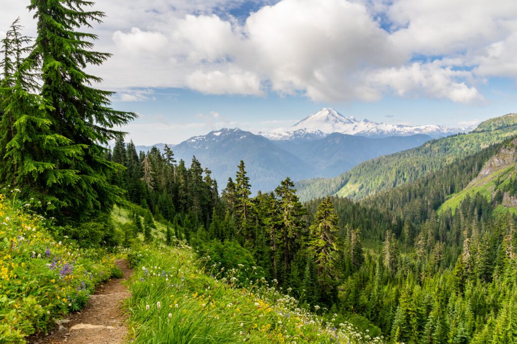
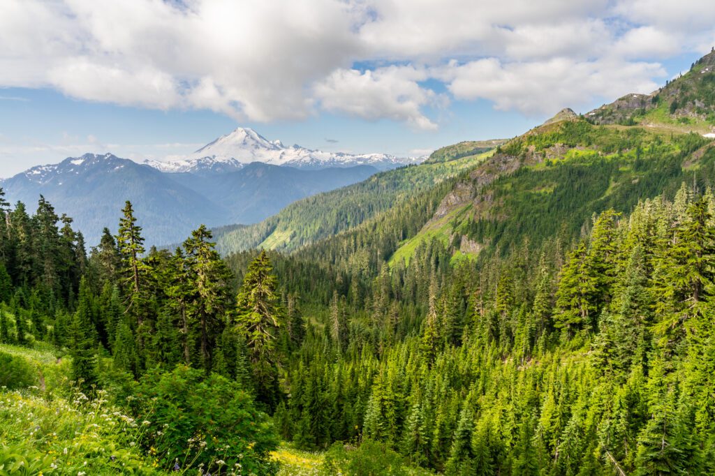
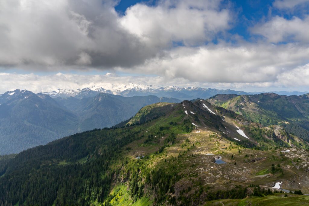
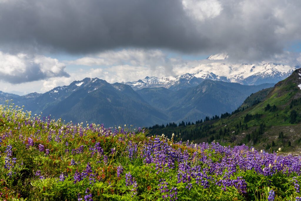
The trail loops around a big basin, and the wildflowers (in the early summer) and views of Mount Baker to the south are nothing short of spectacular from the time you exit the treeline to the end of the trail.
The most controversial part about this hike is the discussion about the summit versus the false summit at the very end.
At the 3.8 mile mark, you will find yourself atop a ridge after a short, steep climb. From here, you have panoramic views – truly 360 degrees – out over this gorgeous landscape.
However, technically speaking, this is a false summit.
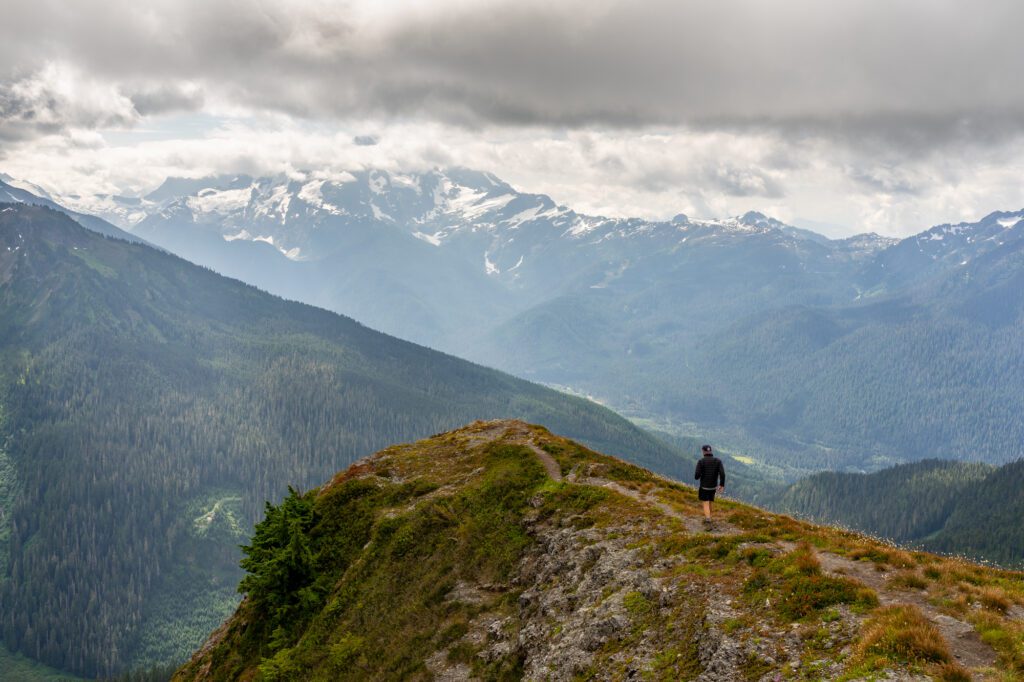
The actual summit of Yellow Aster Butte is another 0.4 miles out along the ridge, which is narrow, requires some scrambling, and has steep drop offs on either side at points.
We decided to skip the journey out to the true summit, which is roughly the same elevation and location, so it’s not like you’re getting significantly better views (more importantly, we’re a little scared of heights, and that journey didn’t sound fun to us).
Know your own limits and you can make the decision for yourself.
It’s worth noting that the hike is only ~7.5 miles round trip if you skip the portion of the trail out to the true summit.
If you want to extend your hike (especially if you want to spend the night in the backcountry), it’s worth dropping down into the basin of alpine lakes, which is off to the left when you turn to make the final push up to the summit.
Down there, you’ll find rolling hills with great wildflowers/fall color and a string of alpine lakes with campsites around them.
It’s a short addition to the hike, but you do have to drop down into that basin (which means you have to come back up).
If you’re feeling really spicy, you can also continue all the way up to Tomyhoi Peak, which adds about 5.6 miles to the distance (along with a big chunk of elevation gain).
To do this, you follow the trail down into the basin and catch the Tomyhoi Peak Trail heading north. More trail information on that hike here.
Getting to the Tomyhoi / Yellow Aster Butte Trailhead
The Yellow Aster Butte trail is in the Mount Baker Wilderness, and it leaves from the Tomyhoi/Yellow Aster Butte Trailhead which you access by turning off of Mount Baker Highway and driving up Forest Road NF-3065.
The turnoff is off of Mount Baker Highway almost exactly 13 miles from the town of Glacier to the west, or a hair under 8 miles from Mount Baker Ski Area.
If you’ve spent time hiking in the Pacific Northwest, you’ve likely encountered forest service roads that vary wildly in terms of their suitability for driving.
This particular forest service road is unpaved, rocky, and features some deep potholes at points.
That being said, we made it up to the trailhead without too much issue in a Honda Odyssey, which has both low clearance and two wheel drive.
However, you cannot go any further past the trailhead (to Twin Lakes, for example) without high clearance and 4WD, because the road deteriorates quickly as soon as you pass the trailhead.
The road should be passable for most vehicles, but you’ll need to take it slow and navigate around the deeper potholes and rocks.
The other thing to know about the road here is that it’s very narrow at points, with barely enough space for two cars to pass each other (especially when you consider the types of cars that are brave enough to come up this road).
We had to pull over and reverse once or twice on the way up – be patient and courteous to other drivers – we’re all here for the same reason!
Parking at the Trailhead
The trailhead itself is less a parking lot and more a “park along the forest road” free for all.
You NEED to make sure that you are parked in a place that allows other cars to pass you.
To get a spot closer to the trailhead, you’re going to want to arrive by 8am at the very latest (otherwise, be prepared to add a half mile or more to your hike). It’s even earlier in the fall, when this trail is at its most popular.
We’d recommend turning around and parking so that you’re facing back down the road if you can, when there are fewer cars to navigate around.
There is, remarkably, a toilet at the trailhead.
The Best Time to Hike This Trail
As with most hikes near Mount Baker, the hiking season this far north is painfully short. For the most part – and it varies slightly by year – this trail is doable from the beginning of August through early October.
You’ve probably already done the math on that, but that’s only ten weeks or so.
There are two particular times where this hike gets very popular (and it seems to get more popular with each passing year).
The first is right at the beginning of August, when the slopes and meadows are blanketed with dense fields of wildflowers of all shapes, sizes, and colors.
We happened to be out here in early August, and we spent several hours basically just dragging our dropped jaws along the trail because the show just kept going on and on.
The second peak time – and this is the time when the entire population of Washington State seems to come out to hike this trail – is in late September and early October, when the same slopes and meadows are now blanketed in fall colors, with hues of yellow, orange, and red lighting up the hillsides.
It is worth noting that this hike is not a destination for golden larches, if that’s what you’re looking for.
Things to Know Before You Hike
Here are a few things to know before you hit the trail.
Dogs are allowed, but MUST be on a leash. It drives us crazy when we see signs plastered all over at the trailhead that say that dogs must be on a leash and we encounter off-leash dogs on the trail.
There are good reasons why dogs need to be leashed – to protect wildlife, to protect the environment off of the trail, to protect people who aren’t into your dog approaching them, etc etc.
Follow the rules, otherwise the Forest Service could just decide dogs aren’t allowed anymore, which would ruin the fun for everyone else.
This is a busy trail. You’re not exactly going to have the trail to yourself. Practice good trail etiquette, specifically giving way to uphill hikers and avoiding playing loud music (headphones are a good choice if you want to have music!).
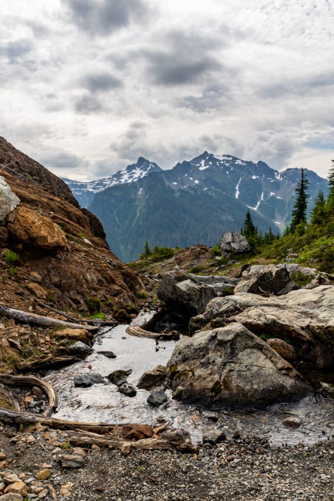
There are limited water sources along this trail. Prepare accordingly, especially if you’re backpacking. We did a day hike here and carried 2L of water each (and finished most of it by the time we got back to the car).
The Yellow Aster Butte Trail: A Complete Trail Guide
Now that we’ve covered most of the information we think you need to know before you get out on the trail, let’s talk about the trail itself!
The hike to Yellow Aster Butte is a pretty straightforward affair, but we’re going to break it into three distinct sections to make it more digestible, and so that you’ll be able to keep track of where you are on the hike when you’re on the trail.
Those three sections are:
- The Trailhead to the Yellow Aster Butte Trail Junction
- Through the Meadows to the Base of the Ridge
- The Final Push to the Summit (and False Summit)
For each section, we’ll give you the (rough) distance and elevation gained in that portion of the hike, along with a relatively short description of the terrain, calling out anything that we think might be useful to know (e.g. there’s a steep section with some scrambling, there’s a toilet, etc).
The Trailhead to the Yellow Aster Butte Trail Junction
Distance: 1.7 miles // Elevation Gain: 1,400 feet
As you can see from the elevation gain here, this first section of the hike is where you’ll do the bulk of the climbing to reach the meadows, where the trail flattens out a bit.
From the trailhead, you’ll start with a set of exposed switchbacks that climb up above the parking area.
This part of the trail was fine in the early morning, but was particularly brutal when we came back down around noon when it was hot and dusty.
After those switchbacks, you enter the forest and continue climbing for another mile and a half, alternating between switchbacks and a well-maintained graded uphill path.
At 1.7 miles in, two things happen.
First, you break out of the trees and get your first real views of the hike, which include Mount Baker over your left shoulder.
Second, you reach the trail junction for the Yellow Aster Butte Trail, which veers left.
If you were to continue right, you’d go to Tomyhoi Lake.
Through the Meadows to the Base of the Ridge
Distance: 1.7 miles // Elevation Gain: 550 feet
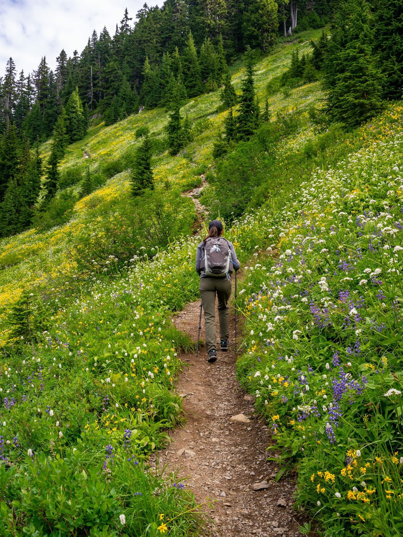
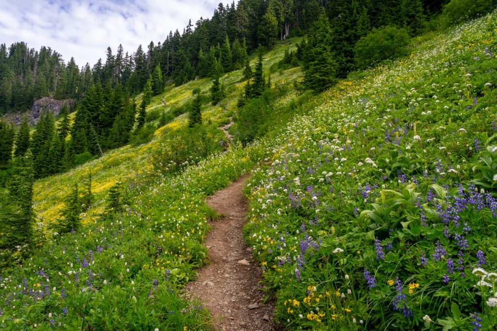
This section is both the easiest stretch of trail, and also the most beautiful. You’re basically making your way around a big valley formed around a creek bed (that I’m sure is more than a creek at certain times of year).
The trail hugs the hillside, climbing gently for the first mile or so of this section.
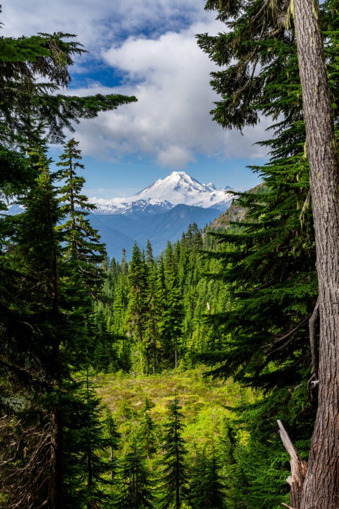
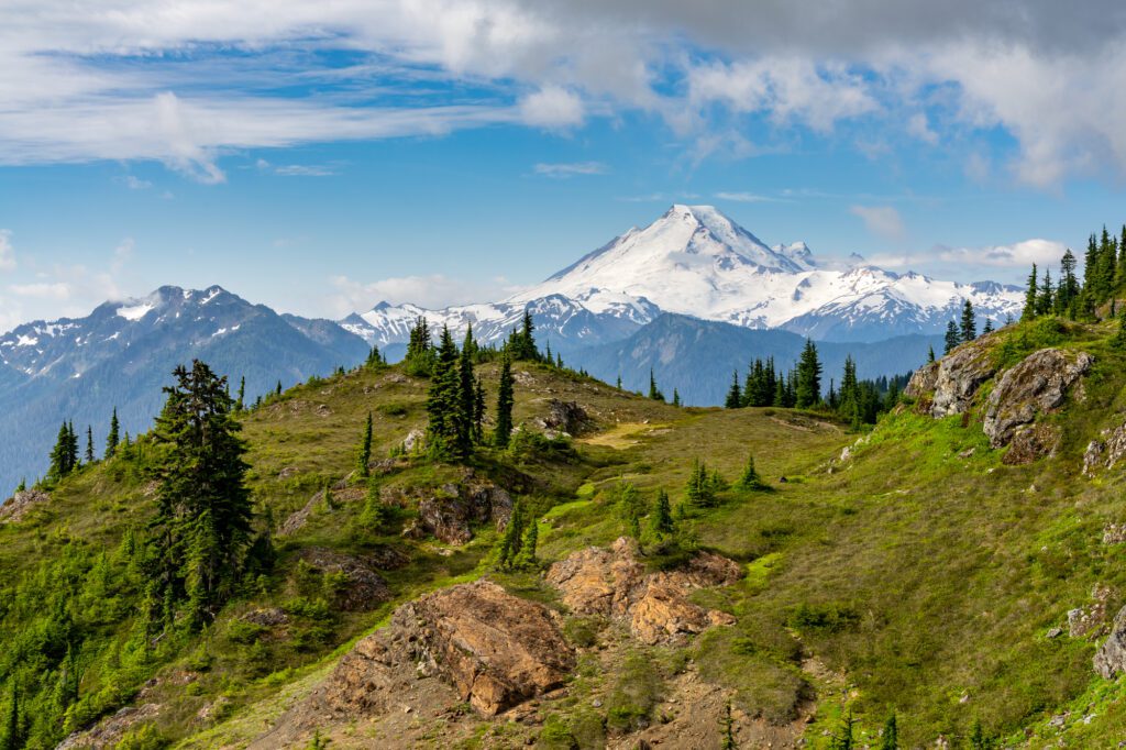
Eventually, you’ll cross the stream, and the trail starts to climb more aggressively as you round a corner and emerge onto the south facing slopes, which have an excellent view of Mount Baker (pictured above).
The trail winds its way up to the ridge with a couple of tight switchbacks, passing a tarn along the way to the trail junction that marks the end of this section, and the beginning of the final push to the summit of Yellow Aster Butte.
Off to the left here, there’s a trail that descends into the basin that is full of alpine lakes and wildflower meadows.
It’s a set of steep switchbacks to get down there, which means you’ll have to come back up them to get back to the trailhead.
You’re going to veer right, and make the final push to the summit.
The Final Push to the Summit (and False Summit)
Distance: 0.6 miles (0.3 miles to false summit) // Elevation Gain: 650 feet (500 feet to false summit)
The climb from this trail junction to the false summit (more on that in a second) is the hardest part of this hike in terms of elevation gain and terrain.
It’s a steep, rocky climb up to the ridgeline, which marks the false summit and the end of the trail unless you’re up for the narrow path out to the true summit (which requires a bit of a scramble).
To this point, the views along this trail have already been pretty spectacular.
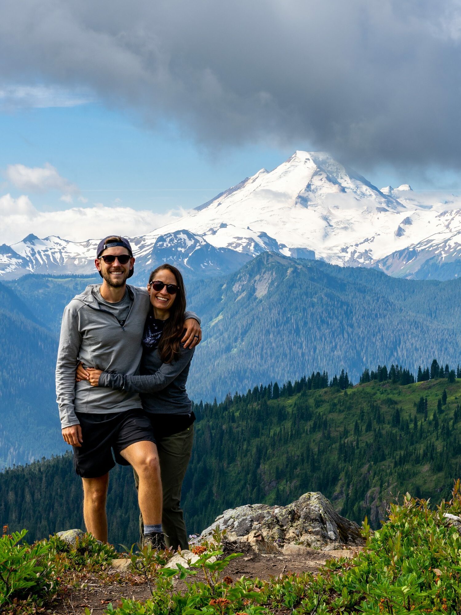
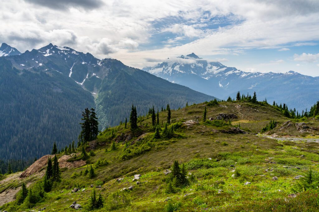
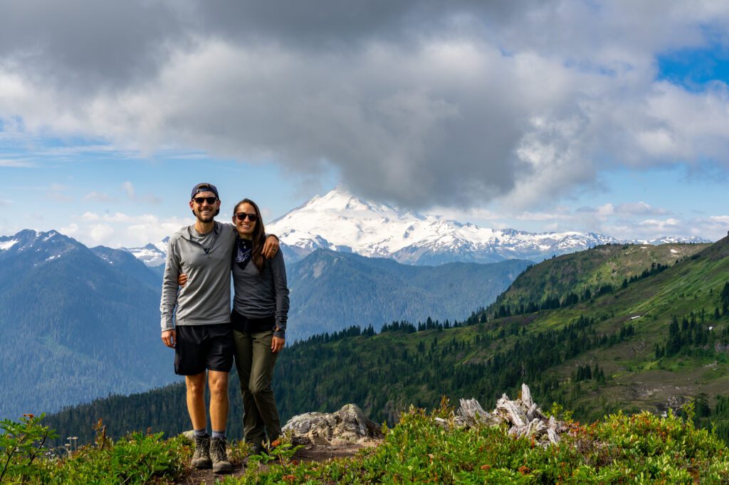
As soon as you emerge onto the top of the ridge and see the view from there, it will quickly become apparent why, for us, this hike belongs in the list of the best hikes in Washington State.
It’s truly a 360 degree view, even from the false summit (which is where we stopped).
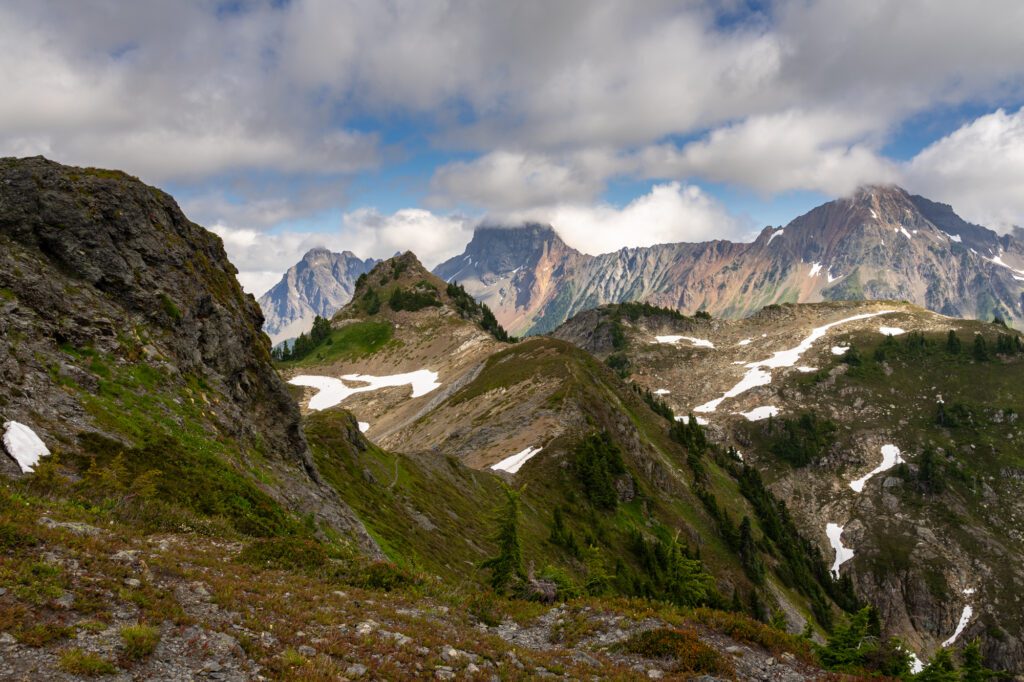
You have the towering peak of Mount Baker off to the south, along with the jagged peaks of Mount Shuksan and Goat Mountain (another great hike up here).
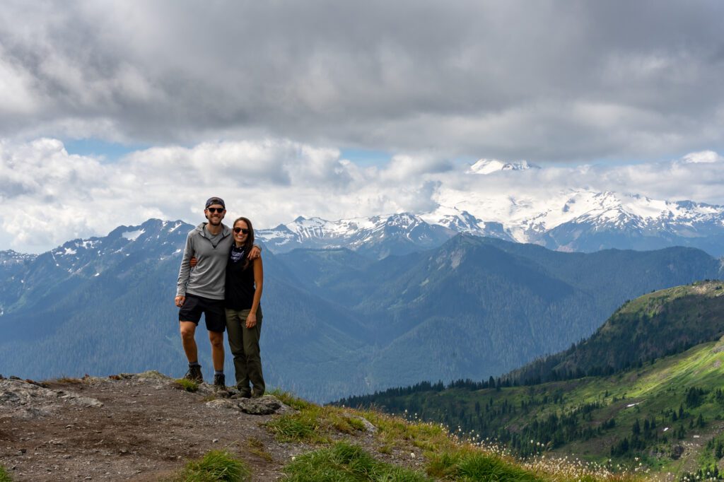
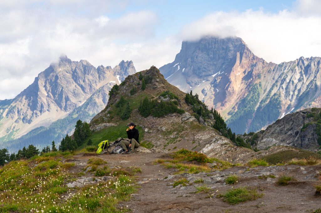
To the north, you can follow the ridgeline to see the true summit and Mount Tomyhoi, along with countless other rocky peaks of the North Cascades that stretch out as far as the eye can see in basically all directions.
As we mentioned above, the actual summit of Yellow Aster Butte is another 0.4 miles out along the ridge, which is narrow, requires some scrambling, and has steep drop offs on either side at points.
The false summit – where most people stop – is where we stopped and turned around after watching a couple of hikers continue along the path and reach the true summit.
They came back and when we asked them if it was worth it, they basically said “meh.”
Aside from those folks, we were the only people up on the summit for about 30 minutes (a weekday in early August), and we sat and enjoyed the views before the brisk wind told us it was probably time to head back down.
On the way down, the traffic on the trail increased exponentially, which is another reason to get an early start.