The Ptarmigan Ridge Trail at Mt. Baker: A Complete Guide
Here’s the short version of this entire guide: this hike is a nonstop showstopper for a relatively moderate effort, and immediately jumped into our list of favorite trails in the Northwest. If you can handle the distance and elevation, you should absolutely do it!
In the car on the way down, we were talking about where exactly this trail would fall on our ranking of the best hikes in Washington State.
Independent of each other (we wrote it down separately to avoid influencing each other), we both put this in our top three hikes in the state (Alysha had it at number one, which might be a little bit of recency bias).
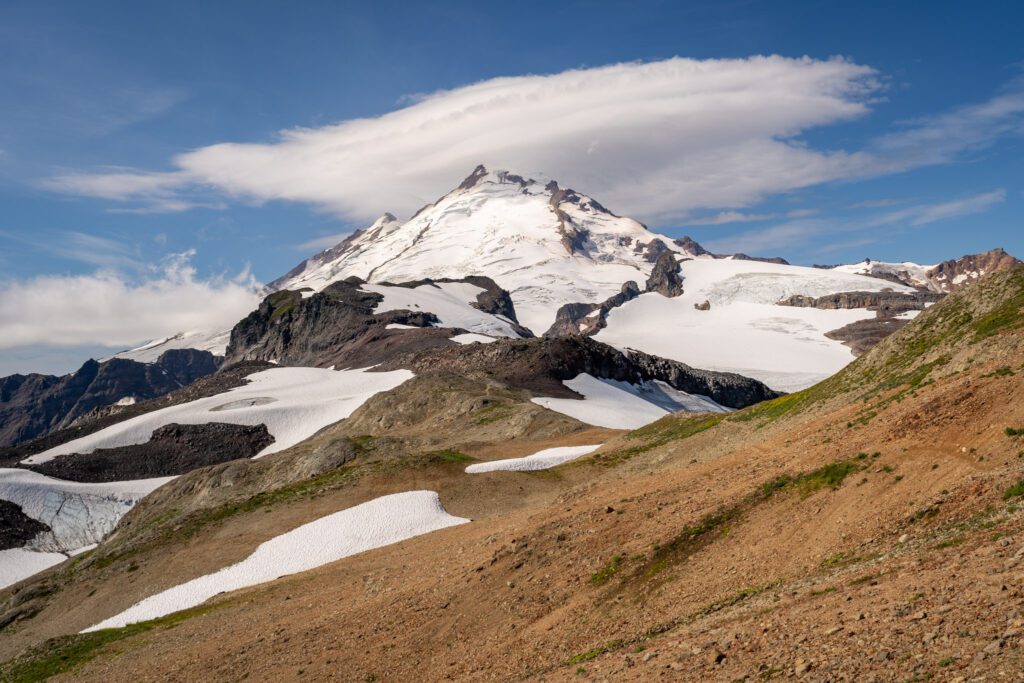
The reason is fairly simple. This hike follows a ridge (as you might imagine based on the name), and as you hike along Ptarmigan Ridge, you have unobstructed views of BOTH Mount Baker and Mount Shuksan.
In a lot of ways, this hike reminds us of the Burroughs Mountain Trail at Mount Rainier, but you get TWO amazing peaks to stare at along the way rather than just the one.
The point is that this is an excellent hike, and if you only have time to do one of the many great hikes at Mount Baker, this is the one we’d strongly encourage you to do (again, if you can handle the distance and elevation gain – more on this below).
In this guide, we’re going to do our best to give you a comprehensive guide to hiking the Ptarmigan Ridge Trail in the Mount Baker Wilderness.
We’ll cover the important trail details, including the route and start and end points of the hike, along with important logistics and things to know before you hike.
Our intention here is that, by the end of this guide, you’ll have all the information you need to be prepared to tackle the trail safely and confidently.
Sound good to you? Let’s get into it.
Disclaimer: Some of the links in this post, like hotel links, are affiliate links, meaning at no additional cost to you, we make a little bit of money if you click through and book. That being said, we would never recommend something to you that we don’t stand behind 100%.
Hiking Ptarmigan Ridge: Trail Details
- Length: 10.5 miles (11.5 miles to the Portals)
- Elevation Gain: 1,800 feet (~2,200 feet to the Portals)
- Trail Type: Out and Back
- Difficulty: Hard
- Pass Required? NW Forest Pass (or America the Beautiful Pass)
- Dog-Friendly? Yes (on a leash)
- Trailhead Location: Artist Point
A Note on the Route: The statistics above represent the hike to Camp Kiser, which more or less represents the end of the maintained trail. Going another half mile (ish) involves some route-finding and scrambling along a rocky route with steep dropoffs that takes you even further, ending at the Portals East (you can’t go any further). We cut our hike off at the end of the maintained trail given the fact that we had the dog with us and didn’t feel comfortable going further with her.
The Route
This hike is fairly straightforward in terms of the route you’re taking because once you’re on the Ptarmigan Ridge Trail, there aren’t many options or detours along the way.
The hike here starts from the Artist Point parking lot (the end point of Mount Baker Highway) and sets out along the Chain Lakes Trail, following the ridge for about a mile out to the trail junction where the Chain Lakes Loop trail heads right.
The trail to Ptarmigan Ridge heads left at that fork in the trail, and winds its way along a series of ridges that climb gently all the way to the base of Mount Baker.
There are a couple of additions near the end of the hike for you to extend your stay in this beautiful part of the world.
First is the detour down to Goat Lake, the glacial lakes on your left as you round the bend to tackle the last section of the hike (these were a pleasant surprise to us).
Second is the continuation of the hike at the end of the maintained trail, which takes you even further towards Baker.
It becomes a bit of a scramble and involves some route-finding, and it’s unclear to us how far up it continues, but we saw (and talked to) multiple people who continued to climb past the point where we turned around (at Camp Kiser).
Getting to the Trailhead (and Parking)
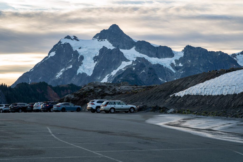
The trailhead for this hike is the parking lot at Artist Point, which marks the end of Mount Baker Highway (aka Highway 542) that runs along the north side of Baker.
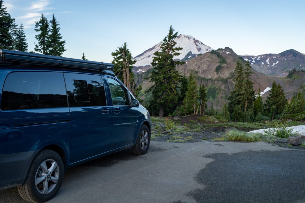
One note for those of you with, uh, less reliable cars (our old Honda Odyssey falls comfortably in this category): it’s a BIG climb.
The road more or less follows the river for most of the drive, and then climbs aggressively to reach the Heather Meadows Parking Lot and Artist Point. Homer (our Honda Odyssey, RIP) made it up to Heather Meadows (somehow), and I’m not sure it would have made it to Artist Point if the road had been open).
Though it is a paved, well-maintained road unlike many others in the Mount Baker Wilderness.
Which brings me to my next point: the road up to Artist Point is closed for the vast majority of the year due to snow.
It sits at 5,000 feet above sea level, and on our first trip to Baker a few years ago it was still closed (and covered in snow) in mid-August.
This latest time, the road was open at roughly the same time of year, and the exact timing of the opening is going to depend on the snowpack and weather in that particular year.
You can check the status of the road up to Artist Point on the WSDOT website.
The implication here is that, if that road is still closed, you will have to park further down at Heather Meadows Visitor Center, which adds ~0.6 miles (and a hefty climb) to your hike.
Chances are, if the road is still closed, you can bet on encountering a fair amount of snow patches on the trail and should prepare accordingly (poles, microspikes, etc).
Anyway, let’s talk about the parking situation and amenities at Artist Point.
When it’s open, this is a popular spot – especially on weekends, when the lot is basically full from 8am or 9am through 4pm (we know because we hung out here all day after our hike to catch sunset).
However, many people are just here to do a short walk from the parking lot, so there’s plenty of turnover and you shouldn’t have to wait too long.
There are (gross) pit toilets at the trailhead, along with garbage cans, but no water.
The Best Time to Hike
Usually, we fold this into the next section, but this is EXTREMELY important here, so it gets its own heading!
The hiking season for the high elevation hikes along Mount Baker Highway is painfully short.
Generally speaking, these trails are accessible (meaning that all roads are open) and snow-free from mid-August through September (and sometimes a few weeks into October).
All of those dates depend on the year’s snowpack and spring/summer weather, of course, and could shift a week or two in either direction.
There are two main implications for your hiking adventure.
First, as we covered briefly above, the road up to Artist Point (the starting point for this hike) is closed until sometime in the middle of August.
If that road is closed, you will have to park further down the road at the Heather Meadows Visitor Center, which will add about 1.2 miles and ~600 feet of climbing to your hike (round trip).
You can check the status of the road up to Artist Point on the WSDOT website.
Second, if you’re doing this hike outside of that tiny 6-8 week window, you’re going to encounter snow along the trail (and sometimes a lot of it).
In the third week of August, there were three snowfields that we had to cross, and they were doable without microspikes (poles were helpful). Be prepared for conditions (which you can check in advance on AllTrails or WTA).
Things to Know Before You Hit the Trail
Here are a few things we think you should know before you head out to do this hike.
Remember the elevation. You’re at about 5,000 feet of elevation at the start of this hike. If you’re coming from sea level, it’s an adjustment. The hike will likely feel harder than it should, and you’ll want to have snacks, water, and plenty of time to deal with the elevation.
There is no drinking water at the trailhead. Bring plenty of water! We hiked with 2L per person and basically ran out by the end of the hike (including the dog).
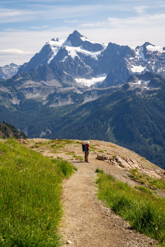
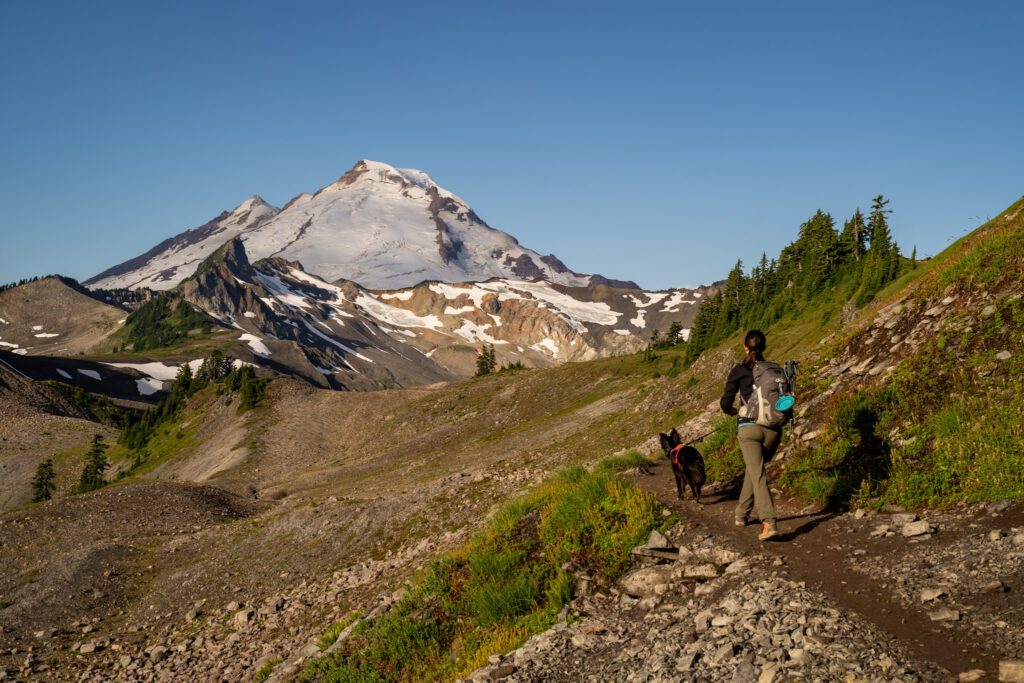
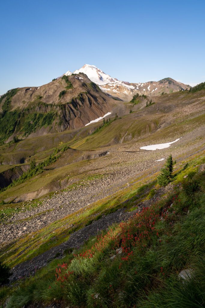
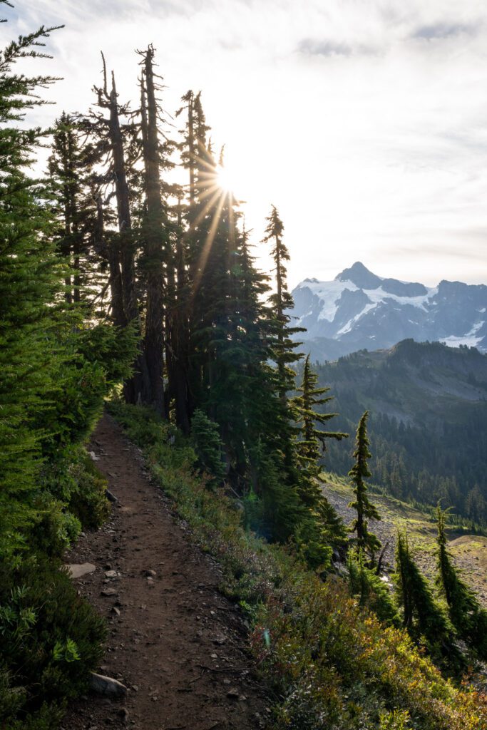
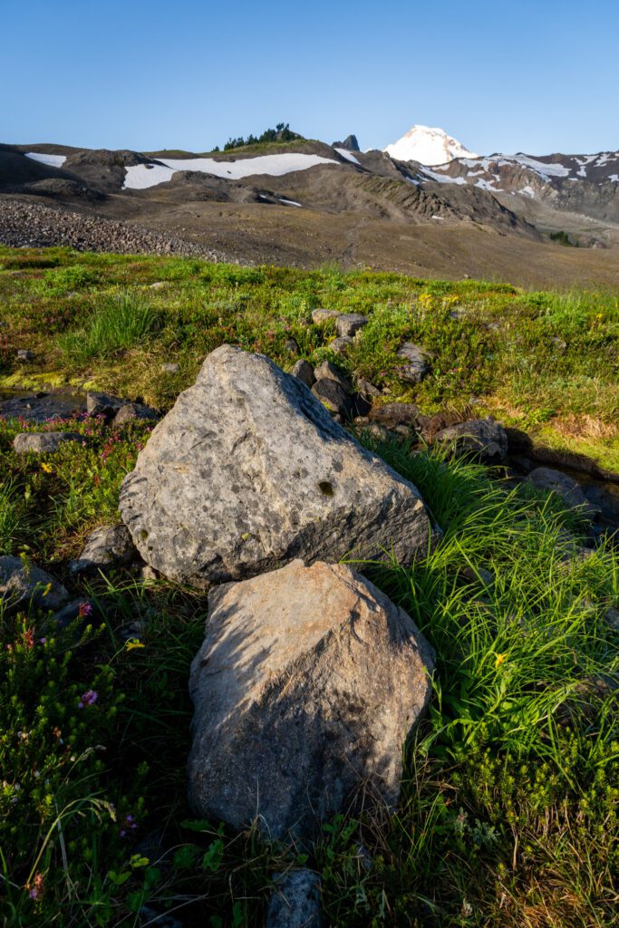
It’s very exposed (there is almost zero shade). This trail follows a series of ridges above the tree line with excellent views of both Mount Baker and Mount Shuksan the entire way.
However, that also means that there is no tree cover to speak of. On a hot summer day, this trail will be brutal.
Be prepared with plenty of water, sun protection (long pants, long sleeves, sunscreen, hat, polarized sunglasses), and get an early start so you can do the climbing when it’s cooler (we were on the trail by 7:30am).
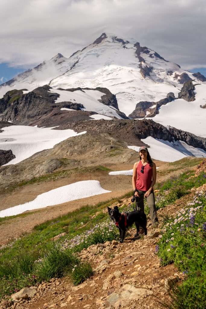
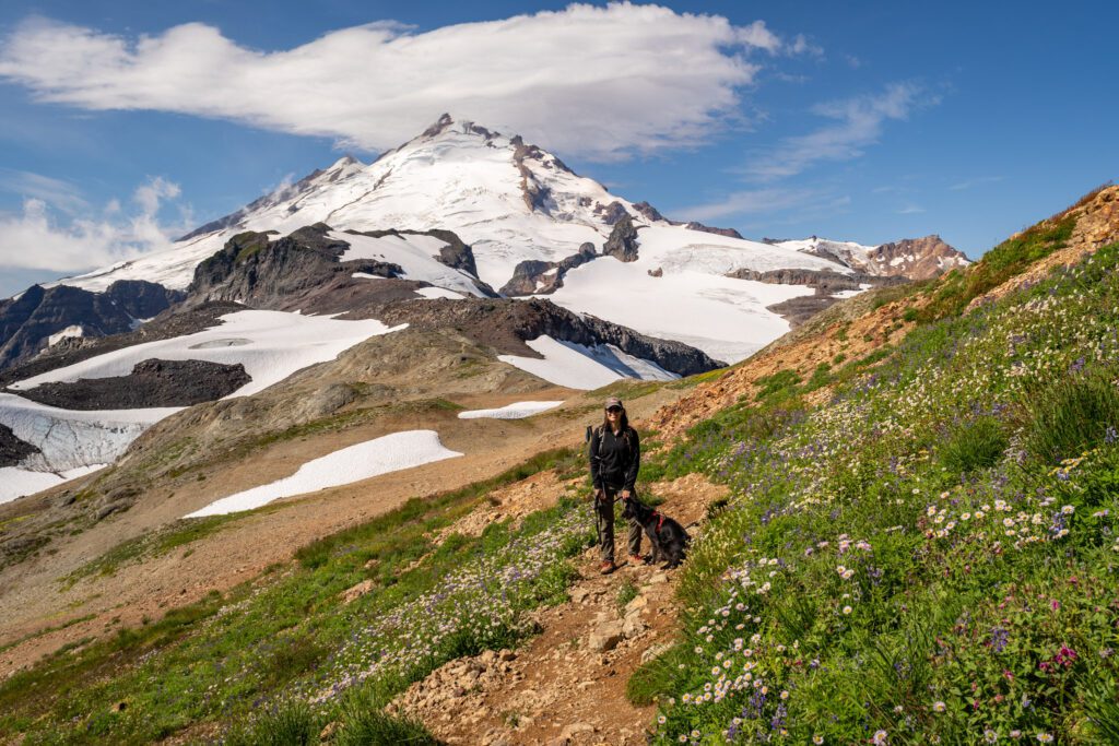
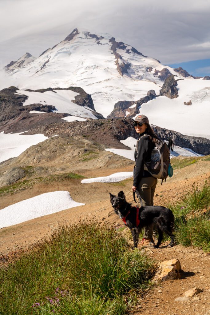
Dogs are allowed on this trail (and should be leashed). As you’ll see from pictures, we hiked this trail with our dog Lupine (who encountered her namesake along the way!).
There are a couple of things to know, though.
One, the “exposed” point above very much applies here – it would be very easy for a dog to get overheated on this hike (and there are very few water sources along the way, so bring plenty for the dog).
Two, this entire hike is rocky and might be a problem for your dog’s paws.
Three, you should really keep your dogs on a leash (even if they’re friendly – which Lupine is – you don’t know if other dogs are friendly, if people are scared of dogs, or what wildlife you’re going to encounter!).
You’re likely to encounter snow patches, even at the end of summer. There are a couple of perpetual snow fields along the ridge that you’re going to have to cross.
We hiked this trail in the middle of August, and there were three different sections of trail where we had to cross some snow.
It was totally doable with poles and boots (and we had the dog with us), but earlier in the season you might want microspikes.
The best way to check trail conditions is to look at reviews and trail reports on either the Washington Trails Association (better detail on the trail reports) and AllTrails (higher quantity of reports).
You need a Northwest Forest Pass to park here. An America the Beautiful Pass (National Parks Pass) also works.
If you don’t have one, you have a few options.
Buy one at the automatic machine along the road up just below Picture Lake, buy one at the Heather Meadows Visitor Center (opens at 10am), or buy one in advance (you can get either a day pass or annual pass at REI, which has a location in Bellingham).
Hiking the Ptarmigan Ridge Trail: A Complete Trail Guide
Now that we’ve covered most of the information we think you need to know before you get out on the trail, let’s talk about the trail itself!
This hike is a pretty straightforward affair, but we’re going to break it into several distinct sections to make it more digestible, and so that you’ll be able to keep track of where you are on the hike when you’re on the trail.
Those sections are:
- Artist Point to the Chain Lakes Trail Junction
- The Chain Lakes Trail Junction to the Goat Lake Junction
- The Final Push
For each section, we’ll give you the (rough) distance and elevation gained in that portion of the hike, along with a relatively short description of the terrain, calling out anything that we think might be useful to know (e.g. there’s a steep section with some scrambling, there’s a toilet, etc).
Here’s a map to help you visualize the route:
Note: The elevation numbers below don’t quite match up to the total elevation gain above because of the climbing you’ll do on the way back.
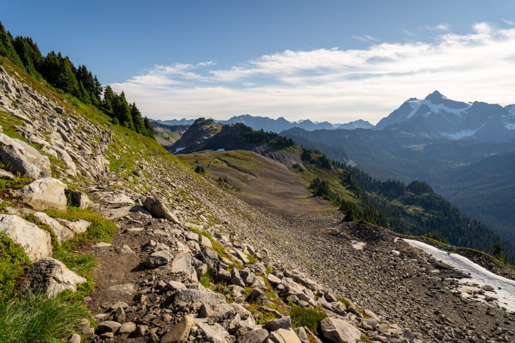
Artist Point to the Chain Lakes Junction
Distance: 1.1 miles // Elevation Gain: 200 feet
As you set out from the Artist Point parking lot, the first section of trail you’ll tackle is a mile-long stretch of the Chain Lakes Loop that takes you out along a hillside with Mount Baker right in front of you, and Mount Shuksan over your shoulder.
You might be thinking that this is one of the best views along the trail. SPOILER ALERT: it’s great, but it’s not.
The trail here is mostly a slight uphill grade, and starts with a short downhill section past the self-issue wilderness permit station before emerging from the trees onto the hillside.
We saw multiple marmots (Lupine was quick to alert us) along the trail here, mostly hanging out in the rocks below the trail.
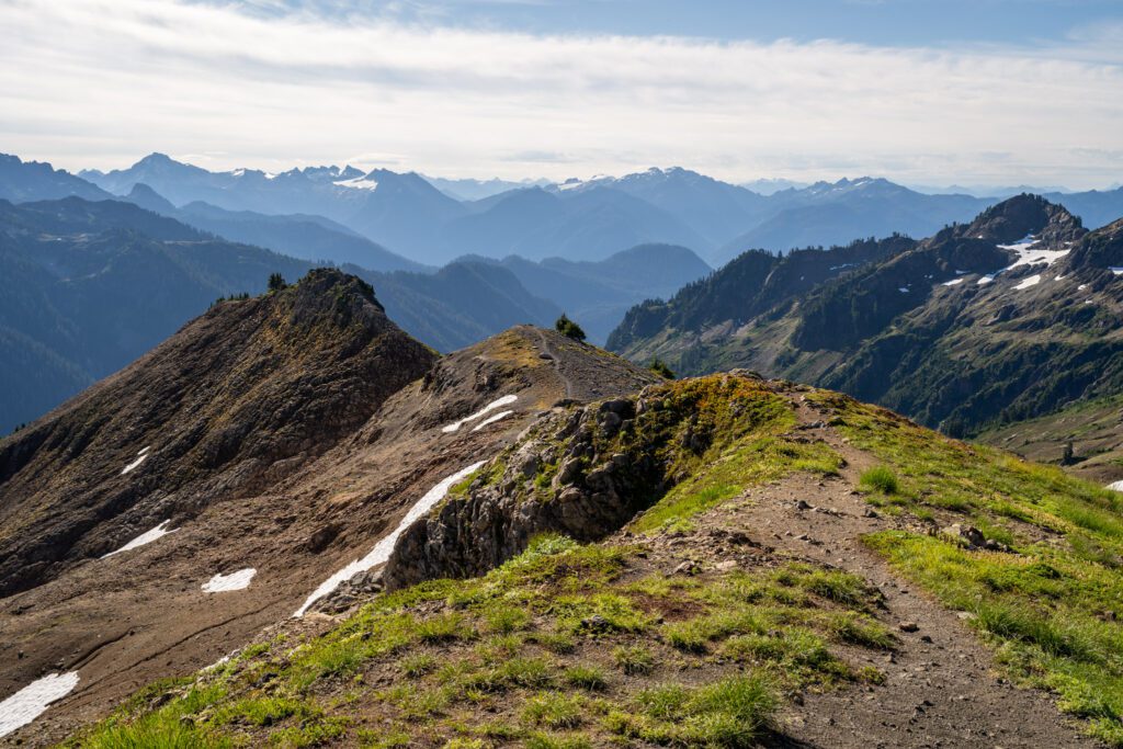
At right around one mile, you’ll hit a fork in the trail where the trails to Ptarmigan Ridge and Chain Lakes split.
You’ll keep left here, rounding the bend and leaving the majority of the people in the area behind.
The Chain Lakes Junction to the Goat Lake Junction
Distance: 3.0 miles // Elevation Gain: 800 feet
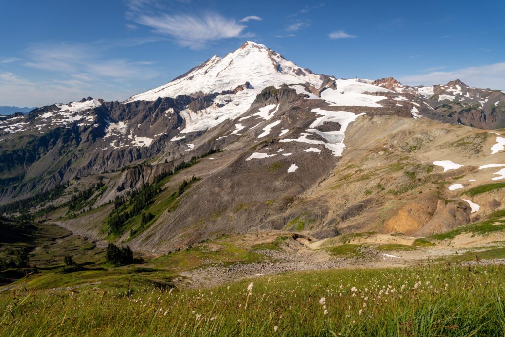
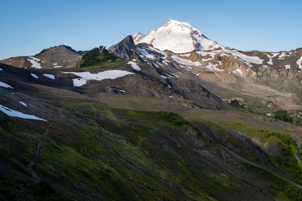
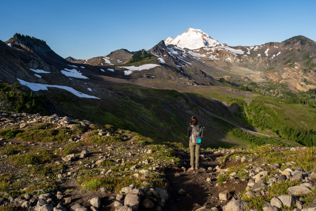
As you round that bend just past the junction, you’ll immediately hit a set of switchbacks that take you DOWN (which means you’ll have the privilege of climbing back up at the end) into a valley, with the snowy peak of Mount Baker looming directly ahead of you.
Say goodbye to Shuksan for now, but fear not! The Shuksan views will return shortly.
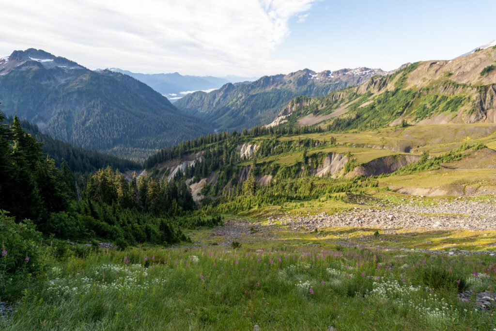
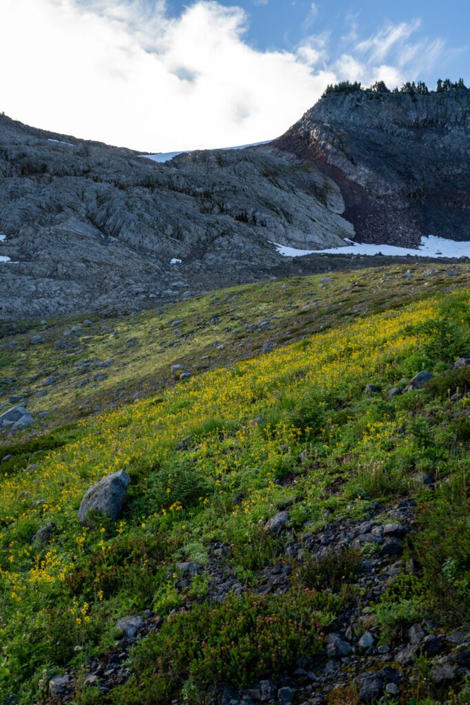
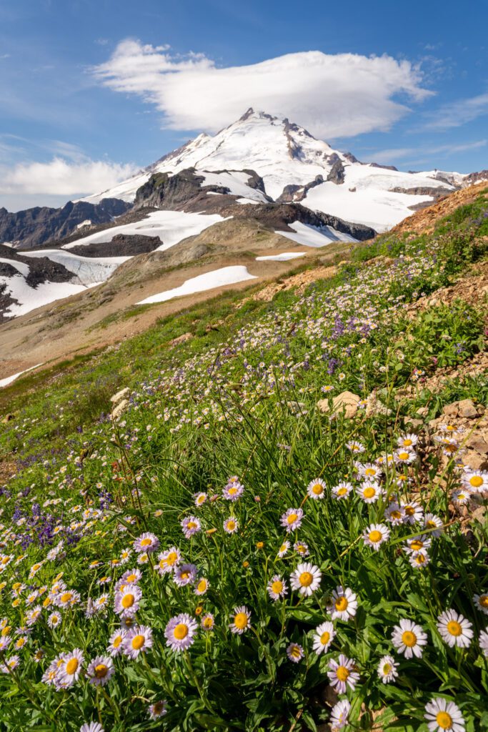
The first half of this section traverses the valley that you drop into, and you’ll pass a couple of streams and patches of wildflowers as you climb steadily.
The climb is going to intensify at the other end of the valley, when you have to do some climbing to get back up onto the ridge. This is where we traversed the first snowfield when we were there.
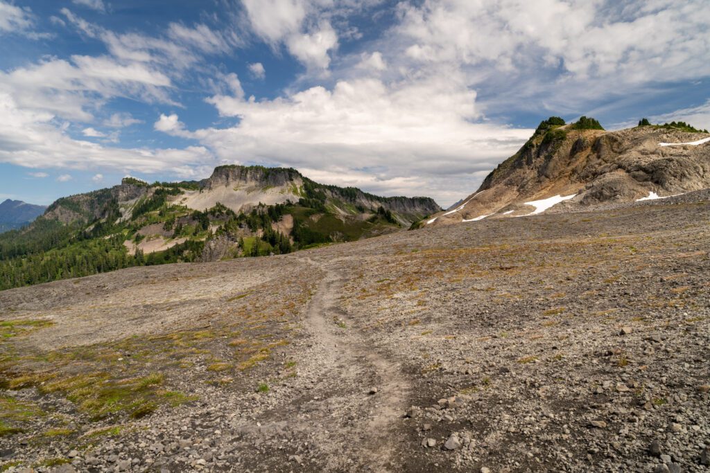
You’ll climb through a rocky section, and then the trail turns into dirt and you’ll pass a lone patch of trees before finding yourself back on a ridge.
This is where the Shuksan views return, though Baker disappears for this stretch.
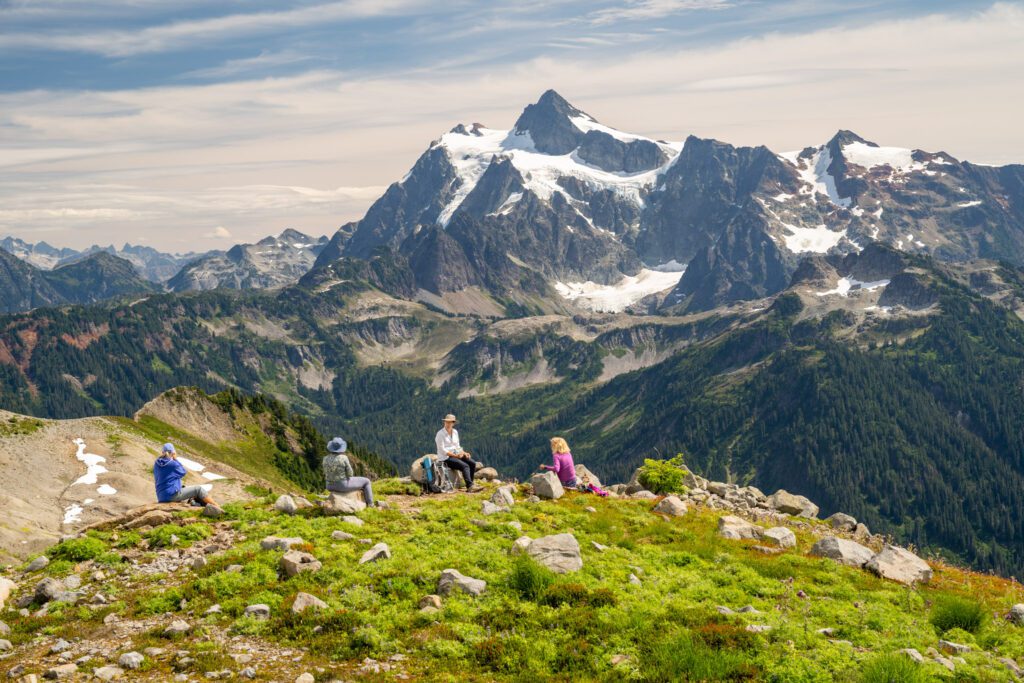
The ridge here is a straightforward affair, climbing gently (there was another snowfield here for us near the viewpoint that ends this section) with the unobstructed view of the rugged, rocky peak of Shuksan directly across the valley to keep you company.
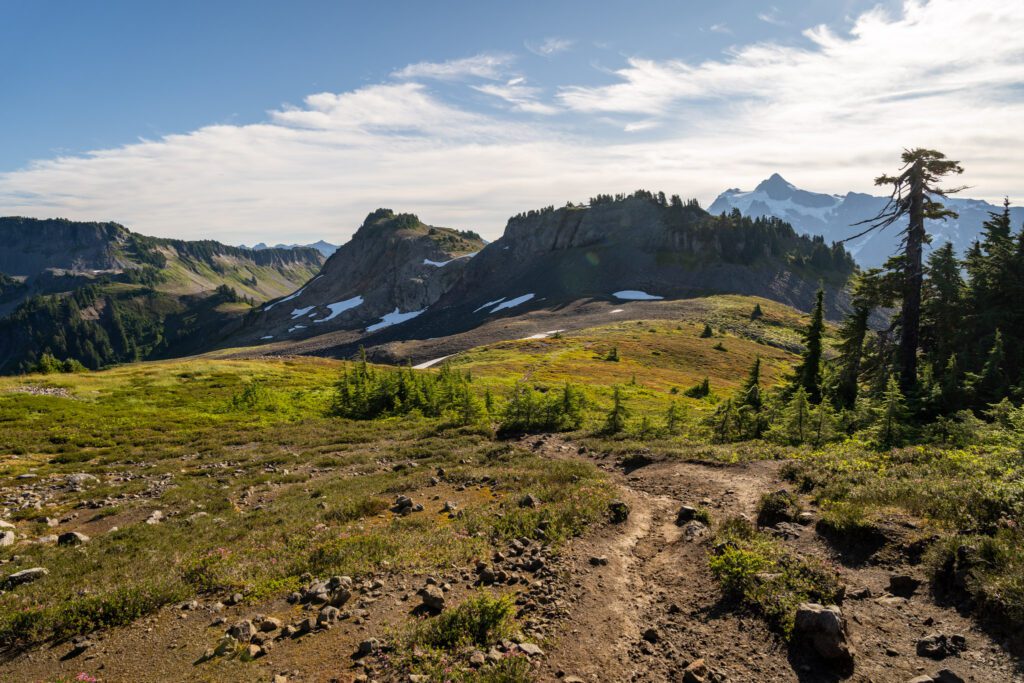
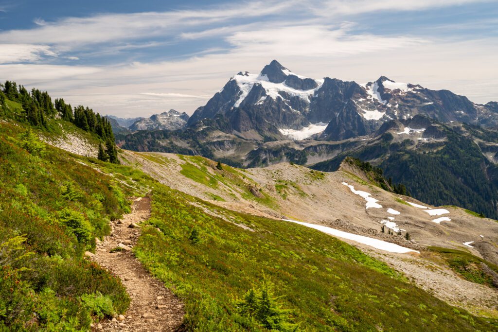
This stretch of trail ends when you hit a saddle, of sorts, where the view of Mount Baker returns so that you can see both peaks again.
There is a short spur trail here that takes you further out on the ridge, but we skipped it because the views are plenty stunning from the main trail.
This would be a good place to take a second to rest, grab water and snacks, and reapply sunscreen.
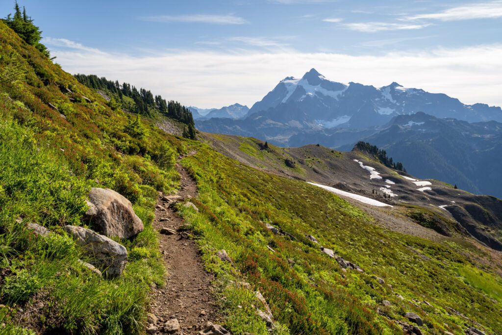
From that viewpoint, the trail continues in a similar fashion, this time turning west towards Baker again.
The climb does start to get rockier and more aggressive the further up you get.
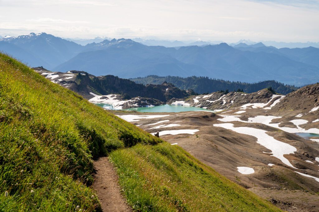
As you reach the base of Coleman Pinnacle, the turquoise water of Goat Lake appears seemingly out of thin air (we had no idea there was a lake up here).
The spur trail off to the left that takes you down to Goat Lake is the end of this section, and would be a worthy detour.
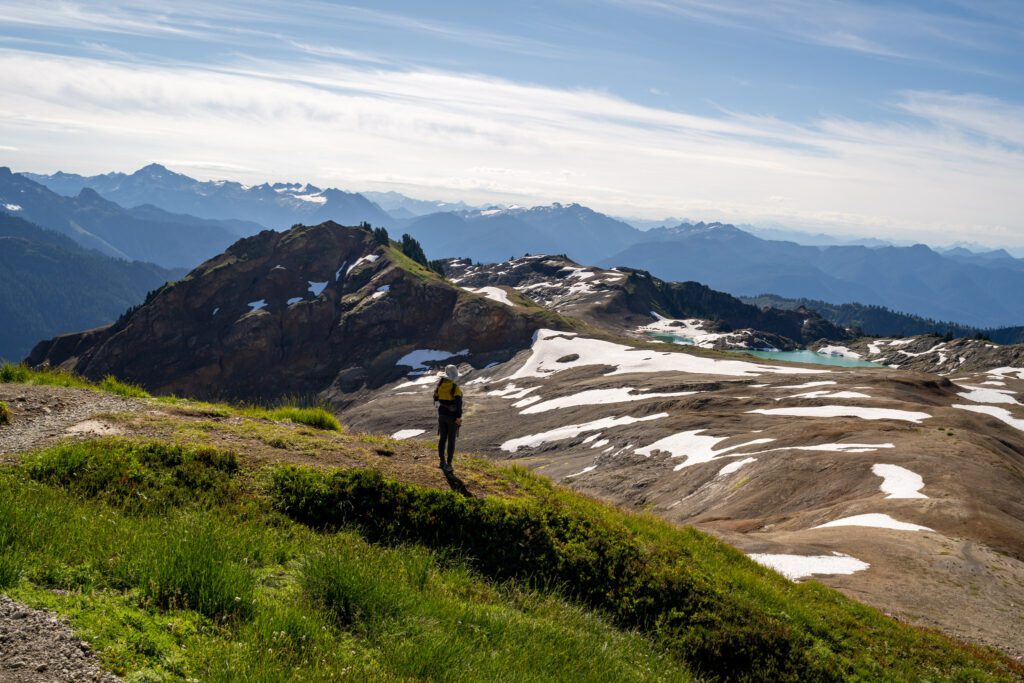
From this rocky section, the views out over the numerous peaks of the North Cascades and Mount Shuksan are nothing short of jaw-dropping.
This was our favorite stretch of the hike, and it really feels like the effort to get here should be higher given the payoff.
The Final Push (and Beyond)
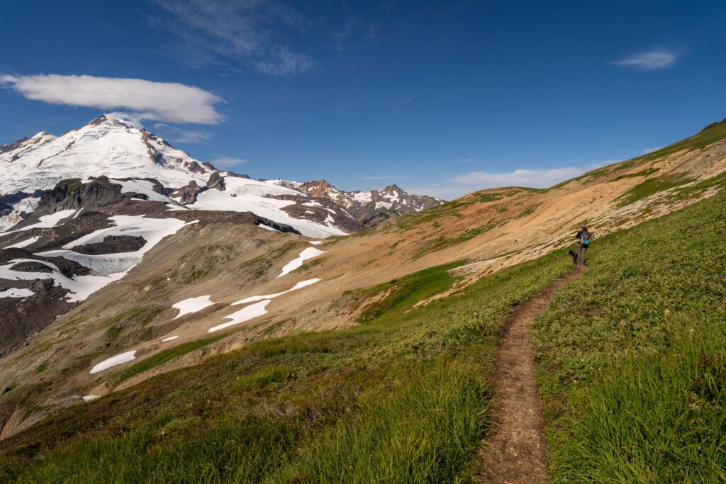
Distance: 1.8 miles // Elevation Gain: 600 feet
Note: The distance and elevation numbers here refer to the hike to the absolute end of the trail, which is Portal East. To the end of the maintained trail at Camp Kiser (roughly), it’s 1.2 miles and ~200 feet of climbing.
From the point where the spur trail cuts left, you have a nearly unobstructed view of both Baker and Shuksan, and the trail continues by climbing aggressively for a short distance – the most intense part of the entire hike in terms of elevation gain – before leveling out and rounding the valley.
The perspective of Mount Baker changes constantly as you get closer, and if you’re lucky the steep grassy hillsides will be dotted with wildflowers, providing a nice foreground element for the countless photos of Mount Baker you’ll likely be taking during this stretch.
This stretch reaches the end of the well-maintained trail at approximately 5.2 miles in, where you’ll sit at Camp Kiser, close enough to Baker’s northeastern face that you can practically touch it.
From here, the trail becomes significantly more difficult to follow, turning into a bit of a route finding exercise that involves some scrambling and more snowfields.
The absolute end of the trail is at Portals East, one of the peaks that flanks the climbers route up to the summit of Mount Baker.
We decided to skip that last ascent after talking to a hiker on their way down who loved it, but pointed out that it’s slippery, steep, and has steep drop offs on either side that might be tough to navigate with the dog (plus, a couple of other snowfields to cross along the way).
To get to the end of the trail, it’s a total of 1.8 miles and ~600 feet of elevation gain from the Goat Lake junction (approximately half a mile and 400 feet of gain past Camp Kiser).