Hiking the Chain Lakes Loop at Mt. Baker: A Complete Guide
Mount Baker has become one of our favorite places in the Pacific Northwest. It has all of the alpine splendor that you find in places like Mount Rainier (which we also love – here are our guides!), but with a tiny fraction of the crowds because of its location tucked away along the Canadian border.
Of the many hikes along the Mount Baker Highway (Highway 542), there might not be a better bang-for-your-buck than the Chain Lakes Loop trail.
It’s relatively moderate in terms of distance and difficulty (and would make a great first backpacking trip), it has a string of beautiful lakes to picnic or swim in (it’s cold!), and it has one of the best views in the state from the top of Herman Saddle.
Plus, it’s right off the nice paved road (no crazy forest service roads to navigate!).
In this guide, we’re going to do our best to give you a comprehensive guide to hiking the Chain Lakes Loop near Mount Baker.
We’ll cover the important trail details, including the route and start and end points of the hike, along with important logistics and things to know before you hike.
Our intention here is that, by the end of this guide, you’ll have all the information you need to be prepared to tackle the trail safely and confidently.
Sound good to you? Let’s get into it.
Disclaimer: Some of the links in this post, like hotel links, are affiliate links, meaning at no additional cost to you, we make a little bit of money if you click through and book. That being said, we would never recommend something to you that we don’t stand behind 100%.
Hiking the Chain Lakes Loop: Trail Details
- Length: 6.3 miles
- Elevation Gain: 1,800 feet
- Trail Type: Loop
- Difficulty: Moderate
- Pass Required? NW Forest Pass (or America the Beautiful Pass)
- Dog-Friendly? Yes (on a leash)
- Trailhead Location: Heather Meadows Visitor Center
The Route for the Chain Lakes Trail
There are a few different ways to do this hike, and the two main questions you need to answer are where to start your hike and which direction to go, which are the two headings you’ll find below with our recommendations for each.
Our overall recommendation is to start at the Heather Meadows Visitor Center and hike clockwise, which means the steep ascent at the beginning and a longer, more gradual descent at the end.
Where to Start the Chain Lakes Loop
There are a few different trailheads that could serve as a starting point for this hike along Mount Baker Highway, but the two that we think are relevant to most people are the parking lot at the Heather Meadows Visitor Center and the bigger parking lot at Artist Point.
For what it’s worth, both times we’ve done this hike, we’ve started at the Heather Meadows Visitor Center.
The first time because the road up to Artist Point was closed, which means that it was our only option.
The second time because we prefer the intense climbing at the beginning and a more gradual descent (more on this in a second).
If you’re visiting before the road up to Artist Point is open for the season (roughly mid-August, most years – check the status of the road up to Artist Point on the WSDOT website), then you don’t have a choice and you’ll have to start at the Heather Meadows Visitor Center.
There’s a steep connector trail that you’ll follow from there up to the Artist Point parking lot.
If the road is open all the way to the top, you can start at either Artist Point (bigger lot, busier) or the Heather Meadows Visitor Center.
There are pros and cons for each, and the biggest difference is which direction to hike.
The last option is the Bagley Lakes trailhead, which is the lowest option in terms of elevation, but adds distance to the loop and makes it a lollipop. We wouldn’t recommend it.
What Direction Should You Hike?
We should start this section with an acknowledgement of our own preferences. Generally speaking, we very much prefer aggressive ascents and gradual descents, and starting our hike with the bulk of the climbing.
Those preferences are important because they inform our recommendations in this section.
If you start at the Heather Meadows Visitor Center, you should hike clockwise if you want the climbing at the beginning, and a more aggressive ascent and gradual descent.
Going the other way means a long slog of an ascent, followed by a steep descent at the end between Artist Point and Heather Meadows.
If you start at Artist Point, we think you should hike counter-clockwise, starting with the steep downhill section and doing the long slog of an ascent.
Going the other direction means saving that short, very steep climb back up to Artist Point for the very end of your hike, which sounds awful to us.
Getting to the Chain Lakes Trailhead (and Parking)
As we’ve covered already, there are multiple trailhead options for this hike.
The two main trailheads are the parking lot at Artist Point, which marks the end of Mount Baker Highway (aka Highway 542) that runs along the north side of Baker, and Heather Meadows Visitor Center, which you reach two miles before the end of the road.
One note for those of you with, uh, less reliable cars (our old Honda Odyssey falls comfortably in this category): it’s a BIG climb.
The road more or less follows the river for most of the drive, and then climbs aggressively to reach the Heather Meadows Parking Lot, with another two miles of even steeper climbing up to Artist Point.
Homer (our Honda Odyssey, RIP) made it up to Heather Meadows (somehow), and I’m not sure it would have made it to Artist Point if the road had been open).
Though it is a paved, well-maintained road unlike many others in the Mount Baker Wilderness.
Which brings me to my next point: the road up to Artist Point is closed for the vast majority of the year due to snow.
It sits at 5,000 feet above sea level, and on our first trip to Baker a few years ago it was still closed (and covered in snow) in mid-August.
This latest time, the road was open at roughly the same time of year, and the exact timing of the opening is going to depend on the snowpack and weather in that particular year.
You can check the status of the road up to Artist Point on the WSDOT website.
The implication here is that, if that road is still closed, you will have to park further down at Heather Meadows Visitor Center, which is our recommendation anyway.
There are two sets of bathrooms and a few picnic tables at the Heather Meadows Visitor Center.
The parking lot at Artist Point is a popular spot when it’s open – especially on weekends, when the lot is basically full from 8am or 9am through 4pm (we know because we hung out here all day after our hike to catch sunset).
However, many people are just here to do a short walk from the parking lot, so there’s plenty of turnover and you shouldn’t have to wait too long.
There are (gross) pit toilets at the trailhead, along with garbage cans.
Things to Know Before You Hike the Chain Lakes Trail
Here are a few things we think you should know before you head out to do this hike.
The hiking season is painfully short. The hiking season for the high elevation hikes along Mount Baker Highway is painfully short. Generally speaking, this trail is accessible (meaning that all roads are open) and snow-free during August and September (and sometimes a few weeks into October).
All of those dates depend on the year’s snowpack and spring/summer weather, of course, and could shift a week or two in either direction.
Remember the elevation. You’re at ~5,200 feet of elevation at the high point of this hike. If you’re coming from sea level, it’s an adjustment.
The hike will likely feel harder than it should, and you’ll want to have snacks, water, and plenty of time to deal with the elevation.
There is no drinking water at the trailhead. Bring plenty of water! We hiked with 2L per person and basically ran out by the end of the hike (including the dog).
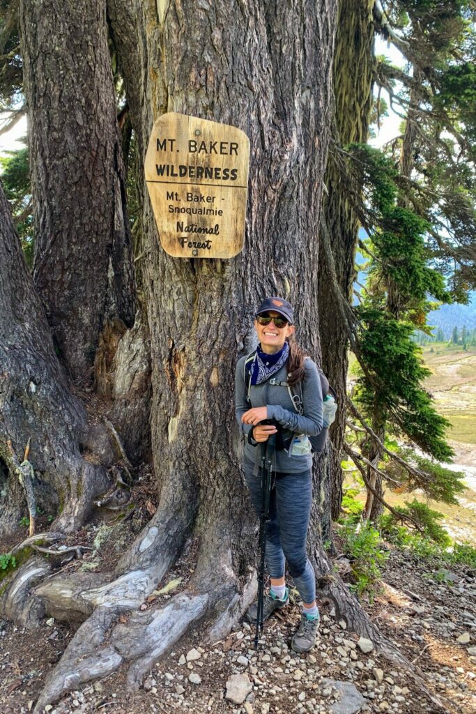
Dogs are allowed on this trail (and should be leashed). As you’ll see from pictures, we hiked this trail with our dog Lupine.
You should really keep your dogs on a leash even if they’re friendly – which Lupine is – you don’t know if other dogs are friendly, if people are scared of dogs, or what wildlife you’re going to encounter!
You need a Northwest Forest Pass to park here. An America the Beautiful Pass (National Parks Pass) also works.
If you don’t have one, you have a few options.
Buy one at the automatic machine along the road up just below Picture Lake, buy one at the Heather Meadows Visitor Center (opens at 10am), or buy one in advance (you can get either a day pass or annual pass at REI, which has a location in Bellingham).
Hiking the Chain Lakes Loop: A Complete Trail Guide
Now that we’ve covered most of the information we think you need to know before you get out on the trail, let’s talk about the trail itself!
This hike is a pretty straightforward affair, but we’re going to break it into several distinct sections to make it more digestible, and so that you’ll be able to keep track of where you are on the hike when you’re on the trail.
Those sections are:
- The Climb to Artist Point and Ridge to the Trail Junction
- The Trail through the Basin up to Herman Saddle
- The Long Descent Back to Heather Meadows
For each section, we’ll give you the (rough) distance and elevation gained in that portion of the hike, along with a relatively short description of the terrain, calling out anything that we think might be useful to know (e.g. there’s a steep section with some scrambling, there’s a toilet, etc).
Here’s a map to help you visualize the route:
We’ve done this hike twice now – once on a clear, perfect hiking day, and once on a cloudy, drizzly day. You’re going to see different conditions reflected in the pictures below, and that’s why.
The Climb to Artist Point and Ridge to the Trail Junction
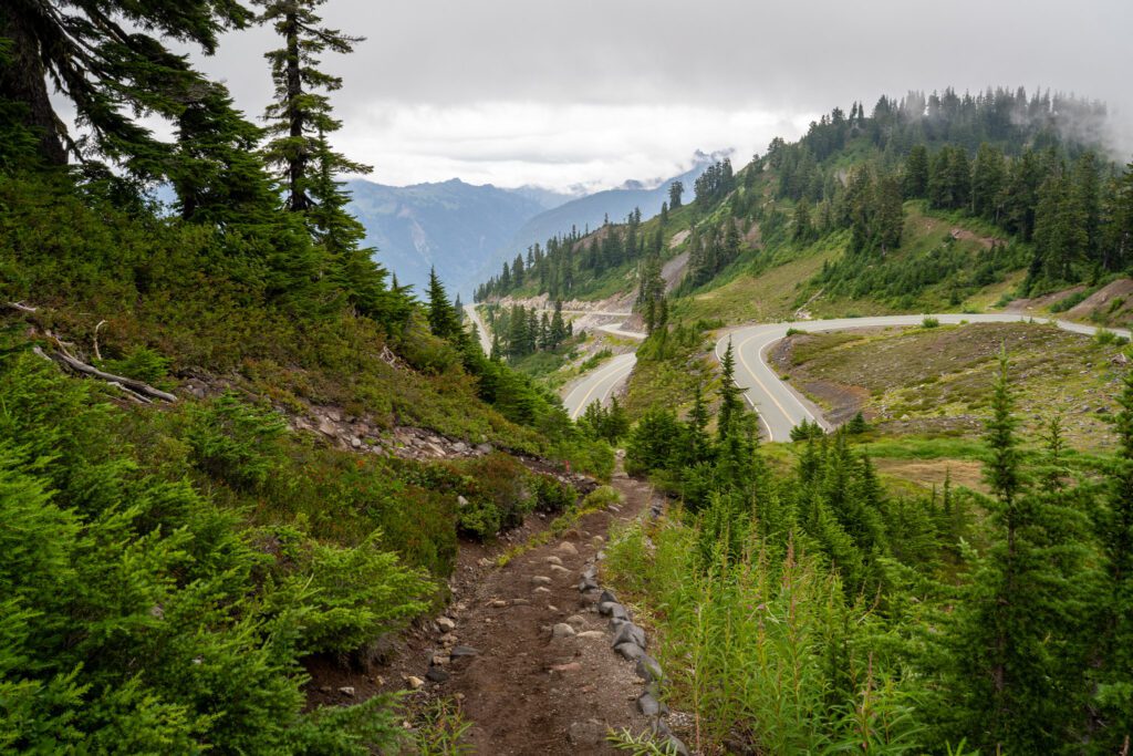
Distance: 2.1 miles // Elevation Gain: 800 feet
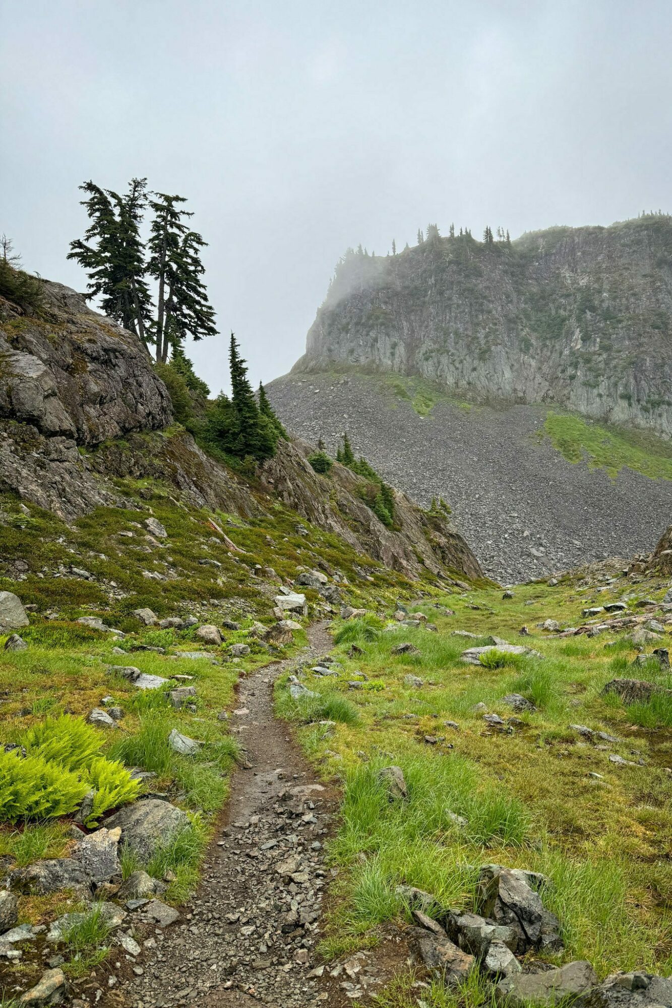
This first section of trail can be split into two distinct subsections; the steep climb from Heather Meadows up to Artist Point along the Wild Goose Trail, and the gentle climb along the Chain Lakes Trail that follows the ridge.
The first section of trail is an unrelenting climb that starts at the parking lot at the Heather Meadows Visitor Center and covers 0.9 miles and climbs 600 feet up to Artist Point.
It’s very steep at times, and there are a couple of sections of steep stairs that would be no fun to do at the end of your day (which is why we have you going in this direction).
However, as you climb, the views out over the Bagley Lakes basin get better and better (before they disappear as you climb towards Artist Point).
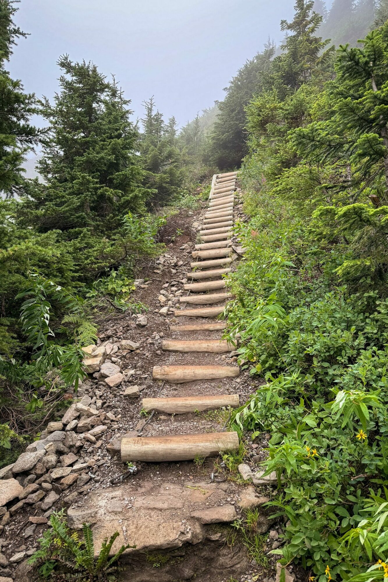
There are cairns periodically along the trail to tell you you’re going in the right direction, especially once you get to the top of the stairs and the trail flattens out a bit.
After 0.9 miles, you’ll cross the road and emerge at the parking lot for Artist Point, sweating profusely as all of the people who decided to drive this section hop out of their cars, fresh as can be.
You’ll cross the parking lot to the right, where you’ll find the start of the Chain Lakes Trail.
As you set out from Artist Point, you’ll tackle a mile-long stretch that takes you out along a hillside with Mount Baker right in front of you, and Mount Shuksan over your shoulder.
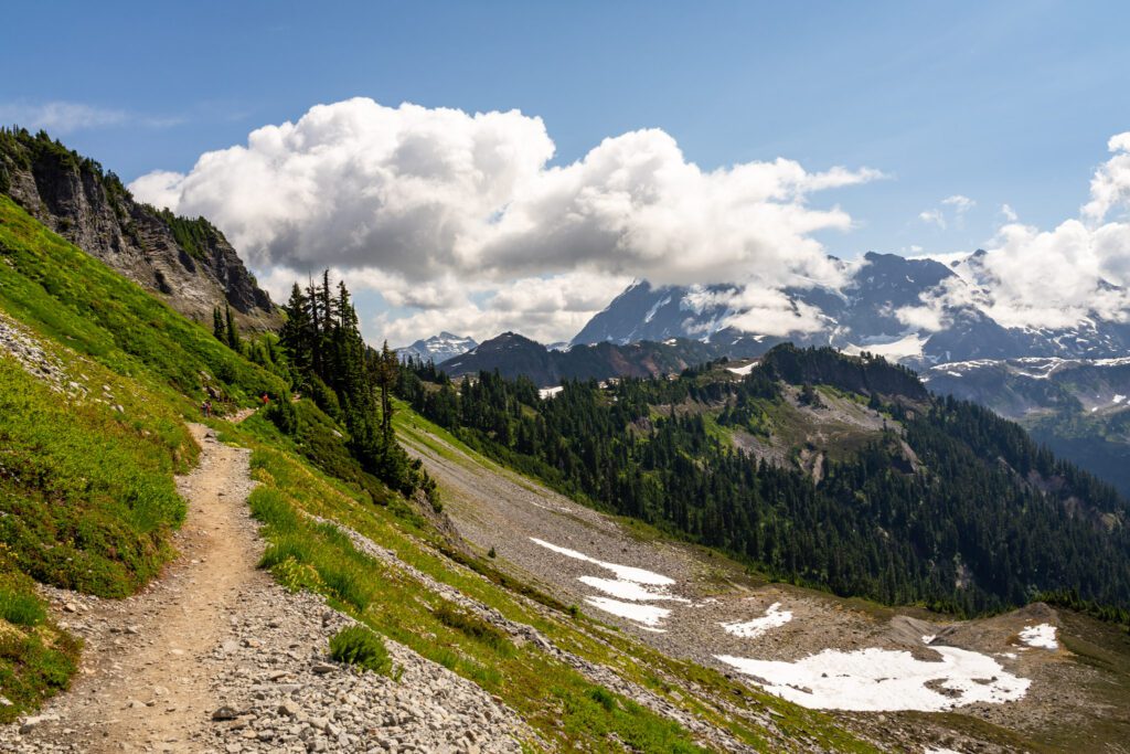
The trail here is mostly a slight uphill grade, and starts with a short downhill section past the self-issue wilderness permit station before emerging from the trees onto the hillside.
We saw multiple marmots (Lupine was quick to alert us) along the trail here, mostly hanging out in the rocks below the trail.
At right around one mile, you’ll hit a fork in the trail where the Ptarmigan Ridge Trail and Chain Lakes Trail split. You’ll keep right here, following the trail downhill.
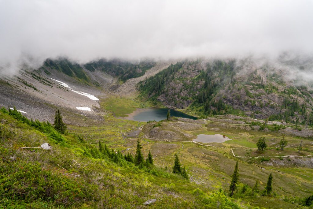
The Trail through the Basin to Herman Saddle
Distance: 2.2 miles // Elevation Gain: 750 feet (net 200 feet – you drop down then climb back up)
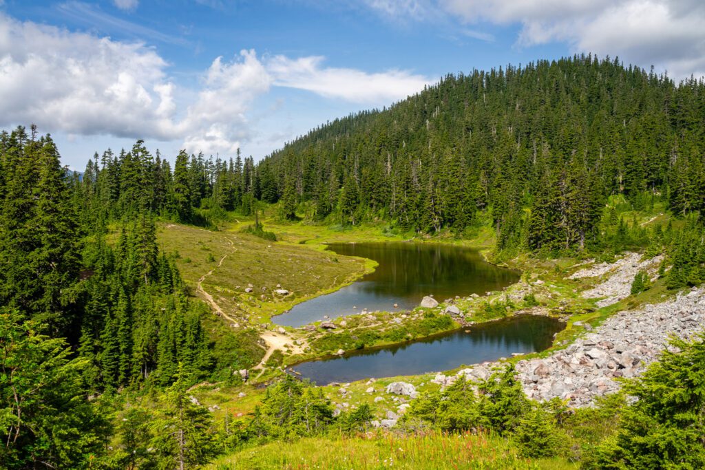
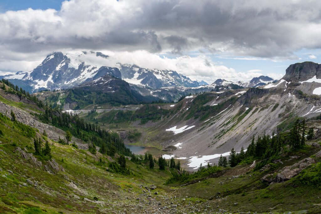
After heading right at the junction, the trail immediately starts to descend down into the basin where you’ll find the namesake basin of alpine lakes.
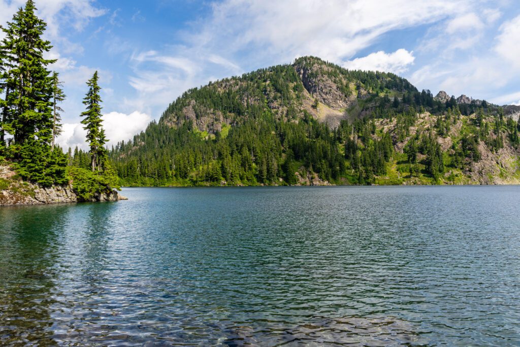
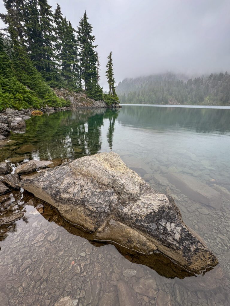
You’ll drop about 500 feet of elevation over the course of just under a mile, which brings you to the first of said lakes: Mazama Lake.
If you’re doing this as an overnight trip, there are campsites on the southern side of the lake (this is the first of two sets of sanctioned campsites along the trail).
If you’re day hiking, continue along the north shore (right side) of the lake, passing through a boulder field and following the trail as it starts to climb gently.
You’ll quickly reach the shore of Iceberg Lake – the biggest of the bunch – and there are some nice views of Herman Saddle and Table Mountain across the lake (or not, if it’s cloudy and raining like it was on our last foray out here).
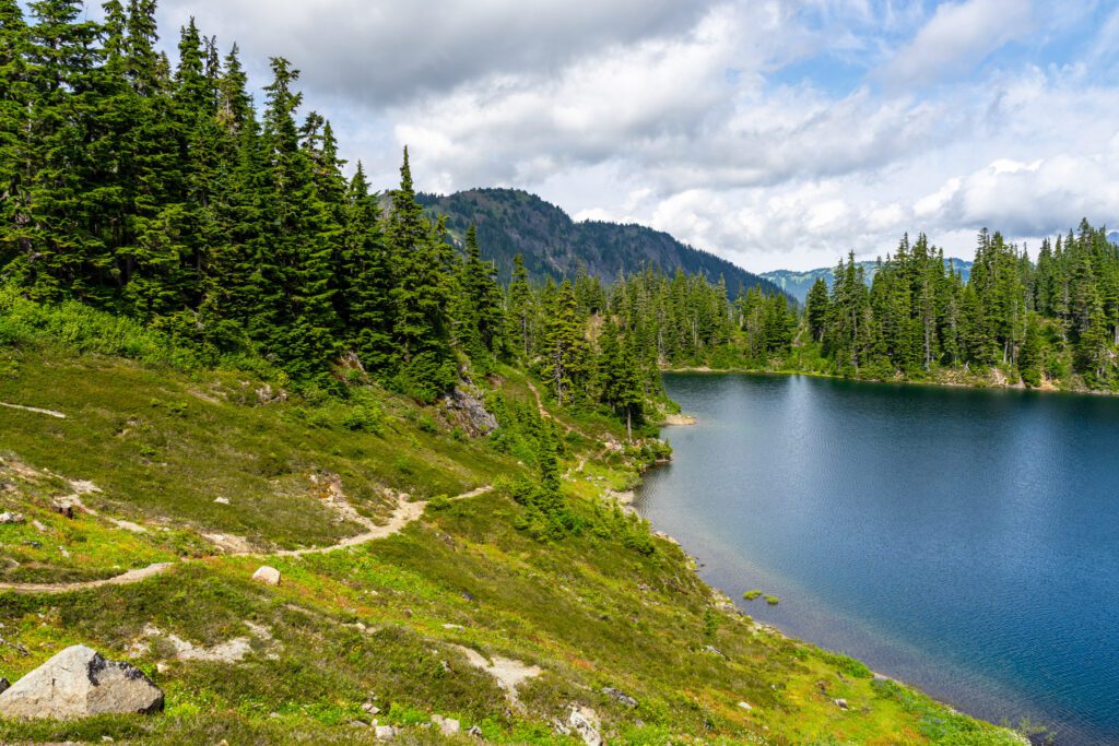
From here, the trail continues its steady, gentle climb to Hayes Lake, which is off to your left.
You’ll reach an offshoot trail to the left that skirts the west side of Hayes Lake, where you’ll find the second set of sanctioned overnight campsites.
There’s also a restroom here, if you need it (BYO-toilet paper).
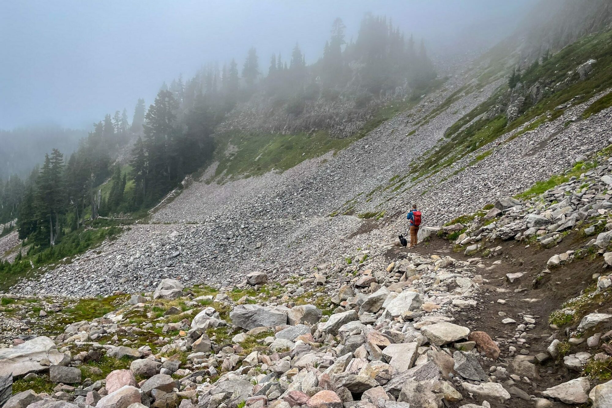
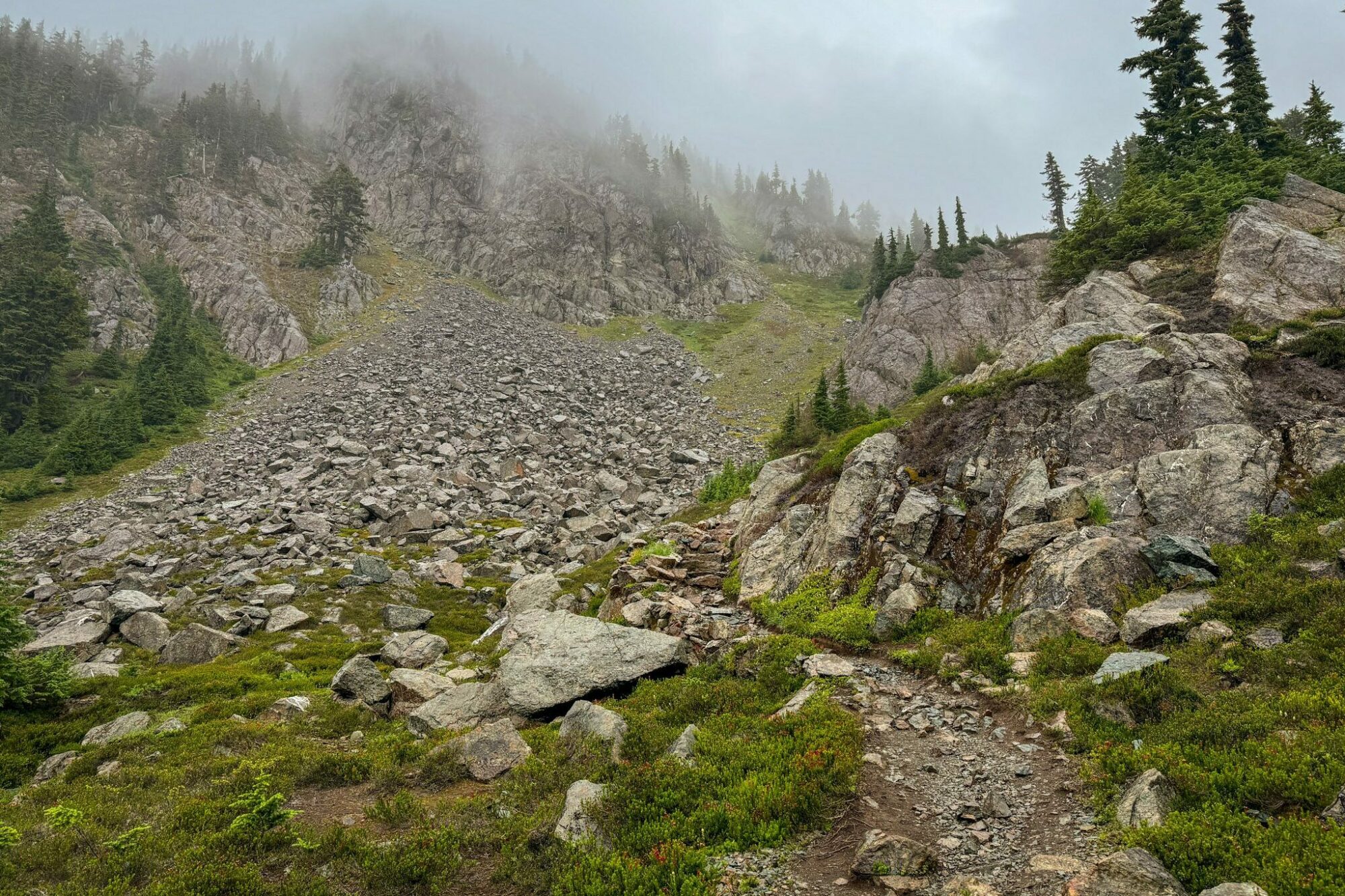
From that junction, the trail starts to climb in earnest with switchbacks that get steeper and rockier the higher you climb. And also views that get better and better the higher you get.
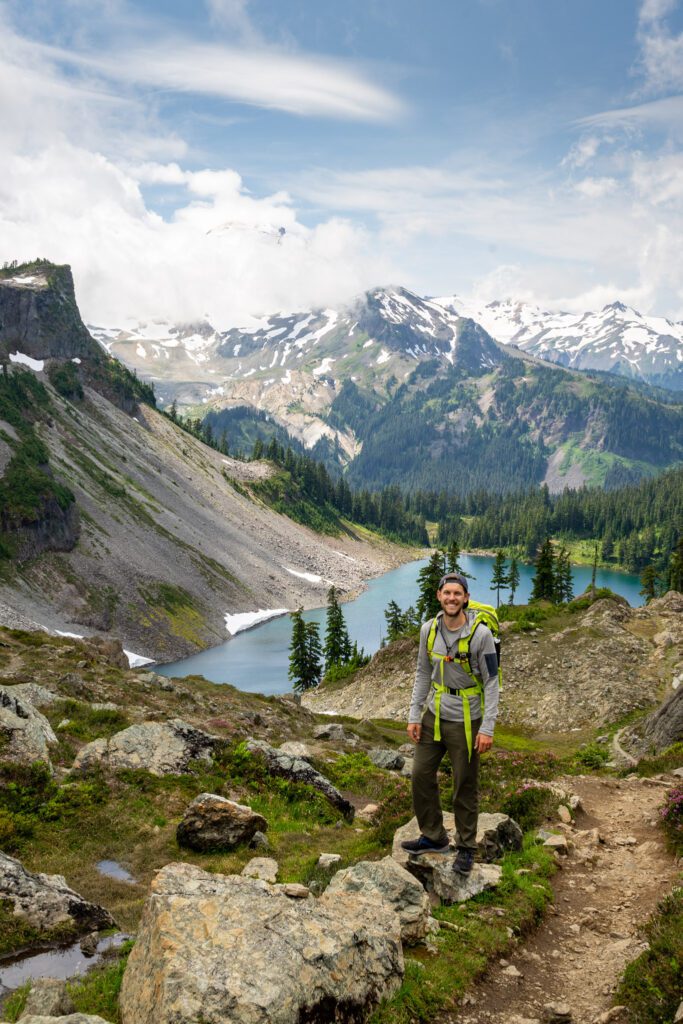
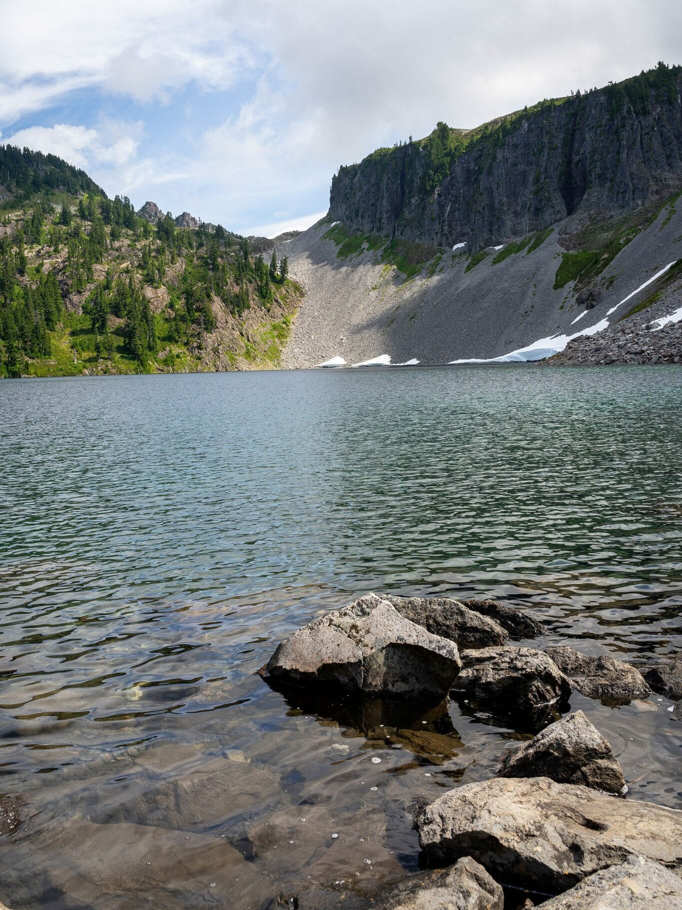
Eventually, after one mile and 600 feet of climbing, you’ll reach Herman Saddle (and have earned the stunning views you’re about to be treated to).
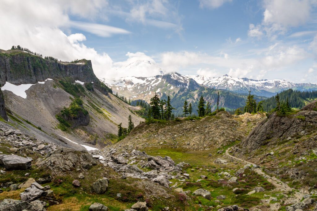
Herman Saddle represents both the high point on this hike, and the best view of the day (we think).
You get the brilliant blue water of Iceberg Lake below, with the snow capped peak of Mount Baker and the flat top of Table Mountain both in view (on a clear day, anyway).
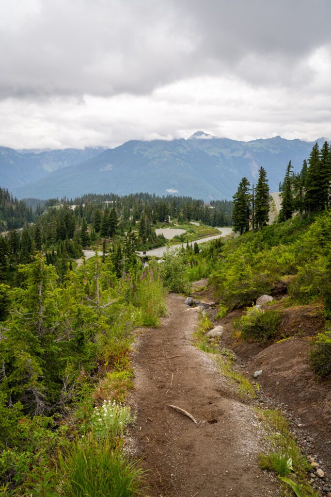
The Long Descent Back to Heather Meadows
Distance: 2.0 miles // Elevation Gain: 200 feet (net -1,000 feet because you drop 1,200 feet, then climb 200 feet back to the parking lot)
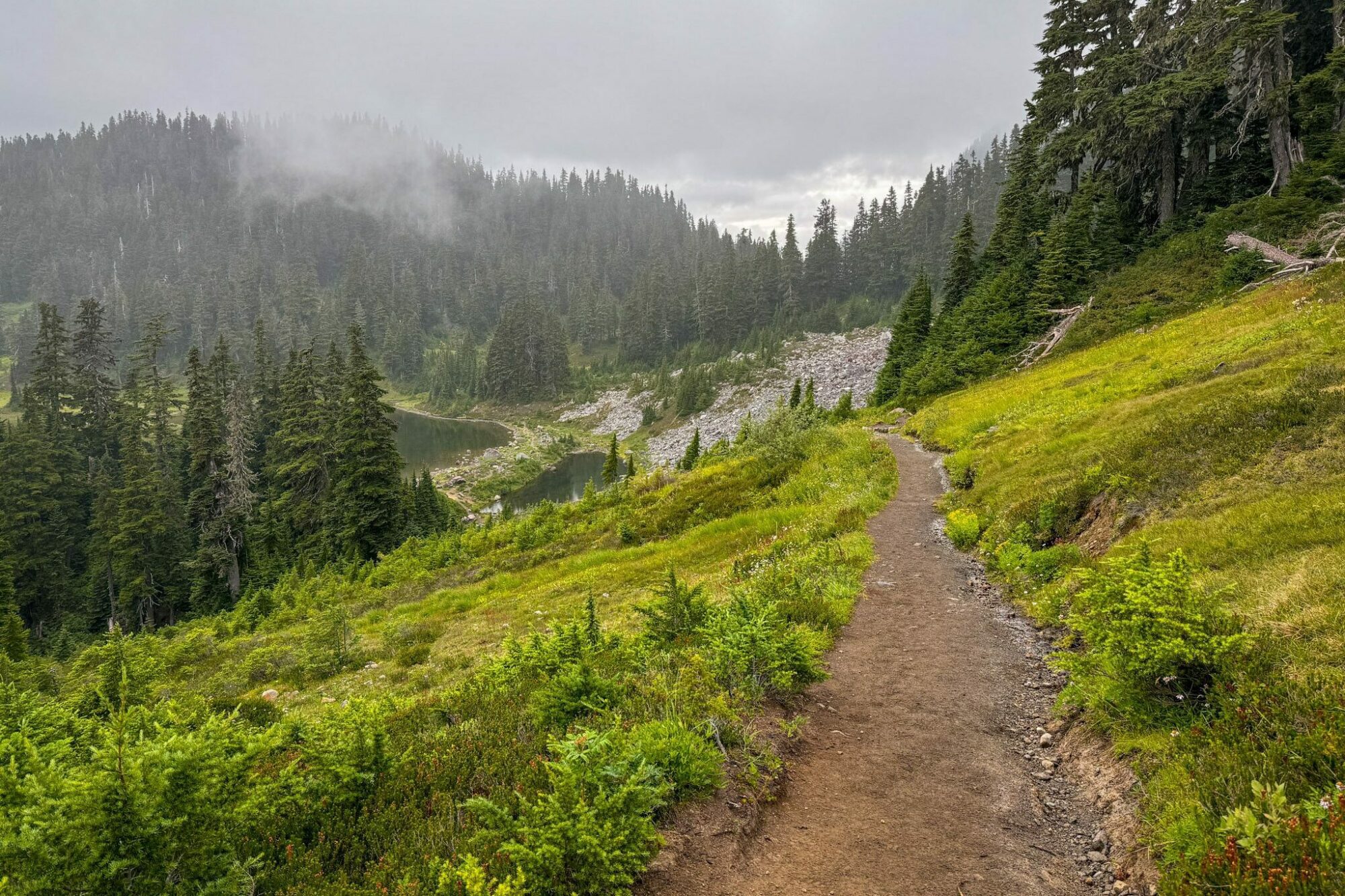
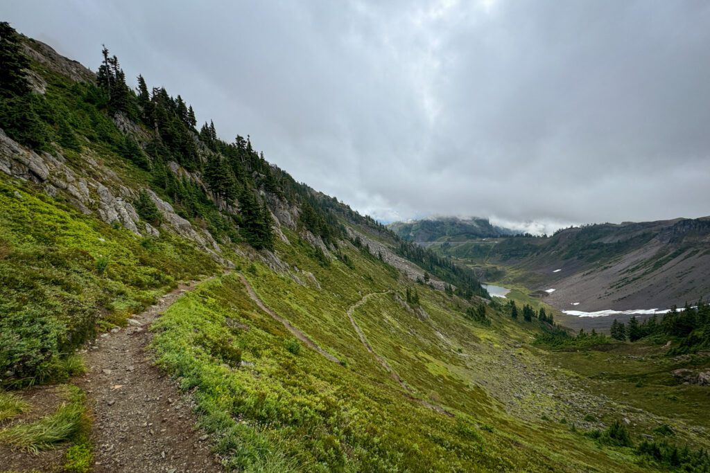
From the high point of the hike at Herman Saddle, the last third of the loop is a long, gradual descent back to Bagley Lakes and the Heather Meadows lot.
For the first section of trail, you’ll be treated to remarkable views of Shuksan and the basin below as you wind along the meandering trail that snakes its way down from the saddle.
However, it soon turns into a slog as the trail straightens out and through the rocky terrain (keep an eye out for marmots – Lupine certainly did), the mountain disappears as you descend, and you find yourself wondering just how much further it is to the car.
You reach the bottom of the valley and the trail turns right and sets you on a set of switchbacks that lose elevation quickly.
The trail continues to descend and eventually spits you out on the northern edge of Bagley Lakes.
From there, it’s a short, surprisingly steep climb back up to the parking lot to end the hike.