How to Plan an Incredible Highway 395 Road Trip
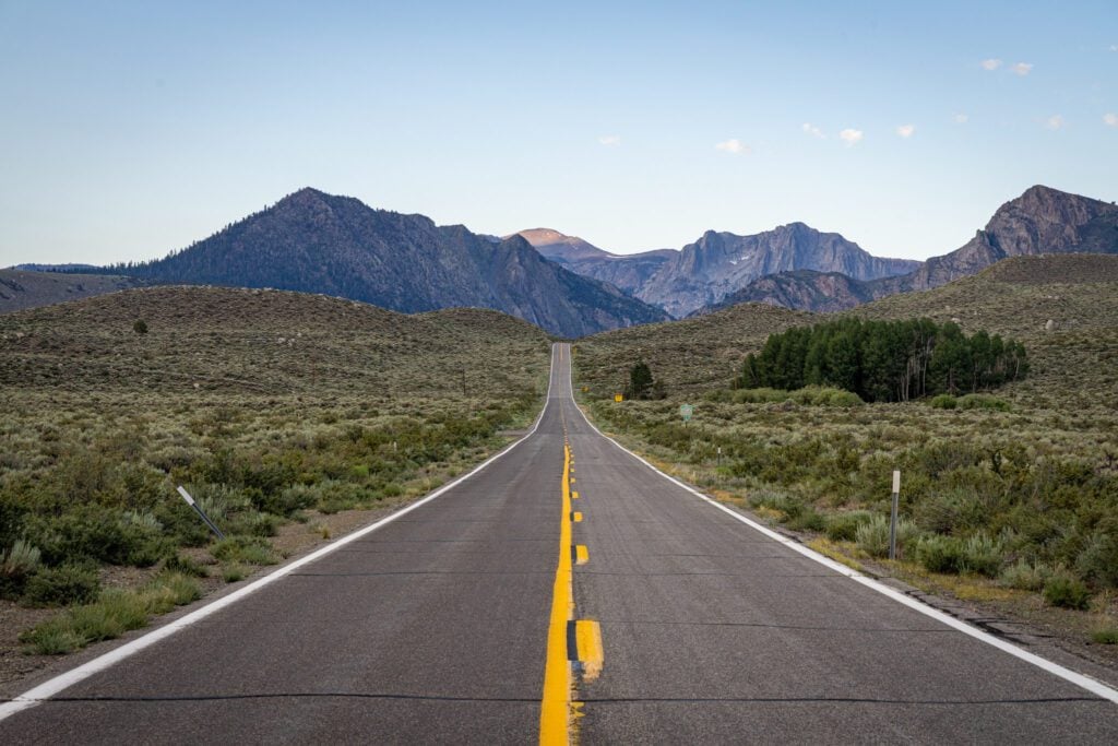
Over the past few years, we’ve spent a fair amount of time ambling up and down Highway 395, which runs from Los Angeles on the south end up through the Eastern Sierra and Lake Tahoe, all the way up to Oregon, and it has quickly become one of our favorite places on earth (especially in the fall when everything turns golden for a few short weeks).
The slice of this drive that we’re talking about in this guide is going to be the stretch from Los Angeles to Lake Tahoe (we considered ending it in Bridgeport, but we do love ourselves some Tahoe – it’s where we got engaged!).
You’ll start your journey in the desert at around sea level and make your way north and up, gaining elevation and watching the landscape change from barren, to a smattering of scrub brush and pine trees, to a full on alpine wonderland of granite and crystal clear lakes.
That progression is one of our favorite parts of this road trip, and is something unique to California, where you have so many distinct ecosystems within a short drive of one another.
In this guide to planning your Los Angeles to Lake Tahoe road trip along Highway 395, we’ll give you the best stops to make along the drive and do our best to present you with itinerary options for the various factors we mentioned above (namely time of year and amount of time you have, in this case).
We’ve driven this route several times now, and we have plenty of opinions and recommendations for you to use (or completely disregard) as you plan your own trip.
The point is that we have plenty of personal experience to draw from, and we’re going to use that experience to help you plan an amazing trip yourself.
Sound good to you? Let’s get into it.
Disclaimer: Some of the links in this post, like hotel links, are affiliate links, meaning at no additional cost to you, we make a little bit of money if you click through and book. That being said, we would never recommend something to you that we don’t stand behind 100%.
How Many Days Do You Need for This Road Trip?
You can absolutely do this drive in just a day (plenty of people do it to reach Tahoe for their trip), but there are SO MANY beautiful stops along the way that it would be a shame to just blow right by it all.
If you want to do the full drive from Los Angeles to Lake Tahoe (one way), with all the associated stops along the way (more on this below), we think you need a full 14 days to really make it worth the drive.
However, if you’re willing to make some compromises and focus on specific sections or stops between L.A. and Lake Tahoe, you can do a really solid road trip with 7-10 days, you just won’t be able to see everything we have listed in this guide.
Don’t worry, we have plenty of ideas of what that shorter road trip looks like below (including what stops we’d recommend based on our own road trips along Highway 395).
With five days or less, we’d pick one single home base (most likely Mammoth or Tahoe) and explore from there, doing day trips to reach areas nearby.
The thinking behind that recommendation is that packing all your stuff up into the car and moving around every day really sucks, and we generally prefer spending more time in fewer places versus moving around every night.
However, all that is really up to you, and the intention behind this guide is to give you the tools to plan your own road trip with all the details and recommendations from our own experiences on this beautiful stretch.
Where to Fly in and Out of
As we covered above, we strongly recommend a one-way road trip so that you cut the amount of driving you’ll have to do in half. That means flying into one end of the trip, renting a car, and driving through to the other end, where you’ll drop the car off and fly home.
In L.A., you have a few airport options to choose from. We think that the two best options are Los Angeles International Airport (LAX) and Hollywood Burbank Airport (BUR).
L.A.X. is the city’s main (and busiest) airport, which means this is where you’ll generally find the best selection of prices from places around the country and the biggest selection of rental cars.
However, we avoid flying in and out of L.A.X. at all costs for a couple of reasons, but mostly because the traffic to and from the airport is absolutely atrocious.
Burbank is a much smaller airport, and it’s on the northern end of the city, which means it’s closer to the starting point for your road trip.
As you might imagine, flights will be less plentiful here, and prices for both flights and rental cars will be a little higher than L.A.X.
On the other end of the trip, the best place to fly out of near Lake Tahoe is Reno’s Reno International Airport (RNO), which is a short drive north of Lake Tahoe.
By “best” here, we mean the most flight and rental car options, which also generally means the lowest prices.
There are a couple of other tiny airports with very limited flight schedules – Mammoth Yosemite Airport (MMH), located just 10 minutes away from Mammoth Lakes, or Eastern Sierra Regional Airport (BIH) in Bishop – but it’s going to be pricey and limited in terms of routes and airlines.
Putting it All Together: Planning Your Itinerary
As we mentioned above, we realized that there are just too many variables to give a single “best” version of this itinerary that will work for everyone.
The two biggest variables are going to be the time of year and the number of days you have dedicated to this road trip.
There are about 10 other variables that were brought up when we were trying to organize this guide that would affect which stops you make.
So, instead, here’s how this is going to work.
First, we’re going to give you three different versions that we think will be best for 90% of people thinking about doing this drive that will cover a variety of different interests.
We’ll give you our “best” version of this trip, which covers the full drive between L.A. and Tahoe over two weeks, with all of our favorite stops (broken up into manageable sections with a suggested home base), along with two options for shorter trips.
The idea is that you can use these itineraries to organize your time on the road, and fill in the details at each stop with all the information in the main body of the guide below.
One note: we’re not including time spent in L.A. as part of this itinerary, so you’ll need to work around that at the beginning (or end) of your trip. We are, however, counting Tahoe in that time.
One big thing that we’d avoid is having too many one night stops.
We’d encourage you to choose home bases where you stay for two or more nights to avoid moving around all the time and, most importantly, packing all of your stuff up every single day (which, we can definitely say from experience, sucks).
For example, Mammoth Lakes is a great home base for exploring both the immediate area, but also for exploring June Lake, Convict Lake, and even North and South Lake to the south.
Rather than staying one night in each place, just stay two nights in Mammoth and make the scenic drive down to those spots (or do it along the way).
Our Ideal Version (14 Days)
With a full two weeks, we think you can experience the magic of starting in the desert of Death Valley National Park and making your way all the way to Tahoe, which is all pine trees, granite, and crystal clear blue lakes.
The change in landscapes and ecosystems over the seven or eight hours of driving – which covers 450 miles and a whopping 9,000+ feet of elevation gain – is pretty astounding, especially if you’re coming from a part of the country that is mostly flat.
With 14 days, we’d break up your time into five chunks, spending a couple of nights (2-3) in Death Valley, Lone Pine (for the Alabama Hills), Bishop (for Rock Creek Canyon and Bishop Creek), Mammoth (for June Lake, Convict Lake, and Tioga Pass), and Lake Tahoe.
You could consolidate that into three different home bases – Death Valley, Mammoth, and Lake Tahoe – which would be more pleasant with less packing up and moving, but also would involve more driving and backtracking.
There is exactly one place where we’d recommend spending only one night, and that’s Lone Pine.
There’s really no other good base for seeing the Alabama Hills without adding an extra hour or two of driving, and there’s not really that much else to see nearby. So one night it is!
Here’s what this itinerary looks like written out.
- Day 1: Death Valley National Park
- Day 2: Death Valley National Park
- Day 3: Death Valley National Park
- Day 4: Lone Pine & Around
- Day 5: Bishop & Around
- Day 6: Bishop & Around
- Day 7: Mammoth Lakes
- Day 8: Mammoth Lakes
- Day 9: Mammoth Lakes (Day Trip #1)
- Day 10: Mammoth Lakes (Day Trip #2)
- Day 11: Drive to Lake Tahoe (Stop at Mono Lake & Lundy Canyon)
- Day 12: Lake Tahoe
- Day 13: Lake Tahoe
- Day 14: Lake Tahoe
Death Valley, Mammoth, & Tahoe (10 Days)
With less time, we’d consolidate your time into three different home bases; Death Valley, Mammoth, and Tahoe.
This version is going to move a little faster, which means you’ll need to pick and choose what you’re most interested in and prioritize those things along the way.
An example of this would be the stretch between Lone Pine and Mammoth, where we have you spending four nights in the longer itinerary, and zero nights here.
That means you have two options for tackling places like the Alabama Hills and Bishop Creek; stop along the drive between Death Valley and Mammoth, or make a day trip of it from Mammoth.
Alternatively, you could stop in Lone Pine or Bishop for a night along the way to give yourself a chance to see some of those places.
Here’s what this shorter version of the itinerary looks like written out.
- Day 1: Death Valley National Park
- Day 2: Death Valley National Park
- Day 3: Drive to Mammoth (Stops at Bishop Creek and Rock Creek Canyon)
- Day 4: Mammoth Lakes
- Day 5: Mammoth Lakes (Day Trip #1)
- Day 6: Mammoth Lakes (Day Trip #2)
- Day 7: Drive to Tahoe (Stops at Mono Lake and Lundy Canyon)
- Day 8: Lake Tahoe
- Day 9: Lake Tahoe
- Day 10: Lake Tahoe
Mammoth & Lake Tahoe (7 Days)
With a week to spend on this road trip, we’d probably zero in on the section between Bishop and Tahoe, with your two home bases being Mammoth and Lake Tahoe.
We’d opt for four nights in Mammoth and three nights in Tahoe, which gives you plenty of time to get out of Mammoth and do some day trips to reach some of the nearby stops to the north (June Lake and Tioga Pass) and south (Bishop Creek, Rock Creek Canyon, etc).
This is the one version of the trip where it might make more sense to pay extra to fly into Mammoth or Bishop because it will save you 4+ hours of driving.
Here’s what that trip might look like written out.
- Day 1: Drive to Mammoth (stop at Alabama Hills)
- Day 2: Mammoth Lakes
- Day 3: Mammoth Lakes (Day Trip #1)
- Day 4: Mammoth Lakes (Day Trip #2)
- Day 5: Drive to Tahoe (stop at Mono Lake and Lundy Canyon)
- Day 6: Lake Tahoe
- Day 7: Lake Tahoe
An Excellent Highway 395 Road Trip (from L.A. to Lake Tahoe)
Now, onto the main attraction. We’re going to give you our top stops to make on your drive that we like and think are worth your time.
We’ll give you the stops that are along the route we’ve mentioned above, along with all the details you need to make the most of your time in those places.
Some stops are bigger stops that deserve the better part of a day, some are smaller stops that might take a few hours. We’ll give you a recommendation, and leave it up to you to decide.
And now, with that out of the way, let’s get into the specific stops along the way!
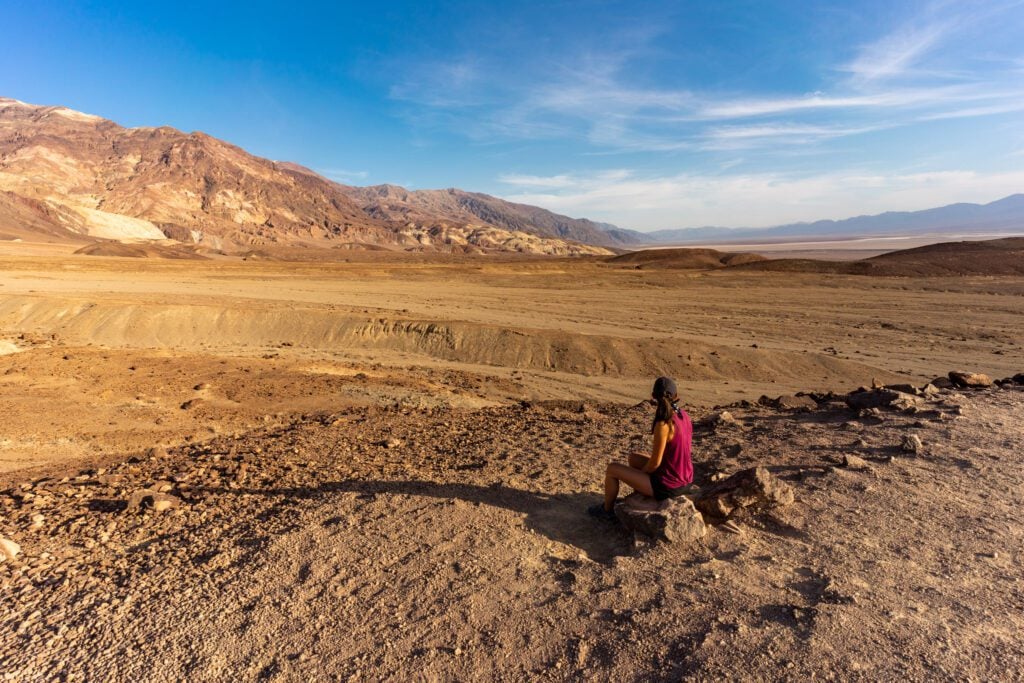
Death Valley National Park
We went back and forth as to whether or not Death Valley belongs on this list, mostly because it requires a bit of a drive off of 395 to reach.
One of the amazing things about driving Highway 395 is the dramatic change in landscapes from the desert outside of Los Angeles up to the alpine paradise of Mammoth Lakes and Lake Tahoe.
There is perhaps no better illustration of the starting point of that journey than Death Valley, which is about as “desert” as it gets.
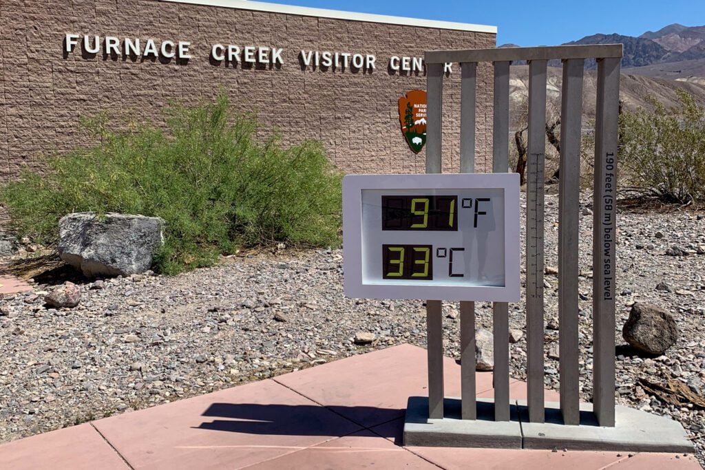
The other odd thing about having Death Valley here is that we generally wouldn’t recommend visiting it in the summer, because it is unbearably hot from roughly 9am to 9pm.
Which is completely different from the high alpine areas like Mammoth and Tahoe, which are best in the summer (if you’re into hiking).
Keep that in mind as you’re planning your trip.
If you’re coming to the Eastern Sierra for the best hiking in, say, July or August, you’re probably going to want to skip Death Valley because it will be too hot and miserable.
However, if you’re planning a spring or fall trip, then maybe Death Valley makes more sense (for example, if you’re coming for fall color in October, Death Valley is a bit more manageable).
Last, there are VERY limited places to stay in Death Valley, especially if you’re not camping, you basically only have two or three options if you want to stay in the park, and there are very few options outside the park (which is different from most national parks).
If you’re camping, there are a handful of campgrounds in the park. Furnace Creek is the most central with the most amenities, and there are a handful of first-come, first-served campgrounds sprinkled throughout the park.
If you’re not camping, the two best options inside the park are the midrange Ranch at Death Valley and the higher end Inn at Death Valley. Both are in central areas that are close to some of the best hikes in the park.
There’s also the Stovepipe Wells Hotel, but the location is worse because it’s further from all the hikes and viewpoints on the south end of the park.
With all that being said, here are our favorite things to do and see in Death Valley, in no particular order (and here’s a link to our Death Valley itinerary for more).
Badwater Basin: At 282 feet below sea level, this is the lowest point in North America. It’s also the hottest, so time your visit for early or late in the day.
It was once covered by a lake that has long since evaporated, leaving behind vast salt flats, which in some areas form dramatic polygons (though you have to walk out at least a mile to see the dramatic ones).
Don’t forget to look to the mountains behind the parking lot to see the sign showing where sea level is.
Artists Drive and Artists Palette: Artist Drive is a scenic 9-mile one way loop road that winds around the colorful and pastel-colored hills and canyons off Badwater Road.
It’s a fun road to drive as there are a lot of curves and dips. About 5 miles in, is the turnoff for Artists Palette.
An overlook on top of a small hill gives you a great view of the really concentrated colors in the hills.
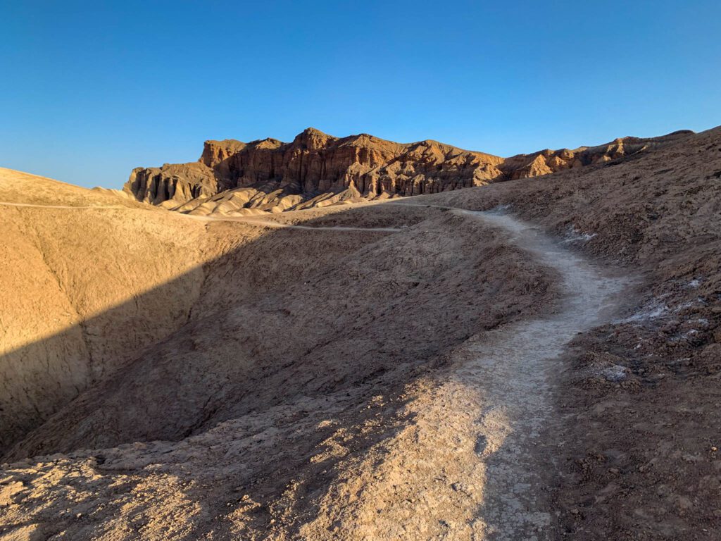
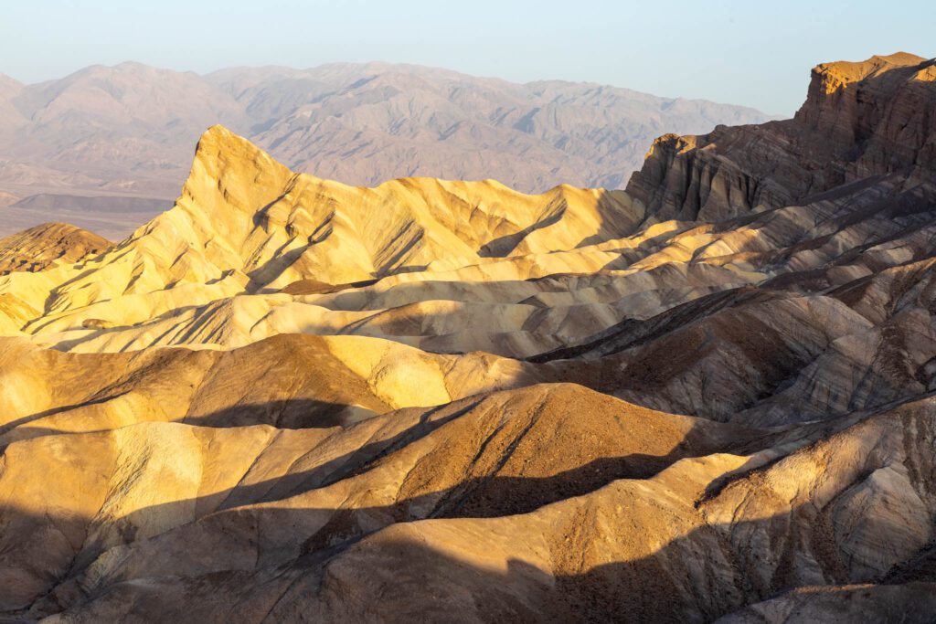
Zabriskie Point: One of the most iconic viewpoints in the park, Zabriskie Point is best seen at sunrise or sunset.
There’s a short hike up a paved path to a viewpoint, where you can see the surreal landscape of badlands stretching out before you, including the prominent sharp peak of Manly Beacon.
You can hike down into the badlands, a hike that can include Gower Gulch and Golden Canyon.
Mesquite Flat Sand Dunes: The most popular and easily accessible sand dunes in the park, the sand dunes stretch out for miles.
Best seen at sunrise or sunset (or under a full moon), you can explore as far as you want, though expect slow going.
It’s also the only place you can sand board. Bring cardboard or an old sled, though you can usually find abandoned sleds by the parking lot. The stars are amazing at night too.
Lone Pine and the Alabama Hills
The town of Lone Pine, which is a hair under an hour north of the western entrance to Death Valley, is the gateway to Mount Whitney and the Alabama Hills.
This is where you start to get a real taste of what you’re in for when you get up to the area around Mammoth.
In the immediate vicinity, you’ll see desert-ish landscapes in all directions, complete with arches in the Alabama Hills that look like they’re straight out of Joshua Tree or one of the Utah parks.
But in the distance, the looming peaks of the Eastern Sierra hint towards what’s to come later on this road trip.
It’s worth stopping at the Eastern Sierra Visitor Center in Lone Pine (here on Google Maps) as you drive through for updates on trail closures and conditions.
Heads up: Most of the roads here are unpaved, and though most are passable with a passenger vehicle, 4WD may be helpful (especially if it’s wet).
Here are some things to do in the Alabama Hills.
Movie Road: An easy way to explore the Alabama Hills, a drive along Movie Road will take you past the boulder strewn landscape, where more than 400 movies have been filmed, including hundreds of westerns, and more recently, Gladiator, Iron Man, and Django Unchained.
Portions of the road have also become Instagram famous in recent years.
From Lone Pine, drive along Whitney Portal Road for 2.5 miles to Movie Road.
You can also drive the full 13 miles of the Whitney Portal Road to Whitney Portal, one of the trailheads to the 14,505-foot Mount Whitney, the tallest mountain in the continental US.
Mobius Arch: There are numerous natural arches in the area, but Mobius Arch is probably the most famous, as it perfectly frames both Mount Whitney and Lone Pine Peak within its arch. Particularly popular at sunrise and sunset.
It’s also a quick and easy walk along the Arch Loop Trail. Don’t miss Lathe Arch next to Mobius Arch. Other famous arches in the area include Eye of Alabama, Heart Arch, and Whitney Portal Arch.
Museum of Western Film History: This small museum in Lone Pine is small but packs a lot in, and well worth a stop, especially if you’re a fan of westerns.
There’s an extensive collection of movie props, memorabilia, costumes, and posters from the many films that have been shot in the Alabama Hills. Be sure to pick up the Movie Road self guided tour map.
As you get further up the road and climb a few thousand feet, you’ll come to Whitney Portal, which is the jumping off point for climbing Mount Whitney (whose peak sits at 14,505 feet above sea level).
Aside from actually climbing Whitney, there are a couple of shorter, easier hikes worth doing here, like Lone Pine Lake (which follows the Mount Whitney Trail for a bit) and the much more difficult Meysan Trail (which veers off to the south to beautiful Meysan Lake).
Keep in mind that both of those hikes get up above 10,000 feet, and if you’re coming from sea level, it’s going to feel brutal.
Ancient Bristlecone Pine Forest
Located above 10,000 feet on the slopes of White Mountain, the Ancient Bristlecone Pine Forest is home to some of the world’s oldest living trees (which also make them the world’s oldest living things). A bunch of the gnarled trees here are more than 4,000 years old.
Methuselah, the oldest known living tree, is 4,700 years old and can be found along the Methuselah Trail in Schulman Grove. The largest bristlecones can be found in the Patriarch Grove.
It’s a thrilling drive just to get from the highway to the forest, climbing thousands of feet up to the ridge with fantastic views of the Eastern Sierra mountains along the way.
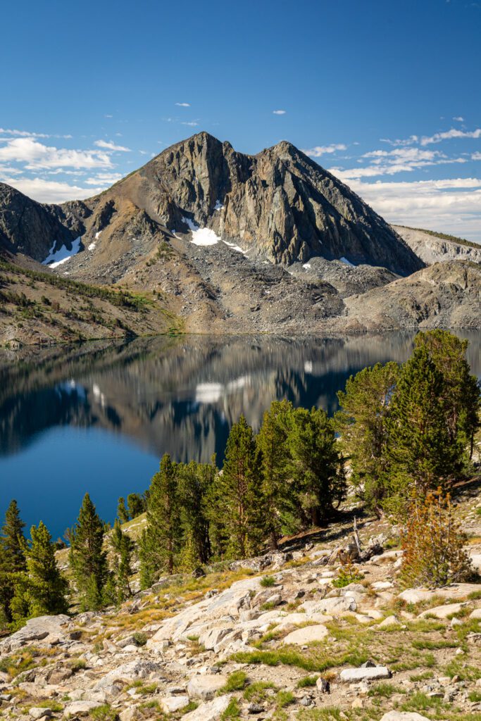
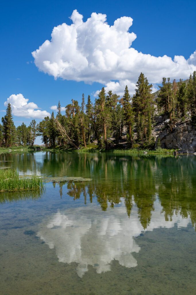
Bishop Creek, Lake Sabrina, & North Lake
Just west of Bishop, tucked away 4,000 feet above Highway 395, is the tiny little town of Aspendell, gateway to some of the most beautiful Eastern Sierra scenery you’ll find in this guide.
It’s quite the dramatic drive up from 395, climbing 4,000 feet over the course of 10 miles or so, but once you’re up there, you’re surrounded by alpine lakes, towering rocky peaks, and a healthy dose of granite.
Once you’re in Aspendell, there are several different paths you can take that will bring you to the beauty we’re talking about.
First, whether you choose to do a longer hike or not, it’s worth heading up to the dam at Lake Sabrina – which sits at 9,000 feet above sea level – for the view across the lake.
We hiked to Blue Lake from here (one of our favorite hikes in Mammoth), and would highly recommend it with the caveat that it is a difficult hike due to the elevation, which will bring you up to just about 10,500 feet above sea level (which is no joke).
If Blue Lake seems too difficult, we’d recommend hopping on the Sabrina Basin trail that skirts the western shore for as long as you can, because the views from it are pretty spectacular, while the trail is a gentle climb for the first mile or so.
A good bang-for-your-buck, we’d say.
Second is to continue climbing up to North Lake, which is yet another beautiful lake backed by granite peaks.
From here, you can tackle the easy hike to Grass Lake, or embark on a longer, more difficult journey to Lamarck Lakes (which was on our list, but we decided we didn’t want to make the two hour roundtrip journey from our home base in Mammoth a second time after doing Blue Lake).
Third, you can head to South Lake and the Bishop Pass Trailhead, which you reach by turning off of Highway 168 early in the ascent and meander up into the mountains.
From there, you can follow the Bishop Pass trail all the way to Bishop Pass (a long, difficult climb), or just to one of the closer lakes in the basin (like Long Lake).
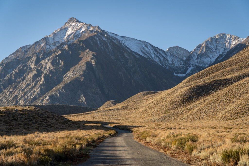
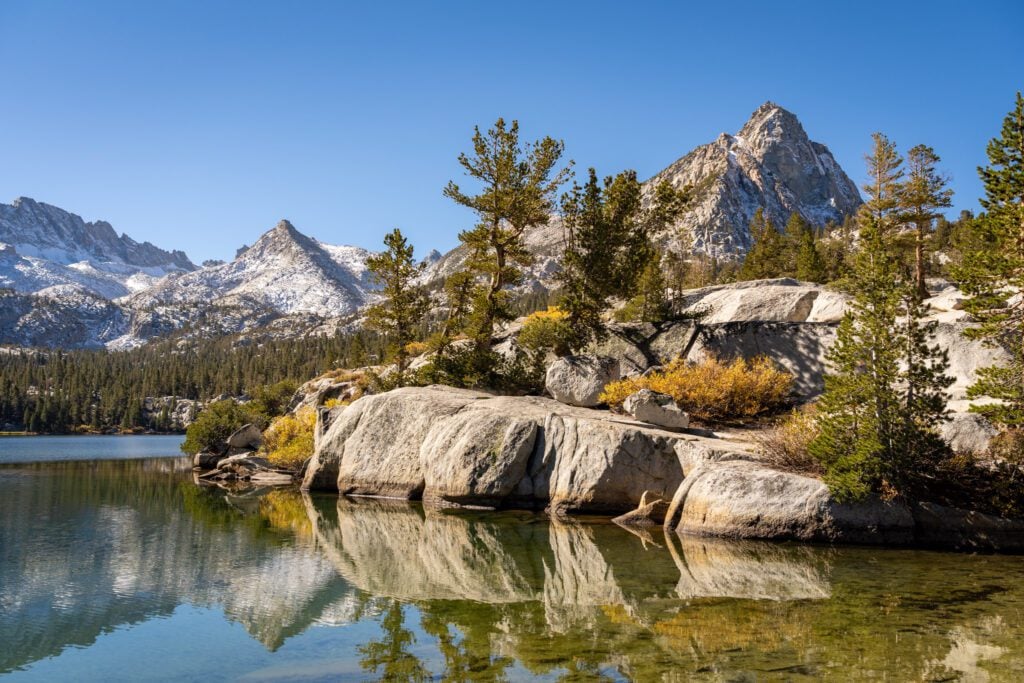
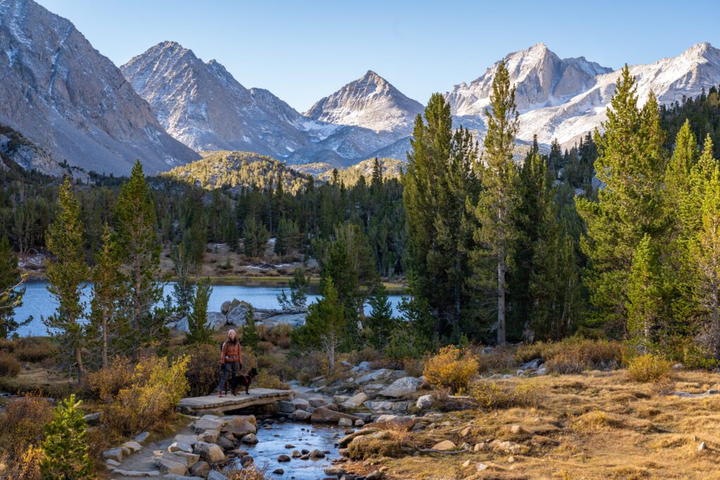
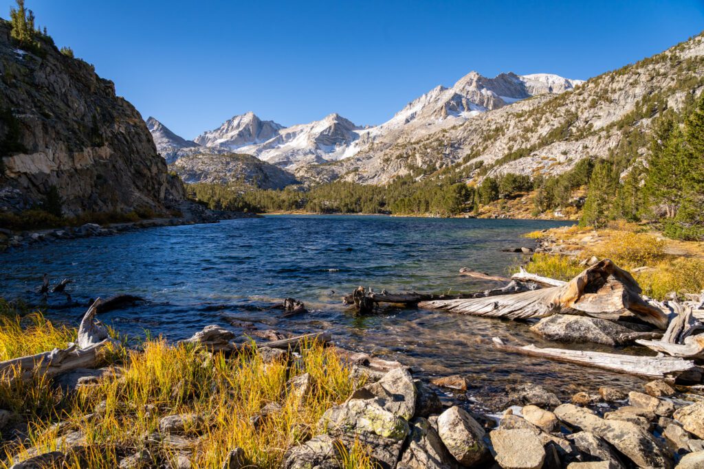
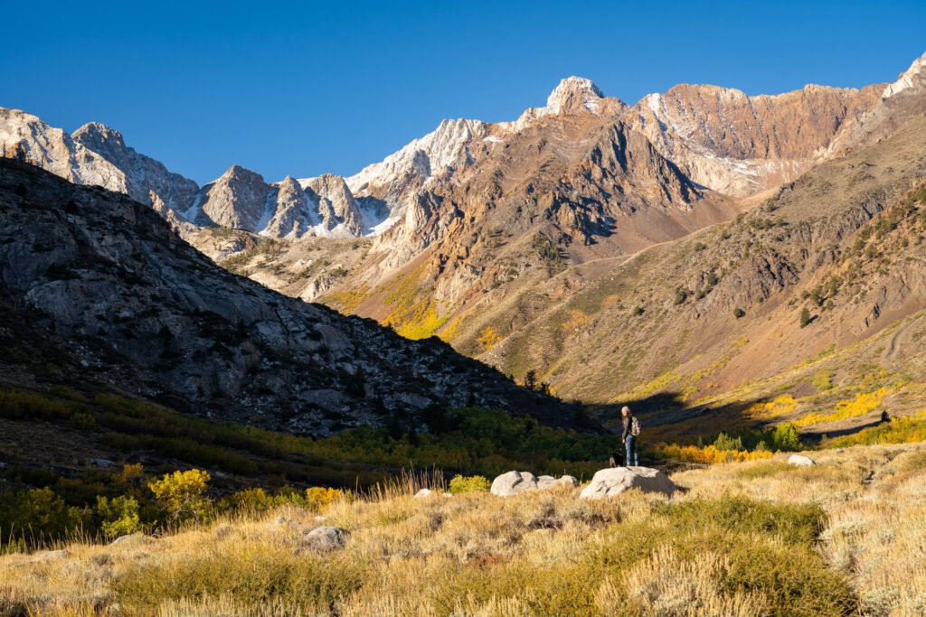
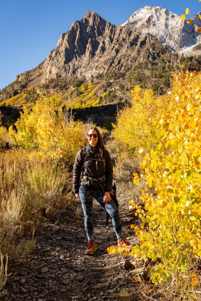
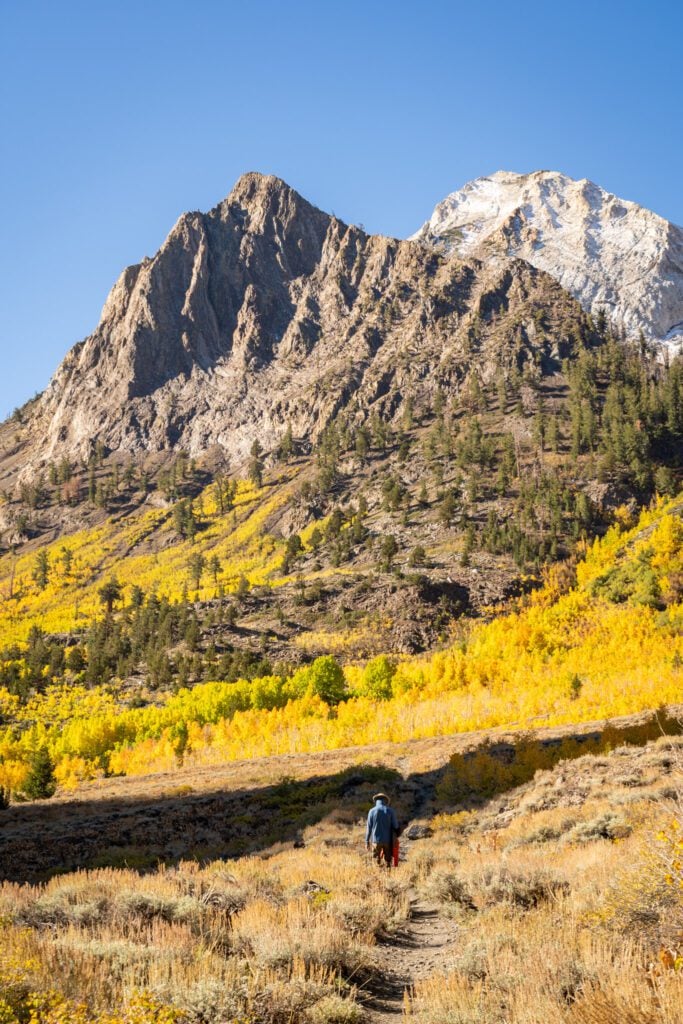
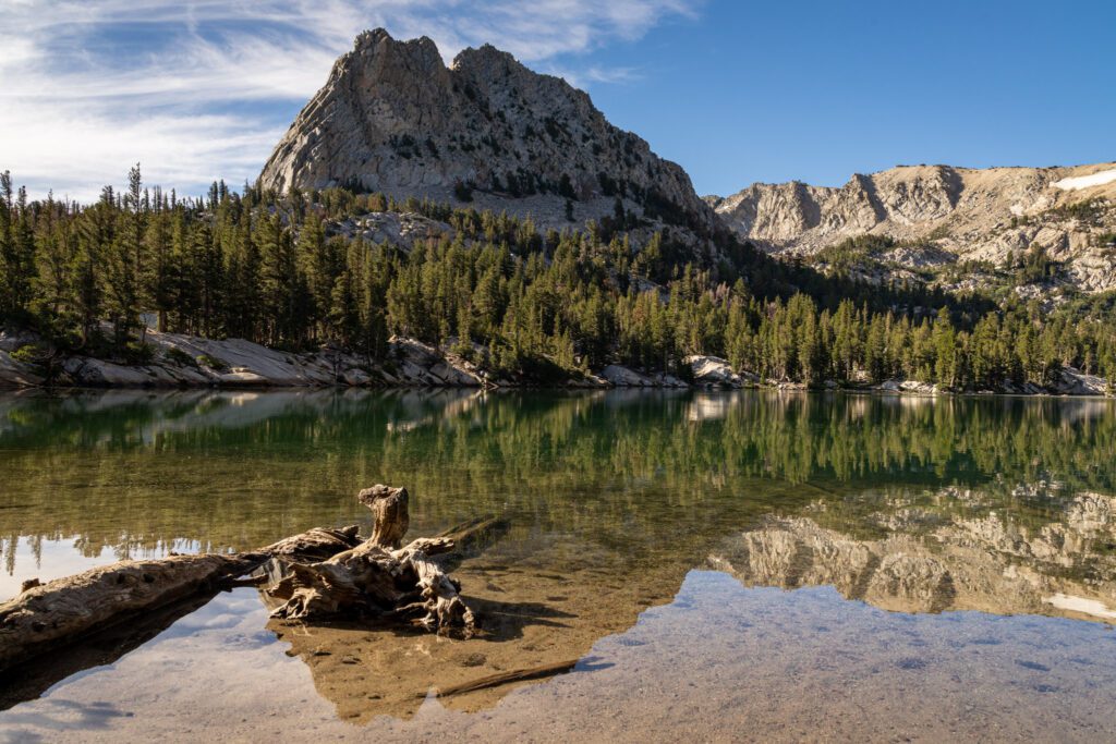
Rock Creek Canyon
Of the three big roads in this vicinity that climb from 395 up into the Sierras, this is our top pick.
You’ll climb 3,000 feet from Highway 395 to get above 10,000 feet at the end of the road, and along the way you’ll have nice views of the valley, Rock Creek Lake, and in October, some nice patches of fall color.
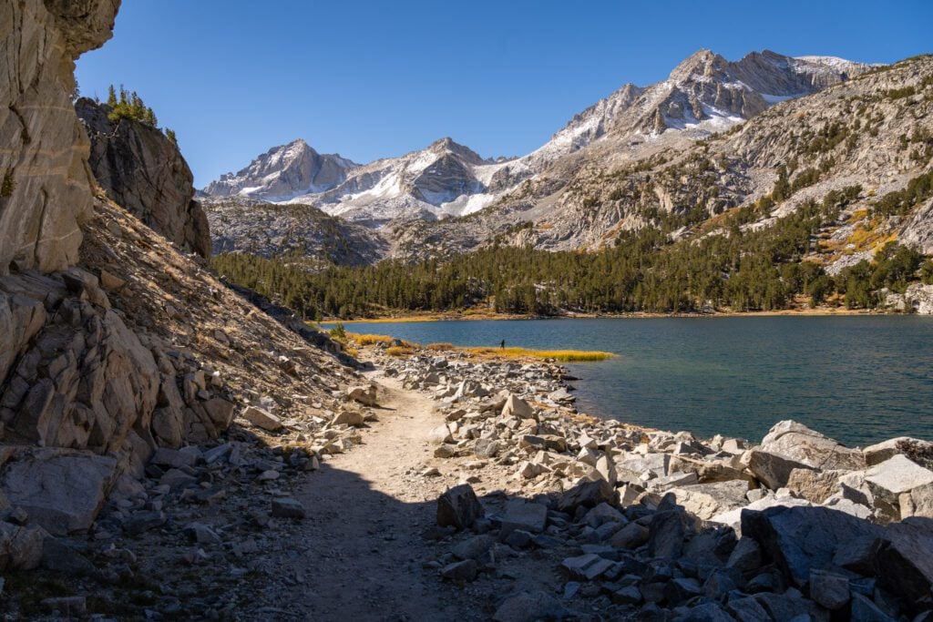
We will say that there is more to do and see up Bishop Creek towards Lake Sabrina, especially if you’re not into hiking, but we absolutely loved the hike through the Little Lakes Valley to Gem Lakes, which begins from the end of Rock Creek Road.
It was our favorite hike on this past trip to the Eastern Sierra, and even if you can only make it to Long Lake, we think it’s worth it.
The hike takes you through a patchy forest of pine trees and up into a basin surrounded by towering rocky peaks and slabs of granite, which is peak Eastern Sierra beauty to us.
This scenic drive – which is paved all the way through – was also on our radar because we were there in early October for fall color, and the front desk person at Tamarack Lodge recommended driving up Rock Creek Road for peaking fall color (they were not wrong).
The other notable thing about Rock Creek Canyon is that there are an unbelievable number of campgrounds along the road (I counted 11), and most of them are first-come, first-served.
So if you’re camping and looking for a site, this stretch is a good bet.
McGee Creek Canyon
We visited this area for the first time on our latest trip to the Eastern Sierra, and it led to what I would call the best bang-for-your-buck hike in the area in the hike from McGee Creek to Horsetail Creek (although, admittedly, there are a bunch of contenders).
It’s a popular hike, and it’s easy to see why once you’ve done it.
It’s only 3.6 miles (with ~650 feet of elevation gain), and the views start almost immediately and only get better as you climb until you’re hiking straight towards Mount Crocker and other picturesque peaks (bonus points if they’re lightly dusted with snow).
There’s also a small campground a mile or so away from the trailhead if you’re looking for a nice place to camp that’s off the road.
This trail is particularly spectacular in the fall – call it early to mid October – when the aspen groves all along the trail turn and the hillsides light up with shades of bright yellows and oranges.
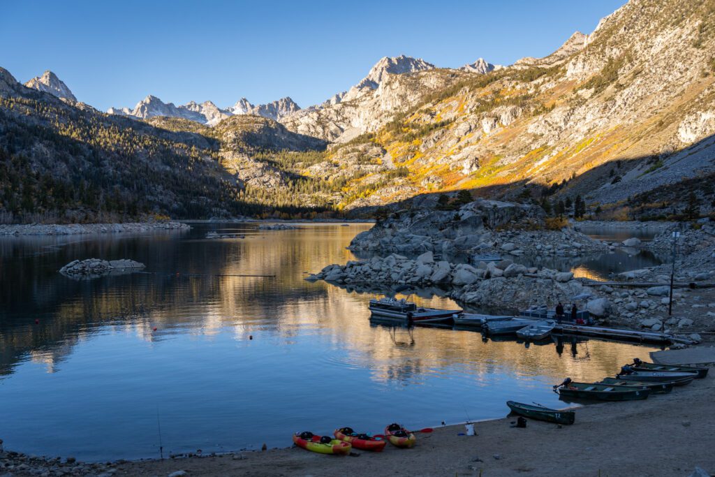
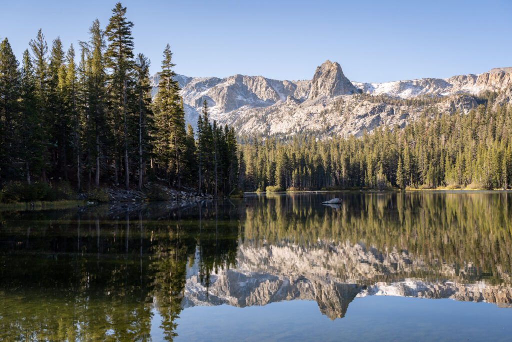
Convict Lake
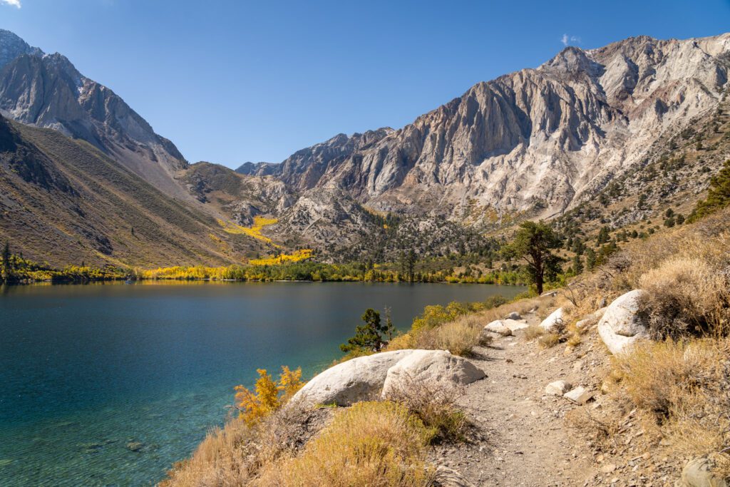
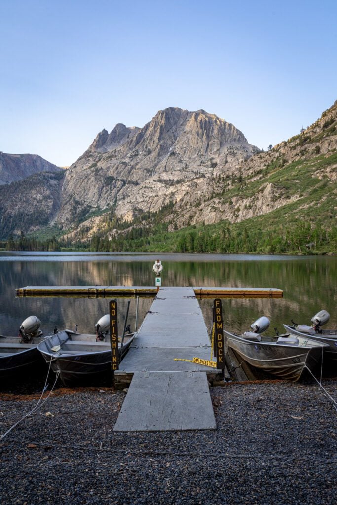
Sitting at 7,500 feet above sea level, Convict Lake is one of the better stops on this road trip for outdoor recreation of almost any kind – hiking, boating, fishing, and more.
First, what’s with the name? It gets its name from a shootout in the 1800’s between escaped criminals who broke out of jail in Carson City, Nevada, and holed up in the hills above the lake.
During the shootout, two people were killed – including one Mr. Morrison, who got the big peak across the lake named after him for his trouble – and eventually the criminals were caught.
We had been to Convict Lake a few years ago on one of our early forays into the Eastern Sierra to take photos of the lake at sunrise, when the rising sun lights up Mount Morrison with that gorgeous pink alpenglow and, if you’re lucky, it’s calm enough to get a reflection in the glassy surface of the lake.
On this last trip, we decided to do the full 2.5 mile loop around the lake, and it did not disappoint.
It’s basically flat (we clocked 250 feet of elevation gain on the entire loop) and it’s one of the better family-friendly hiking options near Mammoth.
This would also be a great place to get out on the water and do some exploring by boat.
They rent pontoon boats, stand-up paddleboards, and kayaks at the boathouse on the water from the last weekend in April through the fishing season (mid-November). More information here.
Convict Lake is also one of the most popular fishing destinations in the area, as evidenced by the anglers we encountered at every single little beach that we found along the lake loop. Seriously, so many people out fishing!
They’re known for rainbow and brown trout, and the season runs from the last Saturday in April through November 15. More information here.
Hot Creek Geological Site
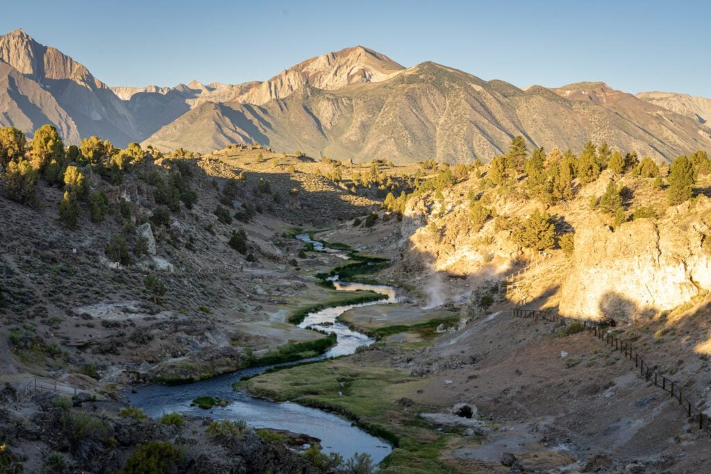
Hot Creek Geological Site is pretty cool. You have an active geological site where the thermal activity deep within the earth leads to hot water bubbling up in a series of multi-colored pools and streams reminiscent of Yellowstone National Park.
It’s all backed by the towering peaks of the Eastern Sierra in the distance, which adds a certain level of drama to the scene.
There’s a short little walk that you can do that takes you to a couple of scenic overlooks, some signage explaining what you’re looking at, and then down to the water level.
It is important to note that this is not a hot spring. The water can be very, very hot, so it should go without saying that you shouldn’t touch it (there are plenty of signs telling you that getting in the water is prohibited).
It’s about 10-15 minutes outside of the town of Mammoth Lakes, right off of 395 near the airport, and probably only requires an hour or two of your time.
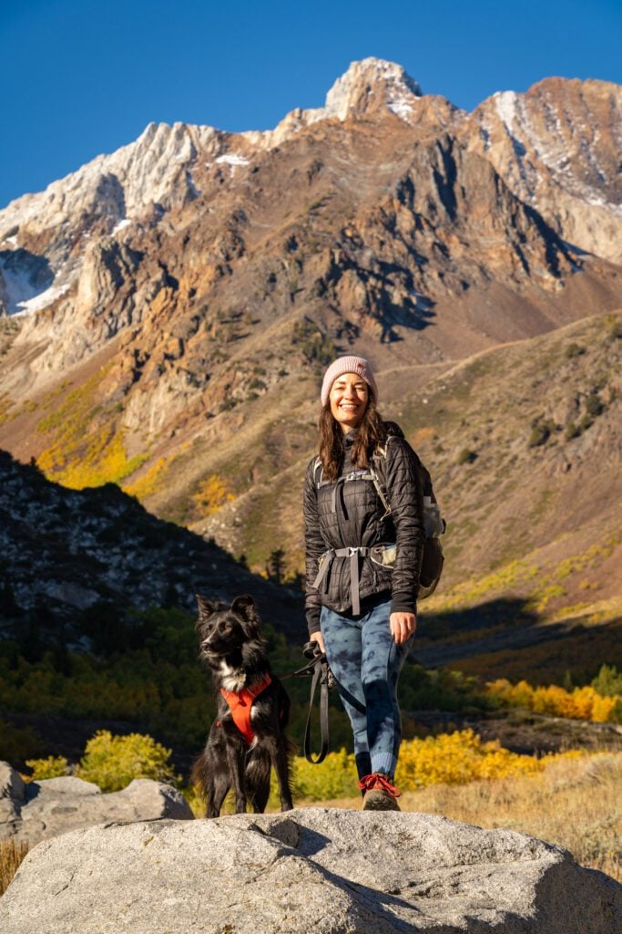
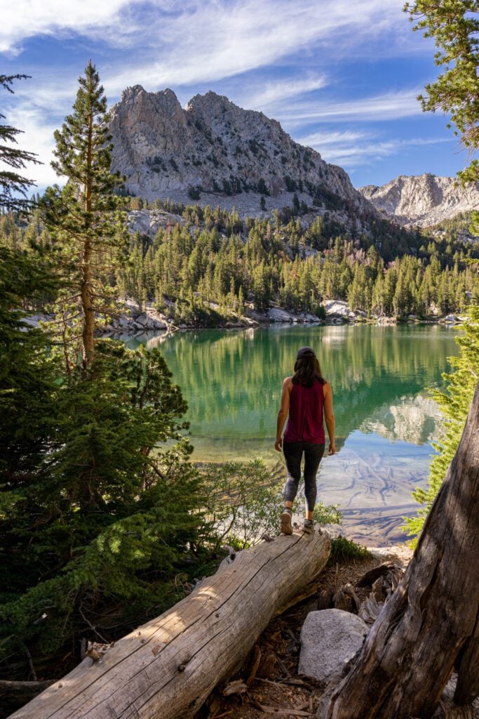
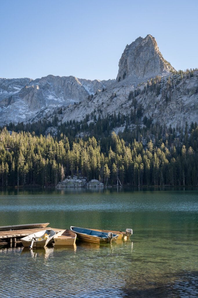
Mammoth Lakes
We love Mammoth Lakes as a home base for the entire stretch between Mono Lake and Bishop (though it definitely will add some driving versus staying in Bishop).
The area is full of gems, from a string of gorgeous alpine lakes that sit 8,800 feet above sea level, to a geologic mystery, to one of our favorite hikes in the world.
Mammoth is the perfect mountain town for us, at least. There’s a grocery store (essential for us because we like to make quality food even when we’re on the road), a good coffee shop (Black Velvet, if you’re curious), and multiple gas stations (which tends to mean lower prices).
I know Mammoth first and foremost as a ski destination, and it’s where my extended family (who all live in Southern California) would do an annual (ish) ski trip growing up.
I had never actually been to Mammoth Lakes in the summertime until a few years ago, when we were on our never ending U.S. road trip and made the journey to the Eastern Sierra.
That was when the beginnings of my love for the granite basins and rocky peaks began, and spending another two weeks in the area this past fall cemented the Eastern Sierra as one of our favorite places on earth.
Let’s take a second to talk about logistics before we get into specific things to do and hikes that we love and recommend.
If you follow a version of the itineraries we covered above, you’re likely going to end up doing multiple day trips from Mammoth.
Like we said, it’s our favorite home base for the surrounding area, and moving around every night sucks, so we’d opt for more nights in Mammoth versus spending a night in, say, June Lake.
Assuming two day trips, we’d split them up into a day trip to the north, which would likely cover June Lake, Mono Lake, and Tioga Pass, and a day trip to the south, which would cover McGee Creek, Rock Creek, and Convict Lake.
With that out of the way, here are some of our favorite things to do and see in Mammoth Lakes.
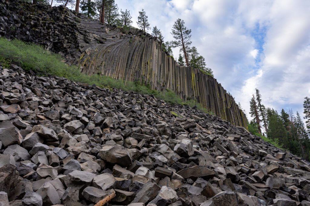
Devil’s Postpile and Rainbow Falls: This hike is great, especially considering that the barrier to entry in terms of distance and elevation isn’t really that high.
You’ll pass both Devil’s Postpile, a geologic marvel formed by volcanic activity that has created these tall, hexagonal basalt columns that jut out of the earth up to 60 feet high, and then head down to Rainbow Falls, a surprisingly powerful waterfall with multiple viewpoints.
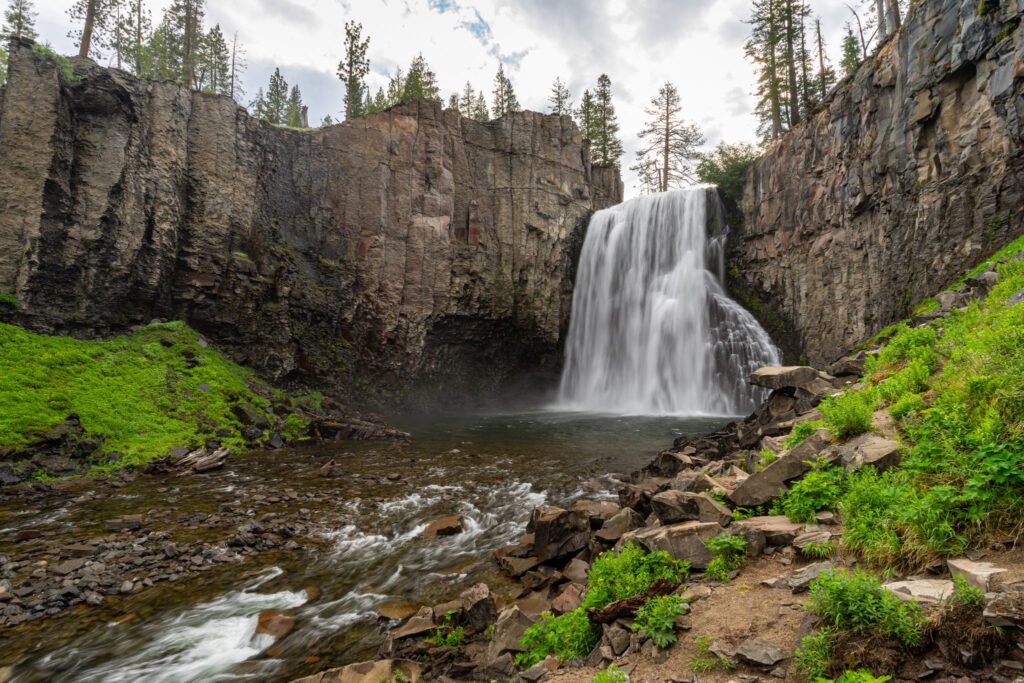
The challenge here is that it’s one of the most popular spots in the region, and they have instituted a shuttle system to deal with crowds in the summer. More information here.
The Mammoth Lakes Basin: The real star of the show here during the summer is the string of alpine lakes that sits up at nearly 9,000 feet above sea level.
It’s magical, and if you’re camping, we’d try your best to snag a spot at one of the many campgrounds here (Twin Lakes is the best, we think, with Lake George as a close second). There are three things to do here that we wouldn’t miss.
First, a hike through the basin (we combined Mcleod Lake and the Horseshoe / Mamie Loop to form one big circuit).
Second, the hike up to Crystal Lake, which is a nice lake that requires some climbing to reach and thus is far less crowded than the other lakes below.
Third, a sunset (or sunrise) at Lake Mary, specifically here where you have an excellent view (and ideally, reflection) of the rocky peaks across the lake.
The Duck Pass Trail: Is Duck Pass our favorite hike of all time? It’s hard to say – we’re lucky enough to have done a lot of incredible hikes in the past five years – but it’s certainly up there.
This hike is no joke, especially given that you start at 9,000+ feet above sea level, but my goodness does this trail have it all.
Gorgeous alpine lakes. Granite basins. Stunning views out over the basin and surrounding valley. It’s paradise if you’re into alpine stuff, which we very much are.
Minaret Vista: This is a viewpoint just outside of town that you’ll drive by if you’re heading to Devil’s Postpile.
It’s an unobstructed view of the Minarets, the spiky rocky peaks you can see from various places in Mammoth.
We came at sunrise to see the pink alpenglow light up the peaks before heading down to Devil’s Postpile.
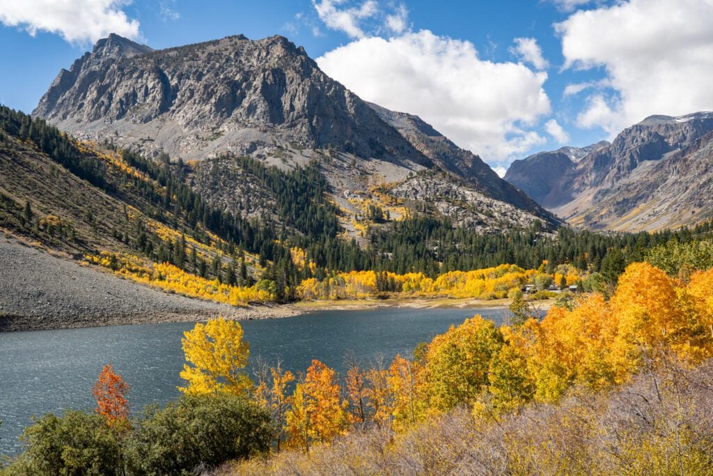
June Lake
June Lake is a small town built around a string of lakes (the biggest of them, as you might have guessed, is June Lake) about 15 minutes north of Mammoth.
It’s a much smaller version of a mountain town – there’s one gas station, a handful of restaurants, and no real grocery store in “downtown” June Lake – and would be an alternative place to stay to Mammoth if that’s what you’re looking for.
The big draws of June Lake are the aforementioned lakes – June, Gull, and Silver are the main ones right along the road – which you can string together in a beautiful 15 mile scenic drive along the June Lake Loop (Highway 158).
Here’s a map with the route and some stops to make.

We particularly enjoy Silver Lake (here on Google Maps), which is backed by towering rocky peaks and has a nice boat dock with a magnificent view.
All of those lakes also have boat rental facilities where you can get out on the water in a kayak or rowboat to do some exploring.
In addition to the lakes along the highway, there are also several nice lakes that involve a short hike to reach.
The two that we’ve done and enjoyed are Fern Lake (definitely NOT an easy hike, but the lake is beautiful) and Parker Lake (a nice easy stroll for the most part).
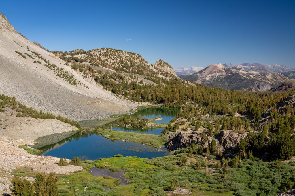
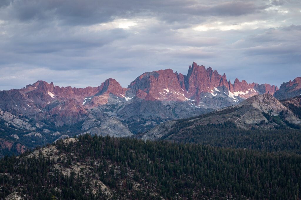
Lee Vining and Tioga Pass (Yosemite National Park)
Our feelings on Yosemite are a bit mixed given our recent experiences in the Yosemite Valley.
Two things are certainly true about Yosemite.
First, it is one of the most beautiful places on earth. If you are from somewhere not in California, Oregon, or Washington State (and maybe Colorado), the landscapes here are mindboggling.
Towering waterfalls. Granite as far as the eye can see. Massive sequoias. It’s spectacular.
The second thing that is true is that, for whatever reason, everybody who enters the Yosemite Valley loses approximately 50% of their IQ points when they pass through the entrance station.
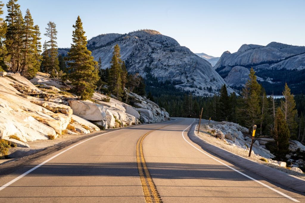
However, the slice of the park that sits along Tioga Road, which is a short drive away from June Lake or Mammoth, is just as spectacular as the valley, and attracts marginally fewer visitors (and it’s more spread out, so everyone isn’t packed into one relatively compact valley).
I (Matt here) had never actually been to Tioga Pass before this latest trip to the Eastern Sierra, and after an early morning excursion into the park, I think you should probably prioritize taking a day trip here from the 395 corridor rather than trying to spend multiple days in the park.
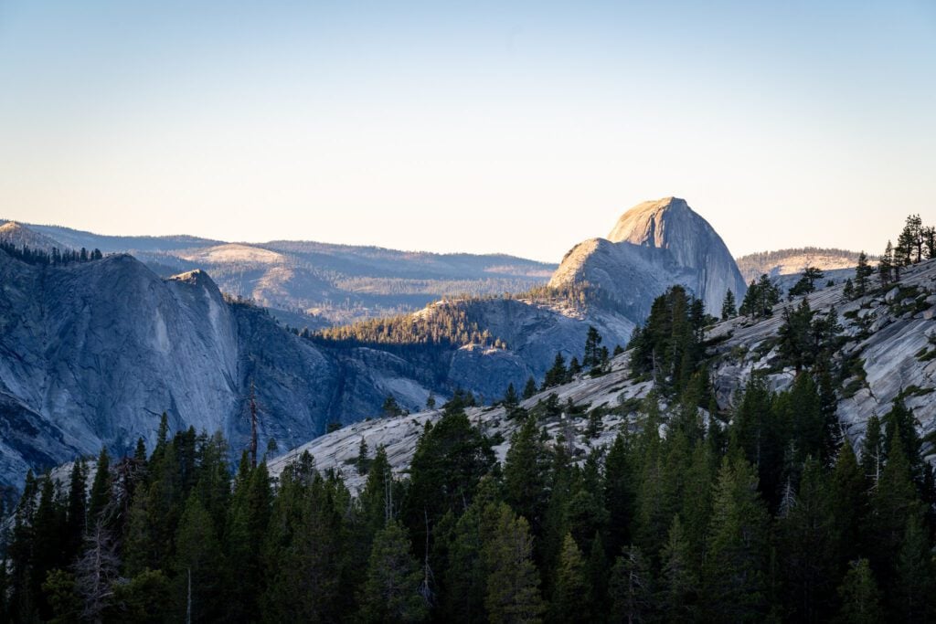
Our recommendation would be to focus that day trip on the stretch between the Tioga Pass entrance station, which is ~10 miles and 3,000 feet of climbing off of Highway 395, and Olmstead Point, where you have an excellent view of Half Dome.
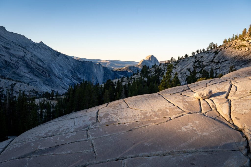
That stretch, which spans roughly 20 miles, has everything you want in a day trip to Yosemite.
Several beautiful lakes backed by rocky peaks, plenty of granite domes that remind you of Half Dome, the entire stretch around Tuolumne Meadows, and a sweeping view out towards the Yosemite Valley, including Half Dome.
You could, of course, go further (even into the Valley), but it will be a long day of driving.
It’s 90 minutes, one way, to Tunnel View from the Tioga Pass Entrance Station, the gateway to the Yosemite Valley.
If you want to add a hike to your day trip, there are a bunch of good options for a variety of fitness levels along this stretch. Here are three options we’d consider:
Soda Springs and Parsons Lodge (1.4 miles, flat): An easy stroll into Tuolumne Meadows, which can easily be extended via the network of trails that branch off from the Lodge. Great views of the meadows!
Cathedral Lakes (9.6 miles, 1,600 feet elevation gain): I’ve had this hike saved in my AllTrails account for years at this point, and we haven’t quite made it happen just yet. It takes you to two different crystal clear alpine lakes, each backed by jagged rocky peaks.
Clouds Rest (12.4 miles, 3,100 feet elevation gain): One of THE iconic views in the park, this is a difficult hike that takes you to a granite outcropping with a truly mind boggling view of the valley below, including Half Dome. Don’t underestimate this hike – there are also stretches of loose scree and steep ascents that don’t show up in the trail stats, but absolutely make this hike more difficult.
There are too many hikes to narrow to just three! Lembert Dome and Pothole Dome are two other nice, moderate trails along this stretch.
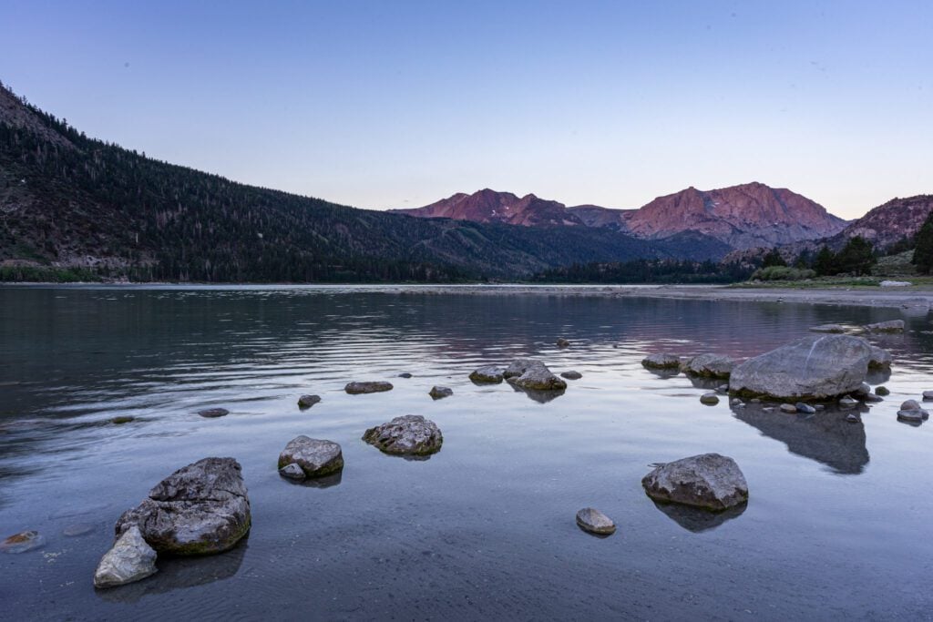
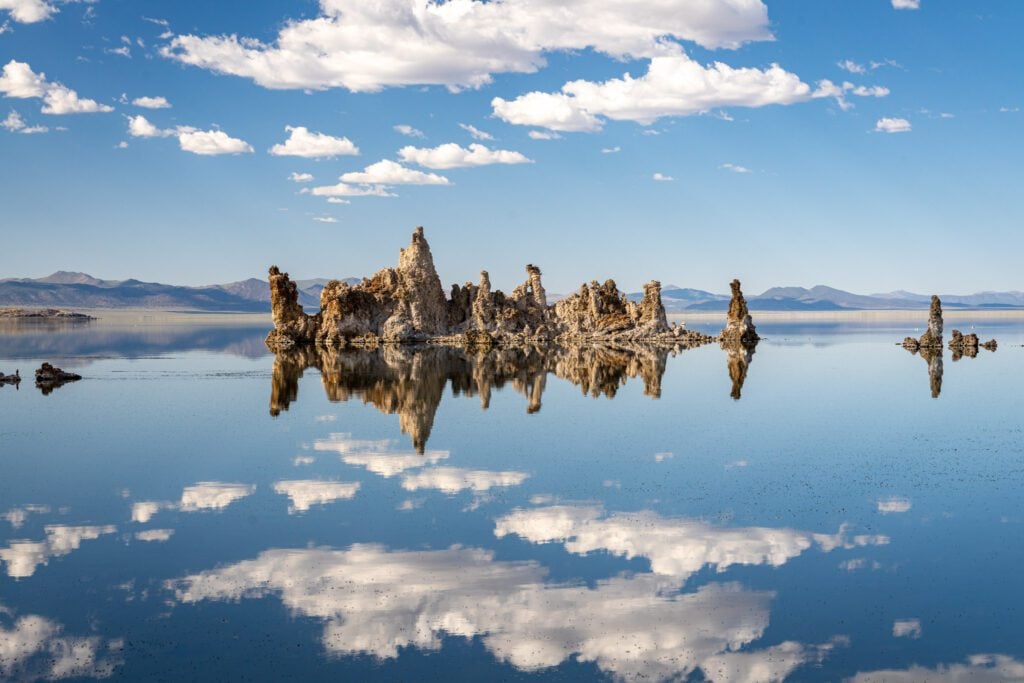
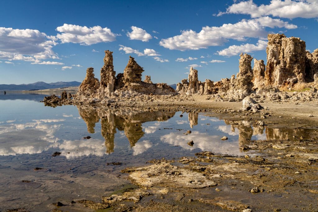
Mono Lake
Every time we find ourselves at Mono Lake, we are astounded at two things.
How massive it is – it basically stretches as far as the eye can see – and the fact that it’s sitting above 7,000 feet above sea level (for some reason, it looks like it belongs in a sea-level desert).
Mono Lake is the second oldest lake in North America, and it’s an ancient saline lake that is more than twice as salty as the ocean and incredibly alkaline.
Which, as you might imagine, means that it has cultivated a unique ecosystem.
It’s a haven for alkali flies, brine shrimp, and numerous migratory birds, including ospreys that nest on the tufa towers.
The standouts for us are its tufas, the spindly towers of calcium carbonate that you find littered around the shore of the lake, and reflections of the Sierra Nevada mountains in its still waters.
The area is particularly scenic at sunrise and sunset, and a big draw for photographers and bird watchers.
The South Tufa area offers the largest concentration of tufa towers, and there’s an easy 1-mile self guided nature trail.
Visit the Mono Basin Scenic Area Ranger Station and Visitor Center (just north of Lee Vining) to learn more about the lake, and for guided tours of the area over the summer.
Nearby Navy Beach is the best spot for swimming and for putting in canoes and kayaks. The parking lot for the south tufas are located 5 miles east of Highway 395, off Highway 120.
Nearby Panum Crater is the youngest of a string of craters that lead towards Mammoth Mountain.

A short (30 minute) trail leads you around the rim of the crater, while a short and steep trail leads you to the crater’s core.
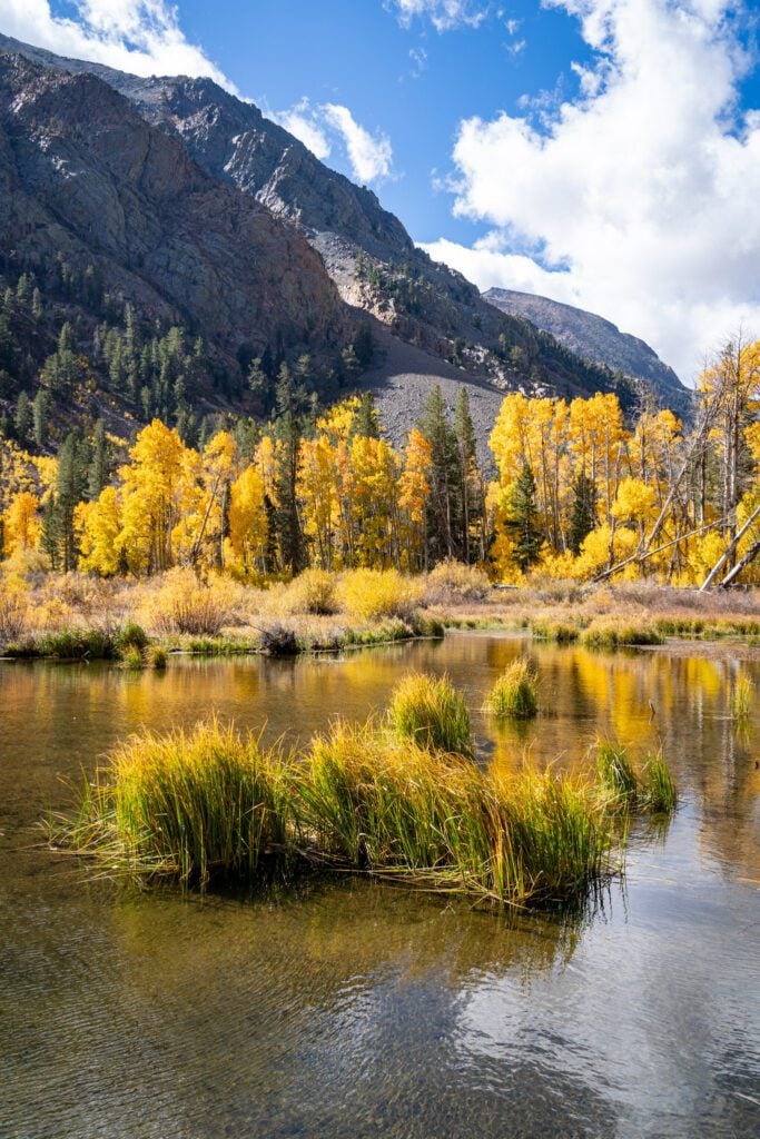
Lundy Lake & Canyon
It’s an easy drive to Lundy Lake, just 5 miles along Lundy Lake Road north of Lee Vining. The 100-acre lake is a great spot for fishing without the crowds, offering shore and boat access.
There are also multiple campgrounds along the road up, so this would be a good base for exploring the Mono Basin (and even Tioga Pass).
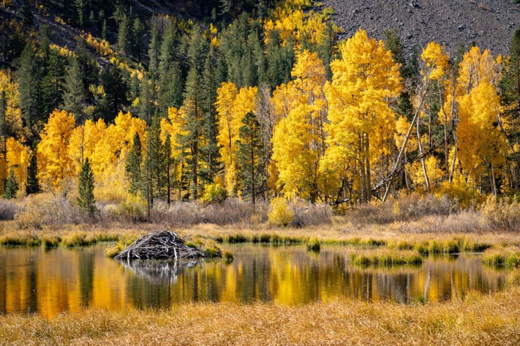
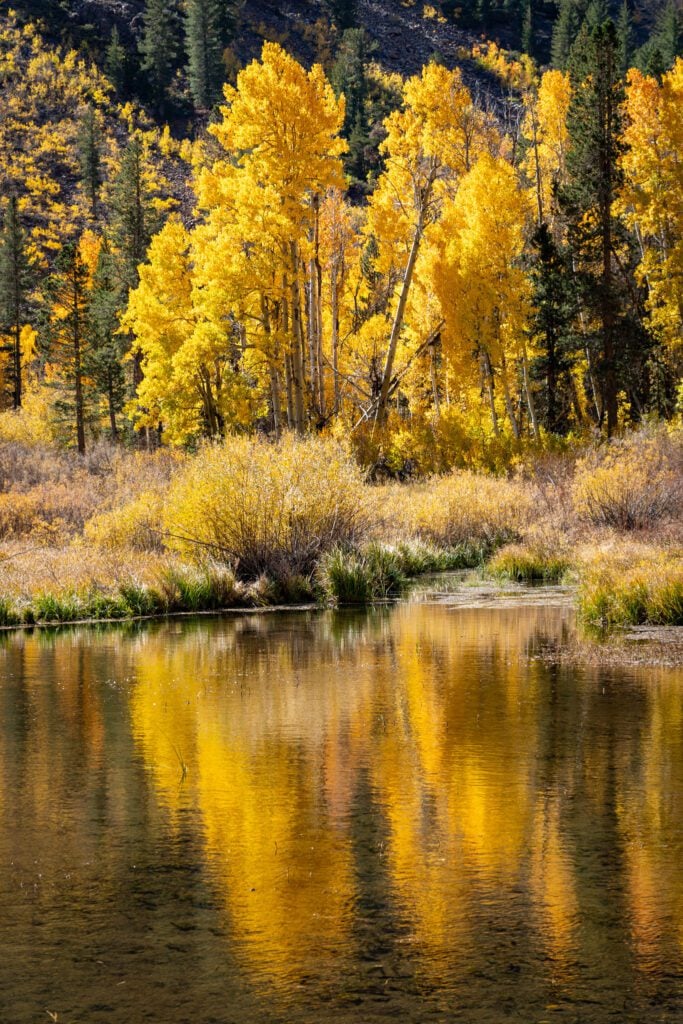
The Lundy Canyon Trail is a fantastic hike, best in July (when wildflowers are in bloom and waterfalls are full) or October (when the quaking aspens turn colors).
The easy to moderate 4-mile out-and-back hike climbs gently along Mill Creek and into the Hoover Wilderness, and takes you past beaver ponds (we saw two dams), the ruins of an old cabin, and several beautiful, cascading waterfalls, including the impressive Lundy Falls.
Even if you don’t do the hike, it’s worth driving the dirt road to seek out fall color (if you’re here in October) because this was our favorite place for fall color when we were there in October, particularly along the road in.
It’s possible to extend the hike up to Lake Helen and the Twenty Lakes Basin, but the route up can be treacherous, with loose shale, and is not recommended when you only have limited time (and even then, only if you are an experienced hiker).
It’s also easier to access those lakes via Tioga Road and Saddlebag Lake (which is what we did).
Bodie State Historic Park
We didn’t stop at Bodie on this latest trip because we were trying to get across the pass ahead of the season’s first major snowstorm. But we wanted to and had planned on it!
Bodie is, essentially, an open-air museum. It’s a ghost town that originally grew as a result of the discovery of gold nearby, blew up to 8,000 residents, and subsequently fell back down to zero residents as the miners that showed up to take advantage of the boom moved on to other endeavors (mostly other mining booms).
The death blow to Bodie was the shuttering of all gold mines in the U.S. during World War 2, and post-war those mines that were sustaining a small population in Bodie never reopened, and the town eventually became completely empty.
Of the huge array of structures that were built in the 19th Century to take advantage of the gold, only about 110 survive, and they’re maintained in a way that preserves the look and feel of the town in that time period.
A self-guided tour will take you no more than an hour, and there are guided tours offered of the Stamp Mill ($6 a person, twice daily, no dogs), along with a free history talk (12:30pm daily).
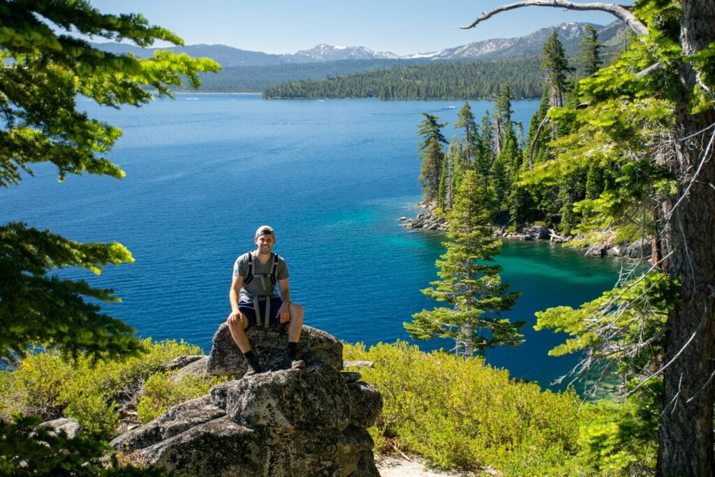
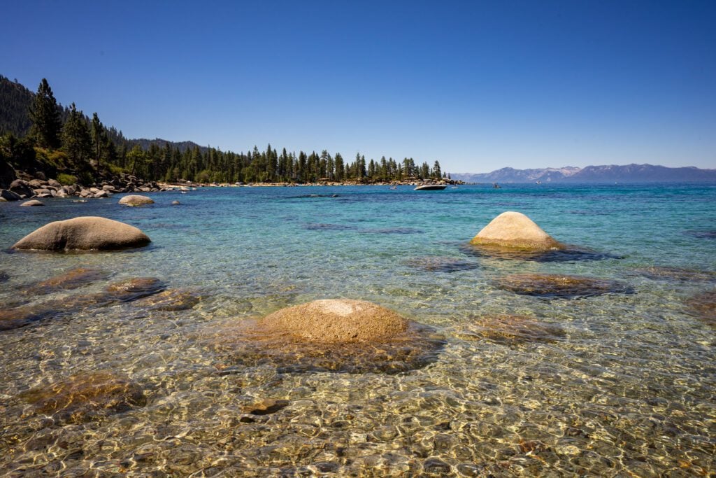
Lake Tahoe
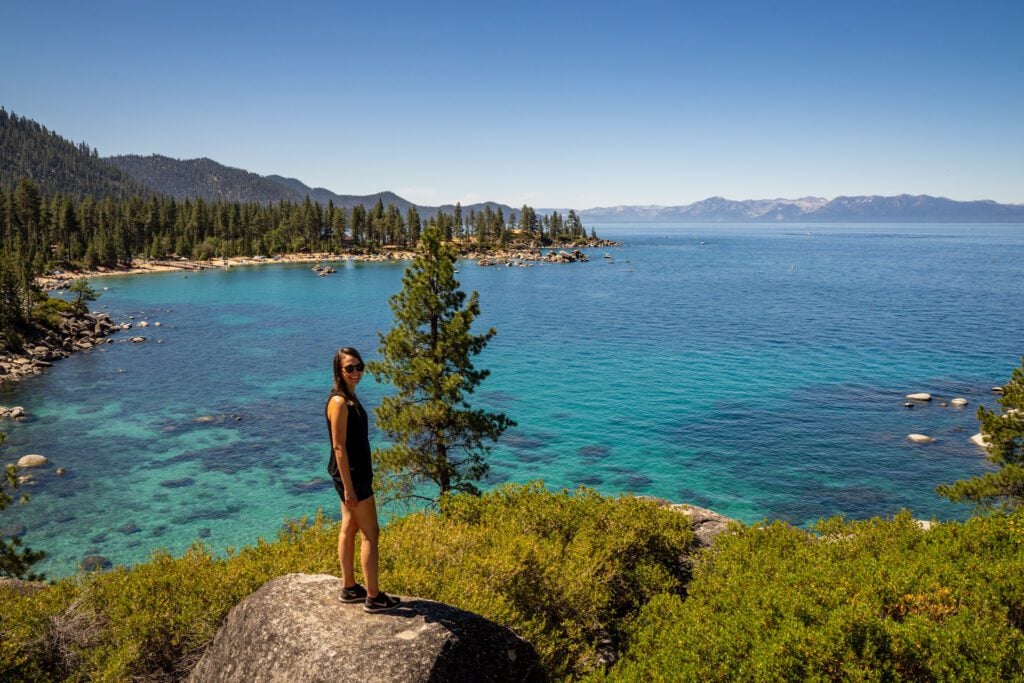
Your last stop on this road trip will be Lake Tahoe, the sapphire blue gem of the Sierra and the largest and second deepest (after Crater Lake – Oregon wins again!) lake in the United States.
When we lived in the Bay Area, Lake Tahoe was the mountain getaway of choice for us and our friends.
We made annual camping trips to Tahoe every summer, and Matt eventually proposed to Alysha on the shores of the lake on the last of those trips before we moved out of the city and bet it all on this website.
We laugh now, because from our home in Portland, we can be in the mountains within 90 minutes, door-to-door, while getting to Tahoe from San Francisco would take us the better part of an entire day (5 hours ish), without traffic (which never happens).
Lake Tahoe is everything you want from a destination is the eastern foothills of the Sierra Nevada range.
With 72 miles of shoreline and clear blue waters surrounded by pine forests and framed by snow-capped mountains, it’s known for its breathtaking scenery and a wide range of outdoor activities.
Our favorite parts of the lake are along its western shore, which is both far less developed (all the casinos are on the southeast corner of the lake in Nevada) and on the side where you get all the granite and alpine lakes associated with the Eastern Sierra.
Hike the Rubicon Trail: The Rubicon Trail runs along the western shore of Lake Tahoe from Emerald Bay State Park to D.L. Bliss State Park, two of our favorite places in Tahoe (and also the place where we got engaged).
It’s a nice, relatively easy walk along the shoreline, and there are beaches at either end.
Technically it’s a one way trail, so keep that in mind as you look at the mileage and elevation profile.
Sand Harbor: We also love this walk along the path on the northeastern shore of Tahoe, where you’ll have excellent views back over the lake to the west, where the snowcapped peaks will be looming in the background.
The parking situation can be a bit of a nightmare, but they’ve expanded it recently.
Hit the trail: The west side of Lake Tahoe is paradise for alpine lake and granite-lovers, and it’s just about every bit as beautiful as the higher elevation areas in the Eastern Sierra (like in Mammoth).
There are several excellent hikes here, from easy ones (Eagle Lake, with a more difficult extension to Velma Lakes) to more strenuous treks through alpine wonderlands (Echo Lakes).
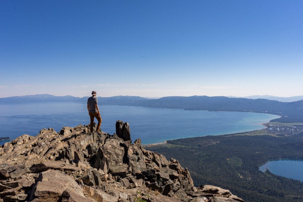
We’ve also done Mount Tallac, which is arguably the best view in Tahoe, but you’re going to pay for it in blood, sweat, and tears (we’d give it 50/50 whether you break into tears after the first of several false summits on the way up).
Relax on the beach: There are no shortage of beaches in Lake Tahoe to get some sun and take a dip in the ice cold water.
On the western shore, we like D.L. Bliss State Park.
On the south shore, Baldwin Beach is a good option (and is one of the more popular beaches in South Lake).
On the north shore, Sand Harbor and King’s Beach are the two main options. There are plenty of great beaches outside of those, some of which require a hike in (and thus will have fewer people there due to the barrier to entry).