The Rachel Lake Trail (+ Rampart Lakes): A Complete Guide
If you’re looking for a taste of the granite and crystal clear water that is a hallmark of the Alpine Lakes Wilderness that you can reasonably get to in a day (while we love the hike to Colchuck, it’s not exactly accessible from Seattle), we have a trail for you!
The Rachel Lake Trail (and the add-on to Rampart Lakes) is in an interesting sweet spot in terms of accessibility that simultaneously makes it an excellent workout and a less-trafficked trail than, say the Snow Lake trail, which is one of the most popular hikes along the I-90 corridor heading east from Seattle.
It’s both harder and further from Seattle than that trail, but it is a significantly shorter journey than the drive out to Colchuck or Lake Ingalls, two hikes that are about equal in terms of effort, but are more like three hours each way if you’re coming for the day.
That’s not to say that this trail isn’t popular – the set of large parking lots will almost certainly be full on a weekend in the summer – but the longer drive from Seattle means the crowds are noticeably thinner (we only saw a few people on our way up, most of them were backpackers coming down from the lakes).
Between the accessibility from the Seattle area (it’s roughly 90 minutes from door-to-door) as a day trip and the relative accessibility to the Alpine Lakes Wilderness (as a day hike or backpacking trip), this hike earned itself a spot on our list of the best hikes near Seattle.
All that being said, I’m not sure I would do this hike again because of the aggressive climb in the mile before you reach Rachel Lake. Especially with a dog (coming down with her on a leash was a nightmare).
However, it is one of the lower barriers to entry – effort, drive time, etc etc – in the Alpine Lakes Wilderness, so if you want to experience the sheer natural beauty in that slice of paradise without spending the night, this is a great option.
In this guide, we’re going to cover everything you need to know to get out and hike the Rachel Lakes and Rampart Lakes Trail yourself.
We’ll start with the logistics – where to park, and other things you need to know for a smooth trip – and then go into a trail report based on our own experiences hiking the trail.
Our intention is to set you up for hiking success by the end of the guide so you can get out on the trail safely and confidently, prepared for the trail and knowing what to expect.
Sound good to you? Let’s get into it.
Disclaimer: Some of the links in this post, like hotel links, are affiliate links, meaning at no additional cost to you, we make a little bit of money if you click through and book. That being said, we would never recommend something to you that we don’t stand behind 100%.
Hiking Rachel Lake & Rampart Lakes: Trail Details
- Length: 10 miles
- Elevation Gain: 2,600 feet
- Trail Type: Out and Back
- Season: Summer – Fall (July – October)
- Difficulty: Moderate / Difficult
- Pass Required? NW Forest Pass (or America the Beautiful Pass)
- Dog-Friendly? Yes, on a leash
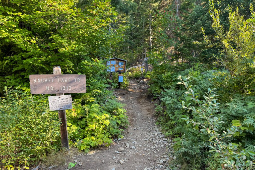
- Trailhead Location: Rachel Lake Trailhead
Note that the AllTrails and WTA numbers differ slightly from the numbers we’ve included above, which is what we clocked on my Garmin watch the day we did the hike.
The Route for Hiking to Rachel Lake
The route for this hike is fairly straightforward. You’ll start from the trailhead and immediately start a four mile climb up to Rachel Lake.
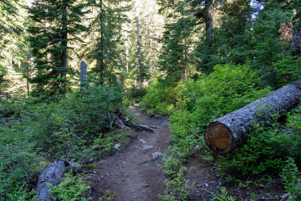
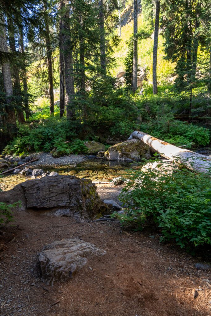
The first two and a half miles of the hike are relatively easy, meandering through the woods following Box Canyon Creek at a slight incline.
Then, you cross the creek one last time and the fun is OVER.
From there, it’s another 1.2 miles to Rachel Lake, and over that distance you’re climbing about 1,200 feet and the trail is rocky, full of roots, and kind of difficult to follow (we pulled out maps multiple times).
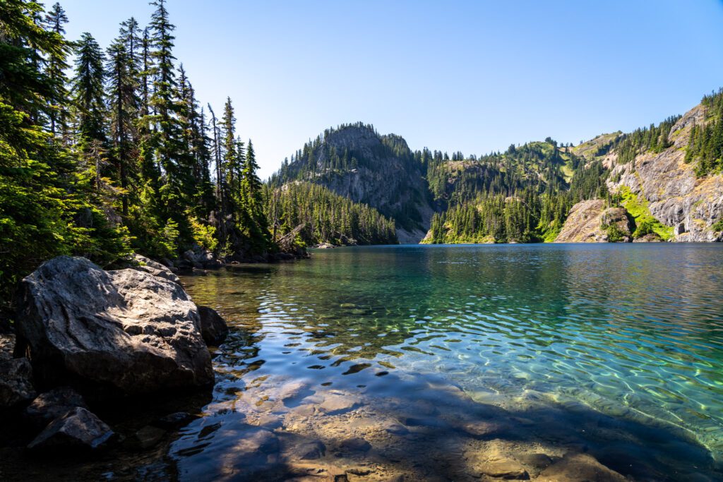
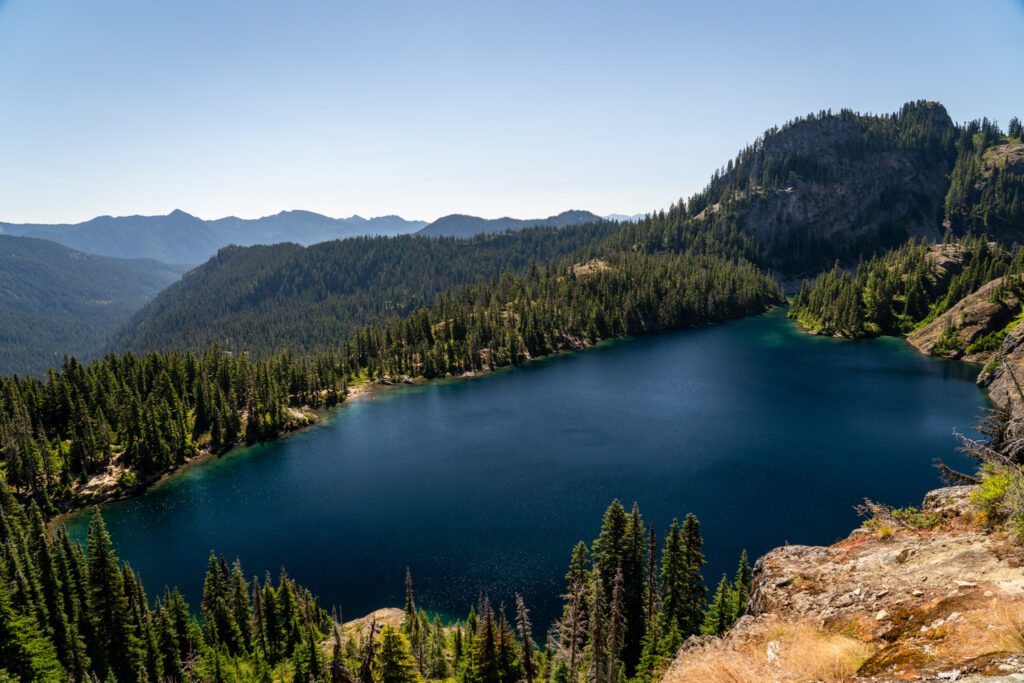
Once you’re at Rachel Lake, there’s a nice trail along the eastern shore where people either set up camp or take a break before heading to the north end of the lake and starting the climb up to the ridge.
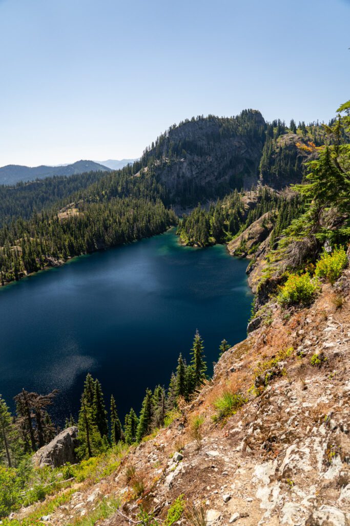
You’ll climb up to the top of the ridge – with some of the best views of Rachel Lake and the surrounding valley from the climb up – and hit a trail junction at the top.
You’ll follow signs to Rampart Lakes, and it’s a mostly flat walk along the ridge to get out to the lakes.
It’s an out-and-back trail, so the way back is a steep descent with uneven footing (not great for those of us with weak ankles), with a two and a half mile slightly downhill trudge to close it all out.
How Difficult is the Hike to Rachel Lake?
This hike is an odd one, because for a hike in the Cascades, the stats don’t seem that outrageous.
In fact, we’d say that it’s bang-on average for your typical hike in the Alpine Lakes Wilderness.
However, once you either a) look a little closer at the elevation profile or b) actually do this hike, it becomes clear why we say that.
While the first 2.5 miles are basically just a flat-ish stroll through the forest, the last 1.2 (ish) miles up to Rachel Lake are BRUTAL.
It climbs roughly 1,200 feet in a hair over a mile, which means you’re climbing around 1,000 feet per mile in that section.
For reference, we generally put anything gaining more than 500 feet per mile in the “difficult” category.
We considered ourselves in pretty good hiking shape at the time when we hiked this trail, and we were GASSED by about halfway through that climb.
It should also be mentioned that the climb isn’t a set of manicured switchbacks. It’s climbing over roots and hopping on boulders from start to finish.
It’s also not an easy trail to follow. There were multiple times where we had to stop and pull up the map to find the correct route because it seemed like there were several different possible options. Make sure to have some sort of offline maps (we use AllTrails Pro and Garmin).
Blending that tough climb with the first half of the hike means that we’re going to put the hike to Rachel Lake in the “moderate” category.
Adding on the climb up onto the ridge about Rachel Lake and over to Rampart Lakes puts this hike in the “difficult” category.
Getting to the Rachel Lake Trailhead
The trailhead for Rachel Lake is near Cle Elum along I-90, eight miles east of Snoqualmie Pass Ski Resort.
You’ll exit the freeway at Kachess Lake Road (exit 62) and follow Kachess Lake Road, which becomes NF-49 and brings you to a junction at Kachess Lake Campground.
From here, you’ll hop on NF-4930, a dirt road, for the last few miles to the trailhead.
At the time of writing (which happens to be a couple of days after the time of hiking), the gravel road from Kachess Lake to the trailhead is in great condition.
It’s a little washboard-y, yes, but there are very few potholes and it should be doable in just about any car.
Parking at the Trailhead for the Rachel Lake Trail
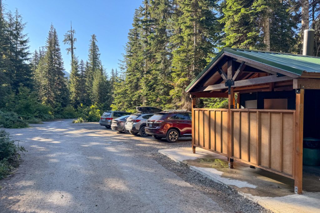
We were surprised by how much parking there is at this trailhead. There are legit parking spots for somewhere around 40-50 cars in the multiple lots, and more parking available along the road coming in (only on one side, though).
We arrived at 8:15am on a Monday morning in August, and there were only a handful of cars in the lot.
By the time we left around 2pm, there were maybe 15 (the lot closest to the trailhead was full).
On a weekend, though, this lot is going to fill up.
On the road in, we saw a few cars parked despite the empty lot – clearly overnight hikers – which means that the lots were full when they showed up (likely Saturday or Sunday).
There are bathrooms at the trailhead (hooray!).
The Best Time to Hike the Rachel Lake Trail
Like many hikes in the Cascades, this hike is going to be covered in snow well into June most years.
The hike starts at ~3,000 feet above sea level, reaching around 5,500 feet of elevation up at Rampart Lakes.
The most predictable window for hiking this trail is going to be July to September.
Earlier in that window means more wildflowers and huckleberries along the way, later in that window means cooler temperatures, fewer hikers on the trail, and the potential for fall color.
Early to mid-October can be doable, but it depends when the first snow of the season falls.
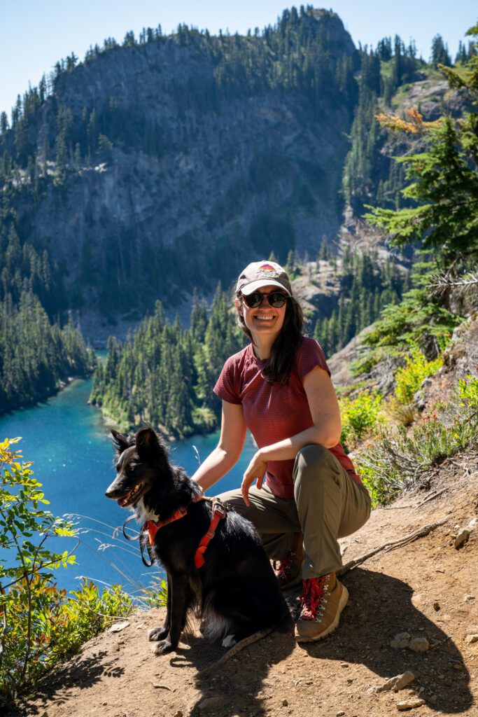
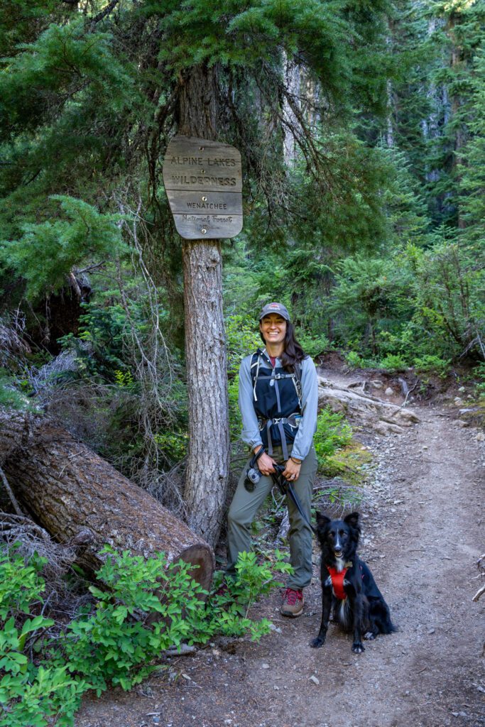
Are Dogs Allowed on the Rachel Lake Trail?
Yes, despite the fact that this is a hike into the Alpine Lakes Wilderness (other hikes, like Lake Ingalls and Colchuck Lake do not allow dogs), dogs are allowed on the Rachel Lake Trail.
However, they must be on a leash on the trail (they’re allowed to be off leash to swim in the lake).
Seriously. On a leash.
Yes, I’m sure your dog is a good dog. But even if they have perfect recall and will not run up and greet other people and dogs on the trail, that’s not the point.
The point is that not every human (or dog) wants another dog all up in their business, and while you or your dog might not be reactive, other people and dogs might be.
That and the fact that dogs can inadvertently destroy habitat for other plants or animals.
Bring your dog (provided they’re in good enough shape for a hike like this) – we did – but they need to be on a leash for the entire hiking portion of this trail.
The Rachel Lake Trail: A Complete Trail Guide
Now, we’ll take you through exactly what to expect on the trail up to Rachel Lake so that you’re prepared for the hike and can hit the trail confidently and safely.
We’re going to break the hike up into three sections, and for each we’ll give you the trail information (distance and elevation per our Garmin) and a short description of that stretch of trail.
Then we’ll give you a couple of additions if you have more energy (or are backpacking), though we haven’t personally done them ourselves.
A Nice Stroll Through the Forest
Length: 2.5 miles // Elevation Gained: 700 feet
This first section of the trail spans 2.5 miles and is just a really pleasant stroll through the woods. You’re roughly following Box Canyon Creek, and there aren’t a whole lot of pieces of the trail that are particularly difficult.
There are a couple of water crossings that were low in August, but earlier in the season I can imagine that they’re pretty muddy or wet.
This stretch of the hike ends when you get to a major crossing of Box Canyon Creek, and from there the hike heads basically straight uphill until you get to Rachel Lake.
The Hardest Mile in Washington (?)
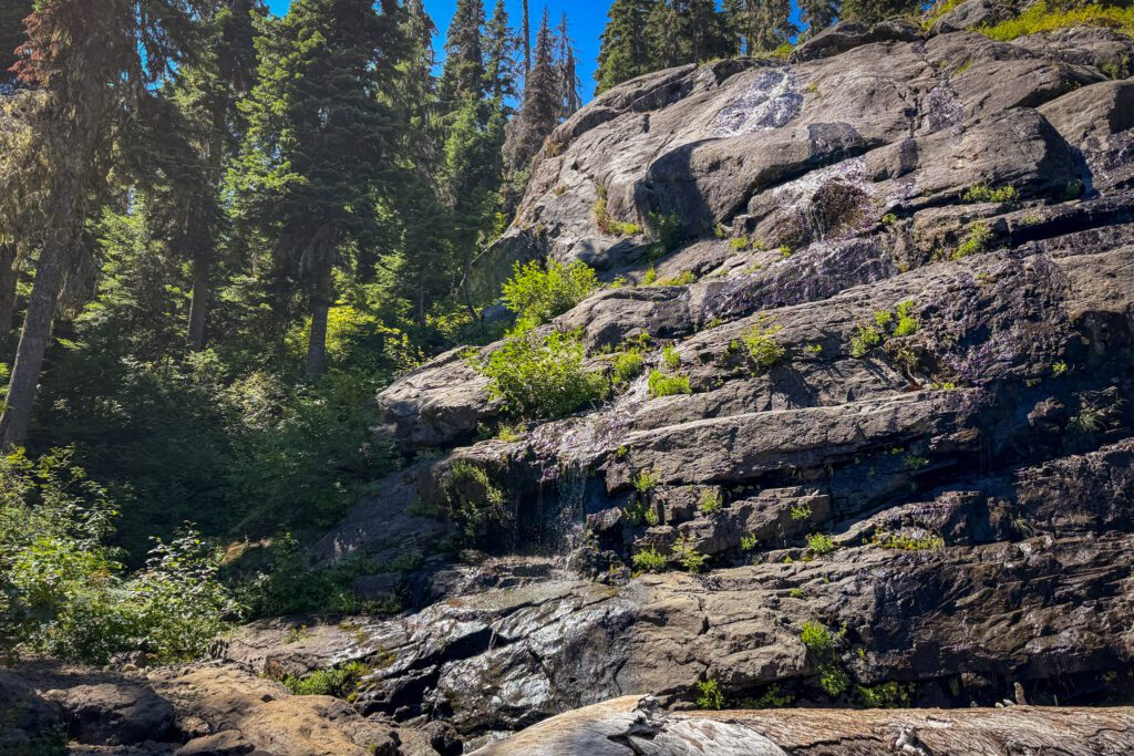
Length: 1.2 miles // Elevation Gained: 1,200 feet
There is an obvious answer to the “what is the hardest mile in Washington State,” and it’s the scramble up Aasgard Pass to get into the Enchantments.
Especially if, like us, you’re backpacking and have an extra 25-30 pounds strapped to your back.
However, this stretch of trail is up there in the top five or so (at least that we can think of).
It’s not just the elevation profile here, though that is brutal, it’s also the terrain. It’s all roots and rocks, and you’re going to expend a lot of mental energy staying upright and trying not to trip as you go.
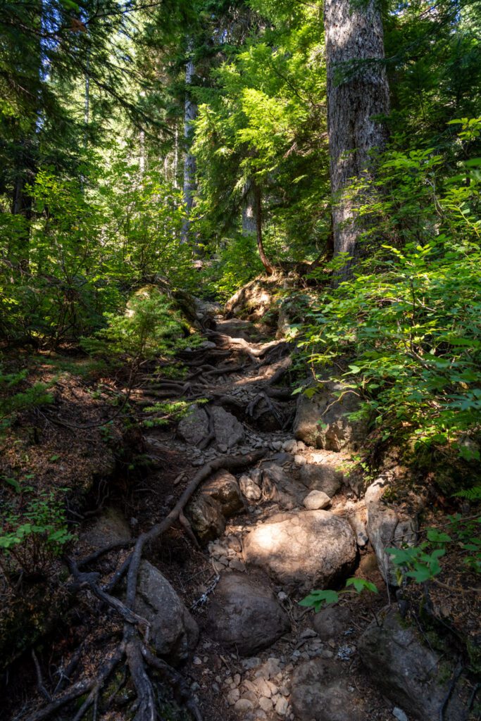
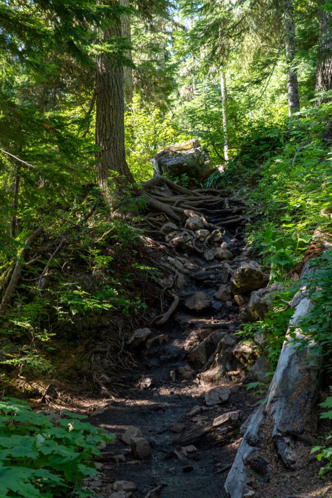
It’s slow going, and every time I looked at our progress, I was disappointed that we hadn’t made it further.
All in all, it took us about an hour and a half to do this section, with several breaks for water and snacks along the way.
About half way through this section, you will start to break through the tree line and get a taste of the views that you’ll have from Rampart Ridge of the surrounding valley, but most of the time you’re in the trees with your head down, your mind focused exclusively on the climbing and not much else.
The Climb to Rampart Ridge and Rampart Lakes
Length: 1 mile // Elevation Gained: 500 feet
The best views of Rachel Lake are from the first half of the hike up to Rampart Lakes (which also happens to be when you’re going to do the extra 500 feet of climbing).
You’re climbing up to a ridge, and along the way there are some great peek-a-boo views of Rachel Lake and the valley beyond.
It’s another relatively steep, rocky climb (you’re basically climbing that 500 feet in the first quarter mile or so). However, this section is in significantly better shape than the stretch before Rachel Lake.
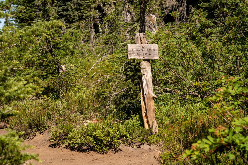
After 0.3 miles, you’ll reach a trail junction that forms a “T.” Left is Rampart Lakes, right is Lila Lake (it’s a one mile addition, roundtrip).
Though I didn’t make it all the way to Rampart Lakes (it was very hot, and we were worried about the dog in the heat), I did go all the way up to the trail junction and a bit down the trail.
It’s mostly flat, and the terrain starts to shift away from the forested landscape you find down at Rachel Lake and into a landscape that features more granite.
It’s an interesting contrast considering you only climbed 500 or so vertical feet.
Options for Extending Your Hike
If you’re doing an overnight hike into this part of the Alpine Lakes Wilderness and are looking for some side trips to add, we have a couple for you.
Both are detours from the junction to Rampart Lakes – usually you’d take a left to go to Rampart, if you go right, you have your choice of another nice lake or a scramble to the top of Alta Mountain.
Lila Lake (+1.5 miles & 600 feet of elevation RT): A much less crowded version of the two other lakes along this route. A good day hike option if you’re backpacking, but we’d probably opt for Rampart if you’re day hiking and only have time or energy for one lake past Rachel.
Alta Mountain (2 miles & 1,100 feet of elevation RT): A climb up along a ridge (looks like some truly stunning views from the ridge in all directions) to the top of Alta Mountain, at 6,100 feet. Definitely requires some light routefinding (make sure you have a map available) and some rough terrain as you get closer to the summit.