The Green Lakes Trail: Everything You Need to Know
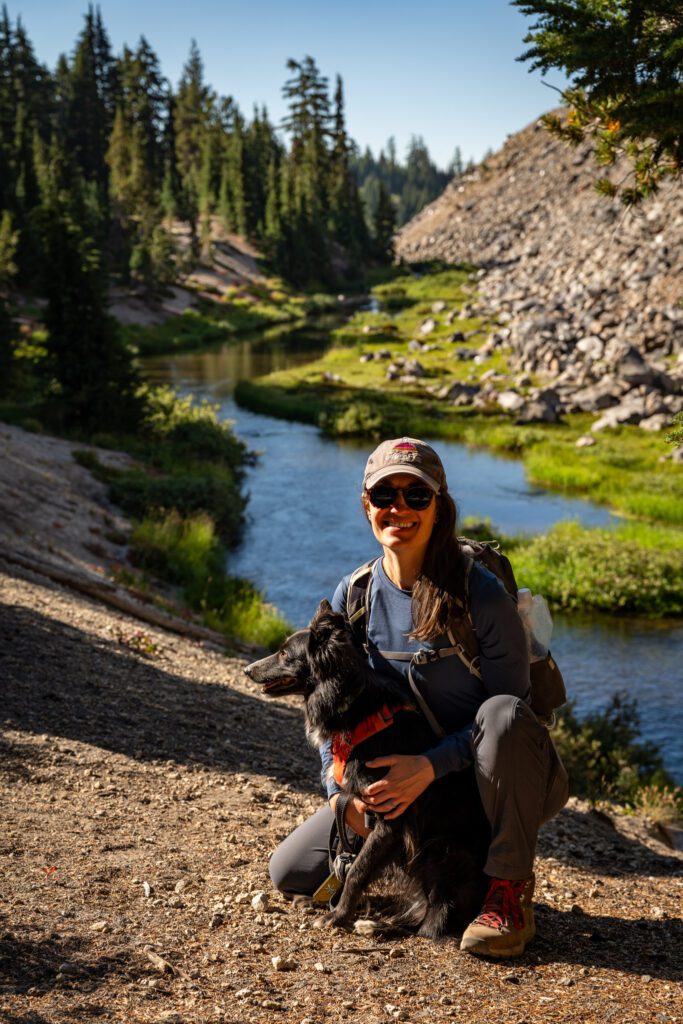
A roaring creek (that turns into a babbling brook). An abundance of wildflowers. Jaw-dropping views of the South Sister and Broken Top. Crystal clear blue-green lakes. As Alysha said during this hike, “I think this is heaven for me.”
Take all of those aspects we mentioned in the first paragraph and package them into a very moderate (bordering on easy) nine mile package, and you’ve got what might be the best bang-for-your-buck hike in the state of Oregon.
Seriously, it’s nine miles, sure, but it feels more like a meander through the forest than a grueling climb.
From beginning to end, this hike is exceedingly pleasant, with a nice mix of terrain that changes as you climb, a continuous soundtrack of water to keep you company, and a nice payoff at the end with excellent views of both the South Sister and Broken Top from the shores of a couple of beautiful lakes.
We have now hiked the Green Lakes Trail near Bend twice, five years apart. And on this most recent hike, we were reminded why this trail is near the top of our list of favorite hikes in the state of Oregon.
In this guide, we’re going to cover everything you need to know to get out and hike the Green Lakes Trail yourself.
We’ll start with the logistics – where to park, and other things you need to know for a smooth trip – and then go into a trail report based on our own experiences hiking the trail.
Our intention is to set you up for hiking success by the end of the guide so you can get out on the trail safely and confidently, prepared for the trail and knowing what to expect.
Sound good to you? Let’s get into it.
Disclaimer: Some of the links in this post, like hotel links, are affiliate links, meaning at no additional cost to you, we make a little bit of money if you click through and book. That being said, we would never recommend something to you that we don’t stand behind 100%.
Hiking the Green Lakes Trail: Trail Details
- Length: 9.8 miles
- Elevation Gain: 1,300 feet
- Trail Type: Out and Back (or Lollipop)
- Season: Summer – Fall (July – October)
- Difficulty: Moderate
- Pass Required? NW Forest Pass (or America the Beautiful Pass)
- Dog-Friendly? Yes, on a leash
- Trailhead Location: Green Lakes / Soda Creek Trailhead
Note on the distance / elevation: These are stats from our Garmin watch and reflect the hike out to the biggest lake, along with some exploring around the shorelines of the smaller lakes nearby. We found it to be about a mile longer than most measurements online.
The Route for the Green Lakes Trail
The route for this hike is fairly straightforward, especially up until the point you reach the Green Lakes Basin at right about four miles in.
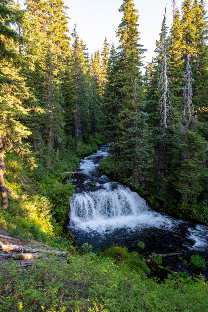
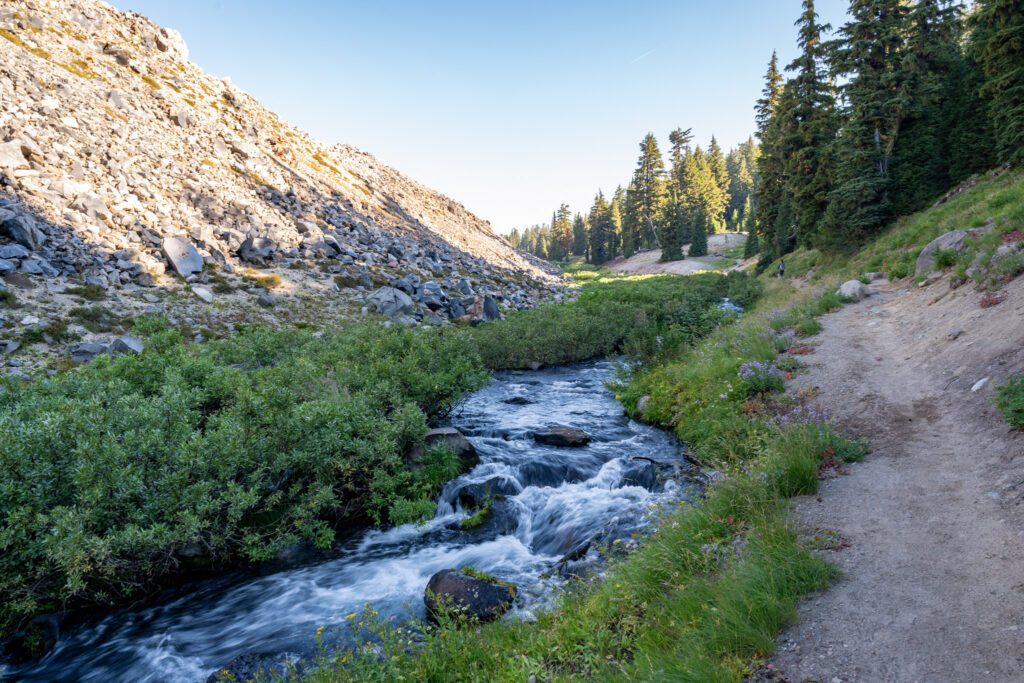
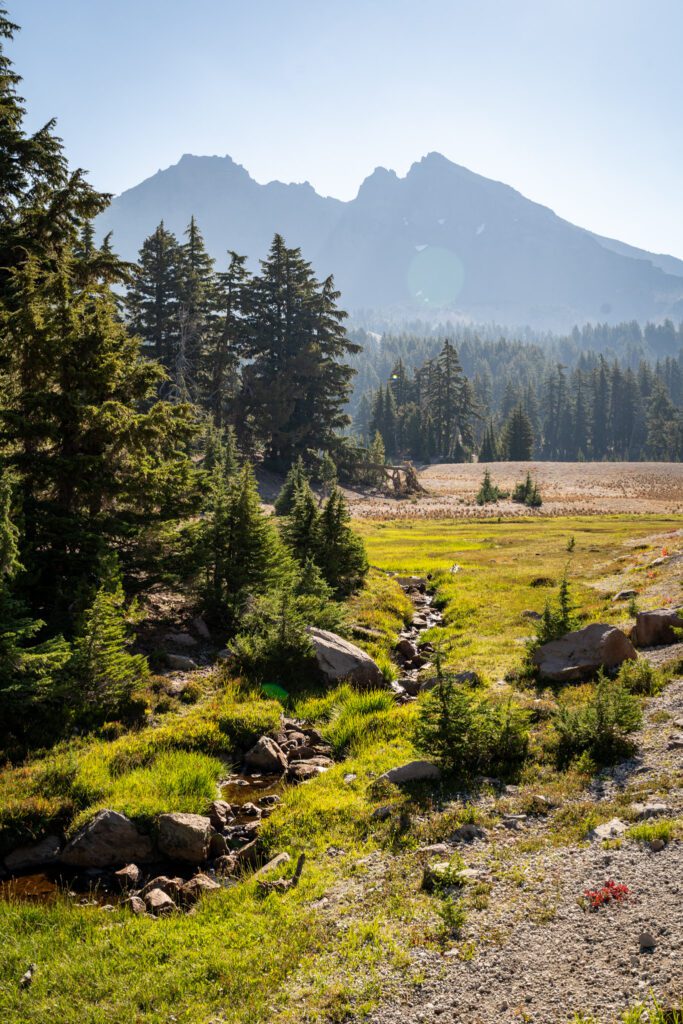
For the entirety of that four miles, you’ll follow both Green Lakes Trail #17 AND Fall Creek, which provides a lovely soundtrack for your walk in the woods.
Fall Creek starts out as a rushing river, with several nice waterfalls over the first two miles or so, and then slowly dissipates into a babbling brook the closer to the lakes you get.
There are a couple of crossings, which are covered by nice wooden bridges (that look relatively new – we don’t remember them from our first foray out here).
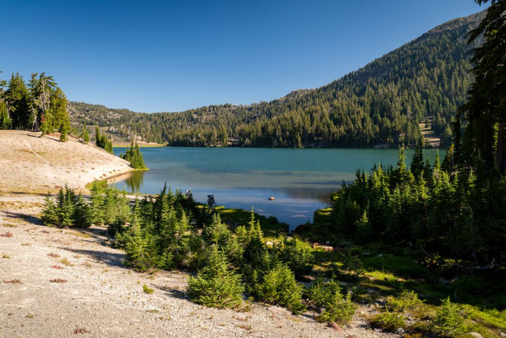
Once you reach the Green Lakes Basin, there is a network of trails criss-crossing all over, forming paths between different lakes.
The route we took – and we’d recommend it – is forming a lollipop and heading left down to the base of the South Sister, following the trail out to the little “day use” peninsula on the lake, and then returning via the trail to the smaller lake southeast of the big one (which has a great view of Broken Top).
There is another lake further north along the trail, but we read multiple reviews that said it’s not really worth going up there if you’re not going to camp there (where it’s a bit quieter), and since we were day hiking, we skipped it.
There are several options for extending your hike that leave from this basin and head out further into the Three Sisters Wilderness in various directions, which we’ll cover in the “Extending Your Hike” section below.
How Difficult is this Hike?
This hike is firmly in the moderate category, we think, and as long as you’re prepared with plenty of water and food, the right footwear, and sun protection, we don’t think you should be scared off by the 9-10 miles of hiking.
The elevation profile has you climbing roughly 265 feet per mile on the ascent, and we generally consider “difficult” to be anything over 500 feet of gain per mile.
The easy category starts at 200 or 250 feet per mile, so this is not far above that border between easy and moderate. Given the distance, though, we’d consider it firmly moderate (but not difficult).
Both times we’ve done this hike – five years apart – we’ve been surprised at how easy it feels.
Yes, we’re in good hiking shape, but there are plenty of hikes that kick our butts, and this is absolutely not one of them.
Getting a Central Cascades Wilderness Permit
For a few years now, many of the most popular hikes on national forest land near Bend require a Central Cascades Wilderness Permit to access between June 15th and October 15th.
Which, for most of the hikes out here at higher elevation, is the vast majority of the time that the trail is accessible.
We’re not going to talk about the merits of the permit system – obviously there was a need because traffic on these trails was overwhelming the ecosystem and infrastructure – so let’s focus on what this means for you, practically speaking.
Whether you are a day hiker or an overnight hiker, if you are hiking this trail between June 15th and October 15th, you need to have a Central Cascades Wilderness Permit available to display to rangers on the trail.
The process to get a permit is relatively straightforward, but it does require you to be available when they go on sale for popular summer weekends, otherwise they will sell out.
Here’s how the permit process works.
They release permits for the popular trailheads (including the Green Lakes / Soda Creek Trailhead, where you start this hike from) in two rolling windows; 10 days in advance of the date of your hike, and two days in advance of the date of your hike.
You can find the wilderness permits for day hikers here, and it’d be a good idea to read through this page with the most up-to-date information on release windows, etc etc.
Overnight permits can be reserved here (and they cannot be used for a day hike).
Permits are released at 7am PST on the dot for each window, and for popular time periods (like weekends in the summer), you’re going to want to snag one as close to that time as possible.
This is the part about permits like these that we don’t like, because not everyone has the time or flexibility to be on Recreation.gov at 7am sharp on a random day.
Permits cost $1 each. You need a permit for each person in your party (they can all be reserved by one person).
To hike this trail, you’re going to want a permit for the “Three Sisters – Green Lake/Soda Creek Trailhead” (that’s directly copied and pasted from Recreation.gov).
Getting to the Green Lakes Trailhead
The Green Lakes trailhead is located along the Cascade Lakes National Scenic Byway, a few miles west of the resort at Mount Bachelor.
If you’re coming from the center of Bend (call it somewhere around Old Mill or Downtown), it’s going to take you around 30-40 minutes.
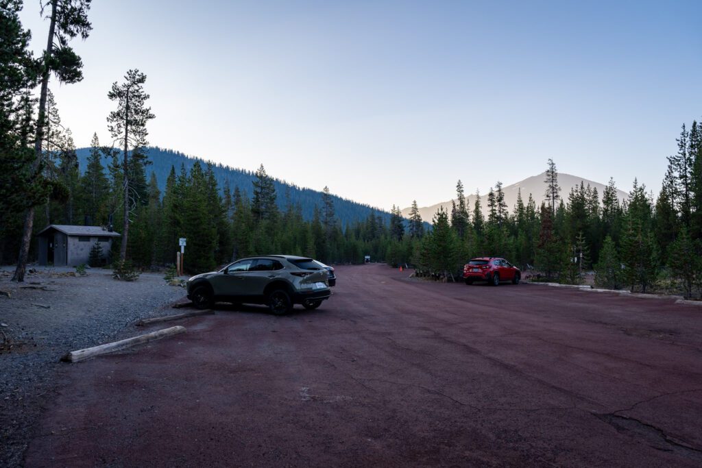
Parking at the Green Lakes Trailhead
There are a couple of lots available at the trailhead, with space for about 30-40 cars and a few trailers between the two of them.
There is also an overflow lot across the Cascade Lakes Scenic Byway with space for a few more cars.
The first time we did this hike was before the implementation of the permit system, and we got to the trailhead at 6:30am and found it almost full.
This time, we arrived at 7:00am and were the fourth car in the lot. By the time we left at around 11:30am, the first lot was full and the second lot was mostly full.
Our hypothesis is that, with the permit system’s limits on people on the trail, the pressure to start early to get a parking spot is lower.
In addition to the Central Cascades Wilderness Permit, you also need to have a parking pass to park at the trailhead.
This is National Forest land, which means either a Northwest Forest Pass (buy one here at REI) or an America the Beautiful Pass (the national parks pass that also covers all federal land – buy one here at REI) will do.
They do have a machine and fee envelopes at the trailhead, and cell service was surprisingly good when we were there, so you can also pay online.
As we were leaving, we saw a ranger checking for passes, and several cars did not have one displayed. Don’t forget!
There is a pit toilet at the trailhead. Hooray!
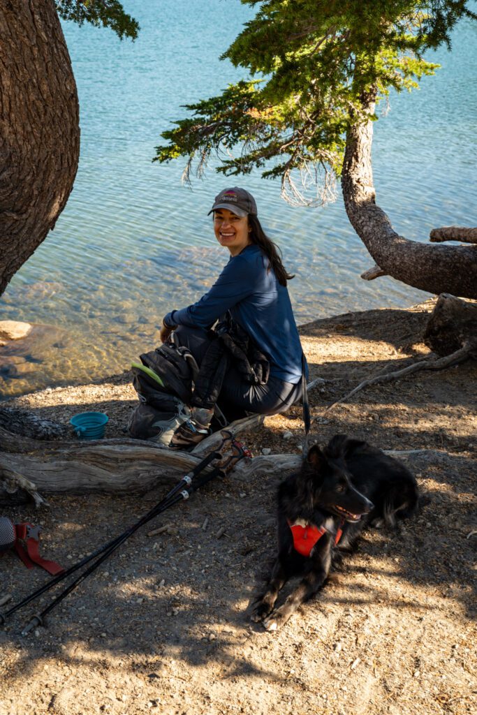
Are Dogs Allowed on the Green Lakes Trail?
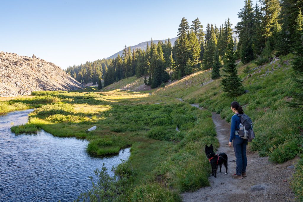
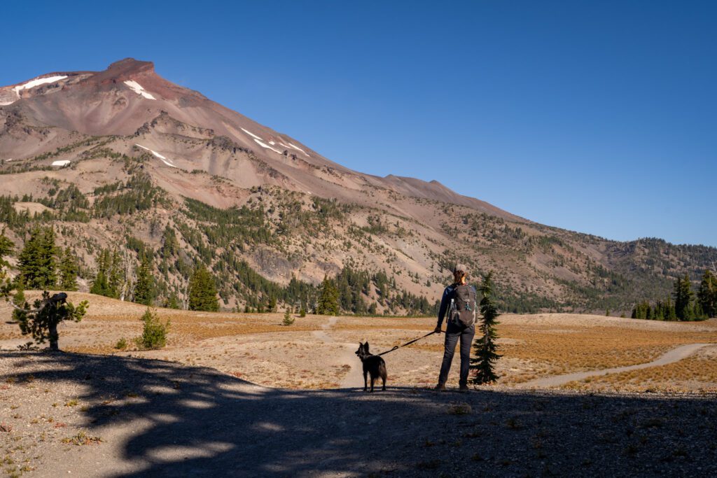
Yes, dogs are allowed on the Green Lakes Trail. Pictured above is Lupine on this very trail.
However, they must be on a leash on the trail between July 15th and September 15th (which is peak season).
Seriously. On a leash.
There are multiple signs posted at the trailhead reiterating that dogs need to be leashed during those two months, yet we still encountered multiple off-leash dogs on the trail up to the lake (at the lake is a murky gray area, we think).
This included one off-leash dog who the owner was leading by the collar, but still managed to drag the owner over to sniff Lupine’s butt.
Luckily, Lupine is friendly, but that owner was wildly unsuccessful if they were trying to keep their dog away from her in case she was reactive.
Yes, I’m sure your dog is a good dog. But even if they have perfect recall and will not run up and greet other people and dogs on the trail, that’s not the point.
The point is that not every human (or dog) wants another dog all up in their business, and while you or your dog might not be reactive, other people and dogs might be.
That and the fact that dogs can inadvertently destroy habitat for other plants or animals.
Bring your dog (provided they’re in good enough shape for a hike like this), we did, but they need to be on a leash for the entire hiking portion of this trail between July 15th and September 15th.
Sorry in advance if you’re the dog parent we mentioned above… but also, do better next time (just put them on a leash!).
The Green Lakes Trail: A Complete Trail Guide
We’re going to break this hike up into three distinct sections, and give you the mileage and elevation profile of each, and give you a written summary of that stretch of trail so that you can be prepared for what this trail is going to throw at you (again, it’s nothing too crazy!).
Those sections are:
- A Nice Stroll Through the Forest
- A Climb Through the Meadows
- Exploring the Green Lakes Basin
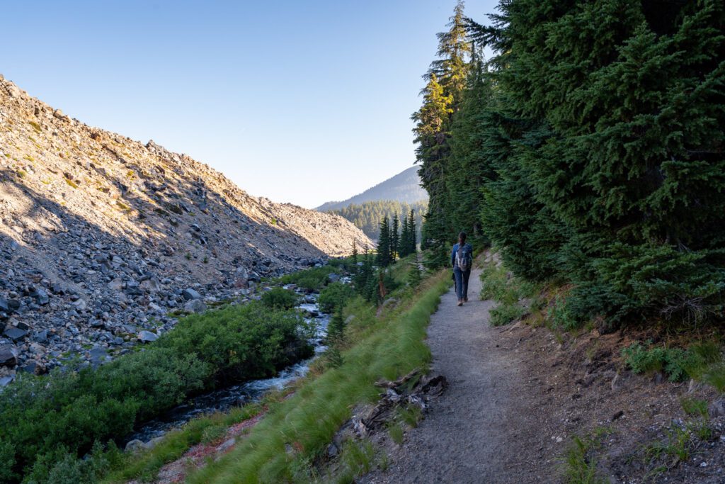
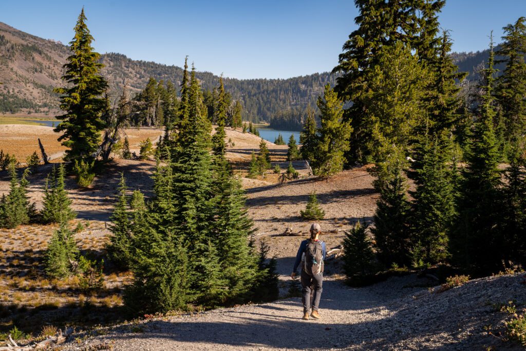
A Nice Stroll Through the Forest
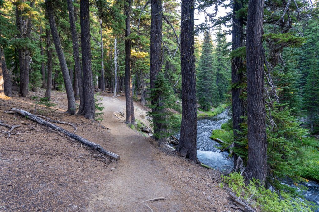
Length: 2.0 miles // Elevation Gained: 580 feet
The first section of this hike follows Fall Creek when it is at its highest flow, feeling more like a river than a creek for most of this section, with several relatively big waterfalls along the way.
You’ll start by crossing a wooden footbridge over the creek to get to the left bank, which is the side you’ll be on for the entirety of this first section.
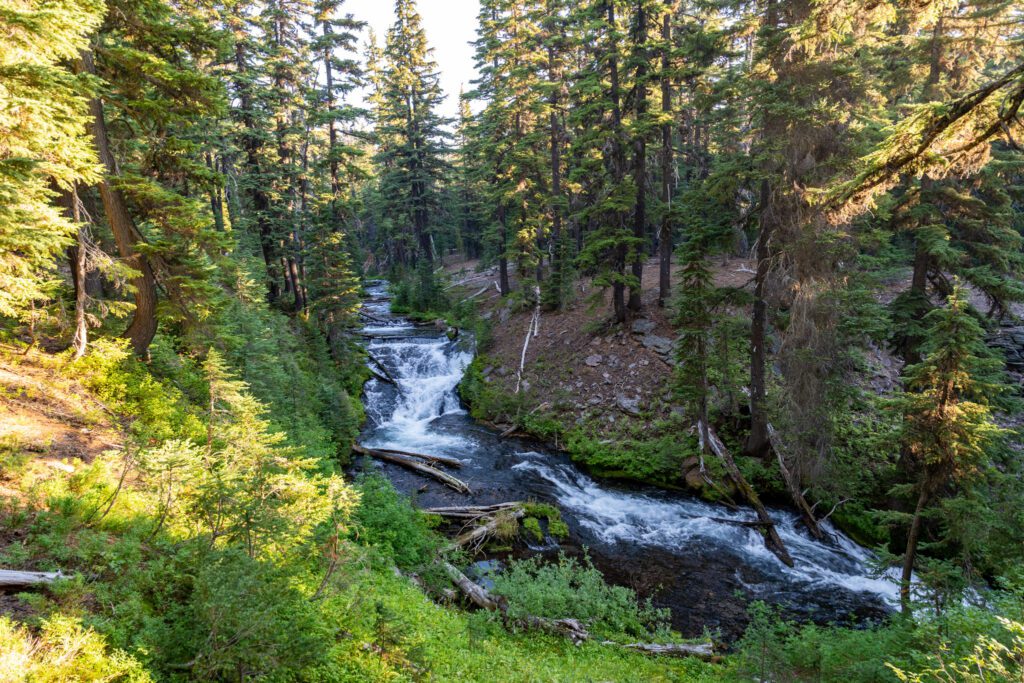
This first section of trail can be dry and dusty, especially in the height of summer.
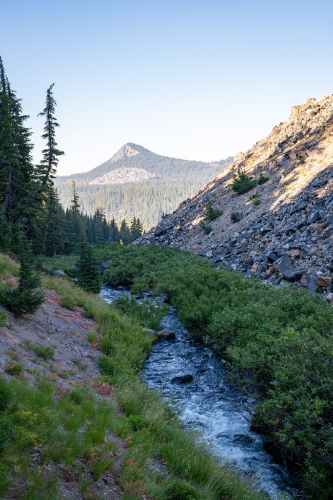
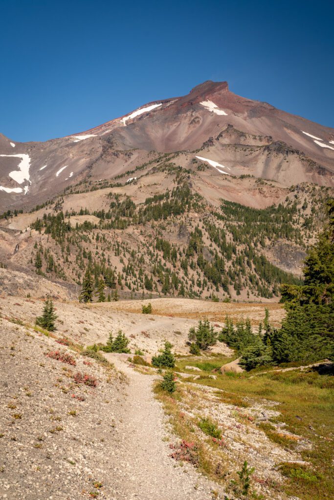
It’s a gentle climb featuring a couple of stunning views of the creek with the South Sister in the distance, or just some nice shots up the creek.
A Climb Through the Meadows
Length: 2.1 miles // Elevation Gained: 560 feet
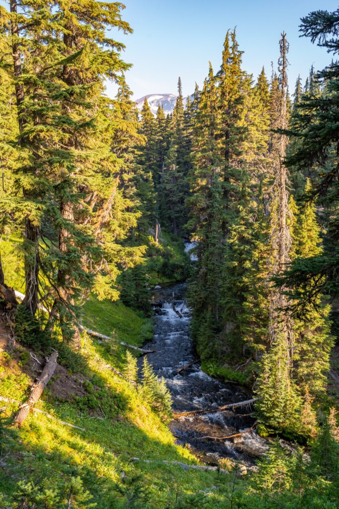
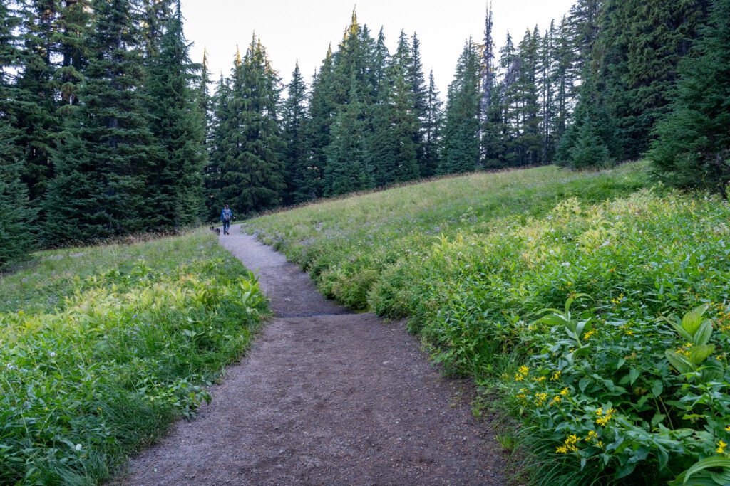
Once you pass the turnoff to Moraine Lake, you’ll start to see the terrain shift as you climb into the lush meadows that, depending on the time of year, may or may not be filled with wildflower blooms (usually in the earlier summer, like mid-July).
After a quarter of a mile, you’ll cross another sturdy wooden bridge, and almost immediately you’ll cross a second bridge.
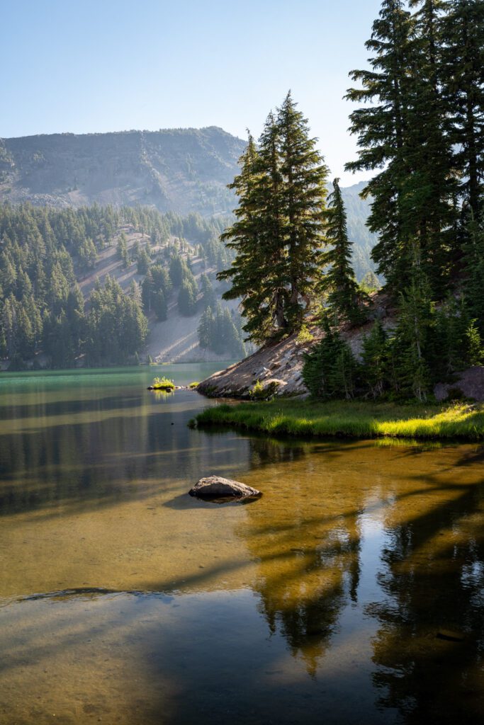
Another quarter of a mile brings you to a completely different landscape, where Fall Creek runs through the center of a gully.
On one side is you, the trail, and on the other side flanking the creek is a gigantic rock wall (I assume a lava flow?) with chunks of rocks that are shiny and reflecting sunlight – obsidian!
Quick, someone tell Jon Snow that we have plenty of dragonglass here in Oregon.
There are a couple of short, steep sections here including a set of three switchbacks, the only switchbacks on this hike. Again, nothing too crazy.
There are also a couple of water crossings during this section, and we ended up with wet boots/paws because there was only so much rock hopping we could do.
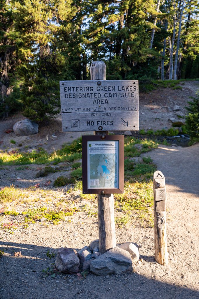
At a hair over four miles into your hike, you’ll arrive at a sign marking the boundary of the Green Lakes basin, with a handy map of overnight camping sites.
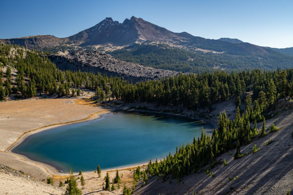
Exploring The Green Lakes Basin
Length: 1.2 mile // Elevation Gained: 100 feet
This is easily the least structured section of the hike because there is a whole network of trails through the basin that you find yourself in, and you can freestyle it and explore on your own without accumulating too much climbing or extra mileage.
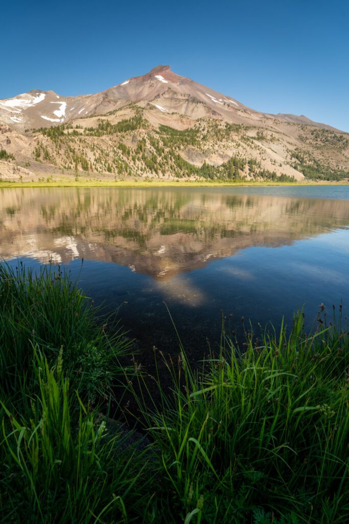
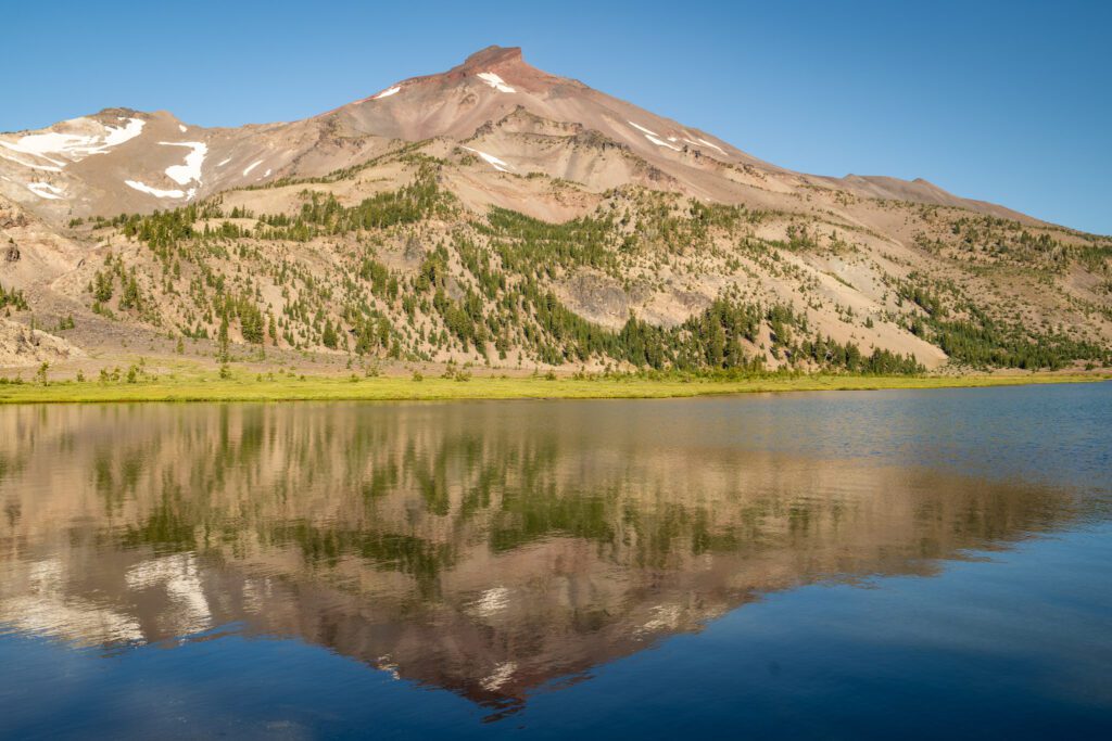
However, we were looking for three things out of our explorations of the basin on this last hike; the reflections of the South Sister in the lake, a nice spot for a snack and a rest, and some good views of Broken Top.
We ended up finding all three by making a nice little loop through the basin, starting by turning left at the first opportunity in the basin to head towards the South Sister and the southwestern edge of the big lake.
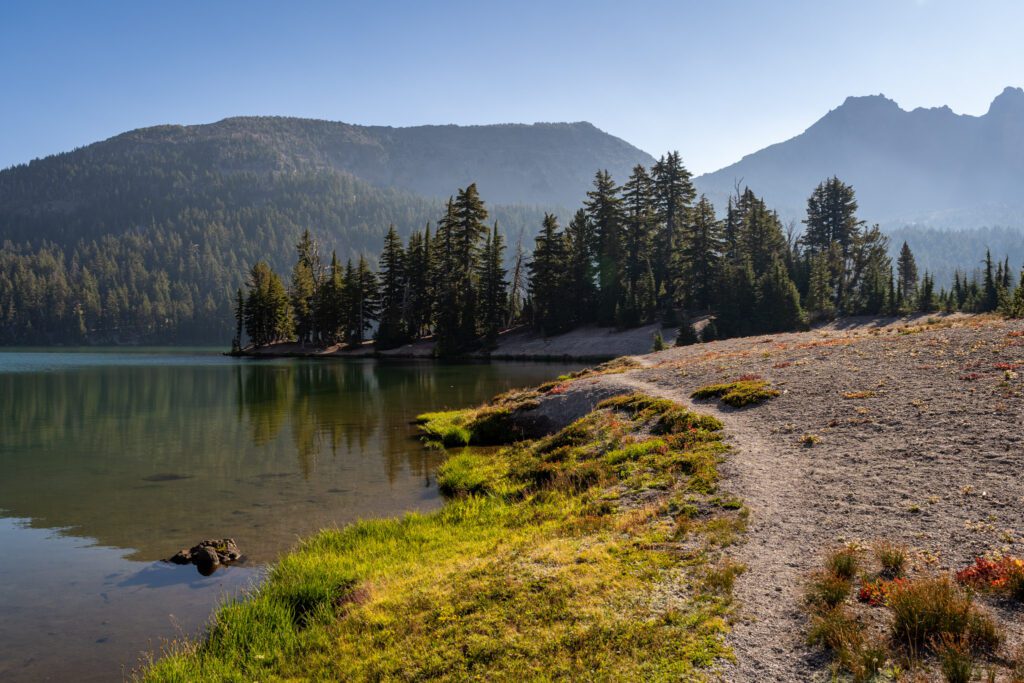
From there, we followed the trail along the south shore of the biggest lake out to a nice little peninsula that was marked “day use only” and had some good views of the South Sister and some good shade.
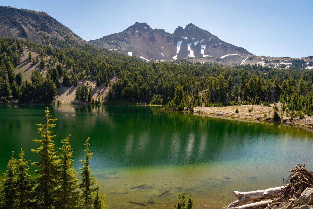
Then we followed the shoreline south and ventured to the smaller lake to the southeast of the big lake, where you’ll find our favorite views of Broken Top (and a reflection, if you’re lucky and/or time it right).
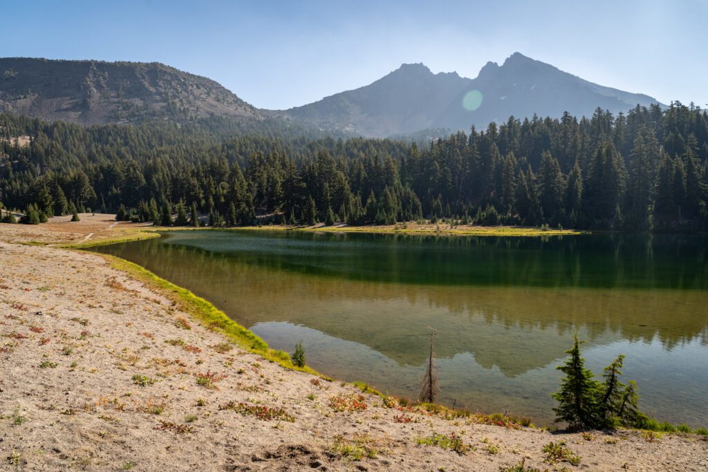
Put it together and you have a nice little loop to make this hike a lollipop and get some great views of both peaks and a good spot at the lake.
Options for Extending Your Hike
If you’re looking to go further (or you’re backpacking and looking for a good day hike to do from a home base near Green Lakes), there is a vast network of trails radiating out from the Green Lakes Basin and heading deeper into the Three Sisters Wilderness.
Moraine Lake (+3 miles, ~500 feet of climbing): We did the hike out to Moraine Lake on our previous trip to Bend, and Moraine Lake is gorgeous.
It sits at the base of the South Sister, and it’s crystal clear and a great place to go for a swim on a hot day.
You’d just turn right at the trail junction along the Green Lakes trail (assuming you’re doing it on your way back to the trailhead), and it adds three miles and around 500 feet of elevation.