Hiking the Dog Mountain Trail: A Complete Guide
The Dog Mountain trail on the Washington side of the Columbia River Gorge is often referenced as the best wildflower hike in the Pacific Northwest (and one of the best hikes in the Columbia River Gorge).
For that short stretch of late spring (usually sometime the month of May and early June is a good bet), the higher elevation hillsides are absolutely COVERED in yellow balsamroot and purple lupine, with a few splashes of red from paintbrush thrown in for good measure.
On our first trip to Dog Mountain a few years ago, we had a pretty common experience when it comes to this particular hike.
It was a beautiful bluebird day at the bottom, and as we finally approached the summit after A LOT of climbing, we started to notice the wind picking up.
By the time we reached the summit, it was full-on fogged in and you could not see a thing.
When we repeated this hike a few years later, it was a funny experience to get to do the exact same hike (albeit a slightly different route) and realize that you could see both Mount Hood and Mount St. Helens from the ridge at the end of the hike, neither of which were visible to us on that first trip.
However, one thing that doing this hike again recently made us remember is that this hike is a BRUTAL climb. It’s pretty clearly the toughest hike in the Gorge (of the more well-trafficked hikes, anyway), and even in peak hiking (or soccer) shape, this hike kicked our butts.
We’ll talk about whether this hike is “worth it” in the guide below, but it’s absolutely imperative that you go into this hike prepared for a big climb. That means sturdy footwear, plenty of water and snacks, and a base level of fitness.
In this guide, we’ll go through everything we think you need to know before you tackle the Dog Mountain Trail.
We’ll start with the basic trail details, cover some things to know before you get to the trailhead (like the somewhat confusing wildflower season permit system), and talk about getting to the trailhead.
Then, after a brief trail report based on our experiences on the trail (with plenty of pictures), you’ll be ready to get out there yourself!
Disclaimer: Some of the links in this post, like hotel links, are affiliate links, meaning at no additional cost to you, we make a little bit of money if you click through and book. That being said, we would never recommend something to you that we don’t stand behind 100%.
Hiking Dog Mountain: Trail Details
- Length: 6.3 miles
- Elevation Gain: 2,800 feet
- Trail Type: Out and Back
- Difficulty: Hard
- Pass Required? Northwest Forest Pass (or an America the Beautiful pass) + Trail System Permit (Weekends in Spring only)
- Dog-Friendly? Yes
- Trailhead Location: Dog Mountain Trailhead
The Route Options for Hiking Dog Mountain
This hike has a couple of route options to choose from. The two main options are to do it as a double-sided-lollipop or as a simple out-and-back.
“Double-sided-lollipop?” you say? What the heck is that?
Basically, one version of this hike takes you up to a trail junction, which gives you two options to get to the second trail junction, where you’ll hop on the Dog Mountain Trail to get up to the summit.
The main choice you’ll have to make has to do with the difficulty of the trail you take in the lollipop section of the hike.
Don’t forget, though, that this hike is difficult no matter which way you slice it.
There are two options waiting for you. If you’re facing the trail junction (so facing up the mountain), the option on the left is the difficult route, while the option on the right is the more gradual climb.
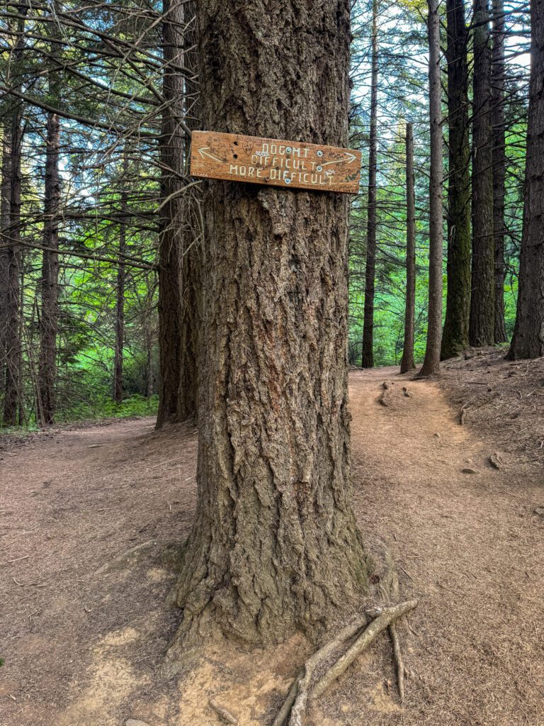
Either way, you’re climbing 1,200 feet to the second trail junction, where you’ll start the final push, but the harder trail covers that ground in roughly 1.2 miles, while the more gradual option does it in 1.5 miles.
As you might imagine, there are pros and cons for each route.
That may not sound like a huge difference, but it’s noticeable – the more gradual route has some flatter sections, while the more difficult route is straight up at what feels like a 30% grade the entire way.
The pros of the lollipop version of this hike are that you’ll find less people on that more difficult trail and that you get to see some slightly different scenery (though it’s mostly forest, so there’s not much to see).
The pros of the more gradual trail are the fact that there are a couple of nice viewpoints of the Gorge along the way, and it’s a much more manageable climb with some nice flatter sections (versus a never ending steep slope to trudge up).
For what it’s worth, if it were us and we were doing this hike for a third time, we’d do the lollipop version to get the climbing out of the way with minimal crowds along the way.
However, if it was our first time AND we were able to get an early start (before 8-9am), we’d recommend the out-and-back version, taking the more gradual route up between the two junctions where you’ll have the peek-a-boo views of the Gorge to keep you going.
The out-and-back version is what we’ll cover in the trail write up below (and, to be honest, there’s really not much to say about the more difficult climb because it’s truly just straight up through the forest).
How Difficult is the Dog Mountain Trail?
Having done this hike twice now over the past few years, I think we can fairly say that this is a trail with high highs and low lows.
3,000 feet of climbing in roughly three miles is no joke, and the only time this hike becomes worth it is when the balsamroot and lupine flowers are in full bloom for those few precious weeks in the spring (usually somewhere in mid-May).
We were lucky (and by lucky, I mean meticulously planned our hike to make sure we got there at precisely the right time) to catch the flowers in full bloom on our last trip up Dog Mountain, and it is, in fact, spectacular.
We got an early start on the trail (on the trail by 7:30am on a sunny Friday) and were basically the only people around for the first two thirds of the climb.
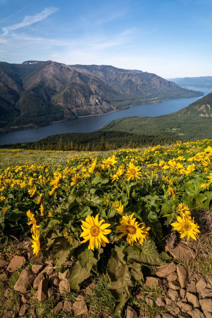
We emerged onto the hillside and climbed the ridge, and it was just a sea of blooming yellow flowers covering the hillsides, with nice views down both directions of the Gorge.
However, it’s also worth noting that we’ve had similar experiences on other trails in the Gorge that DID NOT require climbing 3,000 feet to reach them.
There is basically nothing to see other than forest on the way up to that final stretch (which might be a pro, because it is forested and has nice shade for a hot day).
Is Dog Mountain Worth the Effort?
It’s no secret (based on the hundreds of hikers on the trail each weekend) that the wildflowers at the top of the trail are incredible during that short spring window when they blanket the hillsides in yellow, purple, and red hues.
However, we would also point out that there are several hikes within 20-30 minutes of Dog Mountain that have equally incredible wildflower displays (Coyote Wall and Memaloose Hills) with a fraction of the effort that Dog Mountain requires.
Outside of wildflower season? We’re probably not doing Dog Mountain if we want good views of the Gorge, and we’d head to Angel’s Rest or Coyote Wall (can you tell we love Coyote Wall?) instead.
So if you’re looking for a relatively short hike with a tough climb AND it’s peak wildflower season, we’d say that it’s worth it. Outside of that window? We’d probably look elsewhere.
Getting to the Dog Mountain Trailhead
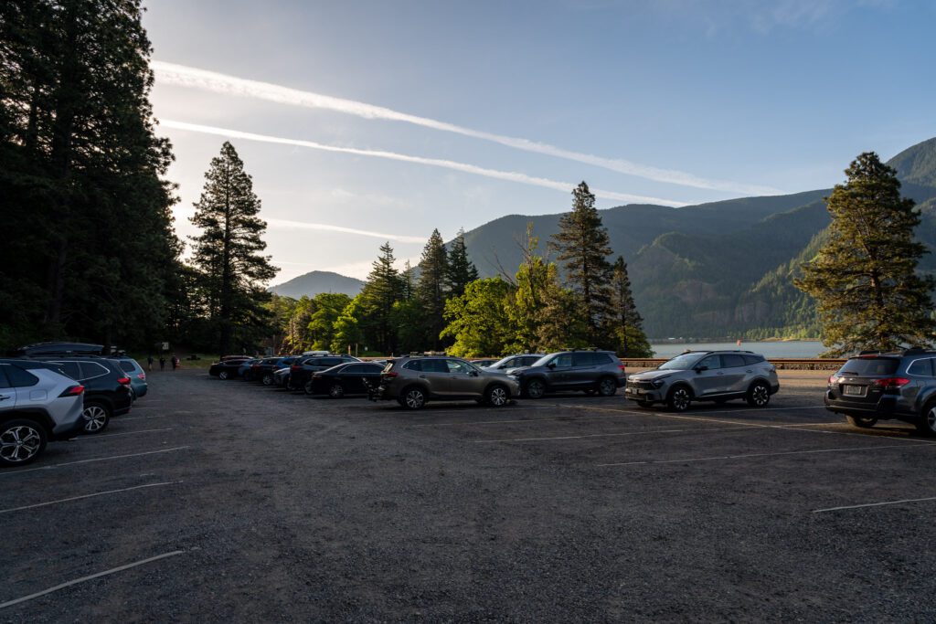
The trailhead for the hike to Dog Mountain is right off of Highway 14 on the Washington side of the Gorge just east of the small town of Stevenson (and about 15 miles west of the town of White Salmon).
It comes up quickly, and traffic is traveling at highway speeds in both directions, so be careful coming in and out of the parking lot.
If, like many people that hike this trail, you’re coming from the Portland Metro area, there are a couple route options to consider with tradeoffs for each.
The fastest – at least if you’re coming from the Oregon side of the Gorge – is to take I-84 out to the Bridge of the Gods, cross the river, and finish the short section on the other side to the trailhead.
However, this route incurs a $3 toll in each direction to cross the Bridge of the Gods, which can be paid with cash or card at the toll booth on the Oregon side of the bridge.
To avoid the toll, you’ll want to cross over to the Washington side on I-205 and hop on Highway 14, which is windier and slower (it adds somewhere between 5-10 minutes of drive time), but is a beautiful drive.
Things To Know Before You Hike Dog Mountain
By far the most important thing to know before you head out to Dog Mountain is that, during the spring wildflower season (late April through mid-June), there are two permits required to access the trailhead on weekends.
The first is the standard trailhead parking pass that you need at most trailheads in Washington and Oregon.
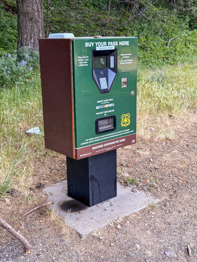
In this case, the trail is on National Forest land, so a Northwest Forest Pass (or an America the Beautiful pass, which covers all federal recreation areas) will work.
There is an electronic pay station at the trailhead to buy a day pass (they cost $5) if you don’t have (or want) an annual pass.
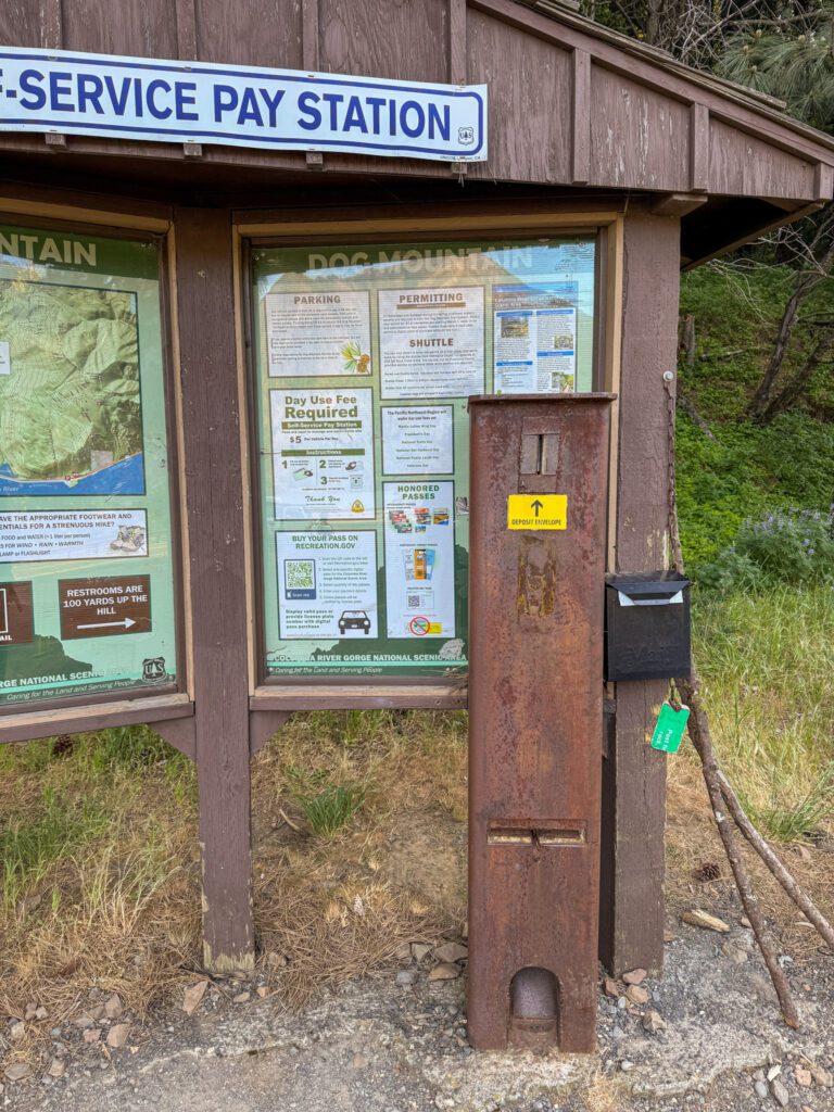
The second is the “Trail System Permit” that was put in place a few years ago to control traffic to this extremely popular trail.
Basically, if you’re coming on a weekend during the peak wildflower bloom (you can find exact dates here), you need to book a permit ahead of time.
Permits go on sale on March 15th for the season, and then they release an additional cache of permits four days prior to the date.
More information on this somewhat confusing system here. Here’s the short version, at least as we understand it:
- If you’re coming on a weekday, you DO NOT need a “Trail System Permit” (with the exception of Memorial Day), but you DO still need the standard parking pass (either a Northwest Forest Pass or America the Beautiful Pass will work).
- If you’re coming on a weekend AND you’re in that wildflower window, you need both a “Trail System Permit” AND a standard parking pass (this also includes the Monday of Memorial Day Weekend).
One way to bypass the permit system altogether is to take the free shuttle operated by CAT (Columbia Area Transit), which runs on weekends during the permit period.
It allows you to park at the Skamania County Fairgrounds (here on Google Maps) and hop on the shuttle, which takes you to the trailhead in roughly 20 minutes.
Using the shuttle system is a great way to not have to deal with the parking situation, and is a way to hit the trail if you missed the permit window – every rider gets a stamp that serves as a permit for the day.
You can find more information on riding the shuttle, including timetables and other FAQs, here.
The Dog Mountain Trail: A Complete Trail Guide
Now, we’ll take you through exactly what to expect on the Dog Mountain Trail so that you’re prepared for the hike and can hit the trail confidently and safely.
This trail guide is based on our own personal experience hiking this trail.
For transparency’s sake, we’ve hiked this trail twice now – both right around the peak of wildflowers.
Crucially, we’ve done both routes, so we have a good understanding of the positives and negatives of each.
We’re going to take you through the out-and-back version of this hike, which is the way we did it on our first trip, and is our recommendation if you’re getting an early start (and it’s your first time).
From the Trailhead to First Junction
Length: 0.5 miles // Elevation Gained: 600 feet
From the parking lot, you’ll climb a short section up to the pit toilets (bring your own toilet paper!), where the hike starts in earnest.
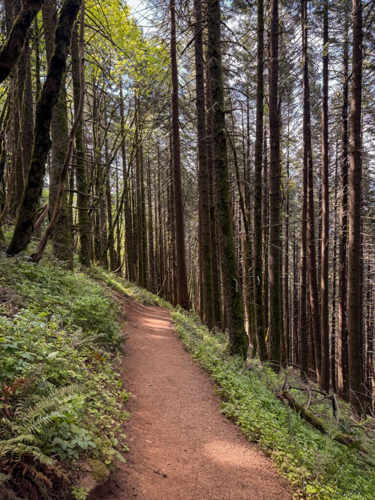
As we already mentioned here, there’s really not that much to say about this part of the climb.
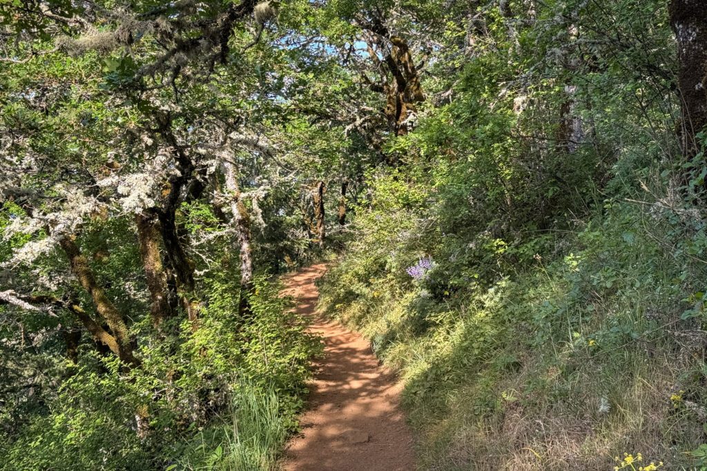
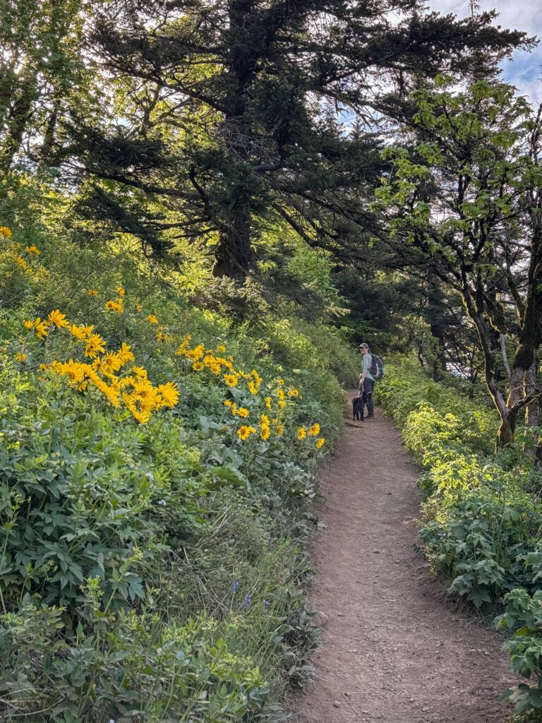
This hike starts with a set of forested switchbacks that climb a half mile up to the first trail junction. There aren’t many views, there aren’t any notable landscape elements, it’s just a quick climb to get your blood pumping.
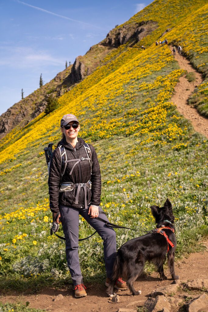
The one thing we will say is that this stretch was COVERED with poison oak on our latest hike, and we had to make sure to keep our dog Lupine firmly in the middle of the trail to avoid it.
At the end of this section, you’ll reach a trail junction that forms a “Y.”
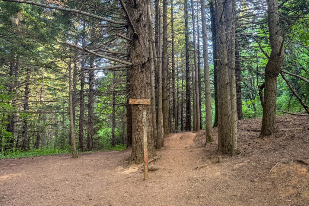
To the left is the more difficult route – the one you would take if you wanted to make this more of a lollipop – and to the right is the slightly more manageable route that has a few nice views along the way.
If you’re taking our advice and doing the out-and-back version, you’ll head right here and continue the climb.
First Junction to Second Junction
Length: 1.5 miles // Elevation Gained: 1,250 feet
After you veer right to take the slightly easier trail, the climbing continues.
You’ll be alternating between steep sections and more mellow climbs on the way to the first main viewpoint at 1.7 miles into the hike (~1.2 miles into this section).
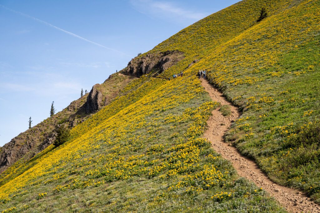
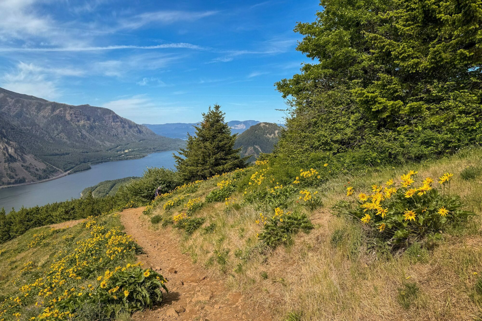
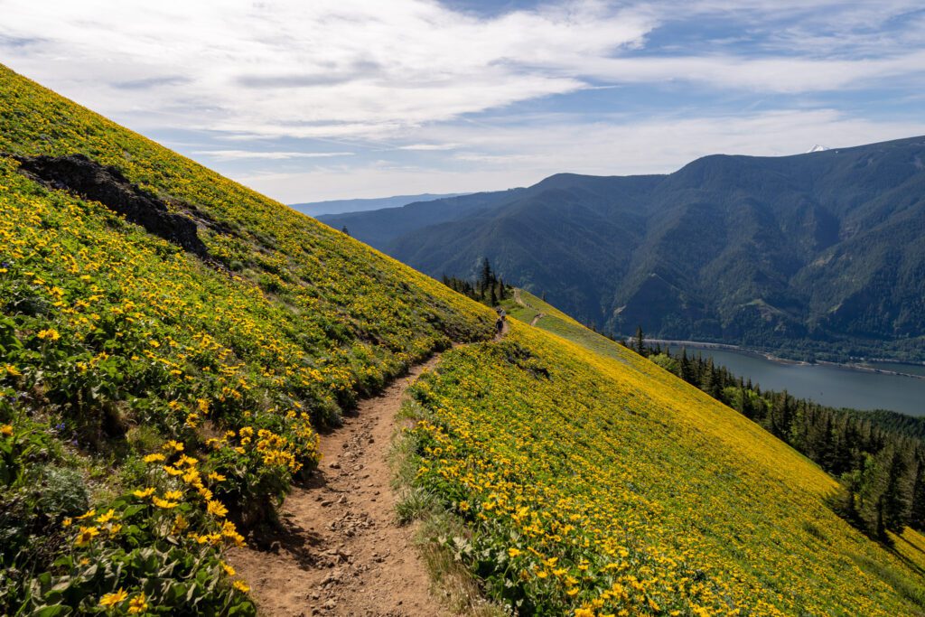
As you approach, you’ll likely start to see some evidence of wildflowers sprouting in sunny spots along the trail (assuming you’re here during the spring), and emerging onto this exposed little ridge is the first real display of balsamroot and lupine that you’ll get (don’t worry, plenty more to come!).
There are some nice views of the Gorge, and it’s a good place to take a breather and have some water and a snack before the climb resumes.
From there, it’s another 0.4 miles of relatively gentle climbing to reach the second junction, where the two trails meet again and form one trail to the peak.
The Final Ascent
Length: 0.9 miles // Elevation Gained: 900 feet
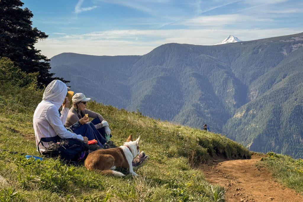
This section of the hike includes the climb from the trail junction up to Puppy Dog Lookout (where there used to be a fire lookout), and then onwards to the top of the mountain, where you’ll find people lounging and resting, taking in the views before they tackle the downhill portion of the hike.
The first stretch as you pass the second trail junction is another brutal section of climbing that feels like it’s straight up.
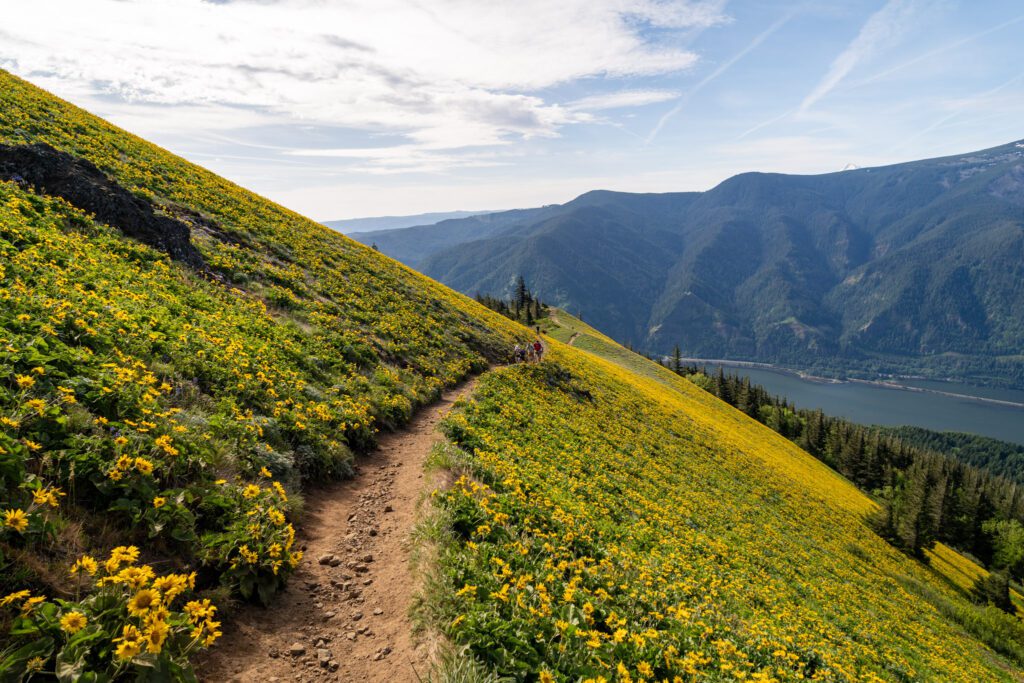
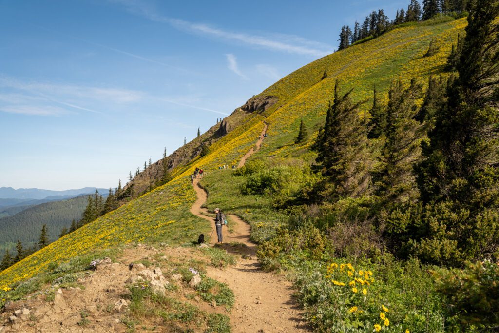
There are a couple of steep switchbacks, and then you will climb along a trail that brings you to the base of the slopes of the mountain that are covered in balsamroot, which will immediately make all the climbing you’ve done to this point worth it.
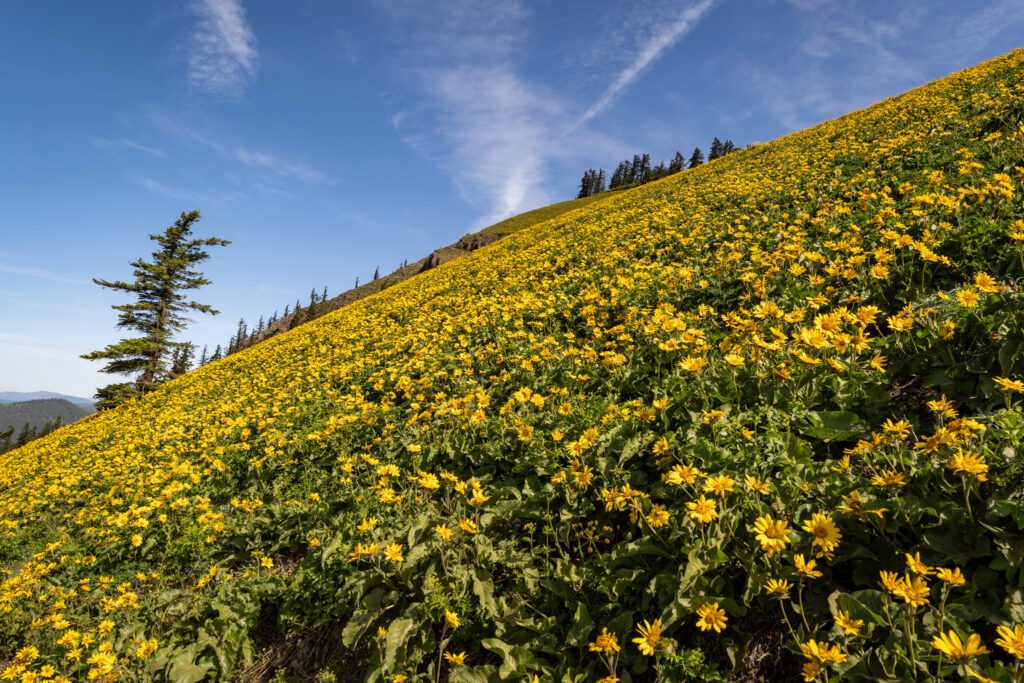
You’ll emerge from the forest onto the exposed hillside, and off to your left is the wildflower display blanketing the south-facing slope in the brilliant yellow of peak balsamroot bloom, and off to your right are some nice views of the Gorge.
Eventually, the trail levels out and brings you to Puppy Dog Lookout.
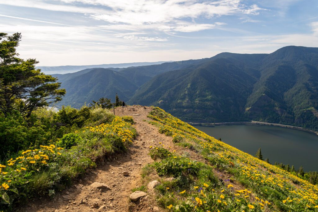
This is, perhaps, the single best view of the hike (though there are some nice views from the ridgeline above you), and is another good stopping point.
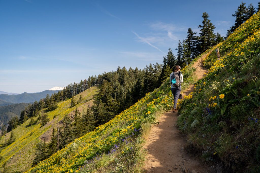
From here, you’ve done the hardest part of the climb and all that’s left is traversing the ridge above Puppy Dog Lookout with amazing views of the Gorge with wildflowers in the foreground and the tip of Mount Hood peeking out on the other side of the Gorge to keep you going.
You’ll turn the corner, see Mount St Helens, and almost immediately reach the summit.
Well, technically the place where almost everyone stops is NOT the summit, but it’s not really worth going up another 0.1 miles to the summit because this is as good as it gets.