Hiking in Oregon: A Complete Guide for First Timers
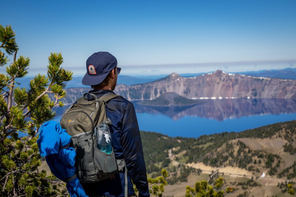
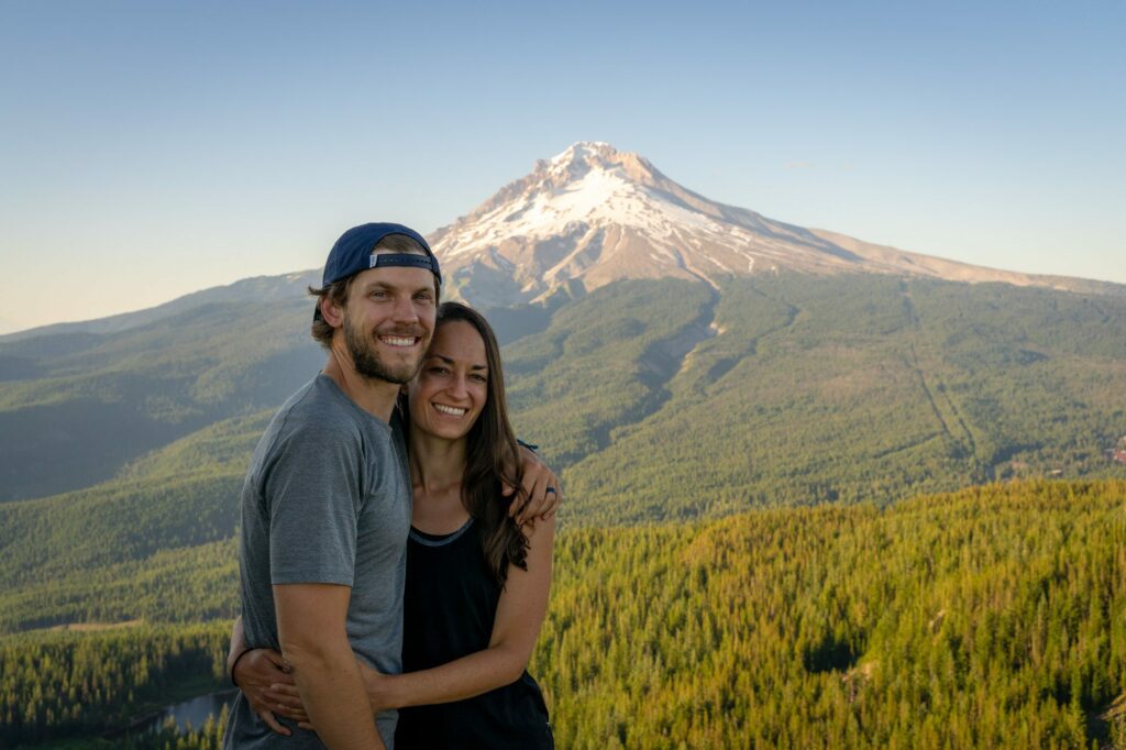
We fell in love with the state of Oregon when, in mid-2020, we decided to try out living in our minivan – Homer the Honda Odyssey – and spent six weeks on an incredible road trip that took us all over the state, from the Oregon Coast, to Bend and Crater Lake National Park, and, of course, to Portland, which is the city we now call home.
Over the course of that road trip, we were living our best lives – hiking 7-10 miles a day, spending all day outside, and eating meals cooked over a camp stove.
Fast forward a few years, and we now have lived in Portland for several years and have spent even more time diving deeper into all of the incredible natural beauty that Oregon has to offer, from the towering peaks of the Cascades, to the sweeping views of the coast, to the mind-bending landscapes of the High Desert in Central Oregon.
One of the countless reasons that we love living in Portland is because it puts many of the incredible hikes on the list below within a few hours of our front door.
From towering waterfalls to steep rocky ascents to peaks and viewpoints, Oregon truly has it all when it comes to stunning landscapes.
The truth is that, despite our best efforts, there are just too many great hikes here to consolidate them into a tidy list.
However, after five straight summers of spending as much time as we can exploring various trails around Oregon, we’ve done our best to put together a list that reflects the plethora of natural beauty that exists in this slice of the world.
In this guide, we’re going to give you our favorite hikes in Oregon based on our own personal experience exploring the state over the years.
In this guide here’s what we’re going to cover:
- A few important logistics to keep in mind as you’re planning, like the different passes you might need and seasonal considerations to know before you go.
- Our favorite hikes in the state, including all the relevant details and a trail description with things to know (and links to deeper guides for some trails).
- A handy map of the trailheads for the hikes in this guide to help you visualize how it all fits together.
Throughout the guide, we’ll share our favorite hikes, viewpoints, waterfalls, and more based on our trips to help you plan your Oregon hiking adventures.
Sound good to you? Let’s get into it.
P.S. We’re certain that there are plenty of other great hikes that should be on this list, we just haven’t gotten around to them yet! If you have hikes that you love that aren’t on this list, we’d like to hear them so we can add them to our list for the future!
Disclaimer: Some of the links in this post, like hotel links, are affiliate links, meaning at no additional cost to you, we make a little bit of money if you click through and book. That being said, we would never recommend something to you that we don’t stand behind 100%.
Our 13 Favorite Hikes in Oregon (A Local’s Guide)
Now, onwards (and probably upwards) to the reason you’ve read this far – the list of our favorite hikes.
Like we mentioned above, we’ve personally done all the hikes in this section of the guide, which means we have some specific tips and pointers for some of them. Like which direction to hike in, or how to get a parking spot.
There are so many great hikes in the state that we actually couldn’t fit all of the trails we had on our shortlist into the main guide, so we have an honorable mention section at the end with a brief description of a few more hikes that are definitely worth your time.
In the list below, you’ll find hikes in state parks, national parks, and on national forest land. The parking pass situation can be confusing!
Which is why for each hike, we’ve included a bullet for which parking pass you’ll need to display at the trailhead.
Here’s a high-level summary of the passes you might need.
A Northwest Forest Pass covers all of the trailheads on national forest land in both Oregon and Washington State, and is essentially a must-have for hikers in either state because the vast majority of hikes are on federal land.
However, the America the Beautiful Pass (colloquially, the “national parks pass”) covers all federal land in the country, including national forests.
Basically, if you’re planning to visit more than two national parks in the next 12 months, buy an America the Beautiful Pass (you can get it online at REI).
If not, just get a Northwest Forest Pass (also available at REI).
There are sometimes day pass envelopes at trailheads, but you should know that the infrastructure on national forest lands is much less reliable (and you’ll need $5 cash in most cases).
There are also a couple of hikes on this list that are on land that is operated by Oregon State Parks.
There is an annual Oregon State Parks Pass that is a great deal for Oregon residents, otherwise you can pay the entrance fee when you enter the park. More information here.
We’re going to organize this list by our personal preference, which is extremely subjective.
This list is NOT an exhaustive list of every single hike in Oregon, but is a list of great hikes that we personally have done and enjoyed, and think you probably will too.
If you have a hike that you love and think should be on this list, reach out or leave us a comment below! We’d love to hear from you and find a new hike to add to our list!
You might notice that we don’t have a single hike that is in the Portland city limits on this list, and though we tried to come up with a justification for including something like the hike to Pittock Mansion or the 4T Trail, we just couldn’t justify it.
If you’re looking for a hike in the city, head over to read our guide to hiking in Portland for our favorites.
Have another question? Don’t hesitate to get in touch, or leave us a comment below. We’re more than happy to chat!
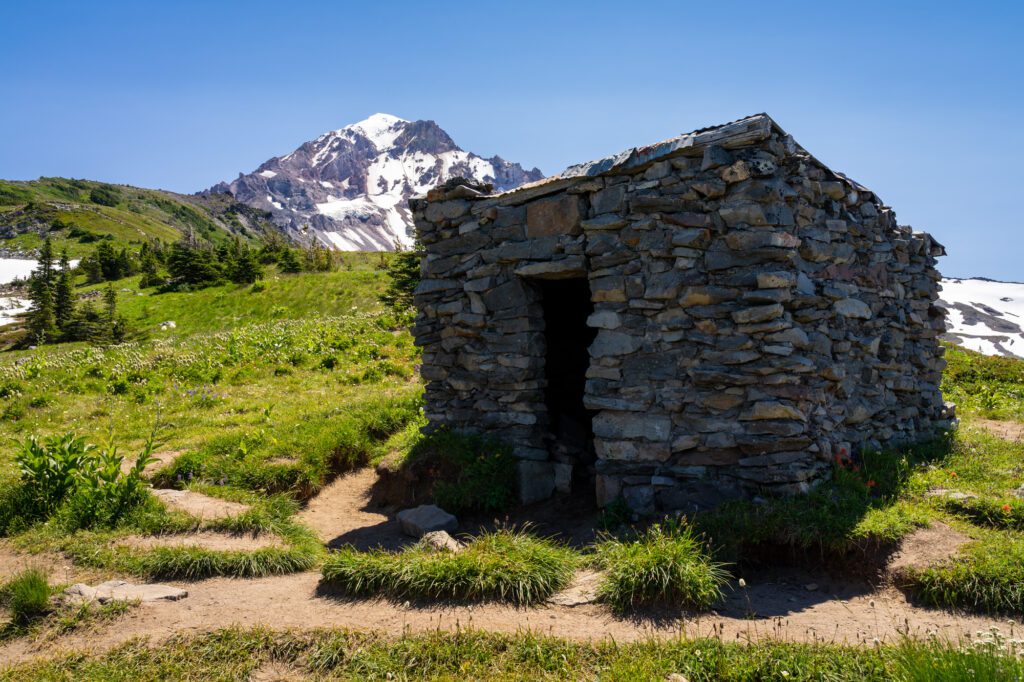
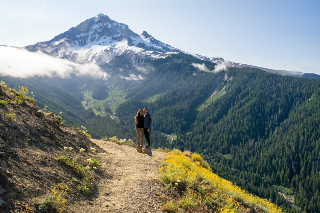
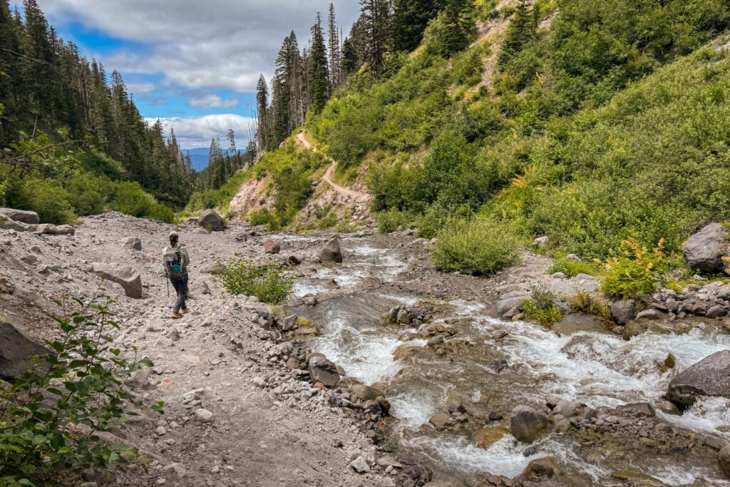
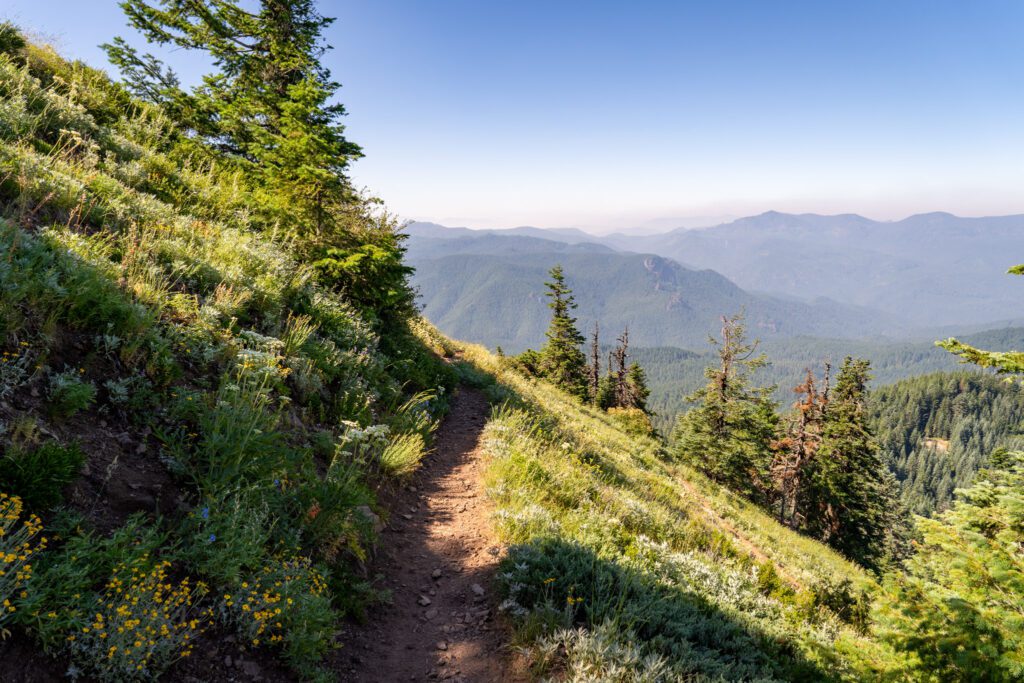
The McNeil Point Trail (Mount Hood)
- Length: 11.2 miles
- Elevation Gain: 3,100 feet
- Trail Type: Out and Back
- Season: Summer – Fall (Mid July – October)
- Difficulty: (Very) Hard
- Pass Required? Northwest Forest Pass
- Dog-Friendly? Yes, on a leash
- Trailhead Location: Top Spur Trailhead
This might be our top pick for the single best hike in Oregon, but there are so many amazing hikes to choose from that it’s hard to choose just one.
The views of Mount Hood from this trail are nothing short of spectacular, but you’re going to have to work hard to earn them.
When we hiked this trail, we were on our Oregon road trip, which had us hiking 7-10 miles almost every single day. We were in the best shape of our lives.
This trail kicked our butts and had us walking funny for several days afterwards. It’s a strenuous hike. Don’t underestimate it.
That being said, we’d do it again in a heartbeat. Especially when the wildflowers in the meadows at the top are in full bloom.
The trail is a lollipop – you’ll climb up to a junction where you start a mini loop near the top.
The views come fast and furious from beginning to end, starting with our favorite view of Mount Hood from Bald Mountain about a mile into the hike.
The trail climbs somewhat gradually (but for a long, long time) up to a junction – going right takes you up a trail that is more of a scramble than a hike, and going left takes you on a longer meander through meadows of wildflowers with views of Mount St. Helens and Mount Adams to the north on a clear day.
There are two main routes to get up to McNeil Point.
First is the out and back version of this hike that avoids the somewhat scary scramble trail.
Second is the lollipop version that goes up the scramble trail (we wouldn’t come down that trail, but that’s just us) and down through the wildflower meadows to complete the lollipop counter clockwise.
We highly recommend the out and back version, because we want no part of that scramble section (and we’re experienced hikers).
The out and back version of this hike that we’re referring to here avoids the cut off completely, veering left at the junction and following the Timberline Trail (#600) for the majority of the hike until it meets the McNeil Point Trail (#600M) for the final ascent.
There are some truly excellent views along that longer section of the lollipop.
While this cuts out the somewhat technical scramble, it does add roughly 1.5 miles to the distance.
If you are set on doing the version that includes a scramble, we’d go up the scramble (definitely don’t go down that way) and down the meander, which will have you facing the great views and avoiding trying to scramble down the mountain.
It is worth noting that, if you are planning to bring your dog, you DEFINITELY should do the out and back version of the hike and skip the scramble, which is not made for dogs.
At the top, there’s an old stone structure that was built by the Civilian Conservation Corps during the depression, the same group that built basically all of the infrastructure in places like Zion National Park.
It’s a nice refuge from the wind, which is sure to be howling.
Bring plenty of food and water on this hike. It’s our favorite of the many amazing hikes at Mount Hood.
We have an entire guide dedicated to hiking the McNeil Point Trail – including logistics like which route to take, and a complete trail guide – which you should read for more detail.
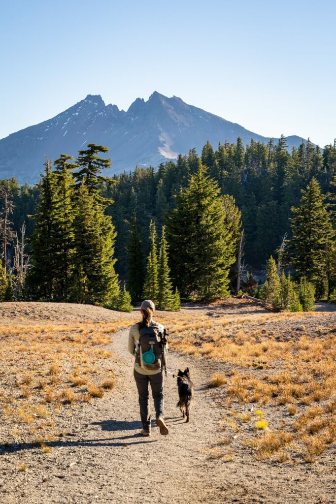
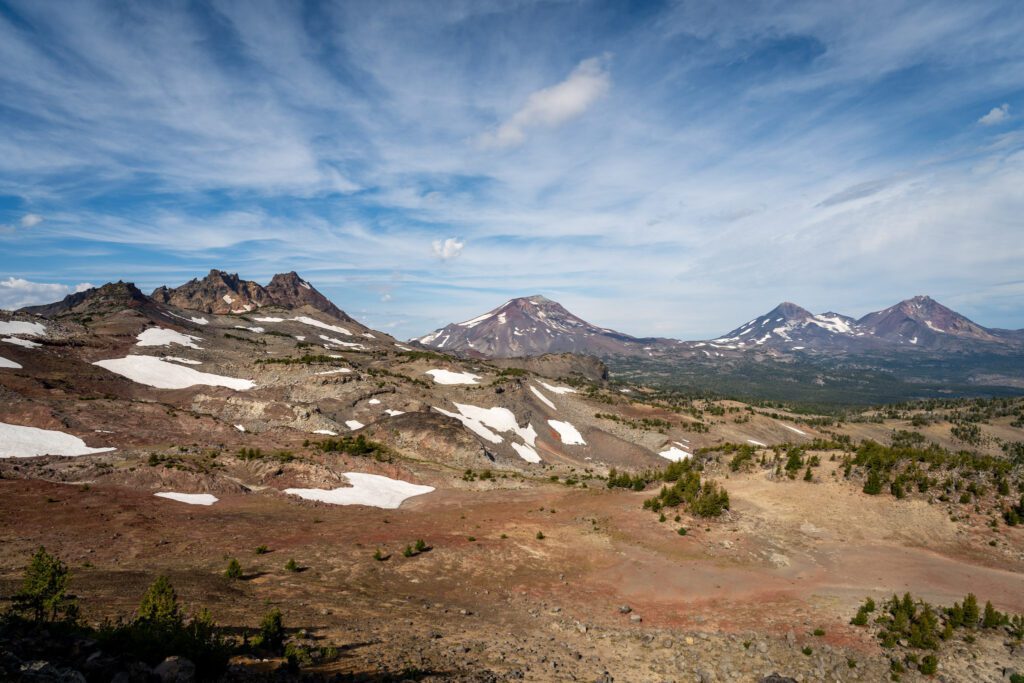
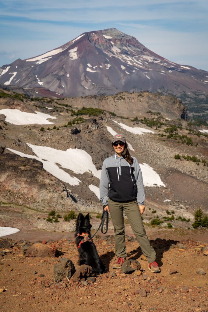
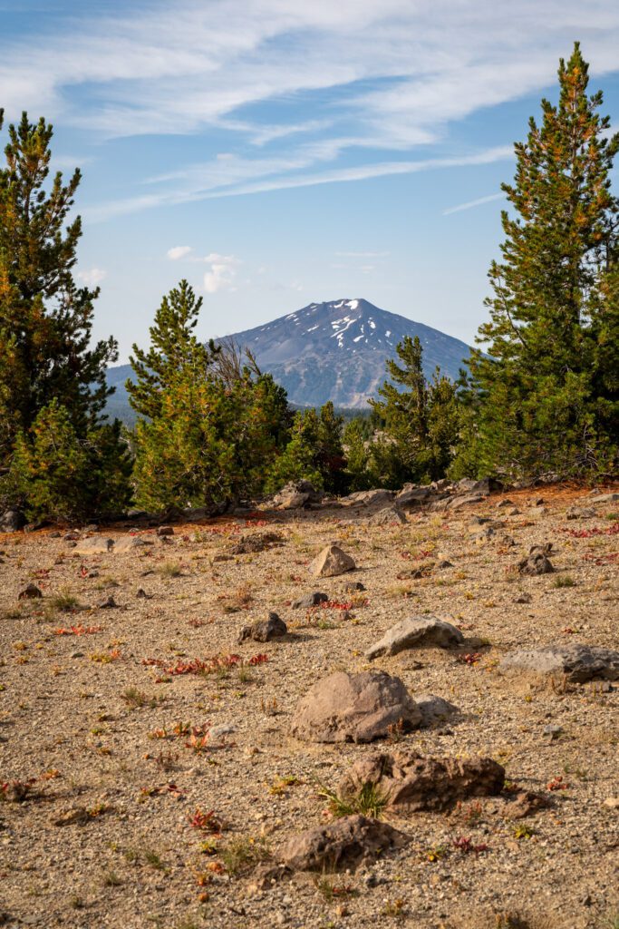
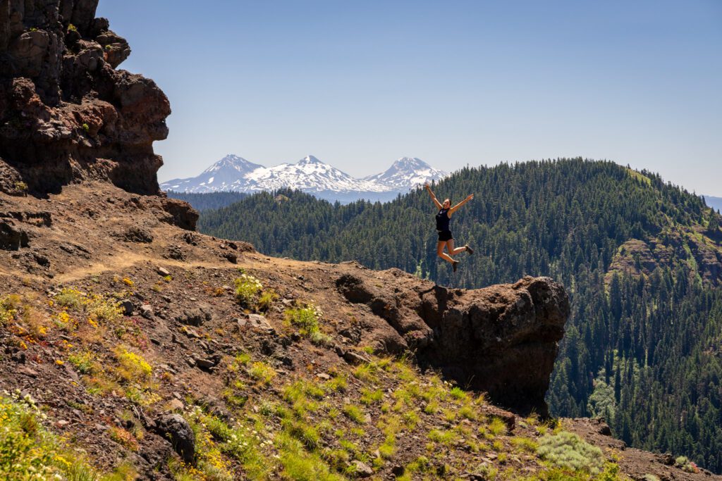
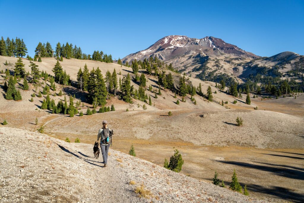
The Tam McArthur Rim Trail to Broken Hand (Three Sisters Wilderness)
- Length: 9.5 miles
- Elevation Gain: 1,900 feet
- Trail Type: Out and Back
- Season: Summer – Early Fall (July – September)
- Difficulty: Moderate
- Pass Required? NW Forest Pass (or America the Beautiful Pass)
- Dog-Friendly? Yes, on a leash
- Trailhead Location: Tam McArthur Rim Trailhead
This is a hike that we were very, very close to not doing on a rainy morning in Bend that came 48 hours after a bout of food poisoning that had Matt down for the count.
We were sitting at the gas station pumping gas and decided we would drive out to Sisters (which was halfway to the trailhead from Bend), stop for coffee (at Sisters Coffee, of course), and make our final decision.
There are very few times in my life that I can think of where, after the fact, I have said “I really wish we hadn’t done that hike today” even if the hike was brutal in the moment.
On the contrary, I can think of quite a few times where we skipped a hike for one reason or another and ended up regretting it.
Obviously, based on the pictures you’ll see in this section, we decided to do it and let me tell you, this hike is a STUNNER.
I truly cannot believe that I haven’t seen this hike mentioned basically anywhere on the internet as a must-do hike near Bend.
The end of this hike is full of nonstop borderline unbelievable views of the Three Sisters, Broken Top, and Mount Bachelor.
This trail is a fairly straightforward out and back, with only a couple of things to keep in mind along the way.
You’ll start with a climb through the forest to get up on the rim, where you’ll have great views out to the north, and then you meander through a high alpine landscape to the base of Broken Hand with excellent views of the surrounding peaks to keep you company.
The big thing to know is that the second half of this hike is along an unmaintained trail.
However, despite being unsure of what we’d find on that portion of the trail, we were pleasantly surprised to find an extremely well-worn path and only minimal routefinding required near Broken Hand (a rock formation across a valley from Broken Top, the more famous mountain peak).
At first glance, the stats for this hike put it on the easy side of moderate, climbing just 1,800 feet over the 4.8 mile ascent. That puts you at a rate of climbing of 375 feet per mile (for us, easy is 250-300 feet of climbing per mile).
However, it’s worth noting that the vast majority of that climbing happens in the first two miles, climbing 1,200 feet in roughly two miles.
For those of you who aren’t math wizards, that’s a rate of 600 feet per mile, and anything over 500 is in the “difficult” category for us.
Taken together, that condensed climb, the length, and the fact that this trail is extremely exposed except for the first mile and a half put this trail firmly in the “moderate” category.
All that being said, we think the payoff here still punches above its weight considering the effort required.
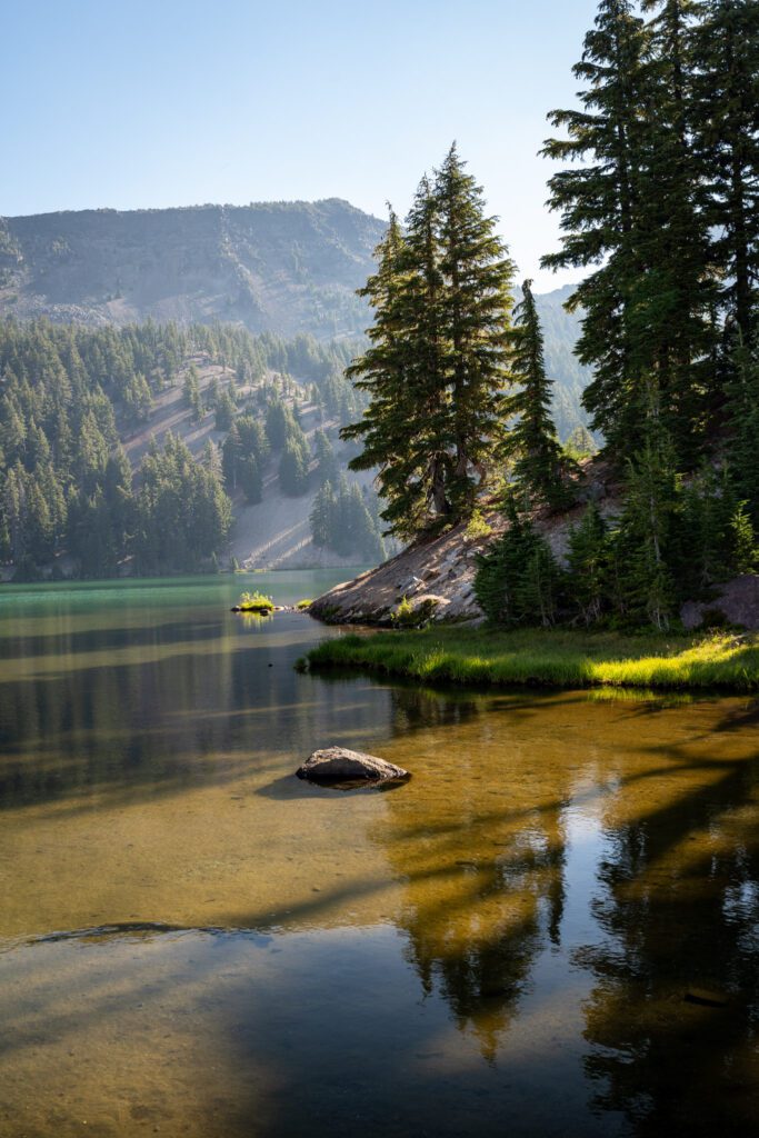
If you have gas in the tank, there’s a reasonable extension to this hike that takes you to one of the most stunning places in Oregon; No Name Lake.
No Name Lake is a blue-green alpine lake that sits at the base of Broken Top, and it’s difficult to access from the other side (on the Cascade Lakes National Scenic Byway) because it requires either a 12+ mile hike (with ~2,800 feet of climbing) or an extremely rugged vehicle and willingness to drive a gnarly rutted forest road.
Lucky for you, if you’re already at Broken Hand, you’re only about 1.2 miles from the edge of No Name Lake. You’ll descend the Broken Hand ridge (where the views of Broken Top and the lake get better and better) and you’ll be at the shore of the lake.
This route adds about 2.5 miles and 400 feet of climbing to the hike, bringing it to roughly 12 miles and 2,200 feet of elevation gain.
For a few years now, many of the most popular hikes on national forest land near Bend require a Central Cascades Wilderness Permit to access between June 15th and October 15th.
This hike is one of those that requires a permit. You can find the wilderness permits for day hikers here, and it’d be a good idea to read through this page with the most up-to-date information on release windows, etc etc.
Overnight permits can be reserved here (and they cannot be used for a day hike).
To hike this trail, you’re going to want a permit for the “Three Sisters – Tam McArthur Rim Trailhead” (that’s directly copied and pasted from Recreation.gov).
We have an entire guide dedicated to hiking Tam McArthur Rim to Broken Hand – including logistics like which route to take, and a complete trail guide – which you should read for more detail.
The Green Lakes Trail (Cascade Lakes Scenic Byway)
- Length: 9.8 miles
- Elevation Gain: 1,300 feet
- Trail Type: Out and Back
- Season: Summer – Fall (July – October)
- Difficulty: Moderate
- Pass Required? NW Forest Pass (or America the Beautiful Pass)
- Dog-Friendly? Yes, on a leash
- Trailhead Location: Green Lakes / Soda Creek Trailhead
If meandering through lush meadows alongside a rushing river (okay, technically it’s a creek) before emerging into a jaw-dropping valley nestled between two rocky peaks – the South Sister and Broken Top – sounds like a good time, this is the trail for you.
Plus, it offers the best bang for your buck in Oregon in terms of the beauty to effort ratio.
Despite the distance, Alysha and I agreed that this hike is actually pretty easy.
There aren’t any really steep portions. It’s just a gentle climb all the way through. Don’t let the 9 mile length scare you off!
We have now hiked this trail twice, five years apart. And on this most recent hike, we were reminded why this trail is near the top of our list of favorites in the state.
From beginning to end, this hike is exceedingly pleasant, with a nice mix of terrain that changes as you climb, a continuous soundtrack of water to keep you company, and a nice payoff at the end with excellent views of both the South Sister and Broken Top from the shores of a couple of beautiful lakes.
This hike is firmly in the moderate category, we think, and as long as you’re prepared with plenty of water and food, the right footwear, and sun protection, we don’t think you should be scared off by the 9-10 miles of hiking.
The elevation profile has you climbing roughly 265 feet per mile on the ascent, and we generally consider “difficult” to be anything over 500 feet of gain per mile.
The first section of this hike follows Fall Creek when it is at its highest flow, feeling more like a river than a creek for most of this section, with several relatively big waterfalls along the way.
Once you pass the turnoff to Moraine Lake (another great hike that appears on this list, and it adds ~3 miles round trip if you add it on to this trail), you’ll start to see the terrain shift as you climb into the lush meadows that, depending on the time of year, may or may not be filled with wildflowers.
Finally, you’ll arrive in the Green Lakes Basin.
We like making a little loop of the basin here by veering left and heading to the southwest corner of the big lake (great views of the South Sister), following the lakeshore around, and finishing at the smaller lake to the southeast (great views of Broken Top), which brings you back to the main trail.
For a few years now, many of the most popular hikes on national forest land near Bend require a Central Cascades Wilderness Permit to access between June 15th and October 15th.
This hike is one of those that requires a permit. You can find the wilderness permits for day hikers here, and it’d be a good idea to read through this page with the most up-to-date information on release windows, etc etc.
Overnight permits can be reserved here (and they cannot be used for a day hike).
To hike this trail, you’re going to want a permit for the “Three Sisters – Green Lake/Soda Creek Trailhead” (that’s directly copied and pasted from Recreation.gov).
We have an entire guide dedicated to hiking the Green Lakes Trail – including logistics like which route to take, and a complete trail guide – which you should read for more detail.
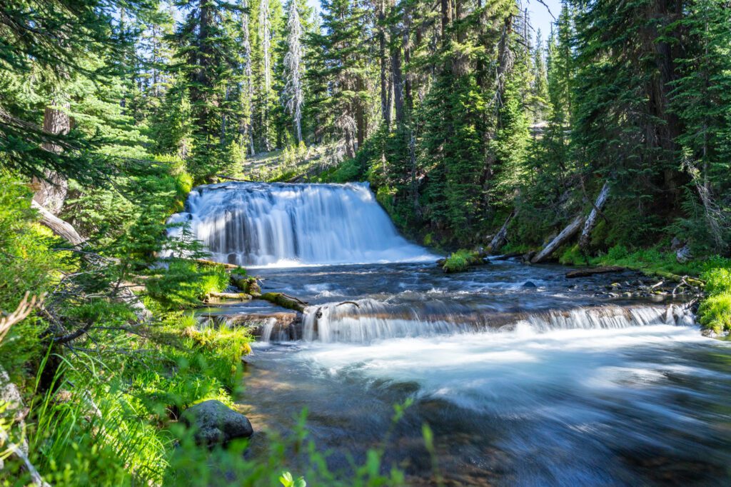
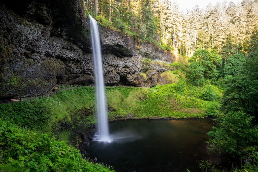
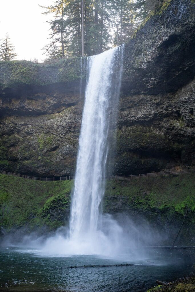
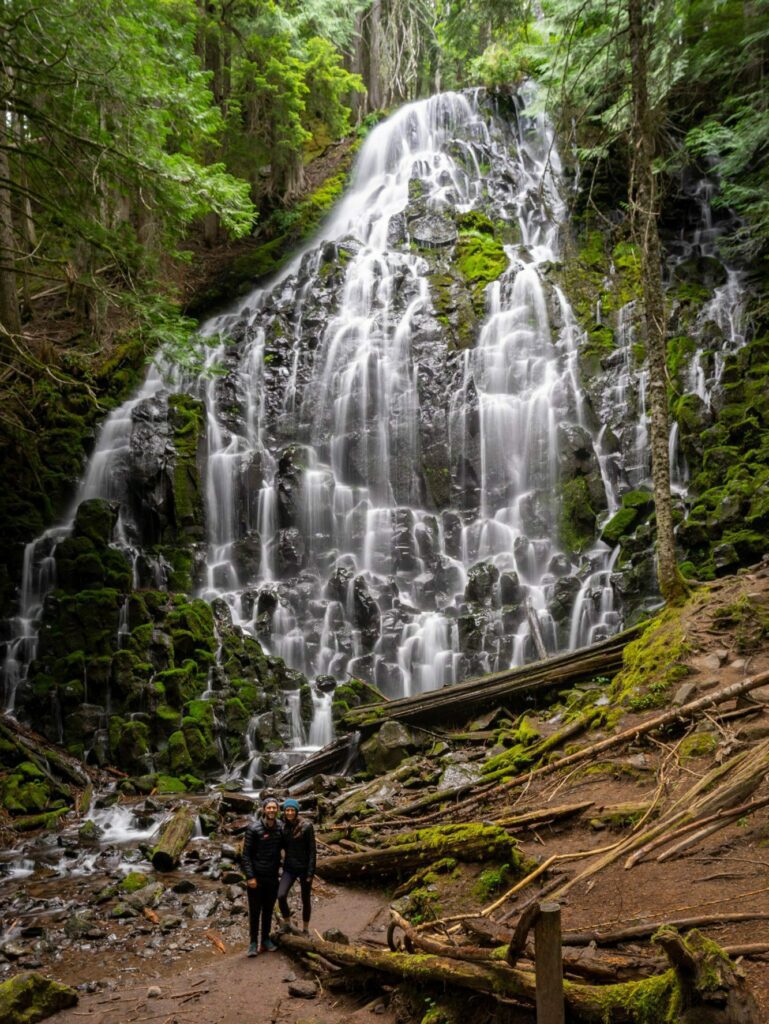
The Trail of Ten Falls (Silver Falls State Park)
- Length: 7.5 miles
- Elevation Gain: 1,200 feet
- Trail Type: Loop
- Season: Year Round (watch out for snow/ice in the winter)
- Difficulty: Easy / Moderate
- Pass Required? Oregon State Parks Pass OR $10 Day Use Fee
- Dog-Friendly? Sort of (ONLY on the Rim Trail)
- Trailhead Location: Silver Falls State Park South Falls Day Use Area
If you’re looking for a waterfall hike in Oregon, a state known for its amazing waterfalls, this is the place to go. Silver Falls State Park is about an hour and a half south of Portland, near Salem.
The Trail of Ten Falls does a big loop, passing – you guessed it! – ten different waterfalls along the way.
There’s no point in this hike where you’ll find significant elevation gain, so it’s a pretty easy hike overall. Don’t let the mileage scare you off.
Since it’s a loop, there are a couple of different places you can pick up the hike, but the best is going to be the South Falls Trailhead, where there’s a big parking lot.
Which, by the way, was completely full when we were there on a weekend morning in the summertime. So you’ll want to get there early to get a spot.
Do it clockwise, starting from South Falls and heading downhill to Lower North Falls, where the trail starts a gradual uphill climb, ending at Upper North Falls. From there, it’s a mostly flat walk back to the parking lot.
South Falls, standing at 177 feet, is the most impressive of them all in our opinion. It tumbles over the lip of a big bowl, which means you can actually walk behind the falls for a different (wetter) point of view.
North Falls (and Upper North Falls) and Double Falls are the other waterfalls that stood out to us.
We have an entire guide dedicated to hiking the Trail of Ten Falls – including logistics like which route to take, and a complete trail guide – which you should read for more detail.
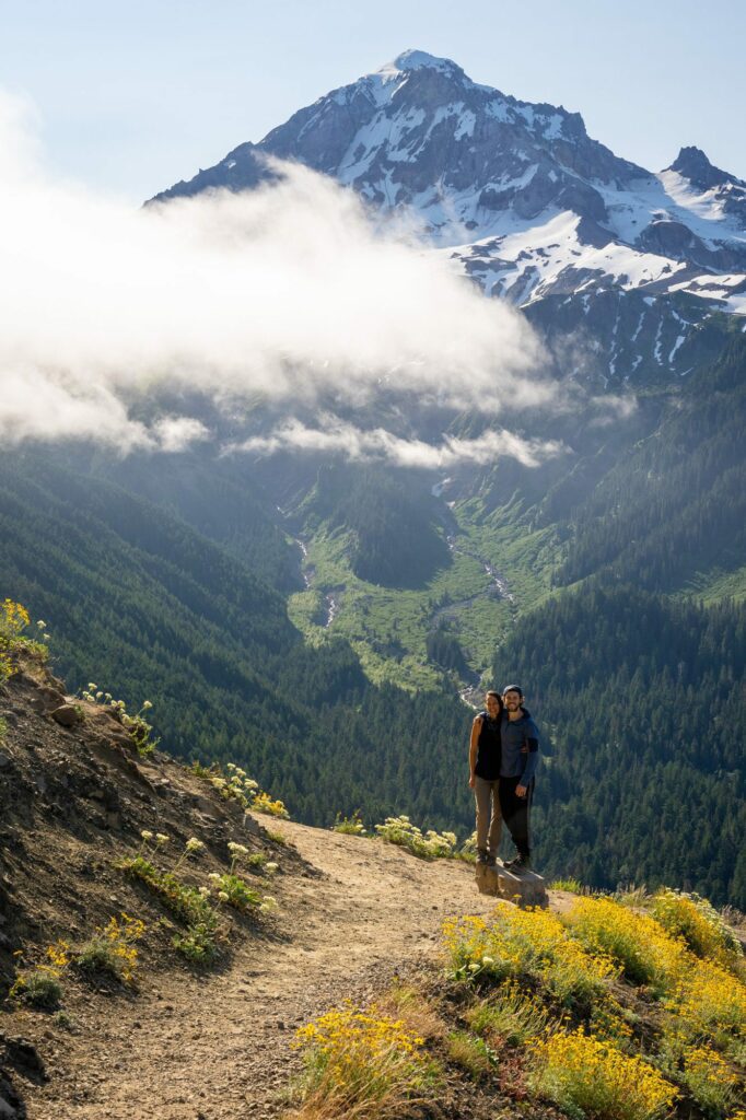
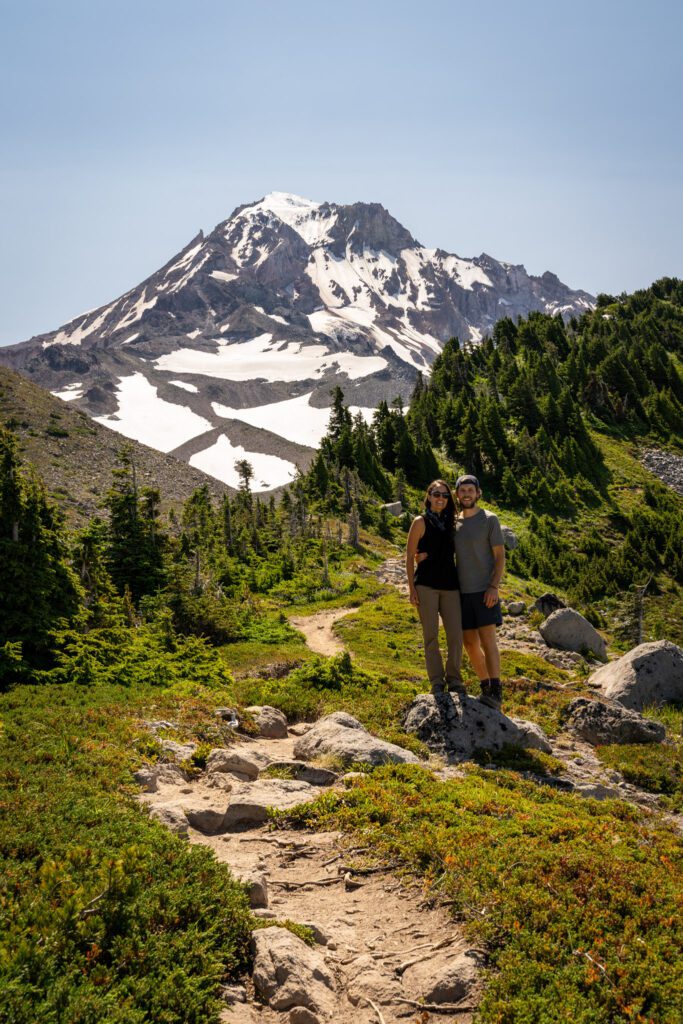
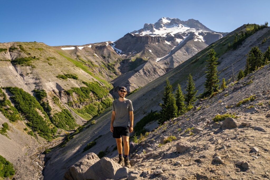
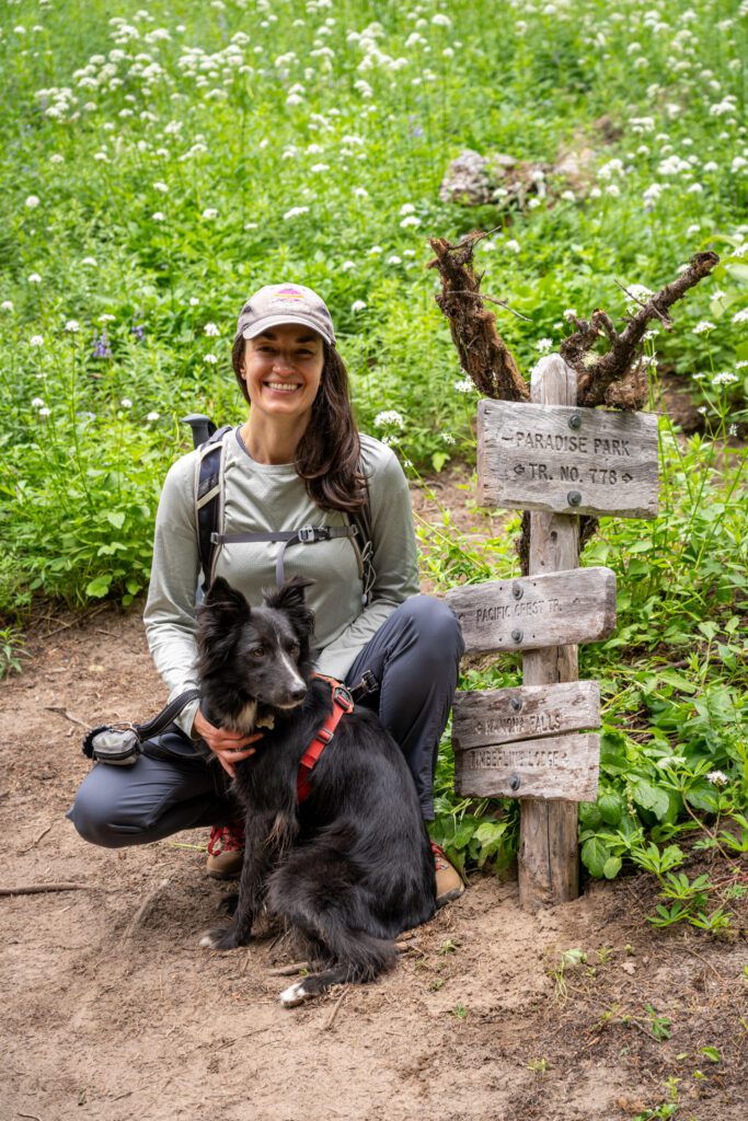
Paradise Park & Zig Zag Canyon (Mount Hood)
- Length: 9.6 miles
- Elevation Gain: 2,500 feet
- Trail Type: Lollipop
- Season: Summer – Fall (July – October)
- Difficulty: Hard
- Pass Required? None
- Dog-Friendly? Yes, on a leash
- Trailhead Location: Timberline Lodge
Of the hikes on this list, we tackled this hike for the first time most recently (at least at the time of writing).
It had been on our list for years, but we hadn’t quite done it yet because of the water crossing and anxiety over whether or not our dog would be able to handle it (she doesn’t like water).
The morning after we did it, we were sitting in the backyard discussing where it should fall on this list.
We landed on Paradise Park being here for two reasons.
First, because of the fact that it’s the worst kind of hike: a hike that starts out mostly descending downhill, and finishes climbing back uphill.
Second, because it involves a water crossing that can be sketchy early in the season.
At the campground the night before doing this hike, I was chatting with a fellow photographer (hey Ryan!) about our plans for the next day and mentioned that we were tackling Paradise Park.
He asked if I meant the area in Mount Rainier National Park, and I chuckled and said no, this wouldn’t be a great place to camp for that hike (we camped at Hoodview Campground on Timothy Lake, which is a place we love).
At our lunch break in Paradise Park, I realized that, yeah, this area is kind of like Paradise at Mount Rainier, but with a TINY fraction of the visitors.
It has the mountain views (though we ended up hiking into a thick layer of fog and never saw Hood from the meadows), the wildflowers, and the water features that make that slice of Rainier one of our favorite places on earth.

However, the big difference is that we only saw about ten people on the trail on the first half of our hike, and most were backpackers doing either the Timberline Trail or the PCT.
The first thing we should talk about is the fact that there are multiple versions of this hike – a longer lollipop (~12 miles) that does the whole PCT / Paradise Park loop, and an out and back from the trailhead off of Kiwanis Camp Road (~15 miles with LOTS of climbing) right off of Highway 26 (here on Google Maps).
We’ve chosen the shortest version of the hike from Timberline Lodge for a few reasons.
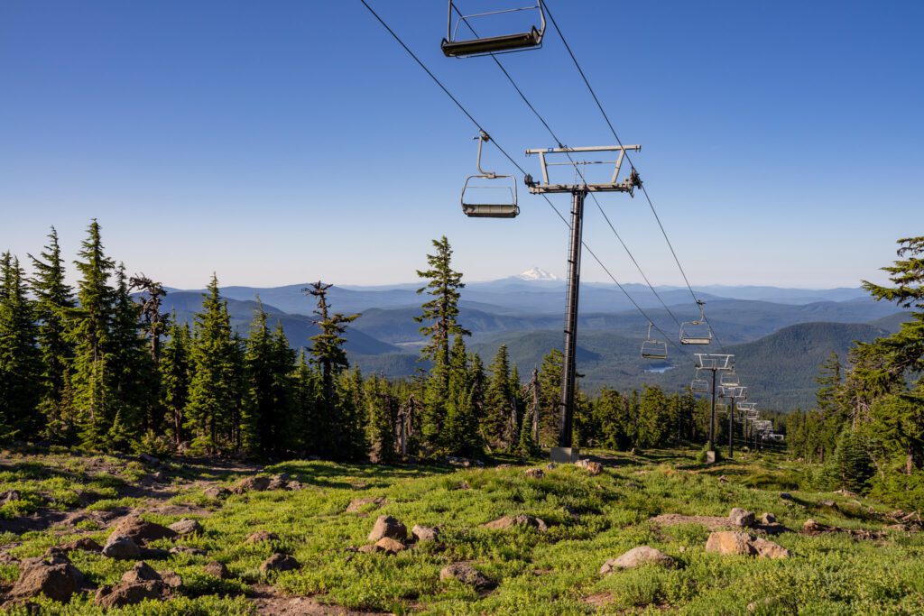
One, Timberline Lodge is cool, and it’s worth seeing if you’ve never been. The first portion of this trail crosses the ski runs under the lifts, which is unique.
Two, this hike gives you the best bang-for-your-buck in terms of difficulty and is a difficult, but achievable, day out in the mountains.
Three, you can easily extend the hike up the Paradise Park trail (which is what we did) if you feel like you’ve got more gas in the tank.
The second thing we should talk about is that this is the worst kind of hike: it’s downhill on the way out, and uphill on the way back.
Which means you’re going to get to your destination in Paradise Park feeling great, and then have a long slog to get back to the car.
The last three miles (ish) from the bottom of Zigzag Canyon back up to the Timberline Lodge are a brutal trudge, at best.
The third thing we should talk about is that river crossing we alluded to above. Several trails up at Mount Hood have you crossing one of the many rivers flowing from the slopes of Mount Hood.
In this case, it’s the Zigzag River, which you hit about three miles into the hike at the lowest point on the trail.
You’ll descend from the top of Zigzag Canyon down to the river, cross, and then climb back out up into Paradise Park.
In the early summer, this crossing can be a little bit treacherous. We were there in the last week of July during a particularly warm and dry year, and it was doable (even for Lupine, who generally doesn’t like water but was miraculously up for this crossing).
However, next year it may not be without wading and getting soaked, and the best way to see what you’re working with in advance is to read trail reviews before you head out.
One last note here: we definitely prefer the Paradise Park side of the lollipop, but the cut-through trail (trail #778) that connects it with the PCT was where we saw the best wildflowers.
If it’s not wildflower season, we’d just skip the PCT side of the lollipop and head straight up the Paradise Park trail (which means a right turn at the trail junction once you’ve climbed up from the Zigzag River).
For what it’s worth, there are tons of campsites along the Paradise Park trail (one of which we used as a lunch spot), and this would make a great 1-2 night backpacking trip.
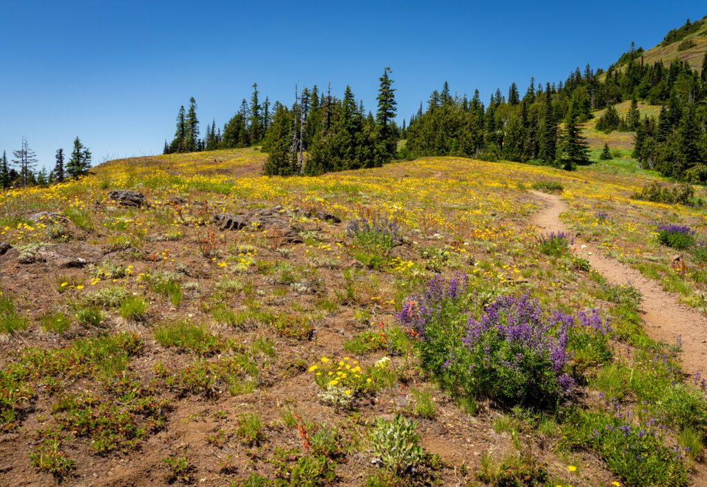
The Iron Peak / Cone Mountain Loop (Willamette National Forest)
- Length: 6.1 miles
- Elevation Gain: 1,800 feet
- Trail Type: Loop
- Season: Summer – Fall (June – October)
- Difficulty: Moderate
- Pass Required? Northwest Forest Pass
- Dog-Friendly? Yes, on leash
- Trailhead Location: Tombstone Pass / Cone Peak Trailhead
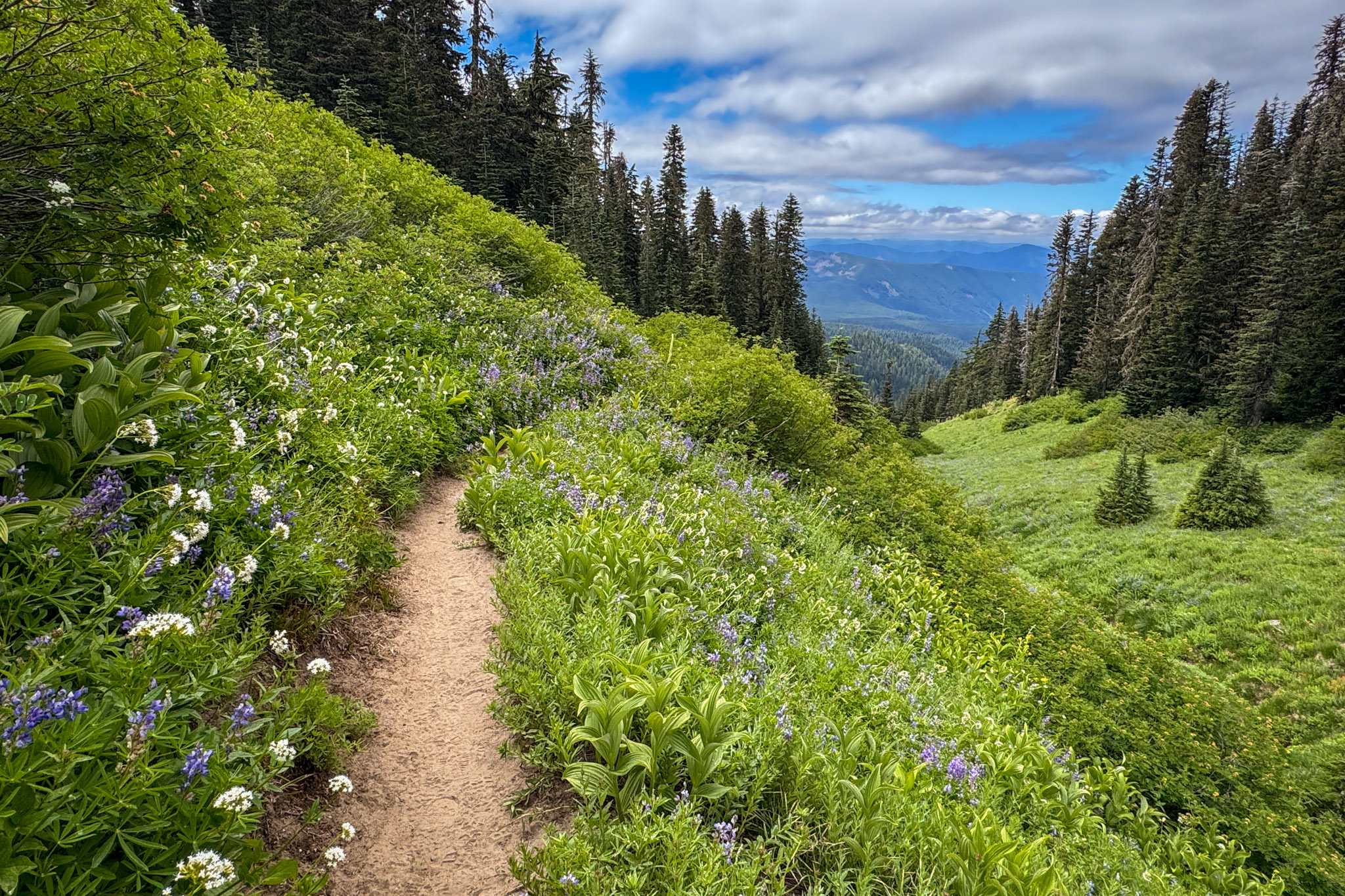
This one is a wildcard. It was very much a “well we’re driving by, let’s check it out” that turned into the most spectacular show of wildflowers that I think we’ve ever seen.
We’ve now done this hike twice, and think that during wildflower season, this is one of the most impressive hikes in central Oregon.
Outside of that season, it’s probably lower on this list (perhaps not even in the main section), but both times we’ve hiked this trail now it has been a nonstop show of flowers.
As we’ve already mentioned, this hike is best in the late spring / early summer, when the landscape is covered in all sorts of different colors – reds, yellows, purples, whites, and more.
For reference, we’ve hiked it in mid-July (the 15th and the 18th, to be exact), which seemed to be near the peak of the wildflower show both years.
There are a couple of ways to do this hike. Most people should begin at the trailhead and tackle it clockwise, starting with the climb to Iron Mountain, where there’s a 360-degree view of the surrounding Cascade Mountain Range with a helpful guide to the different peaks nearby.
From there, descend down to Cone Peak, which is more of a hill if you ask us, and descend the switchbacks back to the trailhead.
Doing it this way means getting the majority of the climbing out of the way early on, and gradually descending through the forested switchbacks at the end.
Did we mention the wildflowers? Cone Peak was blanketed in yellow flowers, and the switchbacks up to Iron Mountain were bursting with reds, yellows, and purples. Truly amazing, and we almost drove right past it and skipped it.
The Moraine Lake Trail (Cascade Lakes Scenic Byway)
- Length: 5.2 miles
- Elevation Gain: 1,500 feet
- Trail Type: Out and Back
- Season: Summer – Fall (July – October)
- Difficulty: Moderate
- Pass Required? Northwest Forest Pass
- Dog-Friendly? Yes, on a leash
- Trailhead Location: Devils Lake / South Sister Trailhead
We did this hike on one of our recent trips to Bend, and it was a stunner.
It’s on the Cascade Lakes Scenic Byway, so it gets a lot of traffic – especially because it shares a trailhead with the route to summit the South Sister – and we got there before 7am and snagged a spot and got an early start on the trail (we only saw a couple of non-backpackers on the way up).
The payoff to effort ratio here is high.
The hike isn’t particularly difficult at all, and once you’ve gotten through the first 1.7 miles or so, you emerge out into a basin at the base of the South Sister, with great views of that peak, along with Broken Top.
Then, you get out to Moraine Lake, which sits at the very base of the South Sister, and it’s magical. The water is cool and clear, and the views across the lake are great.
This hike can be made into a little lollipop by heading left at the fork you’ll hit just before you reach the lake to get up onto the ridge (where the backcountry campsites are) above for even more spectacular views.
You’ll then make a quick, steep climb to meet the South Sister Trail, which you can follow back towards the trail junction you hit when you emerge from the forest.
This hike is great as a day hike, and would be an excellent, pretty accessible overnight backpacking trip (or a two night trip to climb the South Sister, which will shave off five miles from the brutal climb to the summit).
Remember, you will need a Central Cascades Wilderness Permit for the “Three Sisters – Devils Lake/South Sister (Moraine Lake) Trailhead” if you do this hike from June 15th to October 15th (which is basically the only time it’s accessible without snowshoes anyway.
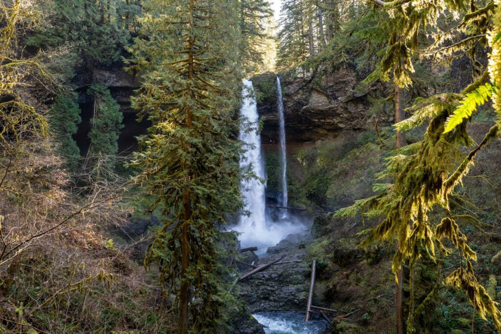
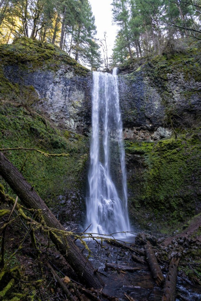
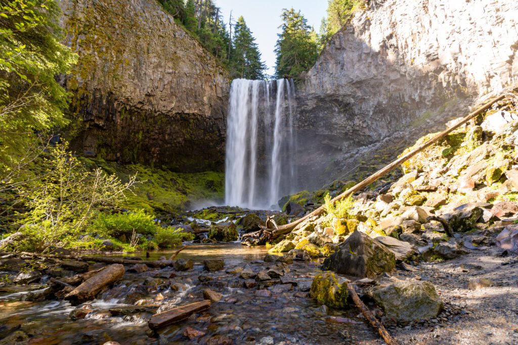
The Tamanawas Falls Trail (Mount Hood)
- Length: 3.4 miles
- Elevation Gain: 600 feet
- Trail Type: Out and Back
- Season: Year Round (watch out for snow/ice in the winter)
- Difficulty: Easy / Moderate
- Pass Required? Northwest Forest Pass OR America the Beautiful Pass
- Dog-Friendly? Yes, on a leash
- Trailhead Location: Tamanawas Falls Trailhead
We finally checked this hike off of our list a few summers ago when we headed up to Mount Hood and Hood River with some friends, and it blew our expectations out of the water.
We’ve since been back three times, and it’s enjoyable every time (go early in the morning to have the trail to yourself).
As we’ve already mentioned in this guide, Oregon is a state known for its epic waterfalls, and Tamanawas Falls should be at the top of every hiker’s list, especially if you’re looking for a good hike near Hood River.
The Tamanawas Falls trail starts right off of Highway 26 on the eastern side of Mount Hood. It’s a small parking lot, and there are signs prohibiting parking all up and down the highway on either side.
There were tons of cars parked on the side of the road anyway, and I’m sure they all thought “they can’t give us ALL tickets, right? Safety in numbers!”
Well, we saw rangers handing out tickets as we left. Get there early, and only park in the lot.
The trail starts by crossing the river over a wooden footbridge, and then heads into the forest.
It’s a pretty easy hike all the way through, and it’s a lovely trail that follows a creek through the woods with the sound of the water accompanying you on your journey up the falls.
There’s one stretch of the hike that’s tough, and it’s right before you get to the falls.
It’s a steep, rocky, slippery section that lasts less than a quarter mile. Alysha actually slipped and fell on the way down, resulting in a big purple bruise.
It’s tough, but it’s not the kind of thing that should prevent most people from doing the hike. Wear shoes or boots with good traction, take it slow, and you’ll likely be fine.
The waterfall at the end is well worth the relatively low effort it takes to reach it. The water tumbles off of a rocky shelf, falling 110 feet down into Cold Spring Creek below.
The mist coming off the waterfall is a nice respite from the heat in the summer, though it makes taking pictures of the falls a little tricky.
We have an entire guide dedicated to giving you all the information you need to hike the Tamanawas Falls trail, which you should read for far more information than we’ve fit into this summary.
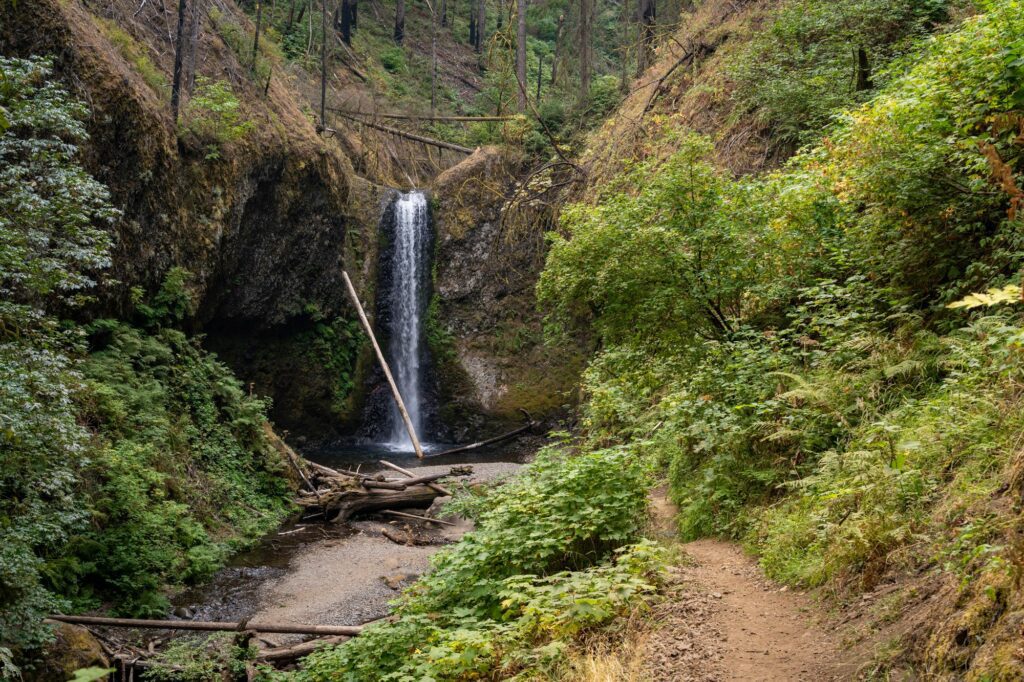
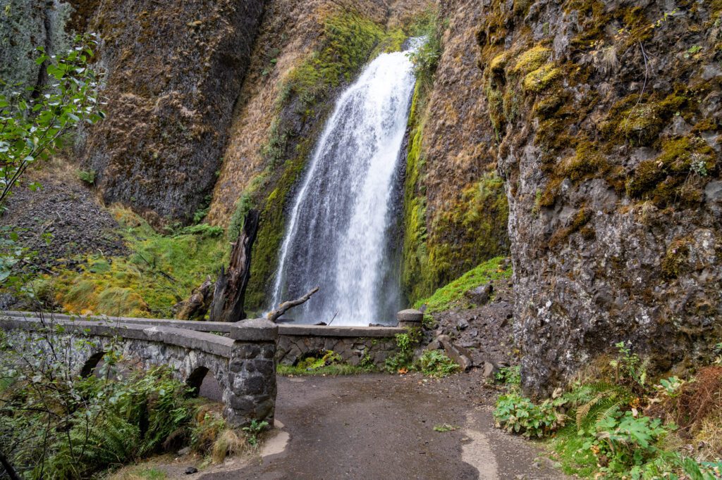
The Multnomah & Wahkeena Falls Loop (Columbia River Gorge)
- Length: 5.1 miles
- Elevation Gain: 1,600 feet
- Trail Type: Loop
- Season: Year Round
- Difficulty: Moderate
- Pass Required? Multnomah Falls timed use permit from Recreation.gov in the summer (more information here)
- Dog-Friendly? Yes, on a leash
- Trailhead Location: Multnomah Falls Parking Lot
Though we didn’t really remember it clearly until after the fact, this was actually our first ever hike that we did in Oregon on our first trip to the state more than a decade ago.
Multnomah Falls is the crown jewel of the Columbia River Gorge waterfalls (it sees a ridiculous number of visitors on an annual basis), and this hike takes you from the base of the falls – which is extremely impressive – up to the top.
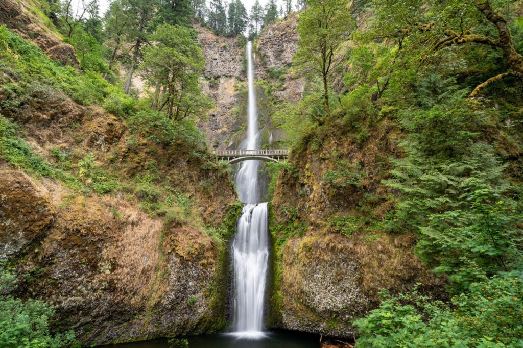
We bring all of our out-of-town visitors to Multnomah Falls, which tumbles 600 feet in two tiers over a rocky ledge into a creek below.
Though we would argue that Multnomah Falls, while amazing, isn’t the only reason to do this hike.
We actually think the rest of the hike, which takes you to four more waterfalls and gets you up on a ridge with some nice views of the Gorge, is also pretty spectacular.
As we were finishing our hike, we started talking about the best way to tackle this loop with our hiking buddies.
The decision point here revolves around crowds at Multnomah Falls.
If you go counterclockwise, it’s a steeper ascent and a more gradual descent (which is generally our preferred direction), but you’ll end up doing that longer descent right in the middle of the peak time for most people visiting Multnomah Falls, which essentially means dodging busloads of cruise ship crowds.
For that reason, we concluded that we’d do it clockwise next time. Which is what we’re recommending here.
For that route, you’ll start at Multnomah Falls bright and early, climb the 11 switchbacks (that are marked so you know how many you have to go) to the top of the falls, then continue up to the ridge to connect with Trail 420, which you’ll follow all the way down past Fairy Falls and Multnomah Falls en route to the Historic Columbia River Highway.
That will get you through the busiest portion of the trail early, and you’ll have the rest of the trail mostly to yourself.
If you’re taking our advice and doing the loop clockwise, that means you’ll want to park at the big parking lot for Multnomah Falls, which is here.
It’s worth noting that, at the time of writing, you need a timed entry permit to access the main parking lot from May 23rd and September 1st between 9am and 6pm, which you can reserve and learn more about here.
We have an entire guide dedicated to hiking the Wahkeena and Multnomah Falls Trail – including logistics like which route to take, and a complete trail guide – which you should read for more detail.
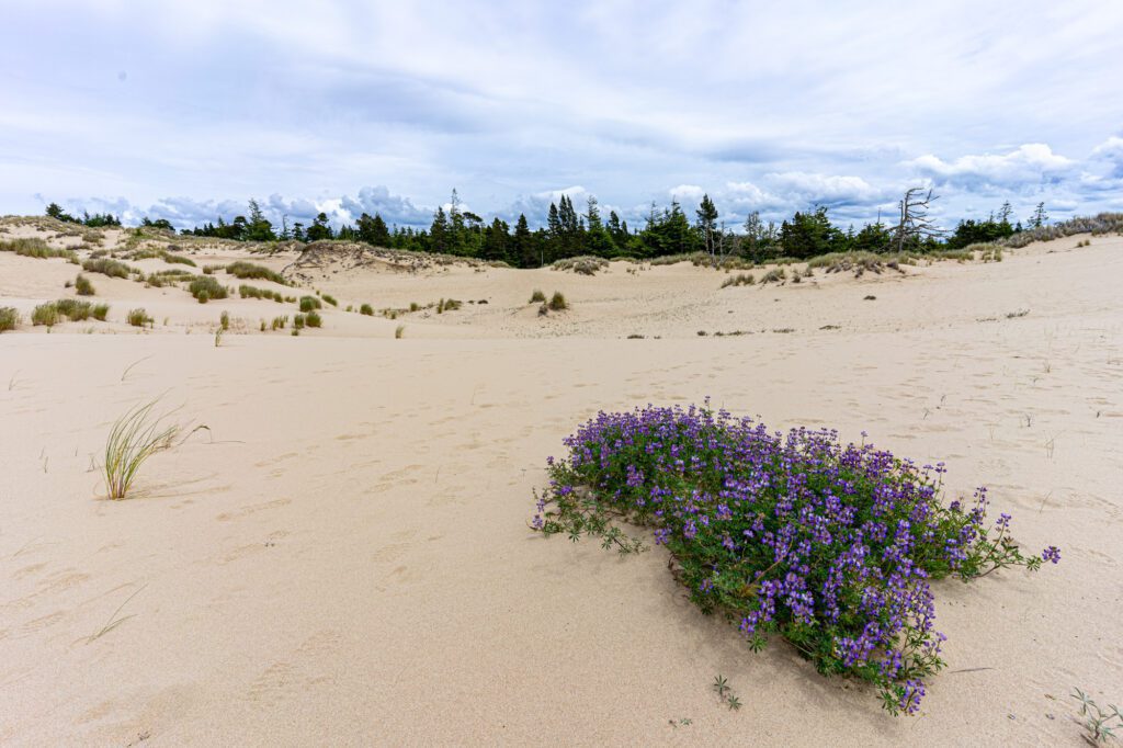
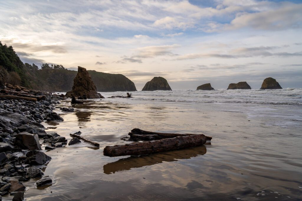
The John Dellenback Dunes Trail (Oregon Coast)
- Length: 5.5 miles
- Elevation Gain: 308 feet
- Trail Type: Out and Back
- Season: Year Round
- Difficulty: Easy
- Pass Required? Northwest Forest Pass
- Dog-Friendly? Yes, on a leash
- Trailhead Location: John Dellenback Dunes Trailhead
We think that this hike deserves a spot on this list because of the fact that, over the course of a relatively short few miles, you get to experience three distinct (ish) ecosystems; the sandy dunes, the forest, and the beach.
After walking through the dunes and following the trail briefly through the forest, you’ll end at a wide sandy beach on the Pacific Ocean.
The best part about that beach is that it’s only accessible by hiking in, which means it’s basically deserted (which can’t be said for many of the other beaches on the coast).
The hike starts with an amble along a well-established sandy trail until you emerge onto a mini bluff, with the sprawling Oregon Dunes in front of you.
The dunes are amazing, and we were in awe of the patches of wildflowers and forest that were somehow alive and well in the middle of this sandy landscape.
Hiking on the dunes is a bit of a nightmare. It’s slow-going, hard, and your shoes will be full of sand by the end of the hike.
High-top hiking boots will be your friend here, otherwise you’ll be in for a day of sandy shoes.
The trail traverses the dunes and when you reach the other side, you briefly enter a forested but still somehow sandy stretch that emerges onto a beautiful beach.
Note: You’ll need a map here, because the trail markers in the dunes are hard to find, at best. We use AllTrails (specifically AllTrails Pro, which gives you the ability to download a trail map and show your own location).
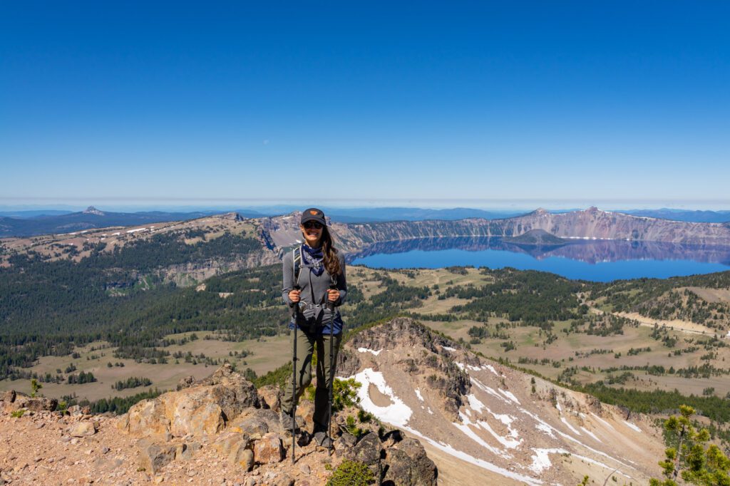
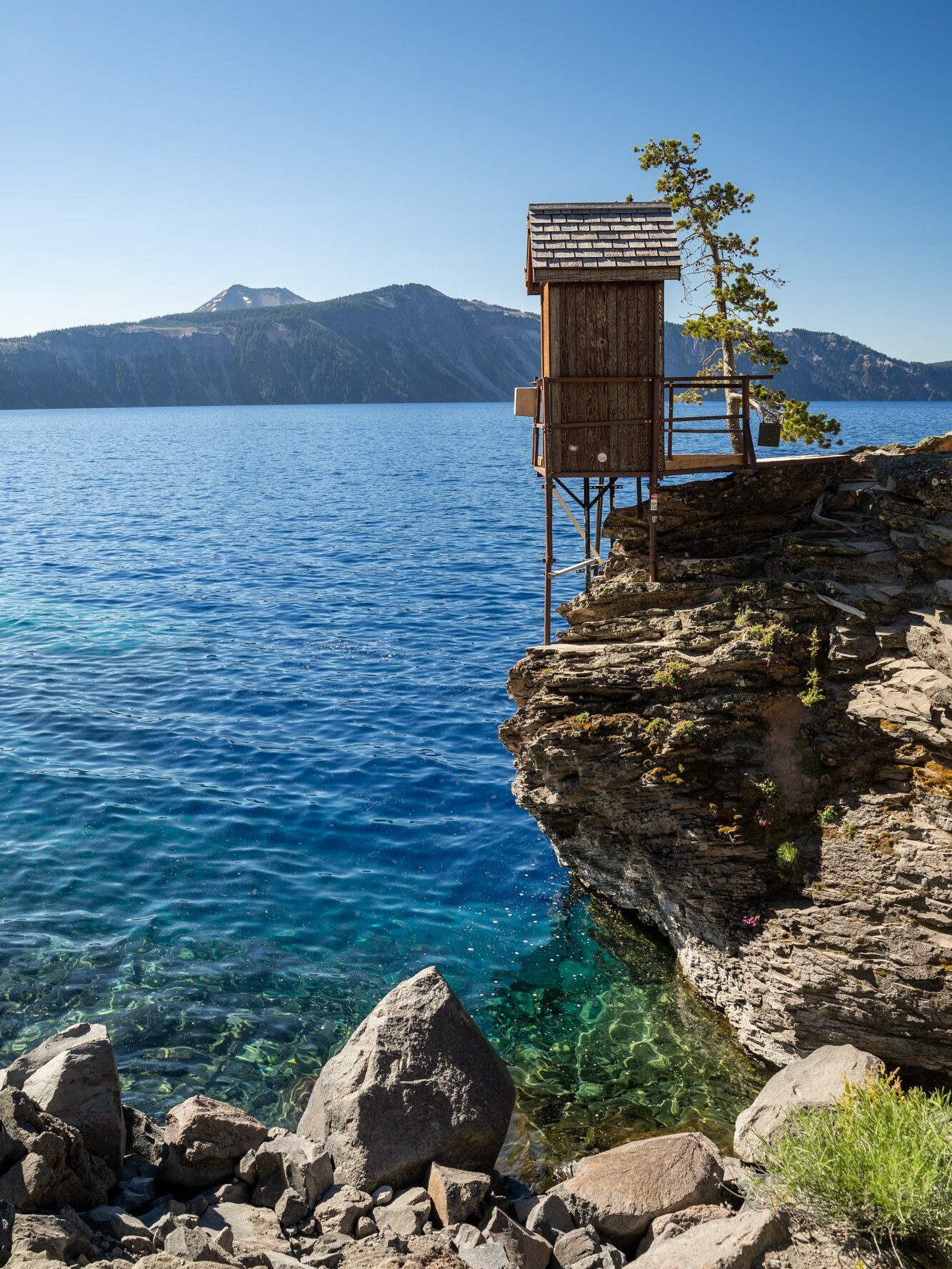
Mount Scott (Crater Lake National Park)
- Length: 4.2 miles
- Elevation Gain: 1,300 feet
- Trail Type: Out and Back
- Season: Summer – Fall (July – October)
- Difficulty: Moderate
- Pass Required? America the Beautiful
- Dog-Friendly? No
- Trailhead Location: Mount Scott Trailhead
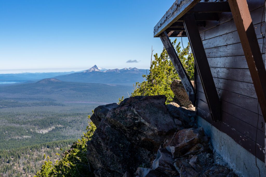
This hike takes you up to the highest accessible point in Crater Lake National Park, on the eastern side of the lake, to an old fire lookout with great views over the lake and surrounding landscape, including Mt. Thielsen and Mt. McLoughlin in the distance.
It’s a pretty steady climb from the trailhead up to the lookout.
There are some switchbacks along the way, and the view of the deep blue water of Crater Lake seems to get better and better as you ascend. Just wait until you get to the top.
Note: The road on the eastern side of Crater Lake is closed in the winter, which means that you can’t drive to the trailhead.
You can still access the trailhead in the late spring / early summer by parking here, right outside the gate, and hiking up the road to the trailhead.
It adds a couple of miles in each direction, but it’s along a paved road. We were there on the day the road opened for the season, but we actually did the hike the day before, when the road was still closed.
Check road conditions here before you go.
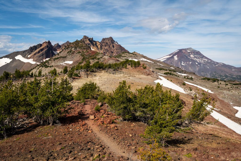
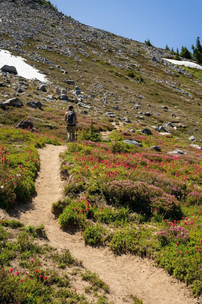
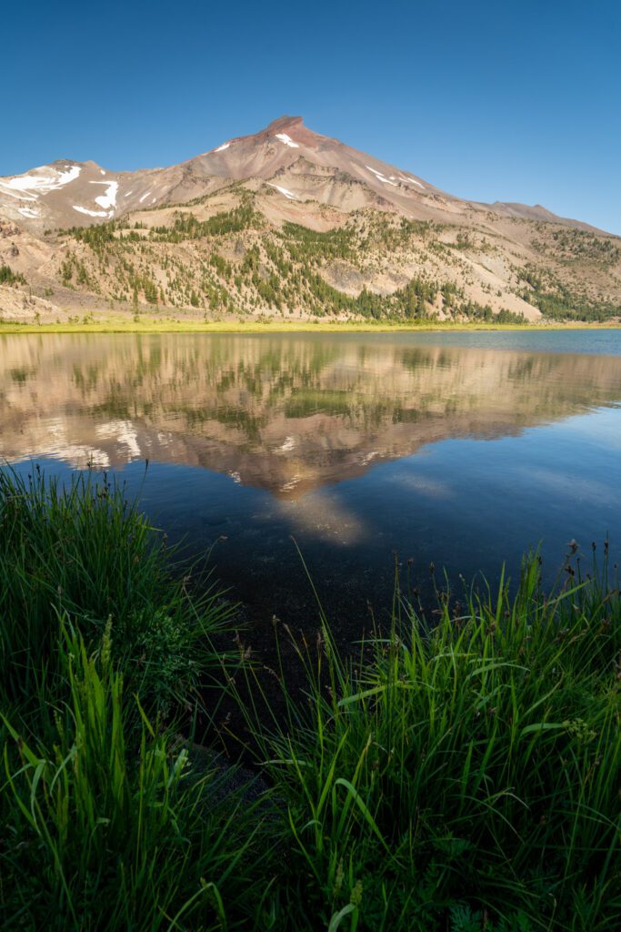
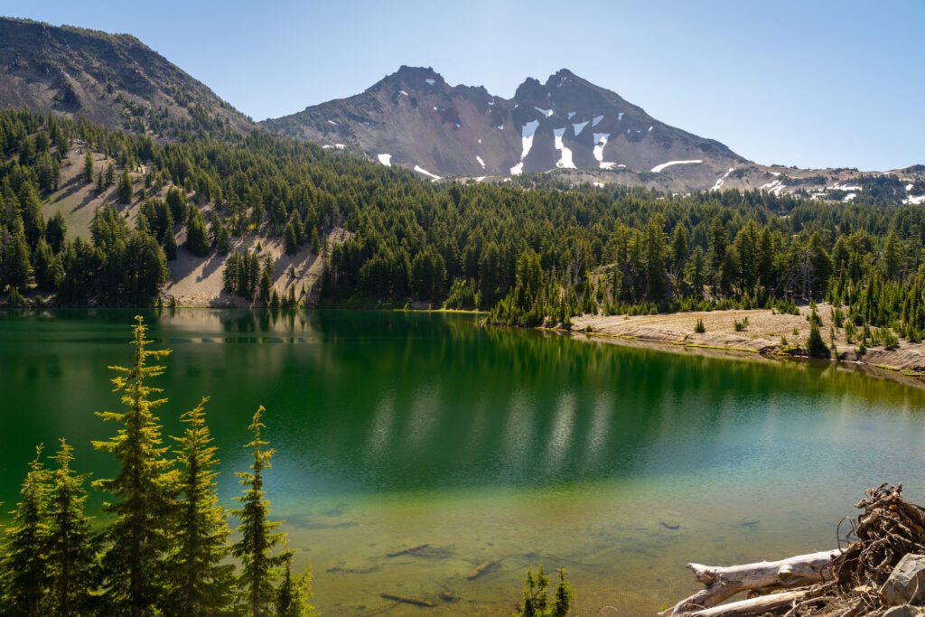
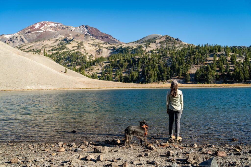
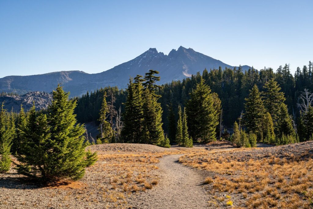
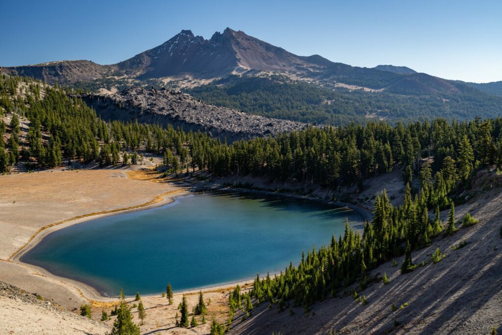
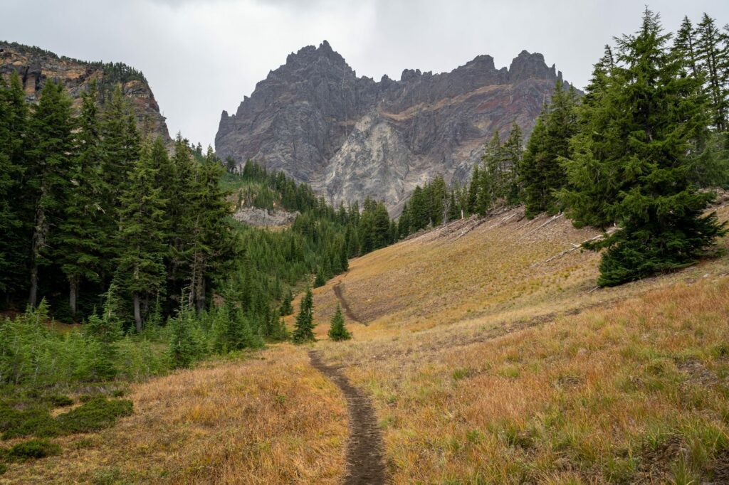
Canyon Creek Meadows (Mt. Jefferson Wilderness)
- Length: 7.5 miles
- Elevation Gain: 1,253 feet
- Trail Type: Loop
- Season: Summer – Fall (July – October)
- Difficulty: Moderate
- Pass Required? Northwest Forest Pass or America the Beautiful Pass
- Dog-Friendly? Yes, on a leash
- Trailhead Location: Jack Lake Trailhead
Another hike that punches above its weight in the “reward to effort ratio” in the central Oregon Cascades.
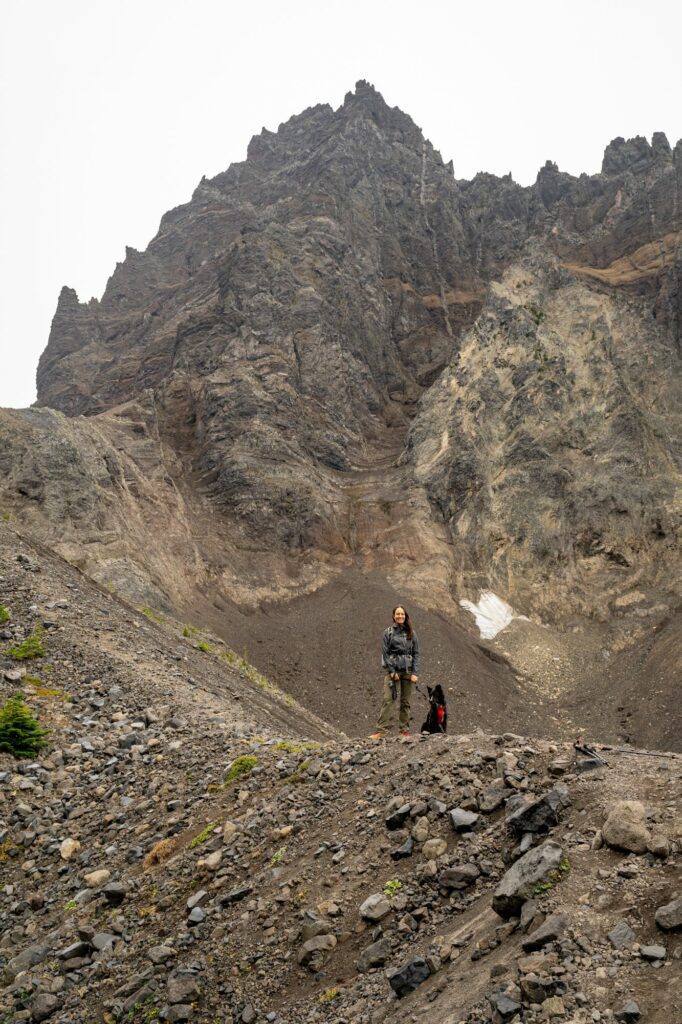
Along this trail, you’re going to get some nice wildflower meadows (depending on the season), a barren high alpine climb, and a beautiful glacial lake with a nice view of a jagged peak (Three Fingered Jack).
Plus, if you’re lucky, mountain goats! Which we see far more of in our explorations of Washington State, and this was actually the first place we ever saw them in Oregon.
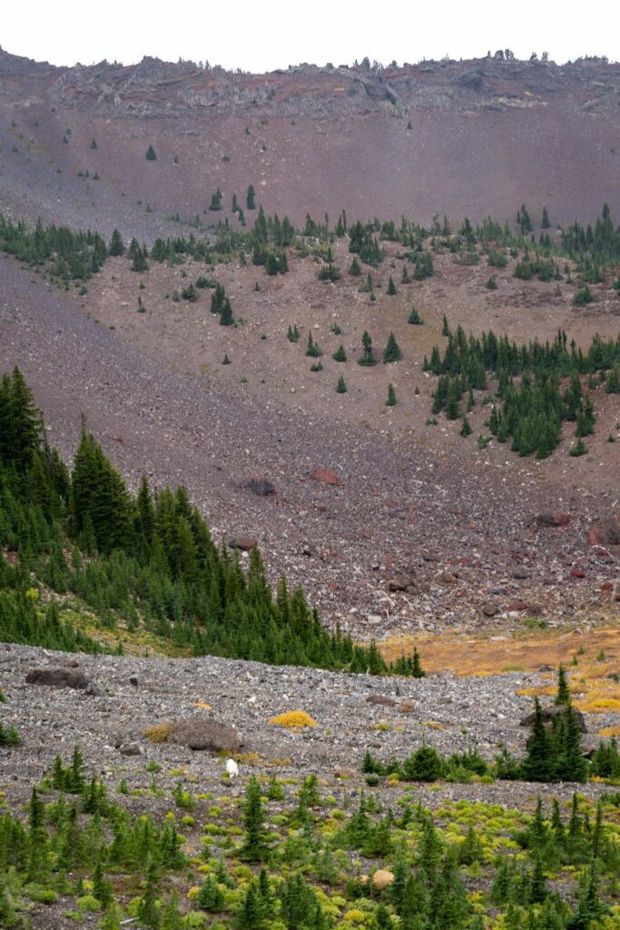
Unfortunately for us, we did this hike on a drizzly day – the day after the weather turned from gorgeous to gross in mid-October – so the glacial lake wasn’t at its most stunning when we got there and the flowers were long gone.
It’s a lollipop that starts from the Jack Lake Trailhead and winds its way up through a pine forest, ending with a steep ascent that takes you to the base of Three Fingered Jack.
The vast majority of this hike is a nice, easy stroll through the forest, with a very moderate (bordering on easy) ascent up through the forest and meadows.
The only difficult part of this hike is the ascent from the meadows up to the lake and saddle, which climbs roughly 1,000 feet over the course of a mile on a steep, rocky, slippery trail. Be very careful here, especially on the way down.
The road to the trailhead is gravel, but was recently re-graded and was one of the better forest roads we’ve ever driven on. In fact, the gravel parts of the road were better than the deteriorating paved section in the middle.
For a few years now, many of the most popular hikes on national forest land near Bend require a Central Cascades Wilderness Permit to access between June 15th and October 15th.
This hike is one of those that requires a permit. You can find the wilderness permits for day hikers here, and it’d be a good idea to read through this page with the most up-to-date information on release windows, etc etc.
Overnight permits can be reserved here (and they cannot be used for a day hike).
To hike this trail, you’re going to want a permit for the “Mt. Jefferson – Jack Lake Trailhead (Canyon Creek Meadows)” (that’s directly copied and pasted from Recreation.gov).
Honorable Mentions: 5 Hikes that Barely Missed the Cut
Here are the next few hikes that we’d recommend (but not enough to crack the top 13).
Tom, Dick, and Harry: If we didn’t already have two hikes in the same vicinity on this list, we would definitely have included the climb to Tom, Dick, and Harry Mountain.
It’s a nice climb up to a rocky ridge directly across the Sandy River valley from Hood, which means once you’re atop the ridge, the views are spectacular.
Ramona Falls: Similar to Tom, Dick, and Harry, we would have included Ramona Falls if we didn’t already have two nearby hikes on the list AND two good waterfall hikes on the list.
It’s a pretty waterfall (we’d put it third in the state, ish), but the hike isn’t anything particularly special and there’s a big water crossing that’s pretty sketchy in the early summer.
Ecola State Park (Oregon Coast): If you’re looking for a nice hike along the coast to a sandy beach, we like both of the main hikes at Ecola State Park near Cannon Beach – the Indian Beach Trail and the hike down to Crescent Beach.
Both leave from the same parking lot, which gets very busy (so go early). Put them together and you have an excellent day out on the coast!
Cleetwood Cove (Crater Lake): The reason this hike got cut is that the payoff is great, but the hike sucks. This trail gets you to the lowest accessible point in Crater Lake National Park. The Cleetwood Cove trail takes you from the rim road right down to the water level. And, yes, you can jump in.
This is the only spot in the park (that we know of – let us know if that has changed or if we’re mistaken!) where you can get to the water level.
To get there, though, you climb straight down an unforgiving set of switchbacks. Great, right? Downhill isn’t too bad! Except what goes down must come back up, and it’s a tough climb on the way back up.
And Crater Lake sits at around 6,000 feet of elevation, which makes it that much harder. More trail information here
Wahclella Falls (Gorge): Wahclella Falls is probably our favorite waterfall in the Gorge, particularly when you talk about bang-for-your-buck.
It’s short and sweet, the waterfall at the end is really nice, and the small parking lot limits crowds (to an extent). We bring a lot of friends and family here when they come to visit.
Other Oregon Hikes on Our Bucket List
Here are a few hikes around the state that we HAVE NOT done yet, but are very much on our hiking bucket list.
Wallowa Lake / Eagle Cap Wilderness: A visit out to northeastern Oregon has been on our list since the second we moved to Portland, and we just haven’t quite made it out there yet (partially because our dog gets very anxious when she gets zipped in a tent, so backpacking is tough these days).
And to see the best of this part of the world, you really do have to sleep out there. We have our eye on this loop for when we do make it out there.
The Strawberry Mountain Wilderness: Oh hey, a beautiful place that’s even further than the Wallowas! The Strawberry Mountain Wilderness is tucked away in the eastern edge of Oregon (near Boise), and is quite a trek from up here in the northwest corner of the state.
But my goodness is it beautiful down there! High on our list for 2026! You can check out some of the hikes here.
Our Favorite Oregon Hikes, Mapped
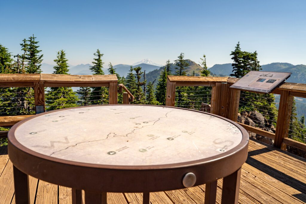
Here’s a map of all of the Oregon hikes (really, the trailheads) mentioned in this guide so that you can visualize where these hikes are.
2 of my all time favorite hikes anywhere are in the Willamette National Forest: 1) Koosah & Sahalie Falls trail and 2) Tamolich Blue Pool via McKenzie River trail. Both are quite easy with hardly any elevation but are so beautiful!
Hey Julie! Speaking as two people who just spent a week in the McKenzie River area, we agree that both of those are great hikes! However, we don’t think either quite cracks our list – there are just TOO MANY great hikes.