Hiking the Tam McArthur Rim Trail to Broken Hand
This is a hike that we were very, very close to not doing on a rainy morning in Bend that came 48 hours after a bout of food poisoning that had Matt down for the count.
We were sitting at the gas station pumping gas and decided we would drive out to Sisters (which was halfway to the trailhead from Bend), stop for coffee (at Sisters Coffee, of course), and make our final decision on whether or not we’d hit the trail.
There are very few times in my life that I can think of where, after the fact, I have said “I really wish we hadn’t done that hike today” even if the hike was brutal in the moment.
On the contrary, I can think of quite a few times where we skipped a hike for one reason or another and ended up regretting it.
Obviously, based on the pictures you’ll see in this guide, we decided to do it and let me tell you, this hike is a STUNNER.
I truly cannot believe that I haven’t seen this hike mentioned basically anywhere on the internet as a must-do hike near Bend.
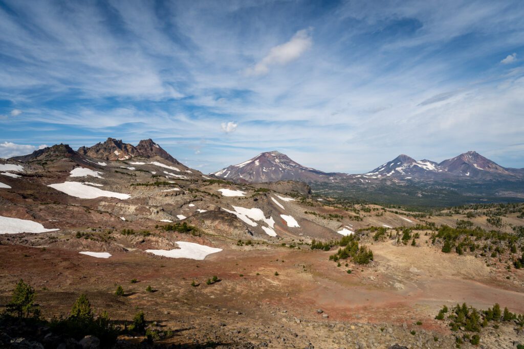
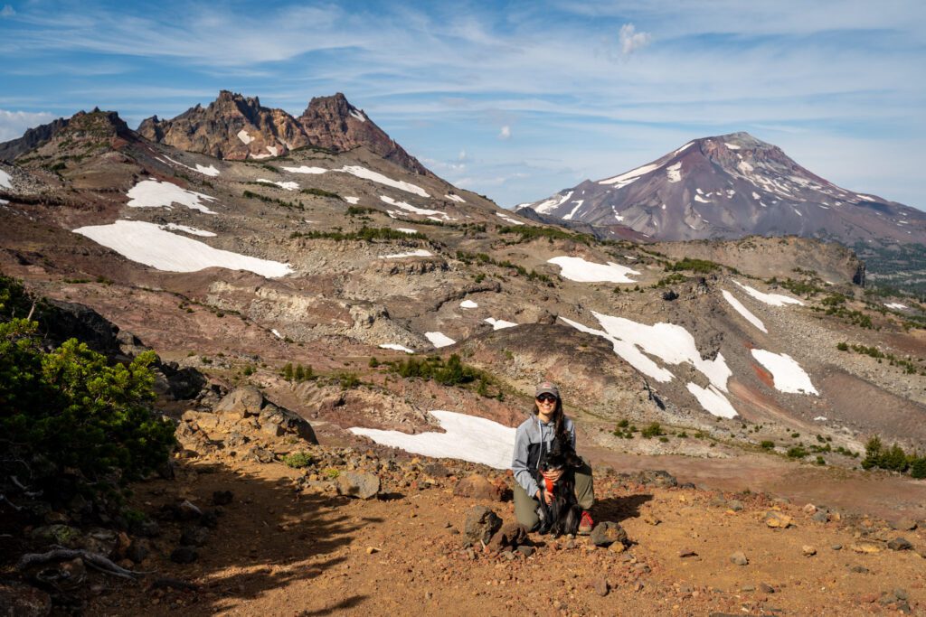
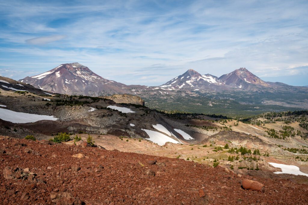
The end of this hike is full of nonstop borderline unbelievable views of the Three Sisters, Broken Top, and Mount Bachelor.
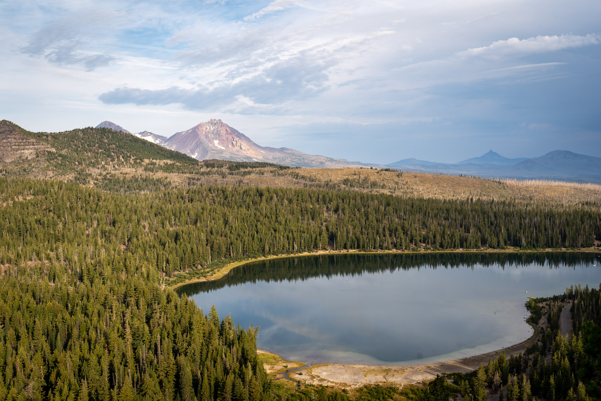
In this guide, we’re going to cover everything you need to know to get out and hike the Tam McArthur Rim trail to Broken Hand for those incredible views (pictured below).
We’ll start with the logistics – where to park, and other things you need to know for a smooth trip – and then go into a trail report based on our own experiences hiking the trail.
Our intention is to set you up for hiking success by the end of the guide so you can get out on the trail safely and confidently, prepared for the trail and knowing what to expect.
Sound good to you? Let’s get into it.
Disclaimer: Some of the links in this post, like hotel links, are affiliate links, meaning at no additional cost to you, we make a little bit of money if you click through and book. That being said, we would never recommend something to you that we don’t stand behind 100%.
Hiking the Tam McArthur Rim Trail: Trail Details
- Length: 9.5 miles
- Elevation Gain: 1,900 feet
- Trail Type: Out and Back
- Season: Summer – Early Fall (July – September)
- Difficulty: Moderate
- Pass Required? NW Forest Pass (or America the Beautiful Pass)
- Dog-Friendly? Yes, on a leash
- Trailhead Location: Tam McArthur Rim Trailhead
The Route for Hiking to Broken Hand
This hike is a fairly straightforward out-and-back, with only a couple of things to keep in mind along the way.
The big thing to know is that the second half of this hike is along an unmaintained trail.
However, despite being unsure of what we’d find on that portion of the trail, we were pleasantly surprised to find an extremely well-worn path and only minimal routefinding required near Broken Hand.
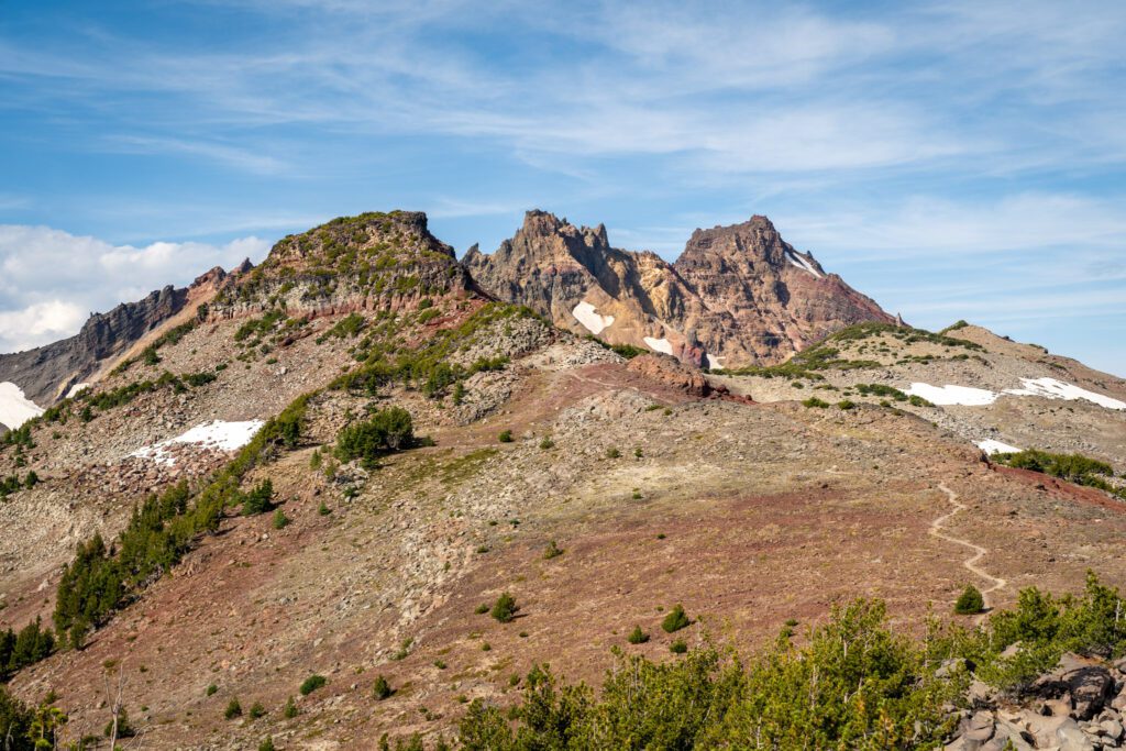
We should note that Broken Hand is a rock formation across the valley from Broken Top (it is not the same as Broken Top).
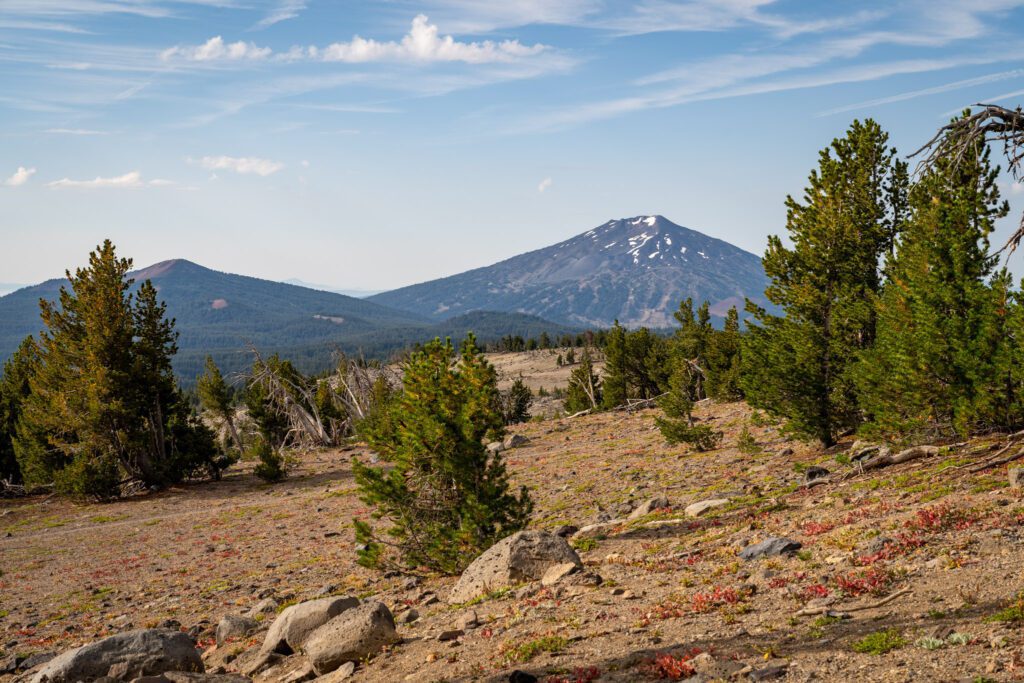
You’ll start with a relatively intense climb through the forest before bursting through the treeline and finding yourself on a plateau with ever-changing views of Mount Bachelor and Tumalo Mountain to your left, and some peek-a-boo views of the top of Broken Top dead ahead.
There are a couple of trail intersections here, all having to do with the horse route versus hiker route (the horse route stays inland away from the crater rim).
Eventually you’ll reach a junction that takes you out to the rim, where you’ll have a short section that skirts the rim where you’ll want to keep an eye on pets and children.
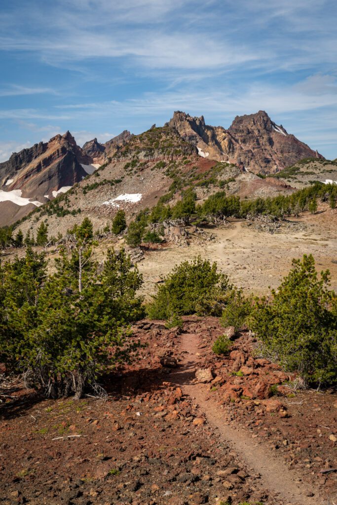
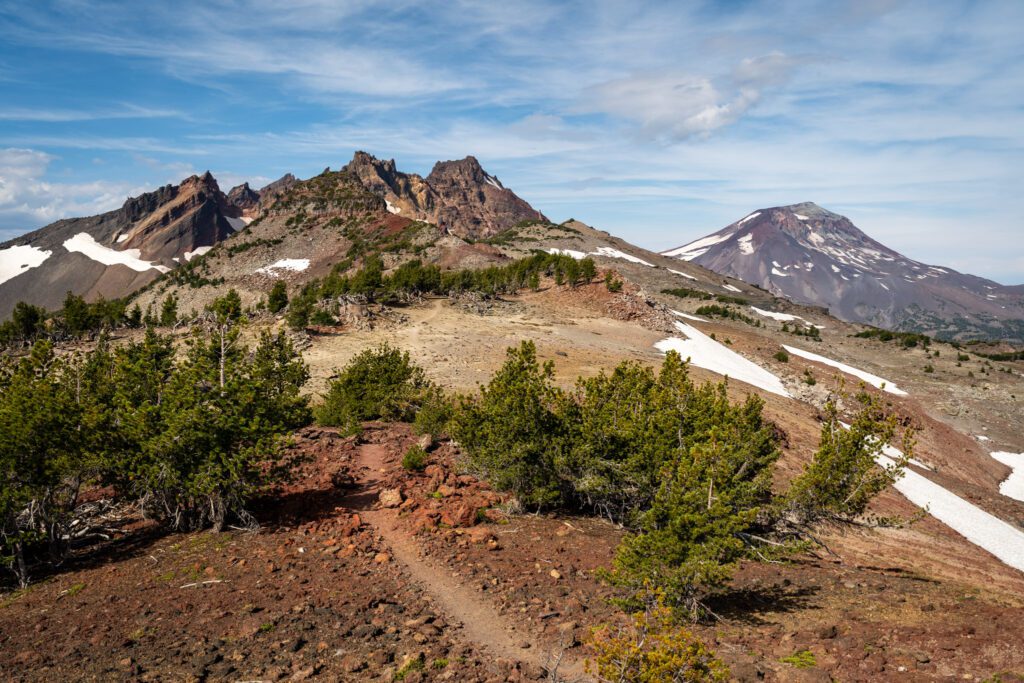
From there, you transition onto the unmaintained trail and it’s an easy mile to the start of a climb along a red-hued ridgeline with jaw-dropping views of Broken Top, all three Sisters, and Mount Washington.
Finally, you’ll reach Broken Hand, and you have two choices – the upper route (which usually involves navigating a snow field until late in the season) and the lower route (which involves some routefinding and crossing a boulder field).
Overall, unless you’re planning on continuing to No Name Lake (more on this in the “extending your hike” section below), we actually aren’t sure it’s worth going to the summit of Broken Hand.
Be prepared to encounter snow on the section of this trail as you approach Broken Hand, even into August.
You’re at ~7,500-8,000 feet above sea level here, so snow is going to linger well into the summer.
How Difficult is the Tam McArthur Rim Trail to Broken Hand?
Having done the Green Lakes Trail – a hike that is surprisingly easy for its length and payoff – again a few days before this hike, we were talking about how hard this hike was on the way down.
Once again, our conclusion is that this hike punches above its weight in terms of payoff to difficulty ratio, and we’d put it firmly in the “moderate” category.
At first glance, the stats for this hike put it on the easy side of moderate, climbing just 1,800 feet over the 4.8 mile ascent. That puts you at a rate of climbing of 375 feet per mile (for us, easy is 250-300 feet of climbing per mile).
However, it’s worth noting that the vast majority of that climbing happens in the first two miles, climbing 1,200 feet in roughly two miles.
For those of you who aren’t math wizards, that’s a rate of 600 feet per mile, and anything over 500 is in the “difficult” category for us.
Taken together, that condensed climb, the length, and the fact that this trail is extremely exposed except for the first mile and a half put this trail firmly in the “moderate” category.
All that being said, we think the payoff here still punches above its weight considering the effort required.
Getting a Central Cascades Wilderness Permit
For a few years now, many of the most popular hikes on national forest land near Bend require a Central Cascades Wilderness Permit to access between June 15th and October 15th.
Which, for most of the hikes out here at higher elevation, is the vast majority of the time that the trail is accessible.
We’re not going to talk about the merits of the permit system – obviously there was a need because traffic on these trails was overwhelming the ecosystem and infrastructure – so let’s focus on what this means for you, practically speaking.
Whether you are a day hiker or an overnight hiker, if you are hiking this trail between June 15th and October 15th, you need to have a Central Cascades Wilderness Permit available to display to rangers on the trail.
The process to get a permit is relatively straightforward, but it does require you to be available when they go on sale for popular summer weekends, otherwise they will sell out.
Here’s how the permit process works at the time of writing: they release permits for the popular trailheads (including the Tam McArthur Rim Trailhead, where you start this hike from) in two rolling windows; 10 days in advance of the date of your hike, and two days in advance of the date of your hike.
You can find the wilderness permits for day hikers here, and it’d be a good idea to read through this page with the most up-to-date information on release windows, etc etc.
Overnight permits can be reserved here (and they cannot be used for a day hike).
Permits are released at 7am PST on the dot for each window, and for popular time periods (like weekends in the summer), you’re going to want to snag one as close to that time as possible.
This is the part about permits like these that we don’t like, because not everyone has the time or flexibility to be on Recreation.gov at 7am sharp on a random day.
Permits cost $1 each. You need a permit for each person in your party (they can all be reserved by one person).
To hike this trail, you’re going to want a permit for the “Three Sisters – Tam McArthur Rim Trailhead” (that’s directly copied and pasted from Recreation.gov).
Getting to the Tam McArthur Rim Trailhead
The Tam McArthur Rim trailhead is located on the shore of Three Creek Lake in the Three Sisters Wilderness, about 30 minutes southwest of the town of Sisters (60 minutes or so if you’re coming from Bend).
The road is paved for most of the journey, but it turns to a washboard gravel road two miles from the trailhead.
This stretch has a few potholes, but we saw several sedans at the trailhead and it wasn’t in terrible condition when we drove it last as long as you’re willing to take it slow.
Parking at the Trailhead for Tam McArthur Rim
Parking for the trailhead is split into two areas – an established parking lot across from the trailhead itself, and parking on the side of the road.
Keep an eye out for the “no parking on this side of the road” signs near the trailhead.
There are no bathrooms at the trailhead, but a short drive past the trailhead brings you to Three Creek Lake Campground (here on Google Maps), where there are pit toilets.
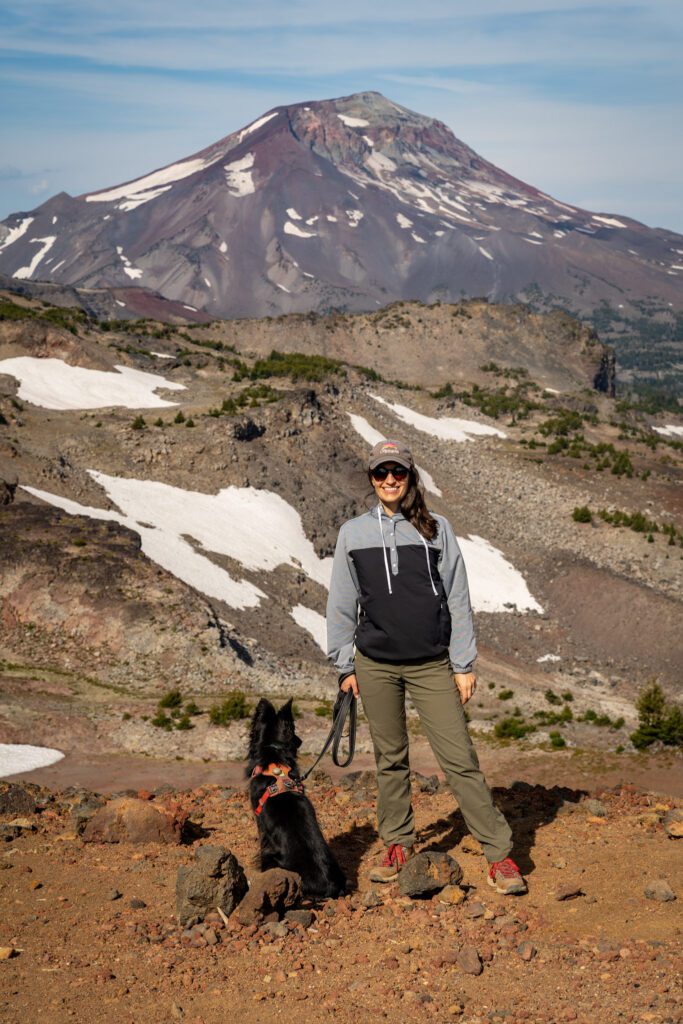
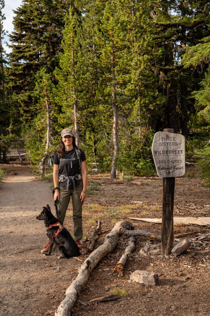
Are Dogs Allowed on the Tam McArthur Rim Trail?
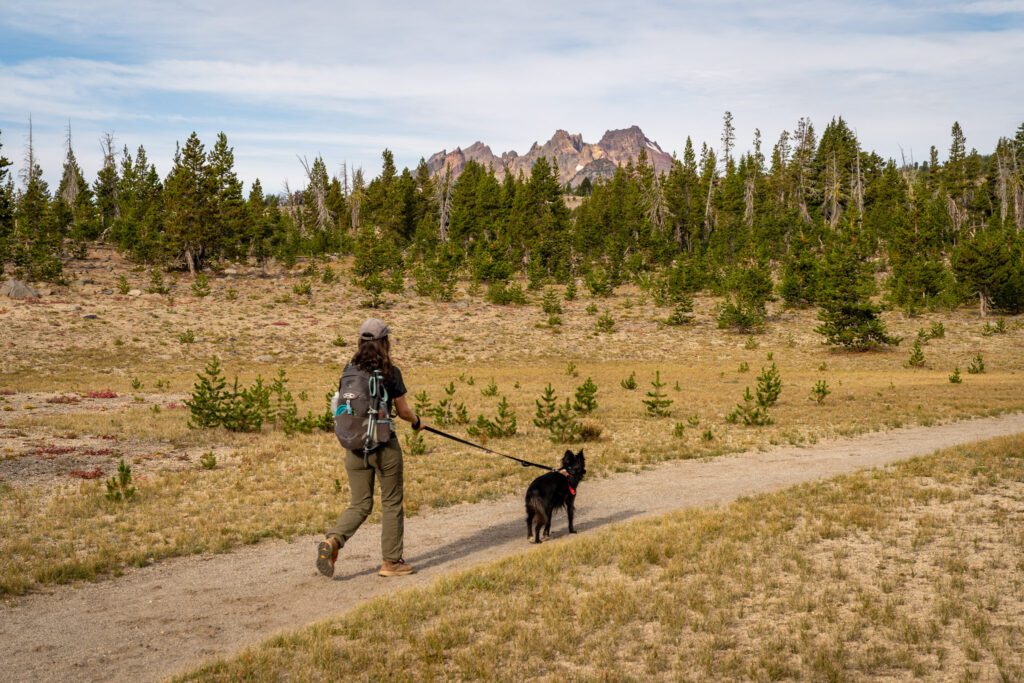
Yes, dogs are allowed on this trail. As you can see from the picture above, we brought our dog Lupine on this hike.
However, they should be on a leash on the trail.
Seriously. On a leash.
Yes, I’m sure your dog is a good dog. But even if they have perfect recall and will not run up and greet other people and dogs on the trail, that’s not the point.
The point is that not every human (or dog) wants another dog all up in their business, and while you or your dog might not be reactive, other people and dogs might be.
That and the fact that dogs can inadvertently destroy habitat for other plants or animals.
Bring your dog (provided they’re in good enough shape for a hike like this) – we did – but they need to be on a leash for the entire hiking portion of this trail.
The Tam McArthur Rim Trail to Broken Hand: A Complete Guide
We’re going to break this hike up into three distinct sections, and give you the mileage and elevation profile of each, and give you a written summary of that stretch of trail so that you can be prepared for what this trail is going to throw at you (again, it’s nothing too crazy!).
Those sections are:
- To the End of the Maintained Trail
- The Flat Section (with Outrageous Views)
- The Final Ascent to Broken Hand
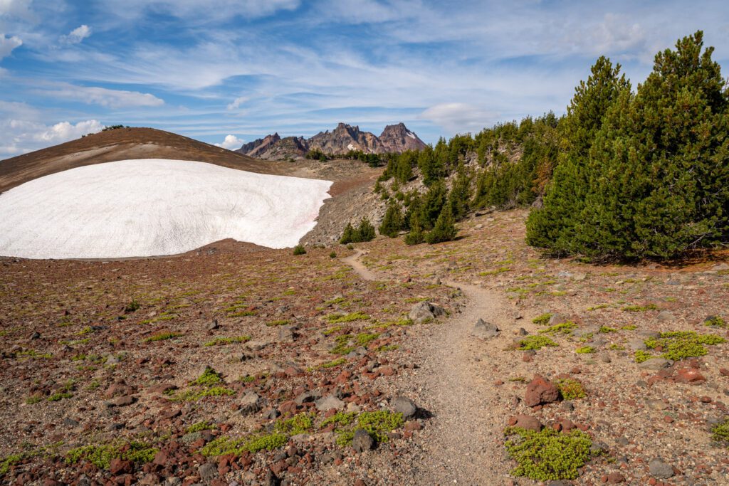
To the End of the Maintained Trail
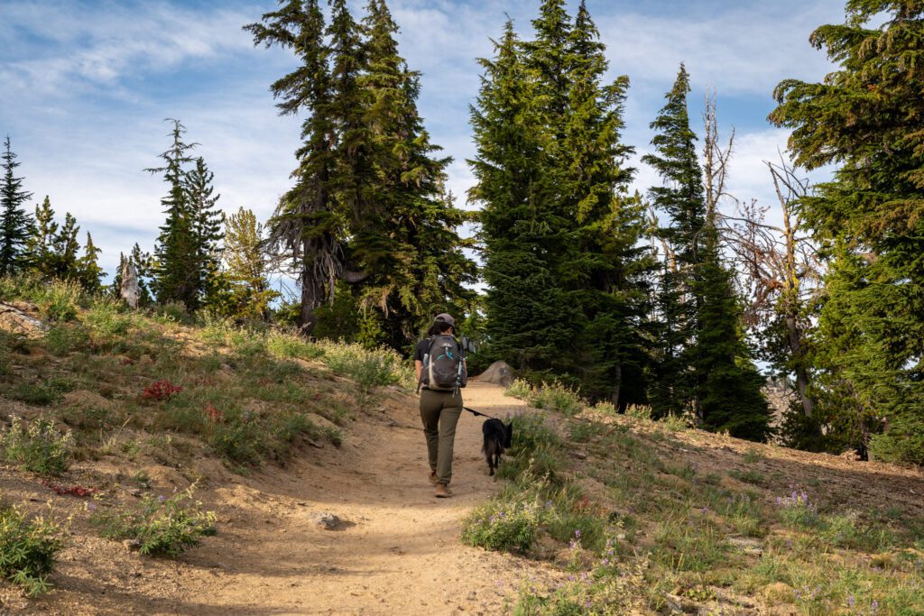
Length: 2.9 miles // Elevation Gained: 1,200 feet
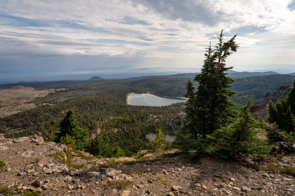
This first section of the hike encompasses the entirety of the maintained Tam McArthur Rim trail, and takes you from the trailhead up to a nice viewpoint that looks out over the lake (really, lakes) and gives you a great view of the interesting geology of this area.
There are two things that are true of this first section of the hike: you will do the majority of the climbing to get up onto the ridge, and the views are somewhat lackluster (especially for the first two miles or so).
However, you should think of it as a workout and an investment in your future self (the version of you that is roughly two miles in the future).
As you start out with a gentle climb through the forest, there are some nice views out over Three Creek Lake, with the South Sister looming in the distance.
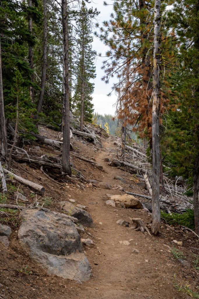
The trail enters the trees for a good long while, with a couple of sets of intense switchbacks (and some occasional good views).
The shade is nice, especially on a hot day, and you’re going to want to cherish it because where you’re going (above the treeline), there is almost exactly zero shade.
There are a couple of horse trails that weave in and out of the main hiker trail, and they are clearly signed and delineated.
You’re going to want to stay on the hiker trail for the most part, because that’s the one that goes out and follows the rim (which is the part with the views).
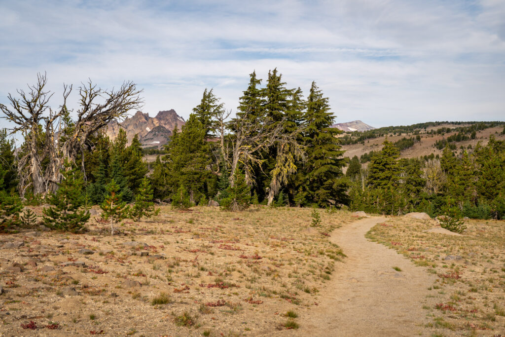
Eventually, after taking in the views at the viewpoint, you’ll continue along the trail and hit a sign that marks the end of the maintained trail (with a great view of the peaks that you’re going to be up-close-and-personal with in a little while).
The Flat Section (with Outrageous Views)
Length: 1.2 miles // Elevation Gained: 200 feet
The middle mile (ish) of this hike, where you leave the maintained trail behind and approach a viewpoint out over the Sisters, is basically flat, with a few minor ups and downs.
Now, we should cover something here because it was something we were a little bit anxious about.
How much routefinding are you going to be doing on this “unmaintained” trail?
The answer, we think, is basically zero.
There is a very well-worn route for the entirety of this section of trail, and we never once had any trouble finding it (though still a good idea to have a map available).
Maybe you would have some trouble if you were literally the first hiker of the season after a particularly tough winter? Although even then we think the path is probably still pretty clear.
We will say that there is some routefinding to be done around Broken Hand – on either the upper or lower route – but even that is pretty light.
The Final Ascent to Broken Hand
Length: 0.9 miles // Elevation Gained: 300 feet
This final section of the hike leaves from that epic viewpoint and takes you on a quick, intense climb up the red-tinged sand to get up onto the ridge that you will follow all the way to Broken Hand.
Once you’re on the ridge, the views are nonstop showstoppers, with Bachelor on your left, all three Sisters and Mount Washington on your right, and Broken Top dead ahead.
It’s pretty special.
There are a couple of sections where I lost the trail as I got closer to Broken Hand, but it was relatively easy to re-route and get back on track.
Finally, you’ll reach Broken Hand, and you have two choices if you’re wanting to get around it – the upper route (which usually involves navigating a snow field until late in the season) and the lower route (which involves some routefinding and crossing a boulder field).
Again, if you’re not extending your hike down to No Name Lake and you’re apprehensive about some routefinding, snow fields, and a rough trail, we’re not actually sure it’s worth going around Broken Hand.
Extending Your Hike to No Name Lake
If you have gas in the tank, there’s a reasonable extension to this hike that takes you to one of the most stunning places in Oregon; No Name Lake.
No Name Lake is a blue-green alpine lake that sits at the base of Broken Top, and it’s difficult to access from the other side (on the Cascade Lakes National Scenic Byway) because it requires either a 12+ mile hike (with ~2,800 feet of climbing) or an extremely rugged vehicle and willingness to drive a gnarly rutted forest road.
Lucky for you, if you’re already at Broken Hand, you’re only about 1.2 miles from the edge of No Name Lake.
You’ll descend the Broken Hand ridge (where the views of Broken Top and the lake get better and better) and you’ll be at the shore of the lake.
This route adds about 2.5 miles and 400 feet of climbing to the hike, bringing it to roughly 12 miles and 2,200 feet of elevation gain.